
November 15, 2026 – Here are the overnight forecast highlights:
Winter Weather Advisory: 4 PM today, Nov. 15 – 10 PM Monday, Nov. 16 for Sierra/southern Cascades/Lassen Park above 6000’. Midweek storm continues to trend stronger. Increasing potential for active weather to continue next weekend into Thanksgiving Week.
Today-Monday

- Widespread rainfall, mountain snow, breezy south winds
- Lower precipitation/snow amounts compared to previous storm
- Gusty winds, but not as strong
- Winter Weather Advisory from 4 PM today through 10 PM Monday for elevations above 6000 ft
- Moderate snow may impact travelers as well as the Monday AM/PM commutes
- Snow amounts have increased slightly, totals 2-7″, up to 16″ over Lassen National Park
- Rates generally 0.5″-1″ per hour

Tuesday night -Thursday
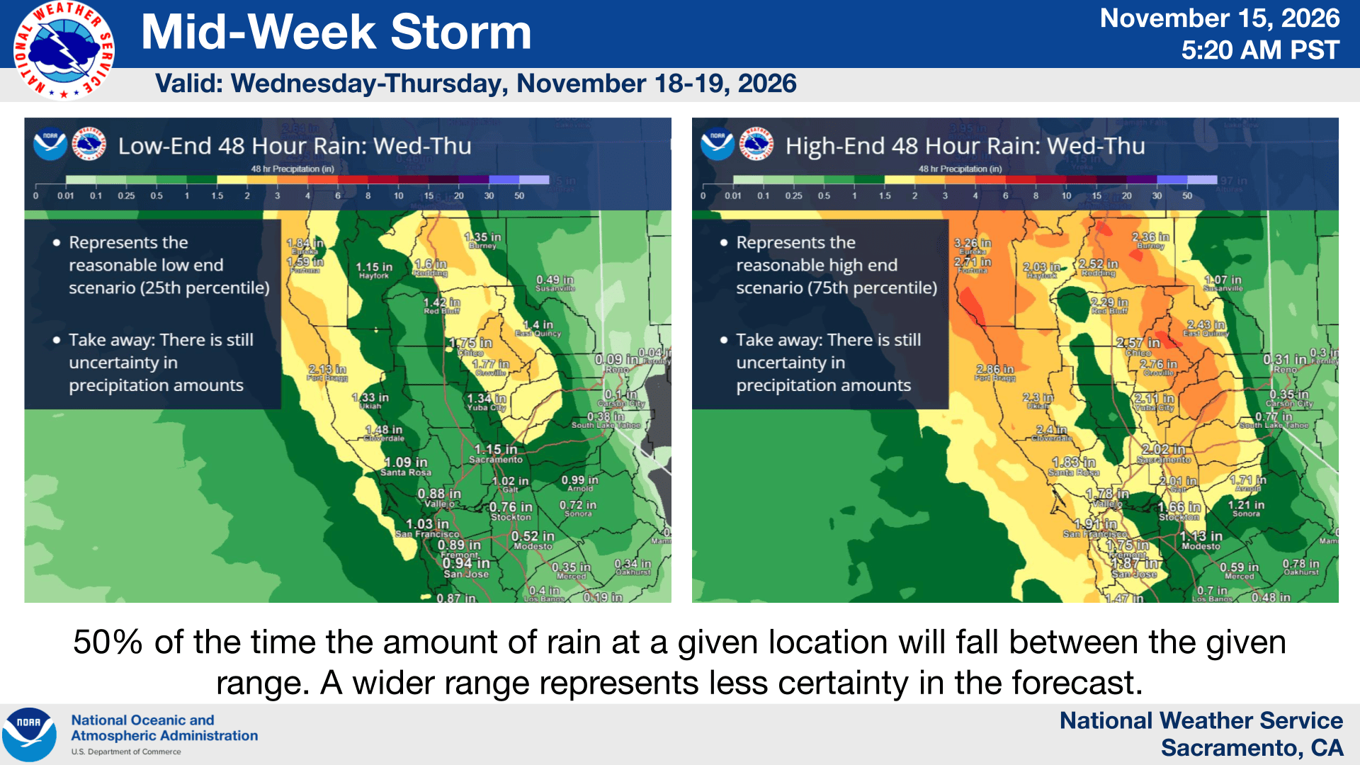

- Confidence in a strong, wet storm mid-week is high
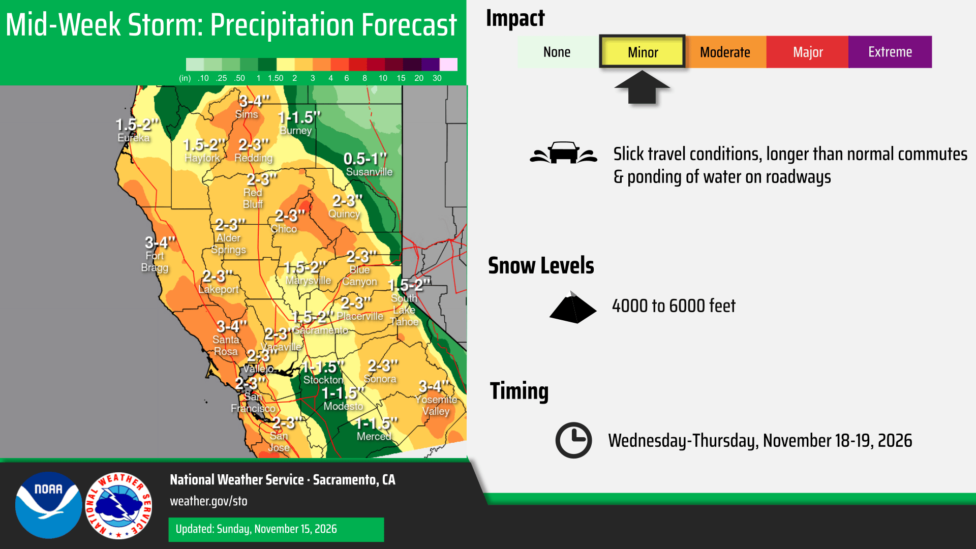
- Rainfall and snow amounts have trended significantly higher
- Current snowfall forecast is 1 to 3 feet above 6000 feet for the southern Cascades and Sierra, with several inches of snow across down to around 4000 feet
- Rainfall totals currently 2-4″ in the mountains and foothills, 1-3″ in the Valley
- Winds have trended stronger, with gusts up to 40 to 50 mph in the Valley and Delta

Friday – Weekend
- Lingering showers Friday. Potential for active pattern into the weekend