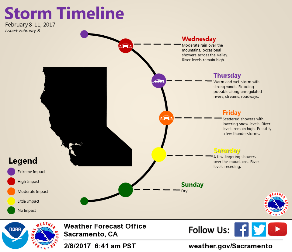
February 8, 2017 – Moderate to heavy precipitation with areas of breezy to gusty winds will continue this week as a series of Pacific storms affect the region. Flooding concerns will continue. Drier weather returns for the weekend. Wind Advisory from 2 PM this afternoon to 4 PM PST Thursday.
Discussion
Very mild and juicy airmass (TPW in excess of an inch) continues to stream up into NorCal ahead of the deep trough over the eastern Pacific. Rain has slackened off for most of interior NorCal overnight, but 12 hour precip amounts of an inch or two still occurred over the foothills and Sierra Nevada to the east of Stockton. Temperatures are very mild early this morning, ranging from the 30s and 40s in the mountains to the 50s and lower 60s elsewhere.
Precip will increase across the area today as strong warm- advection moves overhead. Orographic enhancement will focus heaviest precipitation over the mountains north of Redding and across the west slopes of the northern Sierra and southern Cascade Range where additional QPF of 2-4 inches can be expected over the next 24 hours. Very high snow levels will limit snowfall accumulation to just the highest peaks.
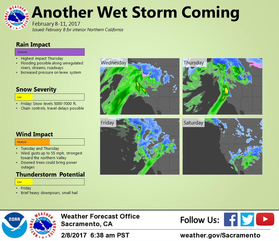
Surface pressure gradients will continue to tighten across the region today with breezy conditions expected to return. Stronger gusts of 40 mph or higher may develop as early as mid-afternoon across the far northern portion of the Sacramento Valley and surrounding terrain.
Gradients will continue to tighten overnight tonight into early Thursday with the Sacramento to Medford gradient forecast to reach about 17 mbs. Gusts of 50 mph or higher will be possible across the northern half of the Sacramento Valley while winds will increase elsewhere across the region.
Precip may decrease and shift northward a bit late tonight as the offshore system approaches, then heavy precip returns Thursday into Thursday evening as the front moves south through the area. Another 1-2 inches of rain can be expected in the valley with 3-6 inches in the foothills and mountains likely resulting in more flooding issues.
Snow levels are forecast to go below pass levels again Thursday night and motorists should be prepared for winter travel over the Sierra.
Showery post-frontal precip is expected Friday with the potential for thunderstorms in the Central Valley if ingredients come together, then drier weather expected to finally return Friday night into the weekend.
Extended discussion (Sunday through Wednesday)
A few snow showers may linger over the mountains into Saturday, but by and large most of the region will be dry under building high pressure. A brief period of breezy north winds will be possible over the weekend, mainly along the western Sacramento Valley and along favored Sierra canyons. High pressure should continue to bring dry weather and perhaps some Valley fog through the middle of next week. Longer-range models are currently suggesting a return to wet weather toward the end of next week.