Late day thunderstorm chances expected over the Sierra Nevada through the week. Above average temperatures return.
Discussion
Skies have cleared out for the most part across the region. Monsoon moisture continues to stream up from the southeast and is resulting in some mid and high clouds over the Sierra south of Tahoe. Some sprinkles may even be possible across the higher elevations of Tuolumne County early this morning.
Current temperatures are cooler across most of the area given the clearing that has taken place, but a relatively weak Delta Breeze is resulting in milder readings across the Sacramento and Stockton areas.
RH is considerably higher across most of the region compared to early Tuesday, especially in the mountain areas that received a little rain yesterday, and this is likely contributing to much less heat showing up on IR imagery from the Dixie Fire.
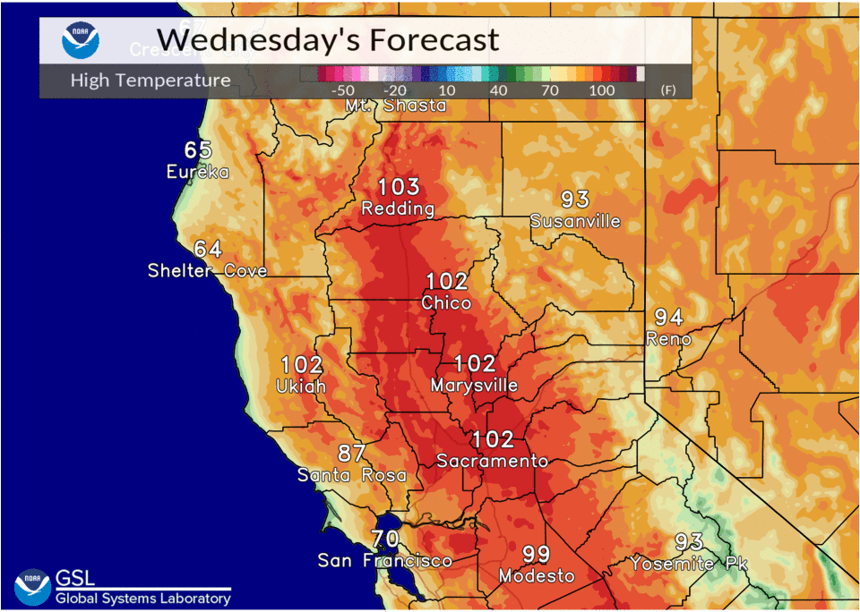
Hotter and drier weather is expected for the most part through the remainder of the week as the strong ridge centered over the central US extends further to the west. This will keep the marine layer, and consequently the Delta Breeze, suppressed resulting in hotter temperatures across the region.
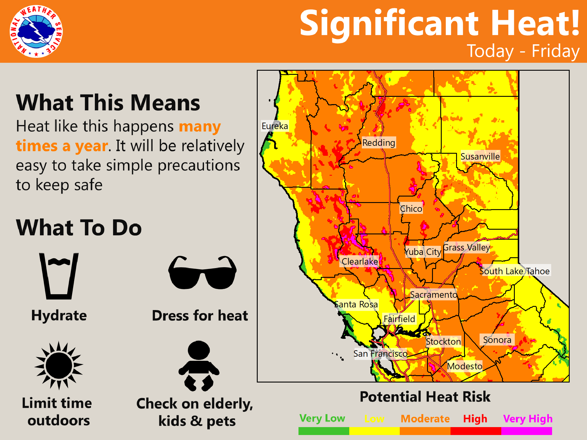
Highs will return to triple digits through much of the valley today, and combined with relatively mild overnight lows, will result in moderate heat risk across much of the area through Friday. Some cooling may be possible by the weekend as the ridge amplifies and shifts a bit further to the east allowing a return of onshore flow.
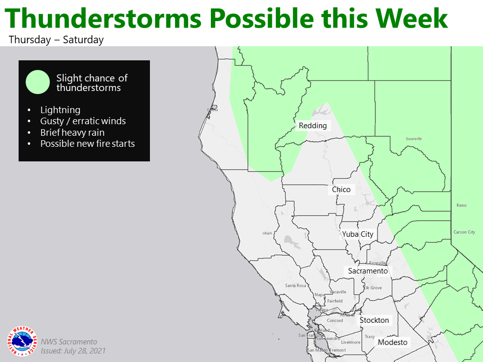
However, the pattern will be favorable for monsoon moisture to continue flowing north along the eastern edge of the forecast area. Mainly diurnal deep convection is expected along and east of the Sierra/Cascade crest, though we`ll be watching for any disturbances embedded in the southeast flow that could extend shower and thunderstorm activity overnight, and possibly push it a bit further to the west. Gusty erratic winds, brief downpours and lightning will be possible with any thunderstorms.
Extended Discussion (Sunday through Wednesday)
Drier southwesterly flow sets up over interior NorCal early next week. This will bring seasonal temperatures through the extended, with Valley highs generally in the mid to upper 90s.
A few afternoon thunderstorms may develop near the Sierra crest and the southern Cascades on Sunday. Monsoon moisture shifts east out of the area Monday through the rest of the extended given increasing dry southwest flow.