June 7, 2017 – Warm and dry today. A chance of rain spreading across the area Thursday and Friday. Showers limited to the northern areas over the weekend. Dry with near normal temperatures for the first half of next week.
Discussion
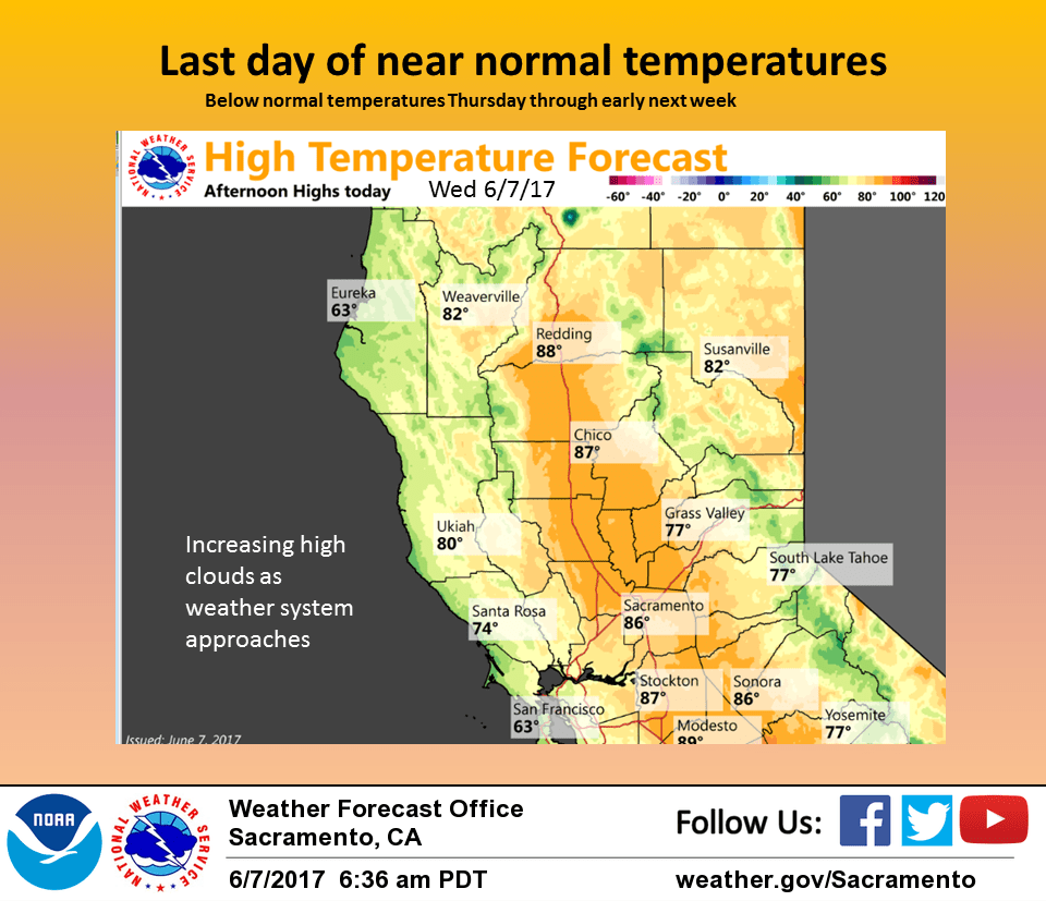
High clouds spreading over the north state this morning indicate a significant change in the weather pattern is on the way. Today will see one more day of fair warm conditions under the western edge of a high pressure ridge over the western U.S. Today’s highs are forecast to come in just a bit above normal.
A Pacific storm system digging into the eastern Pacific will bring airmass cooling and combined with a moderate delta breeze will bring down daytime highs several degrees. Marine layer is around 1000 feet this morning so inland intrusion of coastal status should be minimal.
Models in fair agreement in bringing a Pacific frontal system into northwest California tonight.
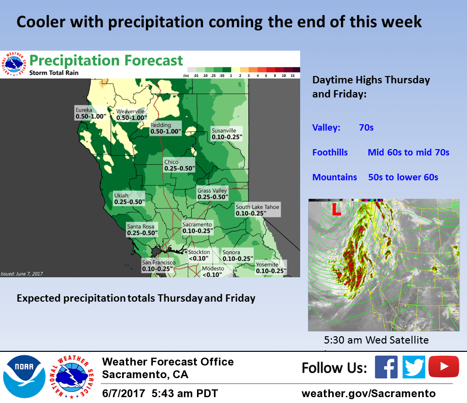
By Thursday morning, most areas should see a chance of precipitation with precipitation chances continuing through the Thursday night. Cloud cover and cooler airmass will bring down daytime highs significantly.
Daytime max temperatures are forecast to come in between 10 and 15 degrees below normal. Cool showery conditions continue into Friday as the frontal band moves into the Sierra.
The upper low associated with the front moves into the Pacific Northwest on Saturday. With the upper low center well north of the Oregon border, precipitation chances will be limited to the northern portions of the CWA.
Enough instability showing up in the afternoon for a slight chance of afternoon and evening thunderstorms over the higher elevations.
Extended discussion (Sunday through Wednesday)
Backwash clouds, showers and cool temps linger over NorCal on Sun under strong cyclonic flow from seasonably deep upper low rotating across ORE. With 850 mbs temps in the single digits over NorCal on Sun, max temps should only reach into the 70s, below much of the NWP guidance models. Most of the showers should remain over the higher terrain and possibly the Northern Sac Valley.
Cyclonic flow weakens on Mon as the upper low moves into ID. Precip should end over NorCal as dry NW flow prevails over the region. As the upper low moves into the Northern Plains the flow transitions to W then SWly and warmer air advects into the area. Temps will be trending upward reaching into the 80s to around 90 in the Valley, or near to slightly below seasonal normals.