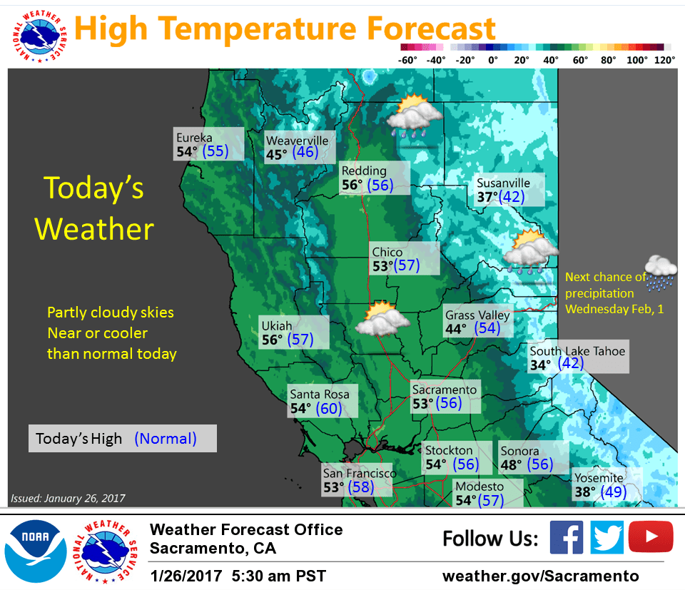
January 26, 2017 – A few showers across northern mountains and Sierra today, otherwise dry next several days. Next wet system impacts the region next Tuesday night into next Thursday.
Short Term Discussion
Weak upper trough dropping southward into the Great Basin and NorCal today. Light north winds and cloud cover from the trough keeping fog out of the the northern and central Sacramento valley this morning.
Lighter winds and less cloud cover has allowed for some fog in the Sacramento area and fog will be possible farther south into the northern San Joaquin valley this morning.
Daytime highs should come in right around normal for this time of year today. Upper ridge pushes in over the west coast today and this ridge will bring dry conditions to all of NorCal Friday on through to early next week.
Daytime highs will climb slowly reaching several degrees above normal by Sunday. Main forecast issue next several days will be valley fog formation night and morning hours. With ridge axis still off the coast Friday, morning fog will likely be limited in intensity again although likely more widespread than this morning since cloud cover will be missing. Upper ridge axis centers over the west coast over the weekend. Upper subsidence maximizes Saturday and Sunday so dense night and morning valley fog will be possible.
Extended discussion (Monday through Thursday)
Dry conditions expected for the beginning of the forecast period as model forecasts continue to depict an upper level ridge over northern California on Monday. The upper level ridge of pressure should keep daytime highs about 2-10 degrees above normal on Monday.
Temperatures will return to near or slightly below normal values by Tuesday as the next weather making system approaches interior NorCal. Model forecasts highlight widespread precipitation across the area by mid-week, and model discrepancies continue to be evident relating to timing between Tuesday night into Wednesday.