February 9, 2021 – Pattern change this week with unsettled weather and cooler daytime temperatures in the forecast. A few light showers will be possible over the mountains thru tonight, then widespread precipitation will be possible later in the week and into the weekend.
Discussion
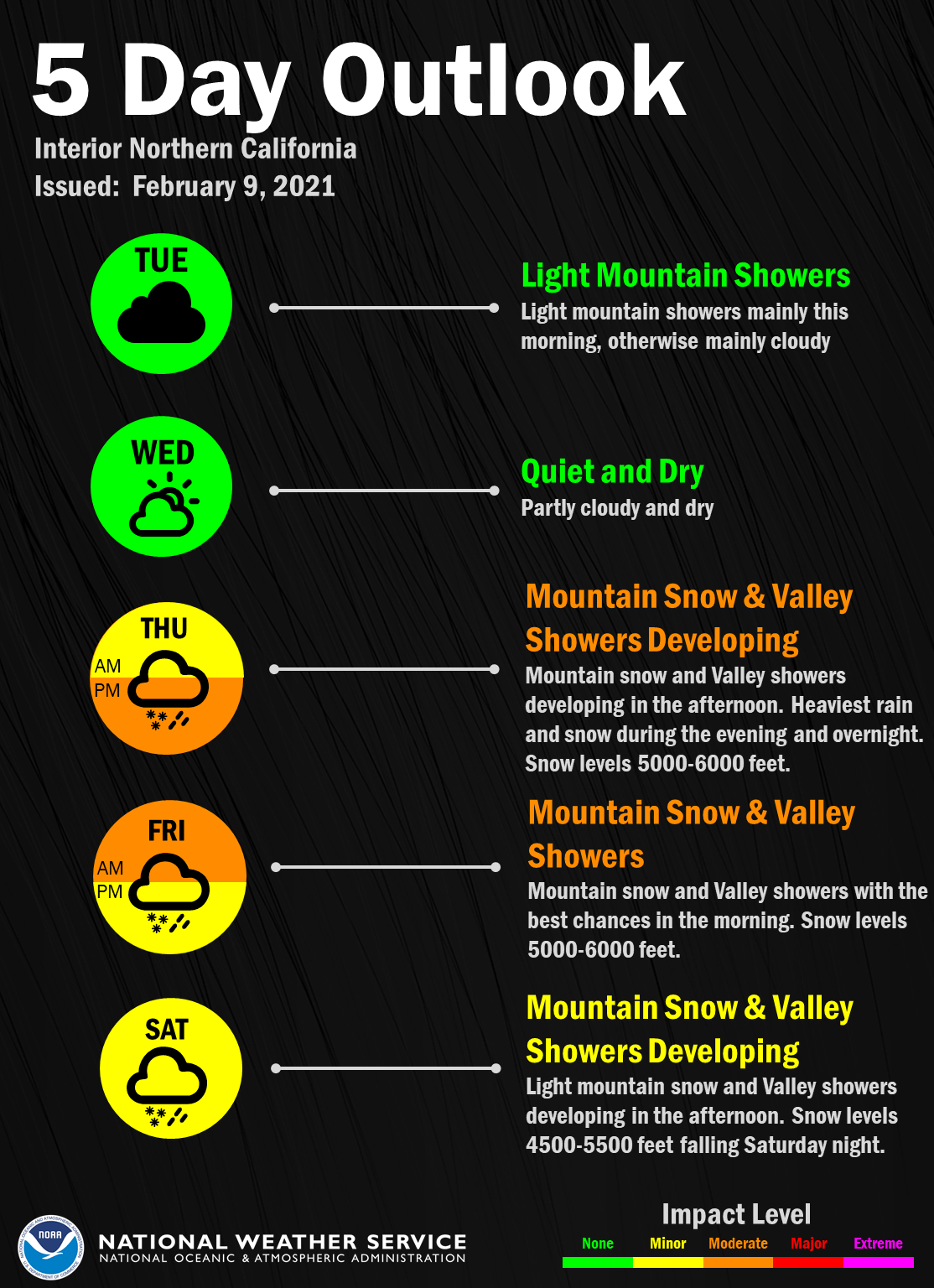
A few light showers are occurring over the mountains as a very weak system breaks under the eastern Pacific ridge and moves into NorCal. Measurable rain has been very local and very minimal, amounting to only a few hundredths of an inch at a few spots across the northern Sierra.
Elsewhere, some sprinkles have been reported at times across the lower elevations. With all the cloud cover, current temperatures early this morning are very mild and generally range from the 30s in the mountains to the mid 40s to lower 50s across the Central Valley.
Lots of cloud cover expected to continue today as moisture continues to make its way into the region. Some sprinkles or light showers will be possible, especially over the northern Sierra. Highs today will be similar to Monday’s.
Short-wave ridging briefly builds in on Wednesday resulting in less cloud cover and increased insolation. Highs are expected to be up a bit compared to today.

Another system is forecast to break under the ridge and move into the region on Thursday. This one is forecast to have a little more vigor, and tap a slightly deeper moisture plume. Overall, QPF looks to be mostly light to moderate, but enough snowfall will be possible over the northern Sierra to potentially pose travel impacts Thursday afternoon into Friday morning before precipitation tapers off.
Extended discussion (Saturday through Tuesday)
Short wave trough moves inland Saturday with models showing associated widespread light to moderate precipitation. Decreasing showers into early Sunday as snow levels lower into the upper foothills. Dry weather expected Sunday under upper level ridging.
Another short wave trough rides the upper ridge into interior NorCal Monday into early Tuesday producing light to moderate precipitation over much of the CWA as snow levels gradually trend up above 4000 feet.