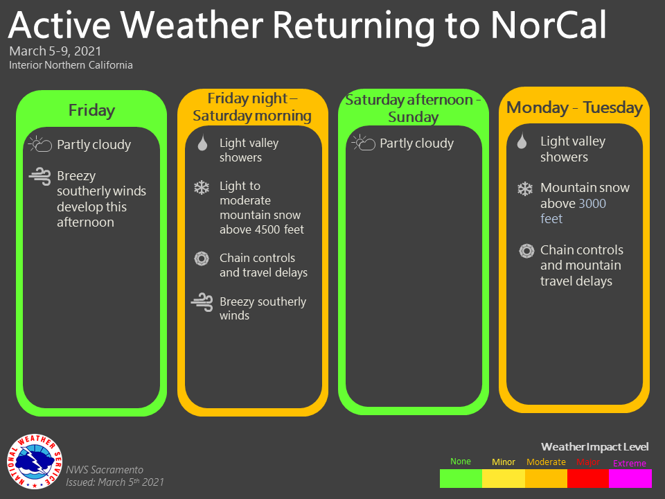
March 5, 2021 – Dry and mild weather continues most of today. Rain and mountain snow returns tonight and early Saturday with mountain travel delays. Unsettled weather is likely most of next week.
Discussion
Dry and mild weather continue for one last day with ridge departing into the Great Basin Region. GEFS then shows upper level trough approaching the West Coast later today with a few light showers reaching the Coast Range and Shasta county by early evening.

Rain and mountain snow will spread east over NorCal tonight. The heaviest snow over the Sierra will fall after midnight into Saturday morning, especially between 1 am-5 am. Snow levels will be around 5000 feet with 4 to 8 inches likely at pass level. Sref ensembles show 4 inches at Blue Canyon(5280ft). This will likely cause a brief period of mountain travel delays and chain controls.
Valley rainfall amounts will range from 0.10 to 0.75 inches, heaviest over the Northern Sacramento Valley, lighter progressing southward. A brief period of breezy winds possible tonight with a few gusts to 30 mph, especially over the Central Sacramento Valley.

Trough will weaken, as it moves east into Nevada Saturday afternoon with precipitation diminishing. Broad southwest flow over the area with dry weather Sunday before a series of systems impact the area next week. Rain and mountain snow is currently forecast to resume late Monday afternoon, see extended discussion for further details. Valley temperatures will be a bit cooler with highs from the upper 50’s to low 60’s.
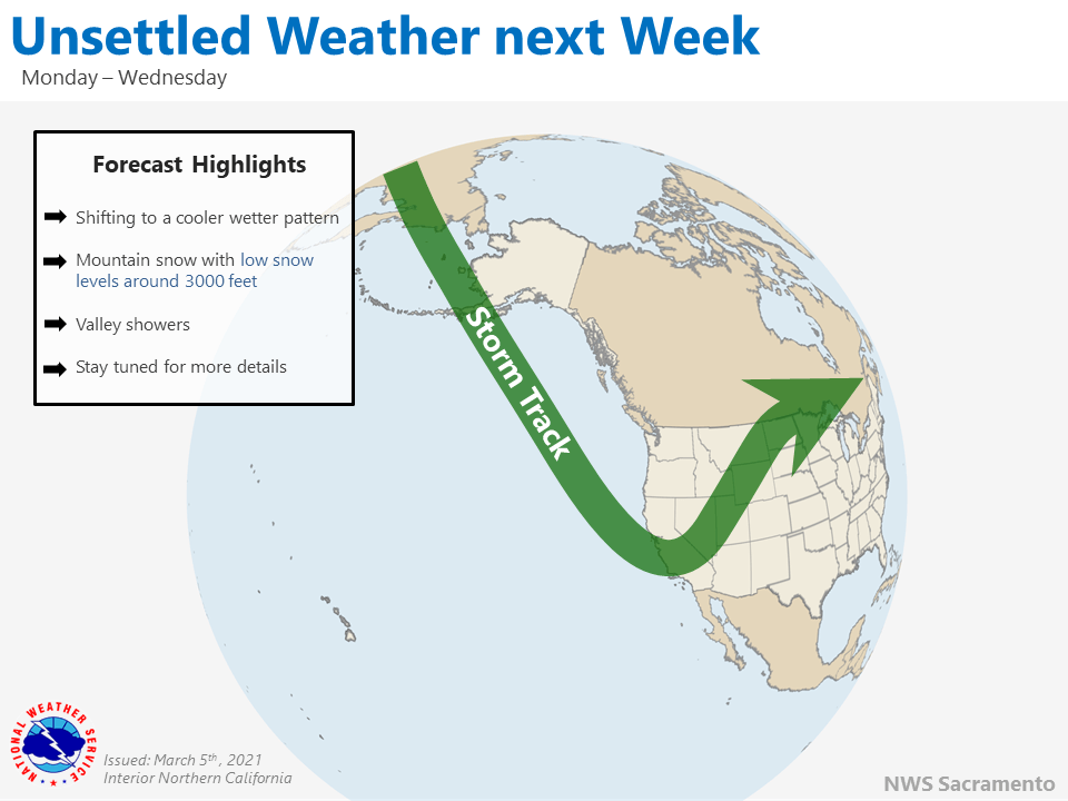
Extended discussion (Tuesday through Friday)
Ensemble cluster analysis suggests good confidence in a cold low from the Gulf of Alaska moving along the coast mid week bringing widespread precipitation across NorCal. There is some uncertainty in the exact track inland, though, which could bring some variation to storm total precipitation amounts.
Heaviest snowfall is expected to be on Tuesday, with NBM currently projecting snow levels to be between 2,500-3500 feet with this rather cold system. This could bring travel impacts down into the upper foothills, and could even see snow accumulate on higher portions of I-5 in Shasta County. Higher elevations could see storm totals of 1-2 feet of snow, which could bring difficult mountain travel conditions. Instability with cold air aloft with this system could bring heavier showers and possibly even thunderstorms Tuesday afternoon. Low snow levels should limit any potential burn scar impacts to all but lowest elevations.
Wednesday is expected to have wrap around showers as the core of the low moves through SoCal. Snow levels could be around 1500-2000 feet but additional snow accumulation should be fairly light. Thursday is trending drier, with some lingering light mountain showers.
Northerly flow with a building eastern Pacific ridge currently looks to bring a return of dry weather late in the week and into the weekend. The NBM has Valley temperatures rising into the mid to upper 60s to around 70 over the northern Sacramento Valley.