January 23, 2017 – Scattered showers and isolated thunderstorms with mountain snow showers continue today. Drier weather Tuesday into the weekend except for a slight chance of some light showers mid-week.
Discussion
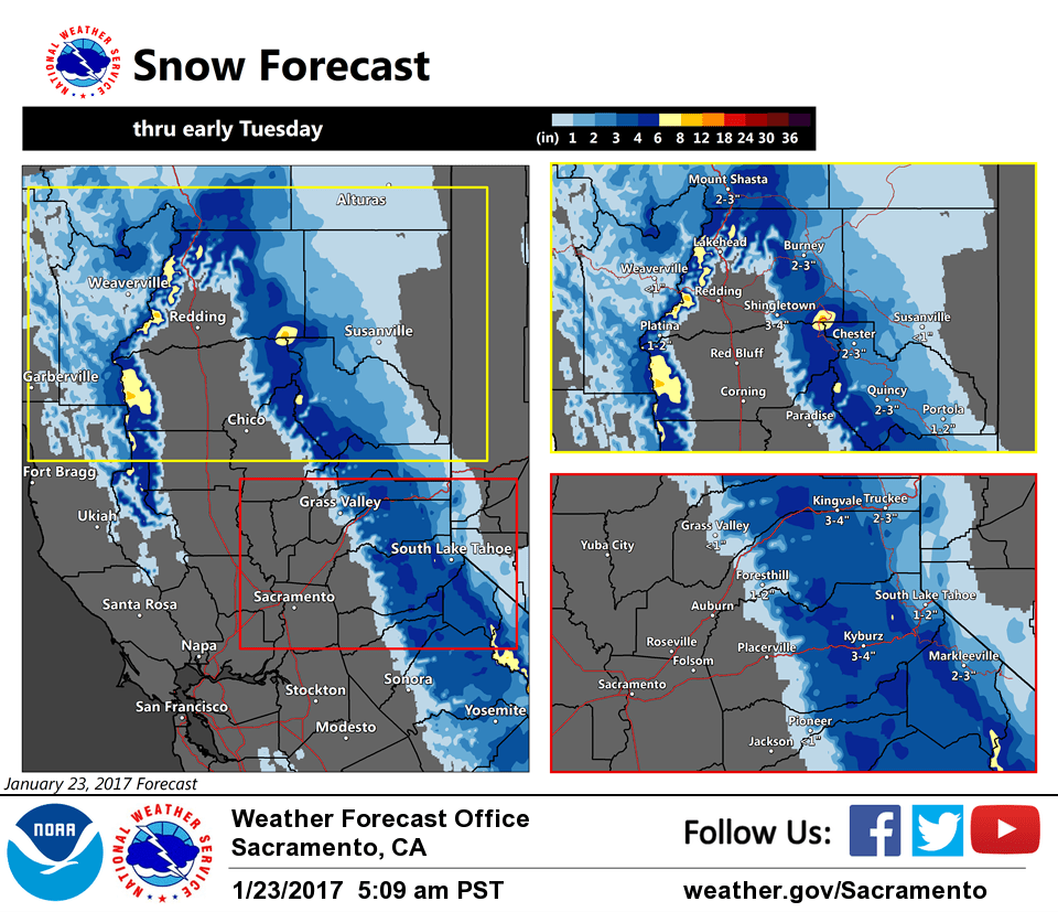
Upper trough moves overhead NorCal today with scattered showers and a few thunderstorms. Snow has decreased across the northern Sierra since Sunday evening, and additional snowfall accumulations today are expected to be much lighter than over the weekend as off and on snow showers continue through the day. Some light snowfall accumulations will also be possible down into the foothills as snow levels are around 2-3K ft.
Vertically stacked system presently off the Oregon coast forecast to drift southeast and continue filling over the next 24-36 hours, skirting down the NorCal coast early Tuesday. Until then, a chance of showers will continue across the region with only light additional QPF.
Drier northerly flow sets up for Tuesday as upper ridging approaches the West Coast and subsidence increases over Interior NorCal. A weaker system moves through the ridge later Wednesday into Thursday and may bring some light showers.
Extended discussion (Friday through Monday)
Upper ridge builds into northern California on Friday and into the weekend bringing dry weather and plenty of sunshine at least in the mountains. The amount of sunshine in the Valley remains to be seen, as fog and stratus may develop. Temperatures should begin to increase, but temperatures will be dependent on how much fog and stratus stick around.