March 22, 2017 – Unsettled weather will continue into next week as a series of weather systems move through the region. Chance of thunderstorms again today.
Discussion
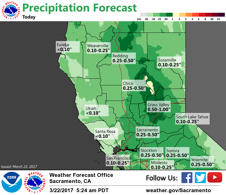
A north-south oriented line of showers accompanied by moderate to occasionally heavy rain is moving through the Central Valley early this morning. Temperatures are running a little cooler compared to 24 hours ago and generally range from the 30s in the mountains to the upper 40s to mid 50s in the valley.
The line of showers will move south and east this morning, but will likely not clear the Sacramento and Stockton areas by the morning commute. Precipitation will turn more showery later this morning and thru the afternoon as the upper trough moves overhead. The risk for thunderstorms will continue, but will likely be more of the pulse variety today (weaker shear) with small hail and heavy rain being the primary concerns.
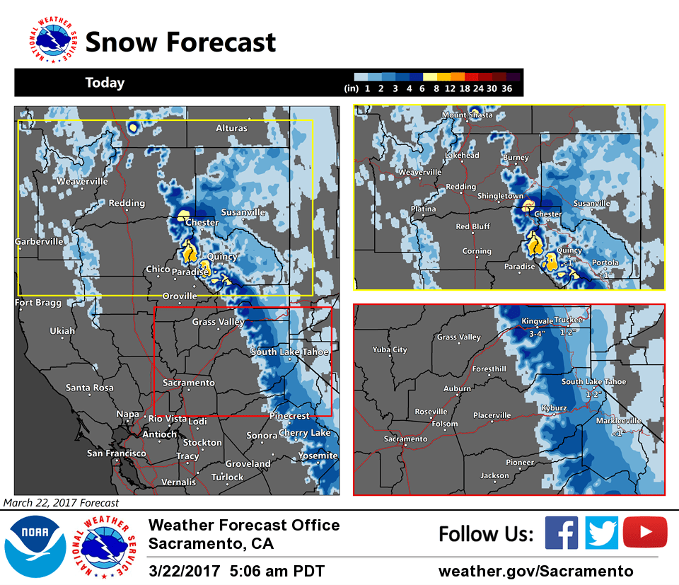
Snow likely to return to the northern Sierra this morning as the band of showers shifts east, so some travel impacts will likely develop over the passes this morning. Radar profilers indicate the snow level is around 5-6K feet and will lower some today.
Showers will to taper off from the north and west this evening, then dry weather is expected for Thursday with brief ridging over the area.
Unsettled pattern continues with the next system forecast to move in Friday with another round of rain and gusty southerly winds with snow in the mountains, then showers decrease Saturday.
Extended discussion (Sunday through Wednesday)
Next in a series of Pacific frontal systems pushes into Norcal on Sunday. All areas of the CWA should see at least a chance of precipitation by afternoon. Precipitation amounts with this week system are expected to be fairly light so even with moderate snow levels, impacts are expected to be minimal. Models diverge as to how fast this system will exit the region. ECMWF and GEM models quickly shift the upper trough axis eastward into the Great Basin by Monday while the slower GFS keeps cyclonic flow and shower threat over the forecast area Monday. Models diverge even more Tuesday and Wednesday. Have kept slight threat of precipitation over the northern mountains Tuesday with ECMWF and GEM showing some sort of trough over Pacific Northwest but GFS puts a fairly strong ridge over Norcal Tuesday so confidence in the forecast for this time period is low. Models seem to be settling in on idea of west coast ridging around the middle of next week for at least a brief drying period but considering poor model consistency, confidence remains low.