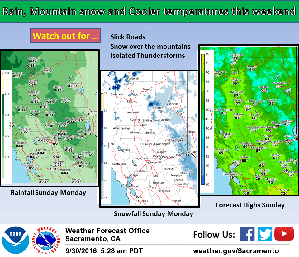
September 30, 2016 – Continued cooling trend through the weekend with daytime highs 15 to 25 degrees below normal by Sunday. Warmer temperatures next week. Chance of showers and isolated thunderstorms Sunday into Tuesday. Drier mid week with another chance of showers northern mountains by Friday.
Discussion
Temperatures are running a few degrees lower this morning most areas and this trend will continue into today as the overall cooling trend continues. As the early season low pressure system from the Gulf of Alaska continues to drop southeast into the eastern Pacific, cooler air will filter into the region bringing a cooling effect of about 5 to 10 degrees compared to Thursday. The delta breeze is running similar to 24 hours ago with winds at Travis AFB sustained at around 20 knots but should see some increase in ridgetop winds today as pressure gradients increase ahead of the low.
A shortwave disturbance passes to the north of the forecast area on Saturday bringing a bit more cooling but any precipitation should remain west and north of the forecast area. Another disturbance out of the Gulf of Alaska will dig the upper low farther southward on Saturday night and Sunday. This disturbance and associated frontal band is now fairly consistently progged by the models to move through northern California during the afternoon on Sunday moving into the Sierra late afternoon or evening. Models show enough instability for a chance of thunderstorms but a lot will depend on timing of the front and coincidence with daytime heating. Cloud cover and cooler airmass will bring another big drop in temperatures Sunday with daytime highs in the valley mainly in the 60s or about 20 degrees below normal. The upper low moves into the Great Basin on Monday and this should bring an end to the precipitation threat most areas although a few lingering showers will be possible over the Sierra in the morning hours. Building high pressure will bring warmer temperatures. ECMWF not as robust in building the ridge however showing a flat ridge solution Monday and this could allow some precipitation into the coast range.
Extended discussion (Tuesday through Friday)
On Tuesday, medium-range models are projecting a weakening wave to approach California from the northwest. Some light precipitation is possible, particularly along the NW portions of our forecast area, but the current consensus keeps most of the region dry. Drier weather is likely next Wednesday and Thursday as a weak, transient ridge moves through. High temperatures are expected to warm back up to near normal levels.
The ECMWF and Canadian models are hinting at another round of precipitation late next week as an upper trough moves through the region. The GFS is much weaker and drier with this system. For now, we’ve opted to include “slight chance” wording across the northern portions of our forecast area, though confidence is low.