
October 14, 2026 – With increasing confidence in an expected downslope wind event along the western Sierra on Thursday and Friday, NWS Sacramento have issued a Red Flag Warning for the Sierra and adjacent foothills, in effect from 12 am Thursday, October 15th to 10 am Friday, October 16th.
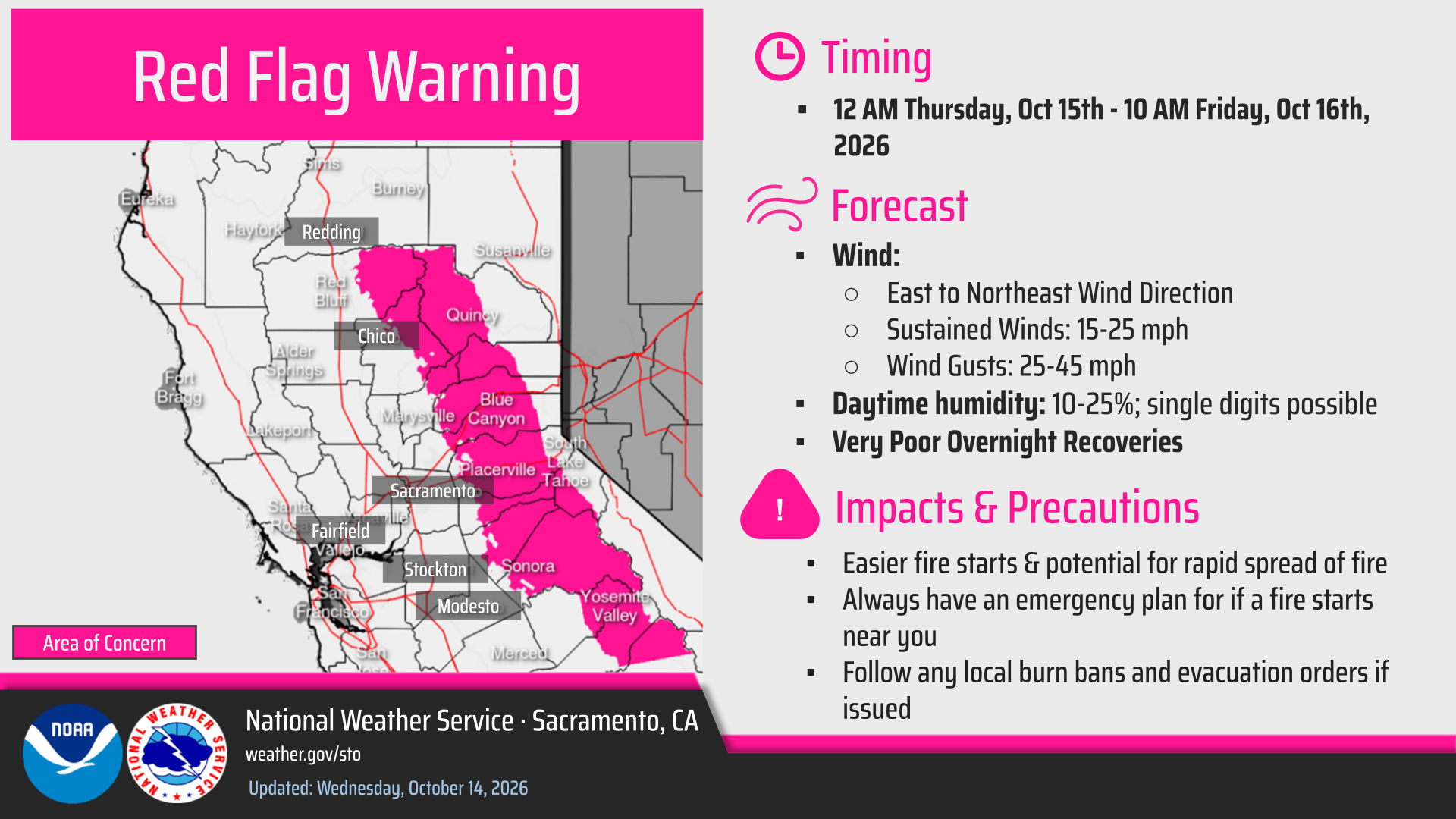
- East-northeast winds 15-25 mph with gusts 25-45 mph
- Potential for locally higher gusts at peaks and gap wind prone areas
- Strongest winds expected above 3000′
- Daytime humidity 10-25% with single digits possible
Rest of Today-Friday
While a dynamic weather pattern aloft will continue evolving through the end of the week, dry weather is expected to persist across interior NorCal. The remainder of today will remain cool to seasonable with clear skies and light winds across the area. As ridging aloft continues to build inland through the end of today a shortwave trough is expected to retrograde and deepen toward SoCal. The placement of the building ridge and deepening trough will culminate in persistent east- northeast flow aloft, allowing enhanced downslope easterly winds to develop along the western Sierra late tonight through Friday morning. With the building ridge remaining in place into the weekend, temperatures will trend above normal over the next several days with highest in the 80s to lower 90s throughout Valley and foothills.
As offshore winds increase as well, daytime humidity values in the teens to lower 20s (with some single digits possible) are expected to persist alongside very poor overnight humidity recovery. Along the Sierra, sustained winds 15-25 mph and gusts 25-45 mph are expected at times from early Thursday morning through Friday morning with probabilities of wind gusts greater than 40 mph currently at 40-60%. Strongest winds at this time are anticipated Thursday morning through Thursday afternoon as an upper level jet streak briefly enhances winds. Additionally, a period of gustier northerly winds is on track for portions of the Sacramento Valley along and west of the Interstate 5 corridor during the same time frame, with gusts 25-35 mph possible. As a result, a Red Flag Warning is in effect from 12 am PDT Thursday – 10 am PDT Friday for the Sierra and adjacent foothills, alongside elevated fire weather conditions for the aforementioned Sacramento Valley locations.

Weekend into Next Week
Heading into the weekend, the ridge axis will begin shifting eastward as the cutoff low in the SoCal vicinity begins to weaken. While cooling temperatures are likely to hold off until Sunday as a result, overall lighter winds are anticipated relative to Thursday and Friday. Even as lighter offshore winds expected, temperatures will remain above normal on Saturday with still low daytime humidity and poor to very poor overnight humidity recovery remaining likely. By Sunday, a noted pattern shift will begin as the weakening cutoff low briefly influences the region, leading to strengthening onshore flow, cooling temperatures, and improving humidity. There still remains some marked uncertainty though regarding the evolution of the upper level pattern early next week as a more prominent longwave trough digs southward from the Gulf of Alaska. A wide range of impacts is possible across interior NorCal as this feature develops, although current trends indicate a continued shift toward a cooler and unsettled weather pattern at this time.
Public Safety Power Shutoff (PSPS)
PG&E’s potential Public Safety Power Shutoff (PSPS) event, forecasted from Wednesday evening through Saturday afternoon, may impact approximately 88,000 customers. As weather conditions continued to evolve, the event scope has been updated, adding approximately 25,000 customers and removing approximately 7,300 customers.