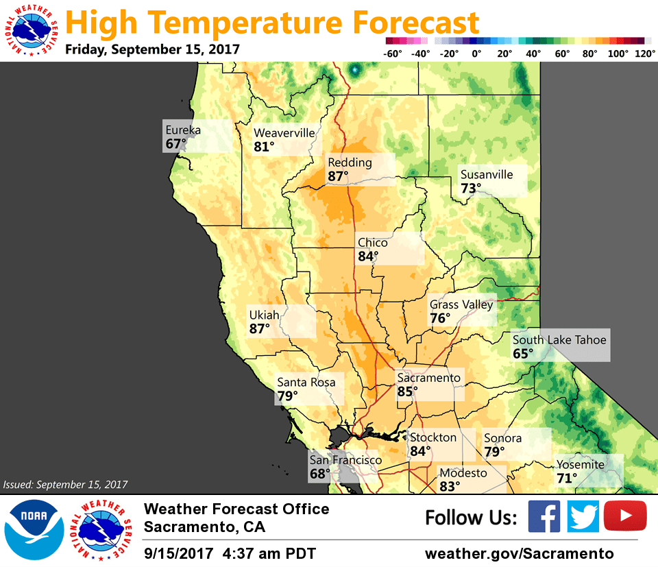
September 15, 2017 – Dry with seasonal temperatures through the weekend. Cooler weather with a chance of showers next week.
Discussion
Upper trough is shifting east with only some lingering clouds left in its wake across portions of the Sacramento Valley and along the west slopes of the northern Sierra Nevada. Current temperatures are cooler compared to 24 hours ago and generally range from the mid 30s to mid 40s in the mountain valleys to the mid 50s to lower 60s in the Central Valley.
Warmer temperatures return to the region today with less cloudiness, synoptic warming and northerly flow. Dry weather with seasonably mild temperatures will continue through the weekend.
Trough forecast to deepen again along the West Coast early next week bringing a return of cooler weather and breezier conditions. Precipitation chances will initially be limited to far northern California.
Extended discussion (Tuesday through Friday)
The extended forecast begins next Tuesday which should be the coolest day with valley highs in the mid 70s and highs over the mountains and foothills ranging 50s to low 70s (40s near the Sierra Crest). This much cooler pattern is thanks to a trough swinging through the Pacific Northwest and extending southward into CA next week.
Latest GFS and ECMWF models indicate that the bulk of precipitation will stay north of us, but we could still see a chance of showers through the end of the week. Showers will likely be over higher terrain, but there’s a slight chance that some shower activity could occur in the northern Sacramento valley.
As stated in the previous extended discussion, these cooler temperatures are likely to catch travelers and outdoor recreationalists off guard! This will also serve to lower snow levels, perhaps significantly enough to cause a dusting of snow across the highest crests. Something to prepare for if you plan to be in higher terrain during the first half of next week. The trough will gradually track eastward which will cause a warming trend after Tuesday.