
November 15, 2016 – A weather system will bring a chance of showers to much of the region today and tonight with lingering showers over the mountains on Wednesday. Dry weather returns Thursday and Friday before another wet weather system approaches for next weekend.
Discussion
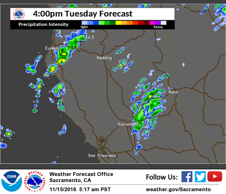
Satellite imagery shows the large trough over the Gulf of Alaska slowly edging closer to the coast. The initial cold front is presently draped across northwest California with radar showing extensive showers extending from south of Cape Mendocino up into southwest Oregon. The leading edge of these showers is nearly moving into western Shasta County.
Much of the remainder of interior NorCal is under clear skies, but increasing winds ahead of the front has lead to milder temperatures early this morning, and valley fog will likely be even more limited than the past several mornings.
The front weakens as it moves inland today, and with rather limited moisture showers will be most numerous over the northern Sierra Nevada with only spotty showers expected in the Sacramento Valley – mainly along the eastern edge. Snow levels will remain above pass levels today, so no travel impacts expected.
A secondary cold front spreads south through the region tonight and Wednesday as the upper trough moves onshore. This will maintain a chance of showers for mainly the mountains and also result in lowering snow levels with some light snowfall accumulations expected across the higher elevations.
Temperatures will lower about 15-20 degrees by Wednesday compared to Monday’s readings. Some moderation of the airmass, and a return of dry weather is expected by Thursday as ridging returns. The strongest warming will be over the foothills and mountains, while strengthening inversions and poor mixing may limit the amount of warming in the Central Valley later this week.
Extended discussion (Saturday through Tuesday)
Widespread precipitation and cooler temperatures are expected over the weekend as a cool trough with a surface cold front moves through Norcal.
Models are a little slower bringing this system in, with precipitation not reaching eastern portions of the forecast area until later Saturday evening or possibly until early evening. The best potential for precipitation continues to be over the Coastal Mountains and Shasta County, where over 2 inches of rain could fall. Locations further south and east should see lesser amounts, especially if the GFS is correct in slowing/stalling the frontal boundary on the west side. Early estimates of snowfall suggest a few inches around pass levels in the Sierra, potentially 6-12 inches at Lassen National Park. Anyone traveling over the mountains this weekend should closely monitor forecast updates for more information on potential winter travel impacts.
Some showers many linger into early next week as weak ridging returns with moist flow. Most shower activity should be in the mountains and foothills and Valley north of I80. Another shortwave could bring more precipitation on Wednesday.