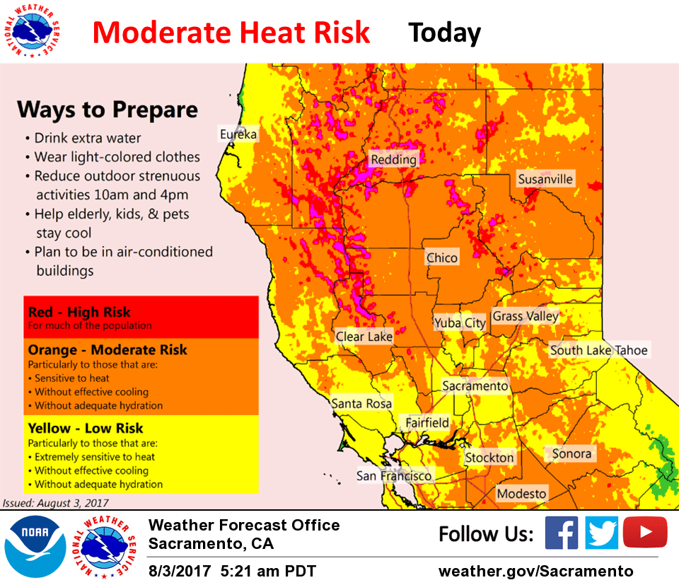
August 3, 2017 – Slightly cooler today but northern portions of CWA still under heat advisory. Isolated late-day thunderstorms over higher terrain each day. A little cooler this weekend and next week but still warmer than normal.
Discussion
Northern California remains under the influence of a strong high pressure ridge over the west coast. This high will weaken slightly today allowing for a slight cooling CWA wide. Satellite imagery shows upper level monsoon moisture pushing northward into the southern forecast area this morning and this cloud cover may also contribute to cooling over the southern CWA and possibly northern CWA as well. A continued light delta breeze will also contribute to the cooling effect in the delta influenced areas. Have therefore downgraded the excessive heat warning to a heat advisory over the northern Sacramento valley and dropped the heat advisory over areas farther south.
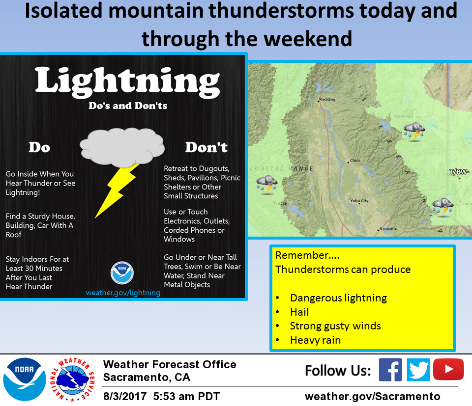
Max temperatures today will still come in well above normal. Other weather concern today is afternoon and evening thunderstorms over the Sierra Cascade crest. Elevated instability proggs indicate that main instability will be over the east side of the CWA so have kept thunderstorm threat out of the coast range today.
A weak upper low over the eastern Pacific nudges closer to the coast on Friday. This will have two impacts. The first will be a little cooling over the entire CWA and enough cooling should occur to end the need for heat related products.
The second will be a more southerly flow aloft which will bring the thunderstorm threat back to the coast range Friday afternoon. Models in fair agreement in pushing the weak upper low over the eastern Pacific inland over the weekend.
Each day should see a little cooling but by Sunday, highs are still predicted to come in a few degrees above normal. Southerly flow aloft will continue to stream tropical moisture northward into the region for varying amounts of mid and upper cloud cover. Currently, forecast holds a thunderstorm threat to the mountain areas only but hinting at some light precip being possible over the lower elevations as well and would not be surprised to see some light precipitation in the valley sometime over the weekend.
Extended discussion (Monday through Thursday)
A weak upper low will remain centered over far northern California next week. This will keep some moisture and instability over the area for slight chances of afternoon showers and thunderstorms over the mountains through Thursday. Temperatures will remain several degrees above normal, but cooler than seen this past week. Valley highs will generally be in the mid to upper 90s, with the low 100s over the northern Sacramento Valley.