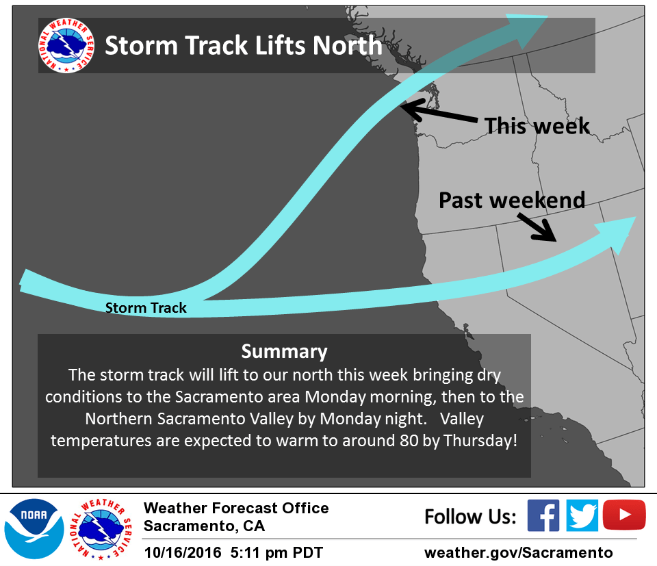
October 17, 2016 – Drier weather returns to NorCal this week as the storm track shifts back to the north of the region.
Winter Weather Advisory until 11 am this morning for West Slope Northern Sierra Nevada.
Discussion
Showers have ended for the most part across the lower elevations of interior NorCal as the slow moving frontal system has shifted south into central California and weakened. Strong westerly flow is continuing orographic showers over the west slopes of the northern Sierra Nevada. Snow levels have lowered enough overnight resulting in chain requirements near the pass levels on I-80 and Highway 50. Winter weather advisory will continue until 11 AM.
Much of the region will begin to see some drying today after several very wet days. However, the northern half of the forecast area will continue to see showers today as the frontal boundary reforms and lifts northward ahead of the next incoming short-wave (currently approaching 140W north of 40N). Soundings look quite saturated this afternoon up in the Redding area with flow continuing to feed up from the south, but some heavier showers and perhaps a thunderstorm cannot be completely ruled out as the short-wave moves onshore.
Further south, weak ridging should provide a chance to mostly dry out today with partly cloudy skies. This will allow creeks and small rivers draining the foothills and Sierra to the east of Sacramento a chance to recede after yesterday’s heavy rains (3-6 inches of rain fell across a large portion of this area).
Strong ridging building along the West Coast will push precipitation chances north of the region beginning Tuesday. Daytime temperatures will see a warmup, and some valley areas may begin to see some late night and morning fog depending on how quickly soils dry from the weekend rain.
Extended discussion (Friday through Monday)
An eastward-retreating ridge will still be in place over the west coast into the weekend. The ECMWF shows a weak trough approaching Northern California on Sunday, while the GFS holds on to the ridge one more day. Either way, Sunday still looks dry with some cloudiness. However, chances are increasing that this precipitation could begin Sunday. Right now the deeper trough impacts the area Monday with some overrunning precipitation across the area ahead of the wave.