Warming trend into next week with widespread moderate heat risk returning to the Valley early next week. Chances for afternoon and evening showers and thunderstorms also return to the Sierra beginning around Tuesday with chances increasing mid-week.

Discussion
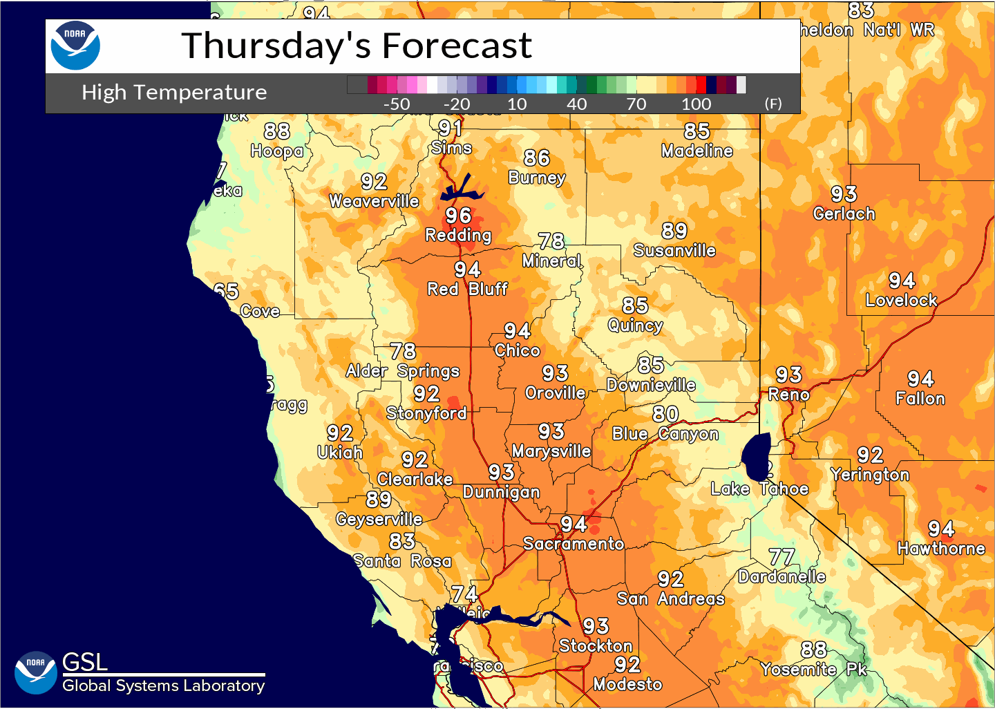
Weather conditions today will be fairly similar to yesterday with a slight uptick in temperatures by a few degrees.
The Delta Breeze is forecast to continue to be in the 20 to 30 mph range. By the afternoon winds increase slightly across the region with gusts expected to be below 15 mph for most locations in the Valley and foothills.
Dry, southwest flow will continue over the region with troughing off the Coast and high pressure to our east.
Extended Discussion (Monday through Thursday)
Ensembles are in decent agreement high pressure is expected to build westward into Northern California early next week as troughing continues off the Pacific Northwest. Temperatures will trend warmer with moderate heat risk across the Valley as well as warm overnight lows along thermal belts.
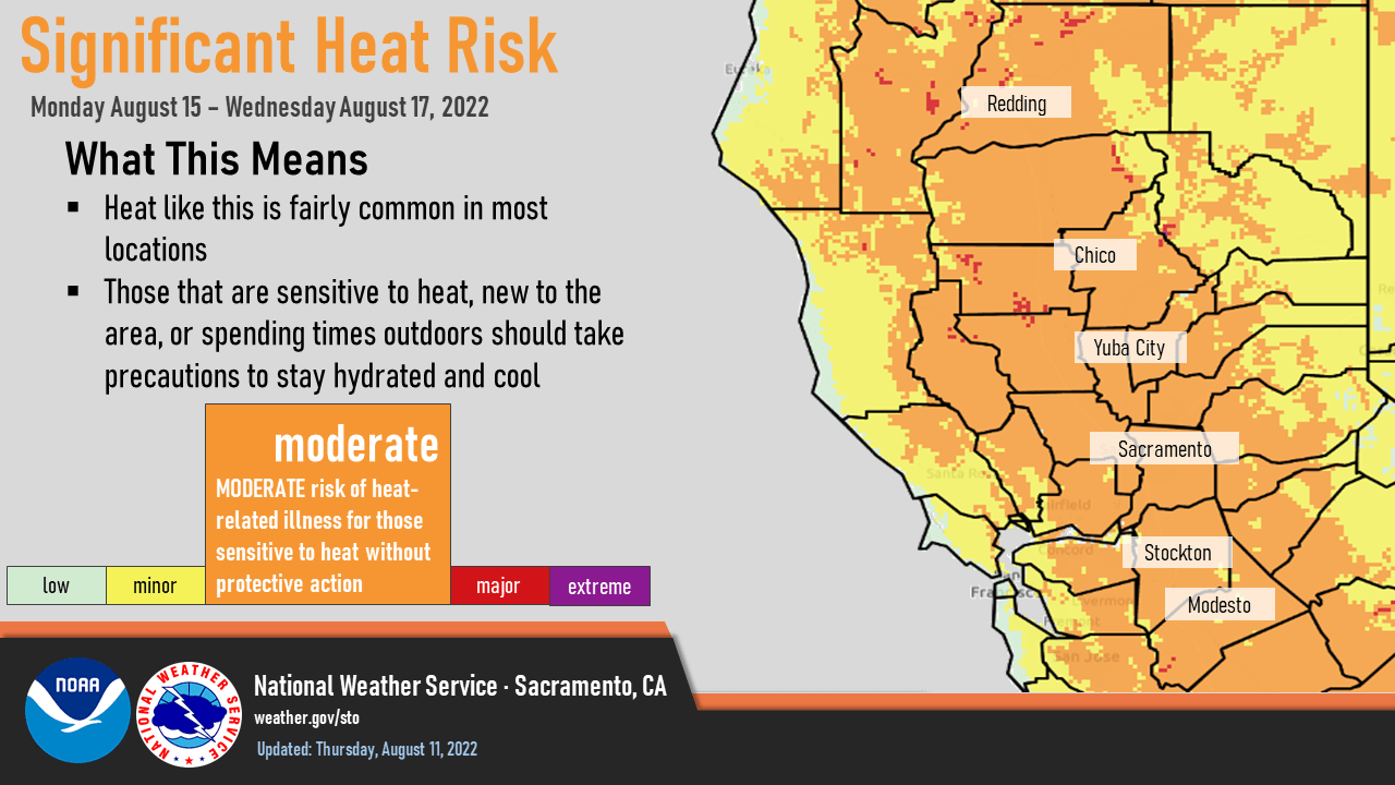
Afternoon highs in the Northern Sacramento Valley could remain in the triple digits for much of next week peaking around mid-week with current forecast highs reaching 106 for some areas.
Monsoonal showers and thunderstorms will be possible once again over the Sierra with chances extending northward mid to late week.
Models are also starting to show the potential for a small low pressure area developing off the Central Coast of California around mid-week. This potential area of low pressure could lead to passing clouds over the region and temperatures trending lower towards next weekend.