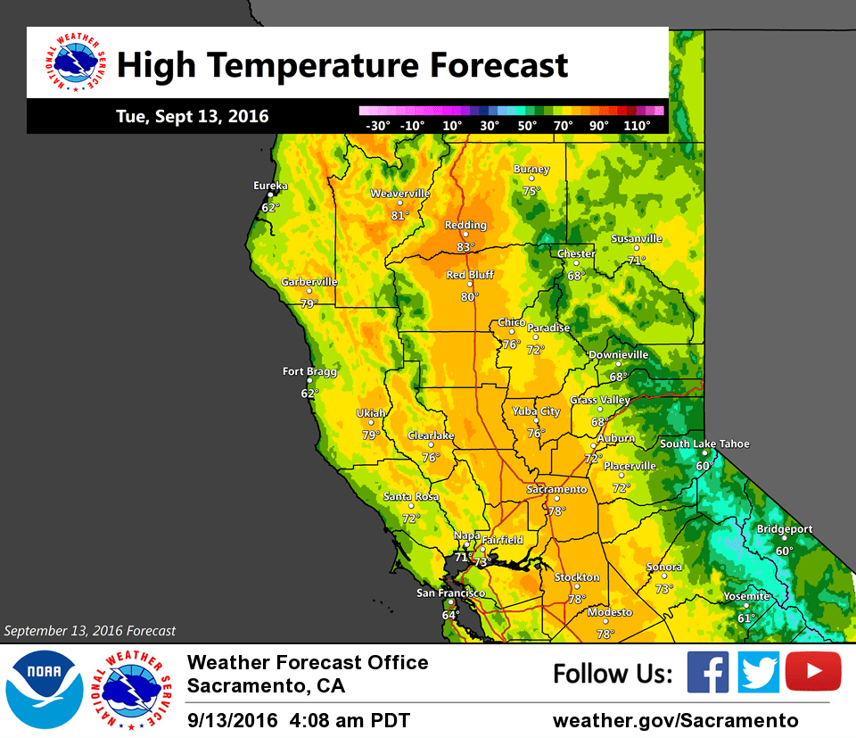
September 13, 2016 – Unseasonably cool today with scattered mountain showers and thunderstorms. Dry with temperatures returning to above average after mid-week.
Discussion
Satellite imagery shows the upper low center now south of the Sacramento area, moving a little faster than models have been projecting. Most of the valley is currently cloud-free while areal coverage of showers and a few thunderstorms has been increasing overnight to the east of the low over the northern Sierra Nevada.
The low is forecast to begin turning more to the east by midday, and then move northeast into northern Nevada this evening. Most shower and thunderstorm activity in the Sierra today is expected to occur from about I-80 southward with perhaps a bit of snow possible over the highest elevations, but little to no travel impact is anticipated over the high passes.
Temperatures will remain well below average today. A modest warming trend will begin Wednesday as the low shifts east and ridging from the eastern Pacific begins to influence the region. Temperatures will return to above average beginning Thursday and continuing into the weekend.
Extended discussion (Saturday through Tuesday)
High pressure will build over California over the weekend, bringing continued dry weather and warming temperatures. Expect highs to reach a few degrees warmer than normal during this timeframe. Although model solutions begin to diverge early next week, all signs currently point to continued dry weather.
Is it too risky to have a fire in one’s wood stove?
Clean chimney and spark arrestor are prerequisites. Safety first! 🙂