Showers return Saturday with snow over the higher elevations. Dry with breezy north wind early next week. Unseasonably warm weather by the middle of next week.
Discussion
Skies are mostly clear across the region early this morning. Surface pressure gradient is nearly flat and winds are calm except for a hint of a Delta Breeze at Travis AFB. Current temperatures are similar to those of 24 hours ago and are mainly in the mid 40s to lower 50s across the Central Valley.
Dry and mild conditions will continue today as short-wave ridging covers the area behind yesterday’s very weak system and the next upstream system that will bring unsettled weather on Saturday.

Precipitation will return late tonight and Saturday morning as the next trough moves in. The system is forecast to split as it moves in with NorCal in-between stronger lift to the north and south of us. Overall, precip amounts of around a quarter inch are expected in the valley with around a half in in the foothills and mountains. Convective enhancement may result in locally higher amounts, especially over the west slopes of the northern Sierra where travel will most likely be impacted.

Snow levels will lower to around 5000-6000 ft Saturday, and 3-6 inches of snow accumulation can be expected over the higher elevations with locally higher amounts. A winter weather advisory remains in effect from Saturday morning until late evening.
Dry and milder weather with breezy north to east wind returns Sunday and Monday as the trough shifts south and east of the area.
Extended Discussion (Tuesday through Friday)
High amplitude EPAC upper ridge builds inland Tuesday as surface high extends through OR into the Great Basin. This will keep gusty north to east wind in the forecast Tuesday with significant warming.
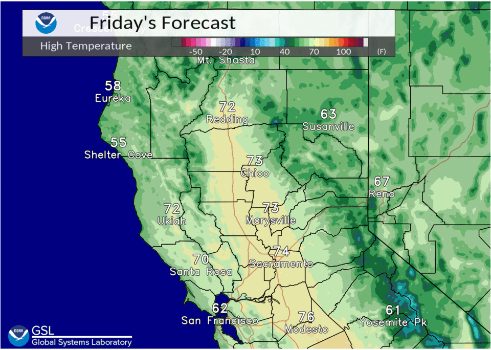
High temperatures in the Central Valley forecast in the 80s Tuesday through Thursday with the potential to set new temperature records. Short wave trough weakens upper ridge Friday, cooling max temps back into the 70s in the Central Valley.