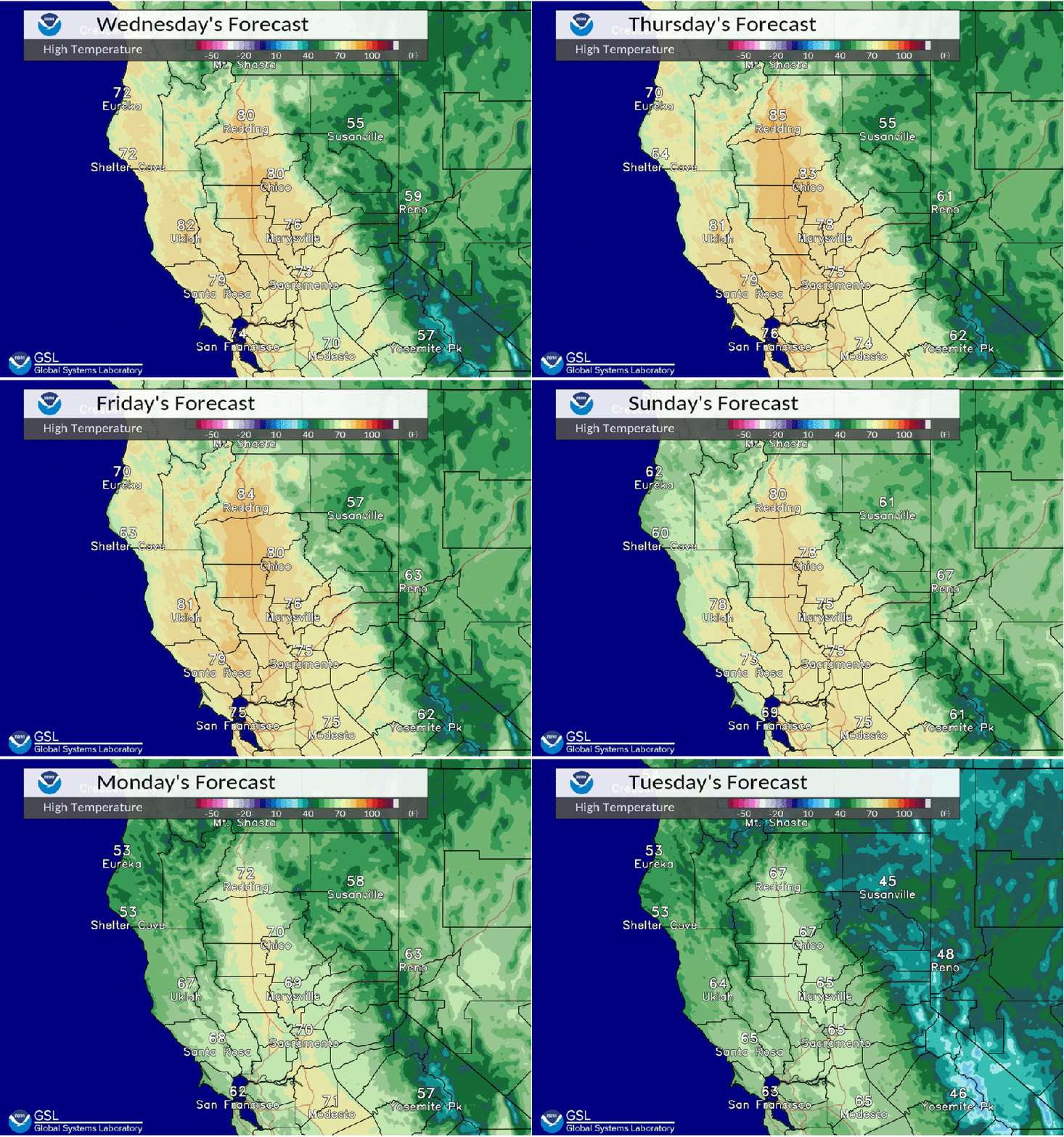
Dry weather with above average high temperatures this week. Breezy north to east wind at times.
Discussion
Other than a few high clouds spilling into NorCal over the eastern Pacific ridge, skies remain clear early this morning. North and east surface pressure gradient remains tight, around 9.5 mbs from MFR to SAC and about 8 mbs from RNO to SAC.

Locally gusty easterly winds of 30-50 mph continue across the usual windier spots in the northern Sierra, and gusts of 15-30 mph persist along the western edge of the Sacramento Valley.
Besides the breezy north to east winds lasting into Thursday, the big story the next several days will be the unseasonably warm temperatures across interior NorCal through the remainder of the week as highs will be around 10-20 degrees above average.
Daily record highs will be in jeopardy today through Saturday, and there’s an outside shot that a few locales may set February monthly records Thursday and Friday as the ridge moves overhead.

Overnight lows will also be mild, especially in the thermal belts where readings will be 5-15 degrees above normal. Clear skies, a dry airmass and light winds will allow good radiational cooling for wind-sheltered valleys where lows will be closer to average.
Extended Discussion (Sunday through Wednesday)
Strong upper level ridging will begin to push to the east over the weekend as a trough digs into the PacNW. This will bring a slight cooling trend to the area but highs will still remain well above normal for this time of year.

Ensembles are starting to come into better agreement with the trough next week as it digs out of the PacNW but there is still some uncertainty on its placement. From the WPC clusters about 75% of the ensemble members support a north and east wind event while about 25% support the trough digging to our west with less wind.
A wind event is favored and given the record heat this week and lack of rain over the last month plus we could see some elevated fire weather concerns for early next week.
