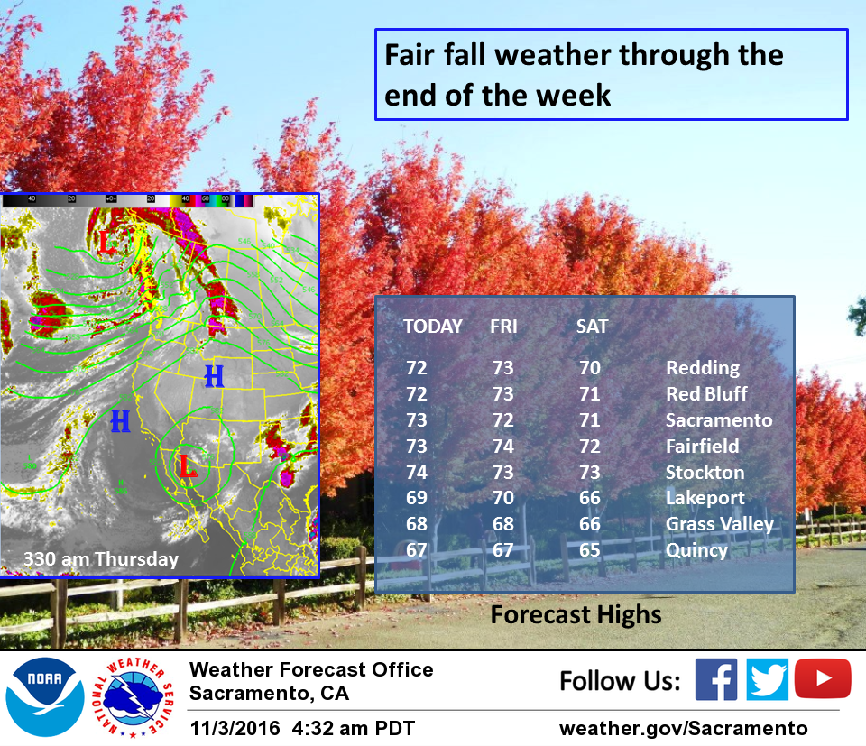
November 3, 2016 – Dry with slightly above normal temperatures into Saturday and patchy morning valley fog. Weak weather system moves through Saturday night into Sunday bringing some cooling and a chance of light scattered showers, mainly north of I-80. Slow warming trend back to near normal by the middle of next week.
Discussion
Large upper ridging centered over the Central U.S. extends westward over NorCal providing subsidence and dry weather. Patchy valley fog/stratus has developed early this morning but for the most part is not impacting the commute and will dissipate quickly. High temperatures today expected to be several degrees above Wednesday with lower 70s throughout the Central Valley. Some high clouds streaming into the area today in southwesterly flow aloft. Pattern continues through Friday with more patchy morning fog and a couple degrees additional warming.
Weak frontal system approaches Saturday and is progged to move through Interior NorCal Saturday night into Sunday. Baroclinic zone stretches and weakens as it moves onshore, so precipitation looks light and scattered, generally north of I-80. Models have been trended less with QPF and POPs may continue to lower as the event gets closer. Some cooling expected over the weekend with below normal temperatures most areas Sunday. Snow levels look to remain above pass levels through the weekend.
Extended discussion (Monday through Thursday)
Dry weather returns early next week as high pressure rebuilds over California. Temperatures are expected to remain within a few degrees of normal through the extended period.
Longer range models are hinting at another weakening weather system moving through the area next Wednesday. The ECMWF is the most bullish with this system, but even it keeps most of the precipitation along the northern CA coast, and away from our forecast area.