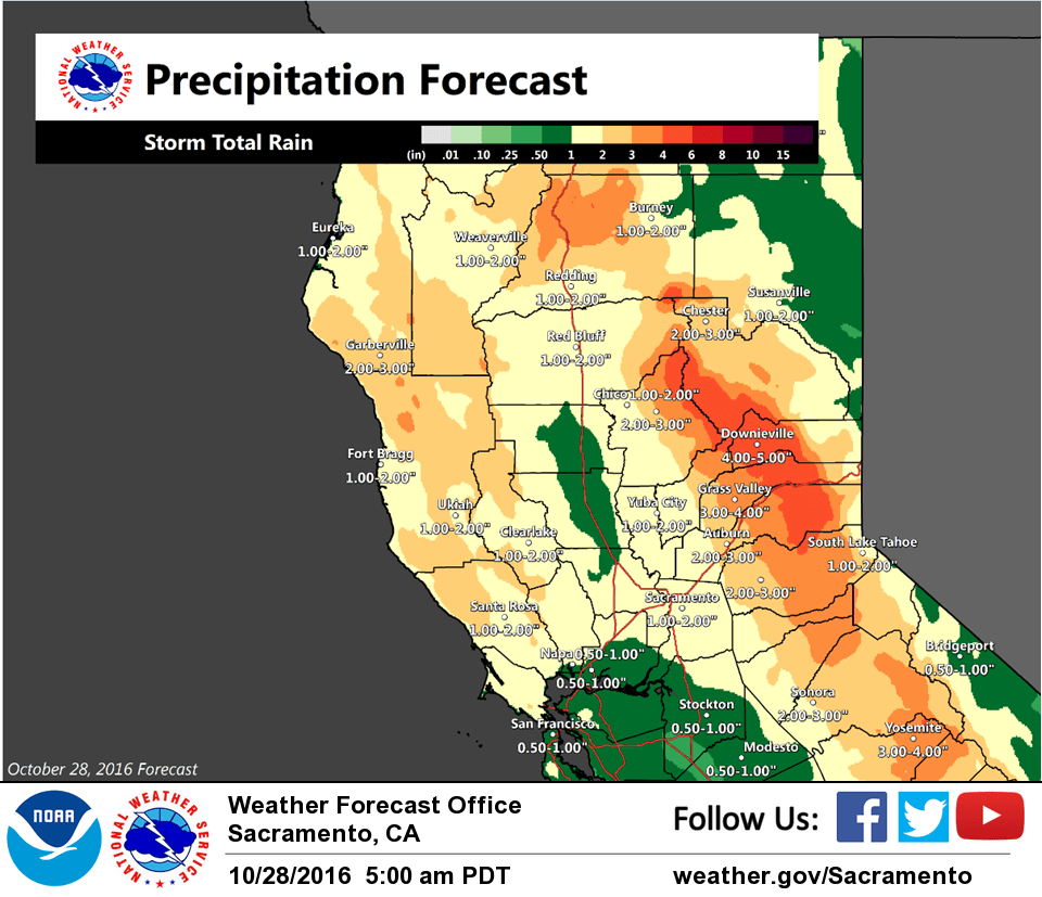
October 28, 2016 – Wet and unsettled weather through the middle of next week as several weather systems move across the area. Gusty south winds on Sunday.
Winter Storm Watch from late Saturday night through Sunday evening for West Slope Northern Sierra Nevada-Western Plumas County/Lassen Park.
Discussion
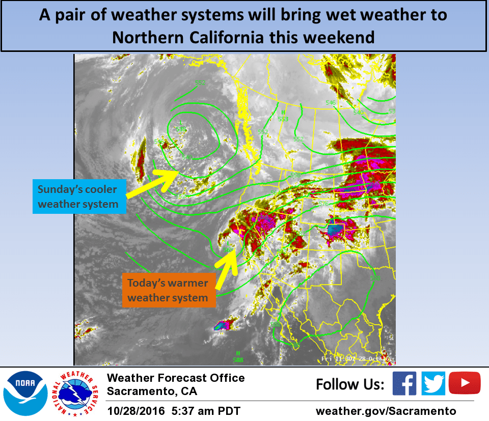
Light to moderate warm sector precipitation has been falling over the southern three quarters of the CWA over night ahead of a low pressure system now centered off the central CA coast. This low and its associated cold front will move through central California today bringing rain or showers to nearly all the forecast area. Surface and upper level pressure gradients remain weak today so winds should not be all that strong.
Moderate precipitation will continue over the northern Sierra but snow levels with this warm system will remain well above pass levels so impacts will be minimal. Norcal remains under moist southwest flow on Saturday. Shortwave disturbances pivoting through this flow will bring a threat of showers overnight and through the day but expected precipitation amounts will be much less than today.
Another colder low pressure system now in the Gulf of Alaska will drop into the eastern Pacific on Saturday night then push into Norcal on Sunday bringing another round of heavier precipitation. The main frontal band is forecast to move into the Sierra by Sunday afternoon.
This colder system will mean lower snow levels and it is likely that significant snowfall will occur at the major passes.
Therefore, have left up the winter storm watch already in place. Surface pressure gradients indicate breezy south winds on Sunday.
At this time, it appears winds Sunday afternoon in the valley will remain under advisory criteria but winds will be somewhat stronger over the Sierra and will continue to mention these winds in the Winter weather watch. The first part of Monday will be another in between day with yet another Pacific storm forecast to push onto the Norcal coast by Monday afternoon and night.
Extended discussion (Tuesday through Friday)
Models swing upper trough through Interior NorCal Tuesday. Dynamics look fairly weak with this wave and thus POPs are slight to chance category with best chances over the mountains. Weak upper riding follows Tuesday night into Wednesday. Models diverge midweek with ECMWF/GEM swinging another Pacific front through Wednesday afternoon into night with associated QPF mainly over the Coastal range and Northern mountains. GFS is significantly slower bringing a more elongated wave inland Thursday. Forecast follows the ECMWF/GEM during this period which advertises mainly dry forecast Thursday into Friday under upper ridging.