January 31, 2017 – Dry with patchy morning valley fog through Wednesday. Wet pattern returns Wednesday night with heavier rain and mountain snow on Thursday and Friday.
Winter Storm Watch from Wednesday evening through Friday evening for Mountains Southwestern Shasta County to Northern Lake County- West Slope Northern Sierra Nevada-Western Plumas County/Lassen Park.
Discussion
Weather conditions are pretty similar to 24 hours ago with high pressure still in control and some high clouds spilling through the ridge. Temperatures are similar to yesterday at this time and generally range from the teens and 20s in the mountains valley to the 30s in the Central Valley. Thermal belts in the foothills and Sierra are in the 40s.
Appears there is a little less high cloudiness and dew points are a bit higher, so a little more patchy fog can be expected across the southern Sacramento and northern San Joaquin Valleys early this morning.
Little overall change is expected through Wednesday with patchy morning fog, cool mornings, and mild afternoon temperatures continuing.
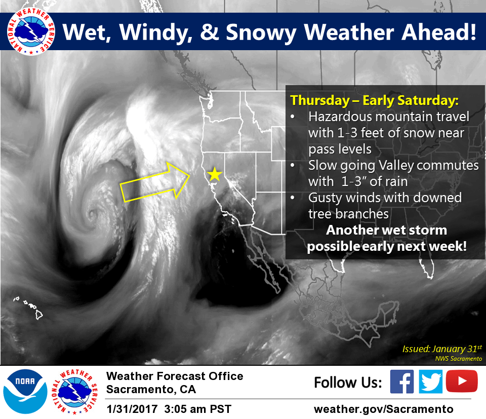
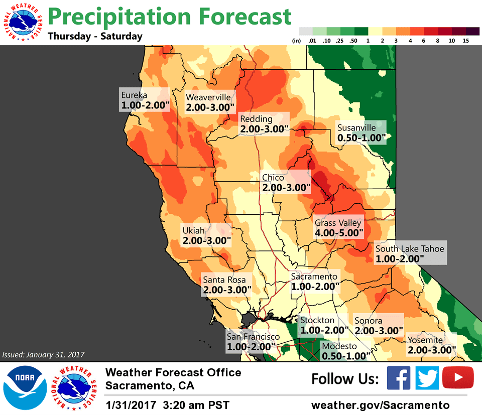
An approaching upper low and associated frontal system in the eastern Pacific will bring a return of wet weather to NorCal starting Wednesday night and continuing into the weekend. By Friday, an inch or two rain will be possible in the valley with 1-2 feet of snow in the mountains above 6K ft (local amounts of 3 ft or more possible over the peaks). Gusty southerly winds will also develop across the region on Thursday and a winter storm watch has been issued for the mountains.
Extended discussion (Saturday through Tuesday)
Several changes made in the extended period as models have trended toward wetter, more active pattern for the weekend into early next week. Thursday/Friday system will continue to push east on Saturday with showers lingering mainly in the mountains. Additional accumulations should be light with a few more inches of snow down to around 6000 feet. May still be enough to impact mountain travelers, especially given usual weekend traffic. Breezy southerly winds will continue. Latest model solutions less robust in building ridging into the area briefly on Sunday. Showers may continue across the mountains, north of I-80, with perhaps a brief break in the Valley.
Models in better agreement for late Sunday into Monday with large storm system/trough brewing off the West Coast. Upper level low will approach the area Sunday night, spreading another round of widespread precipitation across the area into Monday. Have increased chances for precipitation from previous forecast during the period and knocked temperatures down a few degrees. Snow levels look similar to this week’s system, in the 5000-6000 feet range. Some decent accumulations possible if model solutions hold, which would serve to impact mountain travel during this period. Another round of breezy southerly winds would accompany system as well. Details will need to be fine-tuned with future forecasts, but certainly one to keep an eye on.