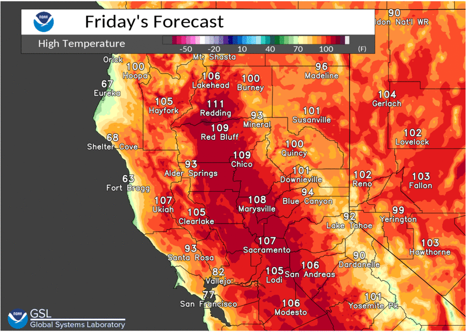
Dry conditions are forecast to continue with very hot temperatures expected through the weekend and continuing into early next week. An Excessive Heat Warning is in effect for much of interior NorCal this afternoon through Monday evening when the hottest weather is expected.

Discussion
Westward extension of the 4-Corners High pressure cell will allow for another impressive heat wave for NorCal today and through the weekend. The hottest days appear to be this weekend when 850 mbs temperature anomalies exceed 2 over the Central Valley, and are forecast to reach 30-31 deg C in the Valley. Usually these temps are to our east, but the westward expansion of the 4-Corners high has pushed them farther W and into the Valley.
Dry-adiabatic descent of this air pushes the max temps into record/near record territory, with only cloud cover or wind direction as a limiting factor. The NBM forecasts RDD (115 in 2002) and DTS (112 in 2002) to tie/break their records on Sat and only RDD (114 in 1999) on Sun. But we did add MOD (110 in 2002) and RBL (114 in 2002) on Sat, and RBL (113 in 1999), MOD (110 in 1961) and DTS (110 in 1961) to that possibility on Sun as 850 mbs temps remain anonymously positive and at 1000 mbs the 40 Deg C isotherm remains in the proximity of the Srn Sac/Nrn San Joaquin Valley.
A more SWly wind flow on Sun may keep the SAC area from a record, instead of the Wly flow on Sat, but the marine layer will be suppressed by the strong ridging over Norcal and may not have a strong impact on cooling until the ridging weakens early next week.
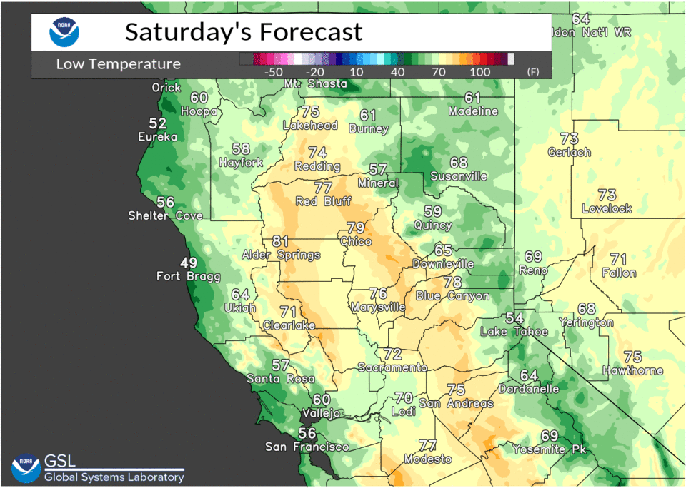
Due to the anonymously hot 850 mbs temps, thermal belt areas will be extremely warm overnite, where high minimum temp records may be achieved as well. By Mon, the extreme anomalies are easing and by Tue/Wed there is enough of a synoptic change to end the excessive heat.


Thunderstorm activity looks virtually nil for our CWA for the next couple of days, except where moisture and instability become focused near the Crest in the Tuolumne/Alpine County areas. Water vapor imagery shows some remnant subtropical moisture working around the high which forecast satellite imagery shows becoming focused over the Central/Srn Sierra during the afternoons, and which may just clip our CWA in the extreme SE corner (mentioned above).

One last note is the possibility that DTS may tie or even break its all time record high of 114 (7/17/1925). Sat appears to be the best chance of this happening with the most reasonable of the CONS models (BCCONSRAW) showing about a 50/50 probability, while the NBM Viewer is less than 10%.
Extended Discussion (Tuesday through Friday)
Upper ridging over interior NorCal flattens through the extended forecast period as short waves progress into the West Coast. This will result in a downward trend in temperatures to near normal towards the end of next week.