
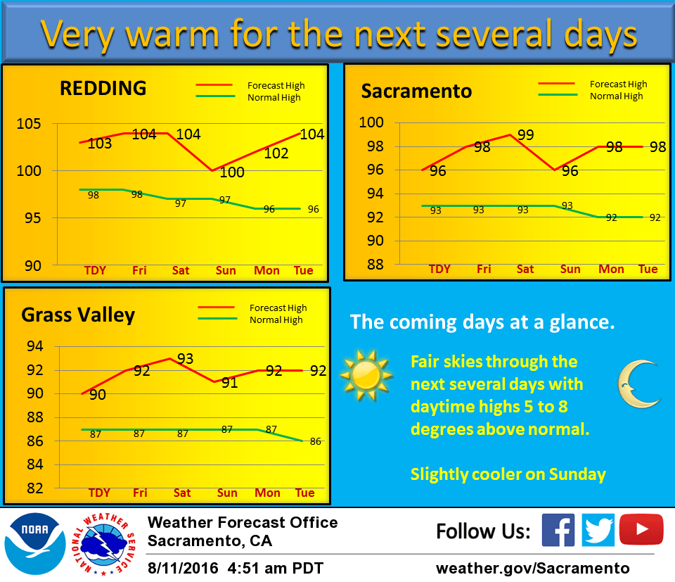
August 11, 2016 – Dry weather with a gradual warming trend for the rest of the week. Continued dry with above normal temperatures through next week.
Discussion
Upper level high pressure pushing in over the west coast for fair skies over the CWA this morning. Delta breeze running slightly stronger than 24 hours ago with a similar marine layer depth. IR fog product shows coastal stratus making it into the western delta at this time. Early morning temperatures running about the same as yesterday morning. Overall airmass under the building ridge will warm a few degrees today putting the northern Sacramento valley back above 100 degrees and everywhere else back a little above normal. Exception could be the delta and near delta areas where a continued moderate delta breeze through the day may bring slightly cooler temperatures. Upper ridge continues to strengthen with its axis centering over the coastline on Friday. This will bring slightly more warming on Friday. This warming process continues into Saturday when daytime highs top out at around 100 to 105 throughout the central valley or several degrees above normal. Winds most areas should remain fairly light under the ridge with a weaker delta breeze. Upper ridge axis gets shifted eastward a bit on Sunday as a small trough pushes into the Pacific Northwest. As a result…most areas will see a few degrees of daytime cooling, although likely staying at least a little above normal, as well as an uptick in onshore winds.
Extended discussion (Monday through Thursday)
Little change in the weather through next Thursday as a weak, dry trough remains over the area. Temperatures remain several degrees above normal, slightly warmer than on Sunday. Northern portions of the Sacramento Valley are expected to see some triple digits. Looking further out, this pattern appears to linger. A possible change could be some monsoonal moisture gradually working northward up the Sierra late next week.