May 4, 2021 – Warm and dry weather pattern will continue through mid week, then cooler Thursday and Friday. Gusty northerly winds through midday today resulting in fire weather concerns.

Discussion
Upper level ridge in place over NorCal is bringing dry and very warm conditions. Surface gradient and resulting gusty north winds down the Sacramento Valley will weaken by midday. A few gusts to 25 mph, combined with low humidity, may result in enhanced fire weather concerns mainly over the Northern/Western Sacramento Valley with the very dry conditions.

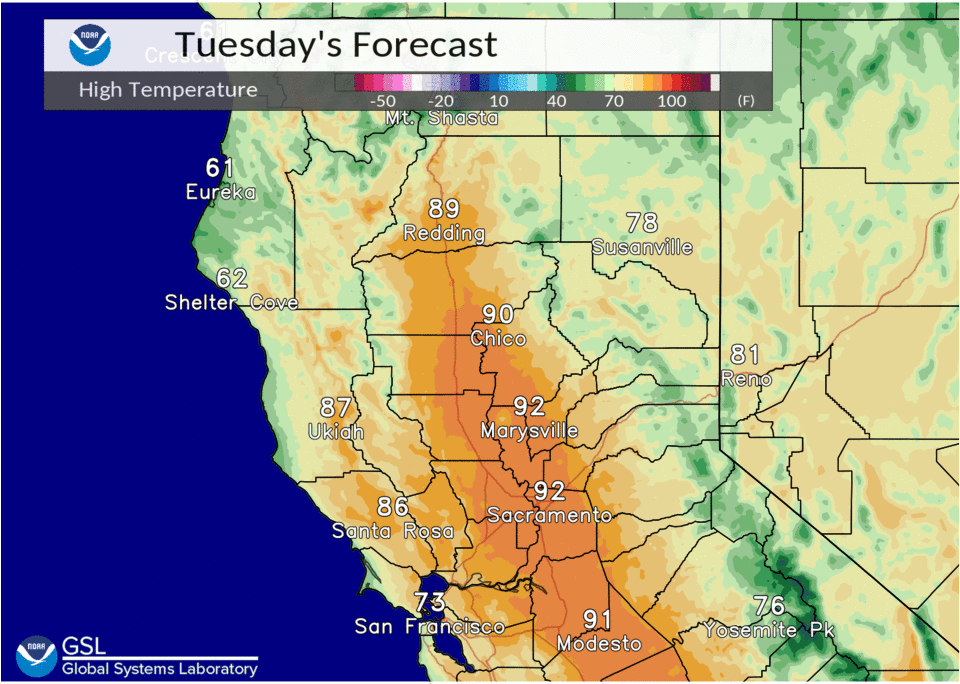
High temperatures will be in the low and mid 90’s today and Wednesday. These readings are 15 to 20 degrees above normal for this time of year. Record highs generally range from 97 to 100 degrees at most locations, so will probably stay just below record levels.
Ensembles and clusters in good agreement with trough approaching the West Coast Thursday and Friday.
This will likely initiate onshore flow/Delta breeze, which will cool temperatures back into the upper 70’s and low 80’s. Southwest wind gusts up to 25 mph will be possible, higher through the Delta, especially Thursday afternoon.
Extended discussion (Saturday through Tuesday)
Dry weather with warming temperatures expected through the extended forecast period as EPAC upper high builds inland. Highs climb from the lower 80s Saturday in the Central Valley to near 90 early next week.
Gusty north to east wind develops late Friday and persists into Monday over much of interior NorCal.