Cooler weather this weekend, with warming back to near average/seasonable temperatures and warmest on Tuesday.

NOAA 6-10 day temperature outlook map for October 1-5, 2026, issued September 25, 2026. Above-normal temperatures likely across the East, South, Southwest, and Hawaii; near-normal in the Plains and Upper Midwest; below-normal in western and northern Alaska

Periods of Elevated Fire Weather Conditions continue into next weekend morning due to breezy winds and low relative humidity.

Fire weather graphic rated minor risk for Sept 28-29, 2026: gusty north-to-east winds 15-40 mph and 15-25% humidity across Northern Sacramento Valley, Sierra, and Coast Range, with fire safety tips listed in accompanying text

Monday PM into Tuesday AM: North to east winds gusting 15 to 25 mph develop through the Sacramento Valley and up to 30-40 MPH over higher terrain.
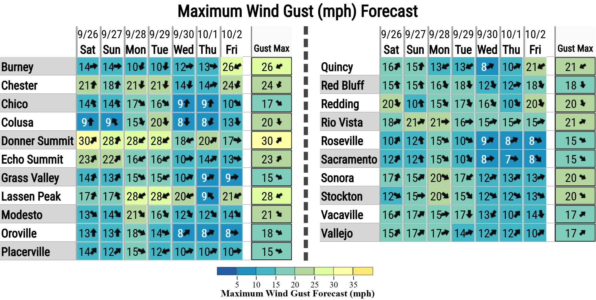
Table of maximum wind gust forecasts (mph) for Northern California towns, Sat 9/26 through Fri 10/2, with weekly max gusts ranging from 15 to 30 mph; Donner Summit highest at 30 mph

There is a slight mountain thunderstorm chances (up to 10%) on Monday along the Sierra, with highest chances remaining south of Highway 50.