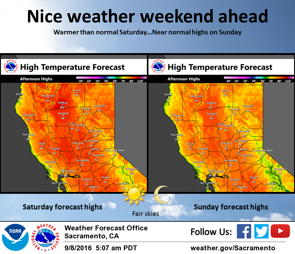
September 8, 2016 – Dry with above normal temperatures through the end of the week. Hazy at times due to fire smoke. Cooling to a little below normal early to middle of next week. A slight threat of Sierra crest thunderstorms Monday and Tuesday.
Discussion
Slightly breezier conditions and a warmer airmass bringing in early morning temperatures several degrees above 24 hours ago. Exception is the northern Sacramento valley where a decrease in the northerly winds from Wednesday morning has allowed for cooler temperatures this morning. Flat high pressure over the eastern Pacific and west coast will bring continued fair skies today except possibly for some haze in the vicinity of major wildfires. Overall, temperatures today will come in similar or slightly warmer to Wednesday or a few degrees above normal for this time of year. The exception will be the delta and delta influenced areas where an increase in the delta breeze today combined with a more extensive marine layer should bring a few degrees of cooling compared to Wednesday. Upper ridge axis amplifies and shifts inland on Friday bringing a little bit of warming most areas. Exception again will be the delta and delta influenced areas where the marine layer and delta breeze will be bigger players. Other than that delta area, winds over the CWA should remain fairly light under light pressure gradients aloft and at the surface. Little change in the weather pattern is expected on Saturday as high pressure ridging slides over the north state. An upper trough dropping into the Pacific northwest out of western Canada will bring the start of a cooling trend as onshore flow is increased and the overall airmass cools. Development of this trough over the region will bring more changes later in the week.
Extended discussion (Monday through Thursday)
High pressure will give way to trough dropping into the region for the start of the work week. Models have been fairly consistent over the past day or so with timing and strength of trough that will bring cooler temperatures to the area. With the exception of the northern Sac Valley, valley highs on Monday will top out in the low to mid 80s, several degrees below normal for this time of year. Even cooler temperatures expected in the Delta region. In additional to cooler weather, trough may bring a chance for precipitation across the Sierra. Overall coverage of any precipitation will depend on how far west the trough moves, but for now looks like best chance for any showers will be near the Sierra crest. A few thunderstorms not out of the question Monday and Tuesday afternoons with marginal instability. Could see some breezy winds as well with system, especially across higher elevations. High pressure builds in by mid-week as trough shifts off to the east. This will bring a warming trend in temperatures and decreasing cloud cover.