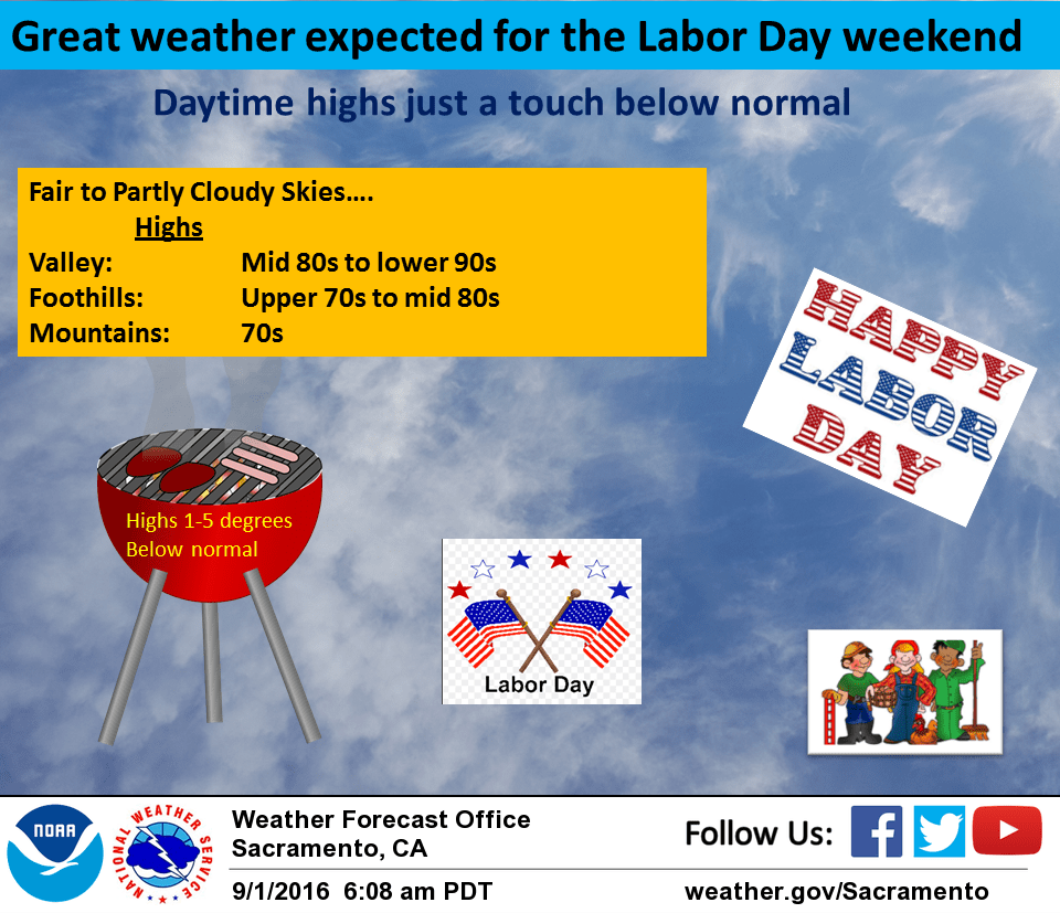
September 1, 2016 – Dry weather with a little below average temperatures through early next week. Warming to a little above normal the second half of next week. Locally breezy at times, mainly in the Delta and over ridgetops.
Discussion
Upper trough over the west coast will bring cool onshore flow and a little below normal temperatures the next couple of days. Shortwaves pivoting through this trough will bring breezy ridge winds at times but any precipitation should remain north of the state. The coolest temperatures over the next week are expected to occur over the weekend when the main trough axis pivots through the north state. Models starting to pick up on idea of some possible precipitation over the northeast corner of the state Saturday night or early Sunday. For now, have left this time period dry since this is a fairly new development but will need to watch this feature to see if future runs continue with this deepening trend. Remainder of Sunday looks dry as the upper trough axis shifts into the Great Basin and northwest flow develops over the north state.
Extended discussion (Monday through Thursday)
Models are in fair agreement to the amplitude and position of the upper level trough over the western third of the CONUS for the beginning of next week. North to northwesterly flow aloft will keep temperatures about 5 degrees below average on Monday as cooler air is advected into northern California. As the upper trough shifts eastward and ridge builds in the eastern Pacific, temperatures will gradually warm up to near normal for mid-week. No significant chances for precipitation are expected at this time across the forecast area.