May 19, 2017 – Dry with a warming trend forecast for the next several days. NorCal’s first triple digit heat possible early next week. A chance of Sierra showers and isolated thunderstorms early next week.
Discussion (Today through Sunday)
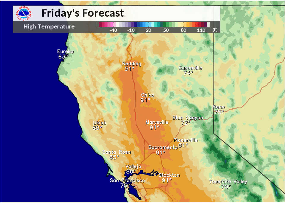
Clear skies over the CWA this morning under building high pressure aloft. Airmass warms several more degrees today bringing daytime highs up to about 10 degrees above normal. Northerly winds will continue today under light northerly flow but gradients have weakened since yesterday so should see a little lighter winds. A shortwave trough dropping through the Pacific northwest will keep temperatures fairly level on Saturday although they may still bump up a degree or two.
Models somewhat in agreement in developing weak troughing over the state on Sunday. GFS consistently deeper with this trough and develops enough instability for a slight threat of showers over the Sierra in the afternoon. The highest instability will be from Tahoe southward so limited thunderstorm threat to south of about U.S 50. Elsewhere will see continued fair skies and a bit more warming.
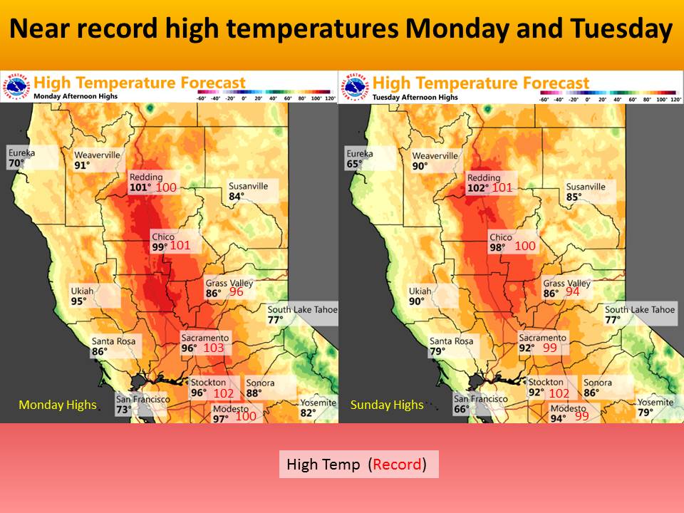
Upper level ridge axis centers over the west coast on Monday bringing more airmass warming. Daytime highs may top 100 in the northern Sacramento valley with a few weaker high temperature records possibly falling. GFS still showing a slight instability over the northern Sierra so could see another day of isolated Northern Sierra afternoon or evening thunderstorms.
Extended discussion (Tuesday through Friday)
High pressure strengthens early next week. 100 degree heat is projected across the northern portions of the Sacramento Valley Monday and Tuesday. By Tuesday, the heat will be limited as the Delta Breeze develops and brings cooler air into the Valley.
An upper low spinning well off the California coast will cause cooling influence of the onshore flow starting Tuesday as the ridge weakens slightly toward the middle of next week.
Enough instability and moisture may exist in the high Sierra for a chance of afternoon/evening showers and thunderstorms near and south of Lake Tahoe through Monday and up through Lassen Park Tuesday and Wednesday. Thunderstorms diminish Thursday and Friday under southwest flow aloft.