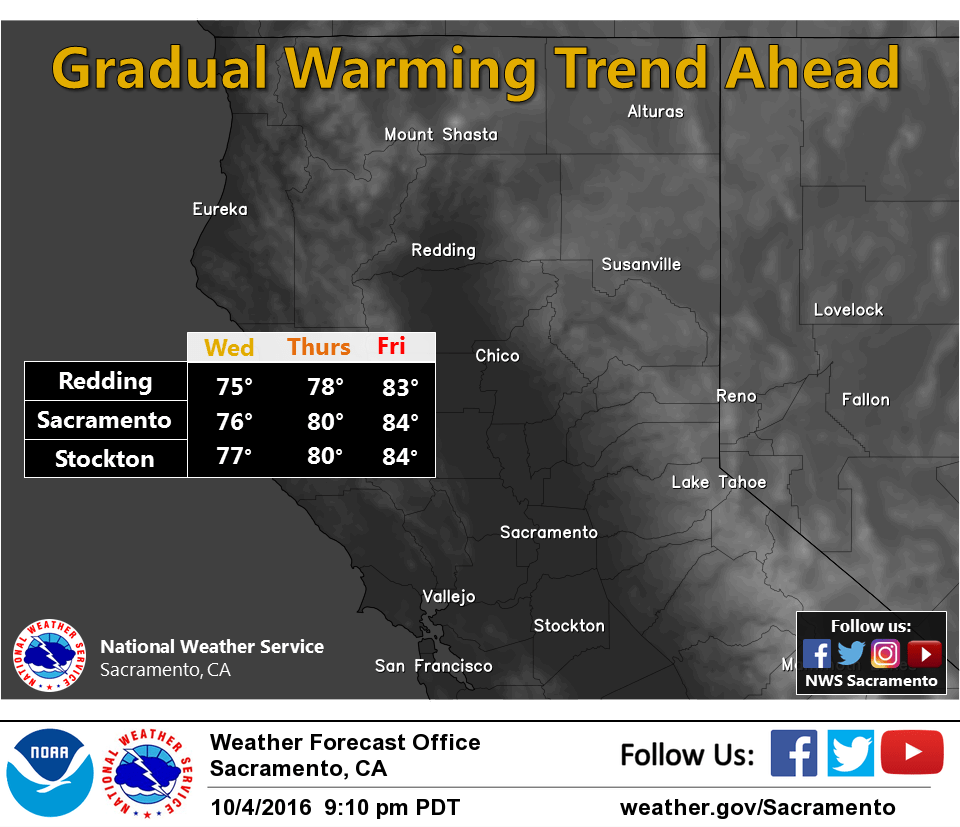
October 5, 2016 – Slight chance of showers over the northern mountains today, then dry weather with a gradual warming trend the rest of the week.
Discussion
Mostly clear skies across interior NorCal except for some clouds over the far north. Temperatures are in the 30s in the mountain valleys, and 40s and 50s elsewhere.
The low pressure area along the Washington coast will move east through the PacNW today with the tail end clipping far northern California, and perhaps generating a few showers across the northern mountains.
The remainder of interior NorCal will see plenty of sunshine today with breezy northerly winds developing through the Central Valley. Temperatures will be similar to Tuesday’s.
Dry and milder weather returns Thursday through the rest of the week with temperatures returning to above average.
Extended discussion (Sunday through Wednesday)
Upper level high pressure brings continued dry conditions on Sunday but daytime highs are forecast to slip down to around normal as the upper ridge axis shifts east of the state. Temperatures continue to cool on Monday as a weak upper trough clips the northwest corner of the state.
At this time, moisture appears limited with this system so have left Monday dry CWA wide for now. Still a bit more cooling is expected on Tuesday as a Pacific frontal system of slightly more strength pushes into the Pacific northwest.
Tuesday looks dry at this time but some increased cloud cover is likely over the northern most forecast area. As this system pushes inland Tuesday night, some light precipitation is possible over Shasta county. Model timing differs with ECMWF being the fastest pushing precipitation into the north state by Tuesday night while the GFS holds off until Wednesday. GEM model looks even a bit slower. At any rate, increasing clouds and a bit more cooling are in store for the middle of next week with daytime highs about 5 to 10 degrees below normal.