December 11, 2016 – Dry Sunday and Monday followed by potentially significant rain and mountain snow Tuesday through Thursday. Winter Storm Watch from Tuesday morning through Wednesday afternoon for West Slope Northern Sierra Nevada.
Short Term Discussion (Tonight through Wednesday)
Precipitation has ended as the cold front has exited the area and the moisture plume shifts southward into Southern California. Clearing skies, light winds and wet ground are allowing areas of fog to develop over the Sacramento Valley this morning. A Dense Fog Advisory is in effect through 10 am this morning for the central and southern Sacramento Valley. Motorists are urged to use caution if driving this morning.
Today will start much cooler than Saturday, with current early morning temperatures about 15 degrees lower than this time yesterday. Dry weather is expected today and Monday. Valley highs in the low to mid 50s are forecast. High cloud cover spreading in early Monday may be enough to inhibit fog formation in the morning.
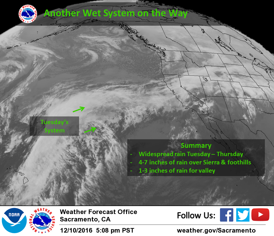
The next storm system begins to spread in late Monday night into early Tuesday. This system will have a very wet plume of moisture, similar to the one which brought heavy precipitation yesterday. While the exact timing and location have varied, confidence is improving in the potential for another wet event.
The difference with this and the last system is there will be some cooler air ahead of this system which will allow somewhat lower snow levels, bringing the potential for significant snow impacts for mountain travel Tuesday into Wednesday.
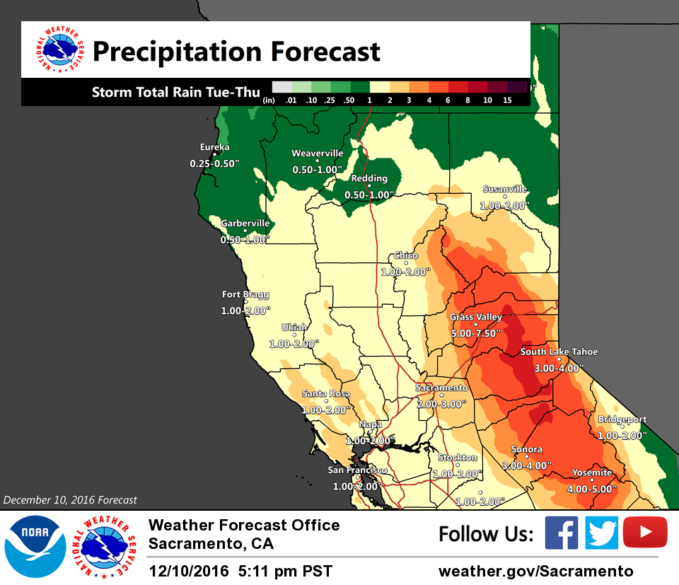
Snow levels are expected to rise to around pass levels late Tuesday night into Wednesday as warmer air advects in. Up to 1 to 2 feet of wet snow are possible at pass levels by Wednesday afternoon. Several inches of snow are possible down to around 5000 feet over the Northern Sierra, and down to 4000 feet over the mountains of western Plumas County and Lassen Park. A Winter Storm Watch is in effect from early Tuesday through Wednesday afternoon. Additional snow is also possible with another system on Thursday.
In addition to heavy mountain snow, moderate to heavy rain is possible in the foothills and lower mountains. While river and stream levels will have a few days to lower some after the latest wet event, they will still be elevated. Rainfall amounts could be enough to cause small stream and street flooding, so this system bears watching.
Extended discussion (Thursday through Sunday)
All long range models indicating another impulse of subtropical moisture will be pushing into northern California on Thursday so looks like another round of moderate valley rain and mountain snow. A upper trough digging down from the Gulf of Alaska will feed in enough cold air to bring snow levels down to well below pass levels so Sierra travel will continue to be impacted. The cool air will also keep daytime highs near or a little below normal despite tropical airmass. The batch of tropical moisture will push inland on Friday as the Gulf of Alaska trough pushes in over the west coast. This will bring a transition to more showery weather and a significant cooling effect. Snow levels with this cold air will drop down to 2000 to 2000 feet with daytime highs forecast at 5 to 10 degrees below average. This will be a much drier airmass so at least precipitation amounts should be fairly light.
By Saturday, northerly flow aloft pushes in over NorCal bringing drying and an end to any shower threat. Daytime highs Saturday will remain on the cold side remaining in the 40s in the central valley and well below season normals. Surface gradient progs indicate breezy north winds. Dry conditions continue on Sunday with temperatures warming a bit as high pressure pushes over the state. Even with warming, daytime highs remain well below normal.
The 5.57 inches of rain dropped on Saturday raises the season-total-to-date to 23.68 inches at Downtown Farm in Colfax, a little more than twice what we had at this time last year. A similar amount from this next storm falling on already saturated ground will likely trigger some land slides, so watch out.