
Happening Now brings you community news, updates and announcements throughout the day.
Send your photos and updates to 530-478-9600.
July 31, 2026 at 8:47 PM There are no evacuations in the Idaho-Maryland area, two-tone sirens were an accidental activation.
July 31, 2026 at 8:30 PM Units in the area, assisted by law enforcement, are searching the Idaho-Maryland area and surroundings.
July 31, 2026 at 8:26 PM Smoke check on Idaho-Maryland Road, units are in the area.
July 31, 2026 at 8:13 PM Power has been fully restored on the San Juan Ridge.
July 31, 2026 at 7:34 PM The outage on the San Juan ridge has been reduced to 442 PG&E customers.
July 31, 2026 at 6:43 PM Reported power outage affecting 1,174 on the San Juan Ridge. No estimated time of restoration yet.

July 31, 2026 at 6:40 PM Jones Air Attack is releasing all aircraft, nothing showing. There is an extinguished campfire on a property on Bitney Springs. All resources staged can cancel with the exception of one engine.
July 31, 2026 at 1:37 PM Possible vehicle fire on westbound Hwy 20 at the South Ponderosa overpass, engine fire likely extinguished already.
July 31, 2026 at 1:15 PM Caprine stroll alert on Jones Bar.

July 31, 2026 at 12:12 PM Air Attack is looking for a reported vehicle fire on Hwy 20 near Omega, so far unable to locate any smoke or fire.
July 31, 2026 at 10:19 AM Nothing to report. Can we keep it that way? Thanks!
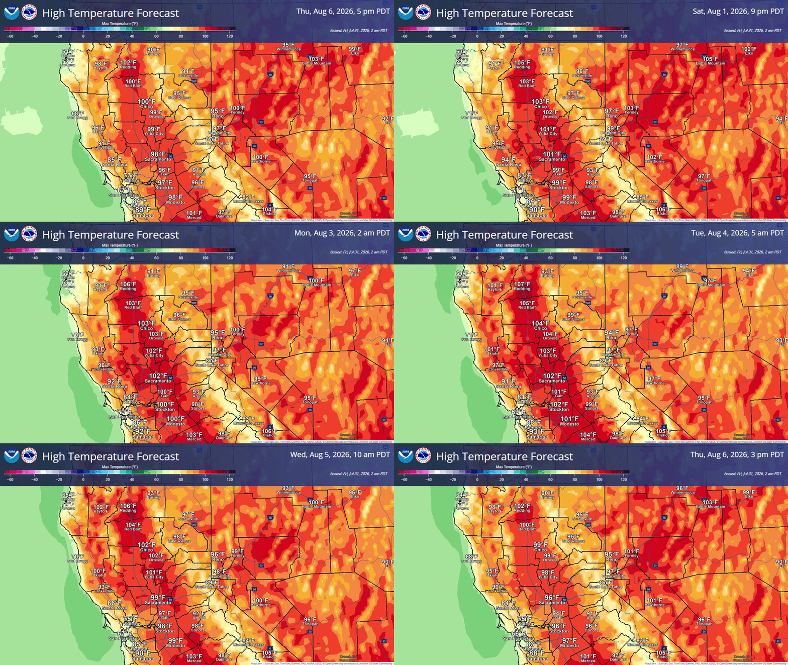
July 31, 2026 at 6:46 AM Little to no changes in the forecast, but here are the NWS Sacramento highlights:
- Hot temperatures today into next week, hottest days Saturday through Monday. Widespread Moderate HeatRisk, with isolated areas of Major HeatRisk in the northern Sacramento Valley.
- Elevated Fire Weather Conditions Today – Monday in the northern Sacramento Valley, Burney Basin, and Sierra foothills. Low humidity values, hot temperatures, and locally breezy winds will lead to easier fire starts and spread.
July 30, 2026 at 11:09 PM Solo vehicle accident on Bitney Springs at Barr Ranch Rd, units dispatched.
July 30, 2026 at 5:00 PM Air Attack 17 has lifted from Grass Valley to a fire in Sonoma County.
July 30, 2026 at 4:10 PM Oil slick creating a traffic hazard on Lime Kiln near Duggans. The irony of the polluting propellant causing cars to swerve… Use extreme caution.
July 30, 2026 at 2:59 PM Units at scene on Mustang Valley report two vehicles, one patient with minor injuries. Canceling all incoming engines.
July 30, 2026 at 2:54 PM All aircraft are leaving the La Porte incident.
July 30, 2026 at 2:52 PM Accident on McCourtney and Mustang Valley Pl. Units dispatched.
July 30, 2026 at 2:46 PM The La Porte fire is holding at 1/2 acre, they can handle with resources dispatched.
July 30, 2026 at 2:39 PM Vehicle fire, smoke coming from an engine compartment, on Hwy 20 at Rough and Ready Hwy.
July 30, 2026 at 2:39 PM The reported fire near Applegate is close to the train tracks, locals are working on it.
July 30, 2026 at 2:37 PM La Porte Air Attack reports a 30 by 30 spot, ground crews are making access.
July 30, 2026 at 2:35 PM Reported vegetation fire on westbound I-80 near Clipper Gap Road or Applegate Road in Placer Hills. Full wildland dispatch on order.
July 30, 2026 at 2:26 PM Air Attack, helicopters and tankers have lifted to the La Porte incident.
July 30, 2026 at 2:16 PM Reported vegetation fire on La Porte Road near Brownsville. Full wildland dispatch on order.
July 30, 2026 at 2:05 PM Six local fire departments are asking for a bigger share of county money. This is a long read, but we feel it’s necessary to explain how our local fire departments are faring financially and how asking for an unspecified amount of money is not a viable solution. Firefighters need to be well-trained, well-equipped and well paid. Who should foot the bill?
July 30, 2026 at 1:59 PM Units at scene are checking the propane fill equipment at the gas station on the corner of Brunswick and Nevada City Hwy. They can handle with units at scene.
July 30, 2026 at 1:57 PM Smell of gas on Nevada City Hwy near Brunswick, units dispatched. One engine at scene already.
July 30, 2026 at 7:47 AM Non-injury accident on Lime Kiln Road, car vs power pole.
July 30, 2026 at 6:15 AM Here are the latest updates to the NWS Sacramento forecast.
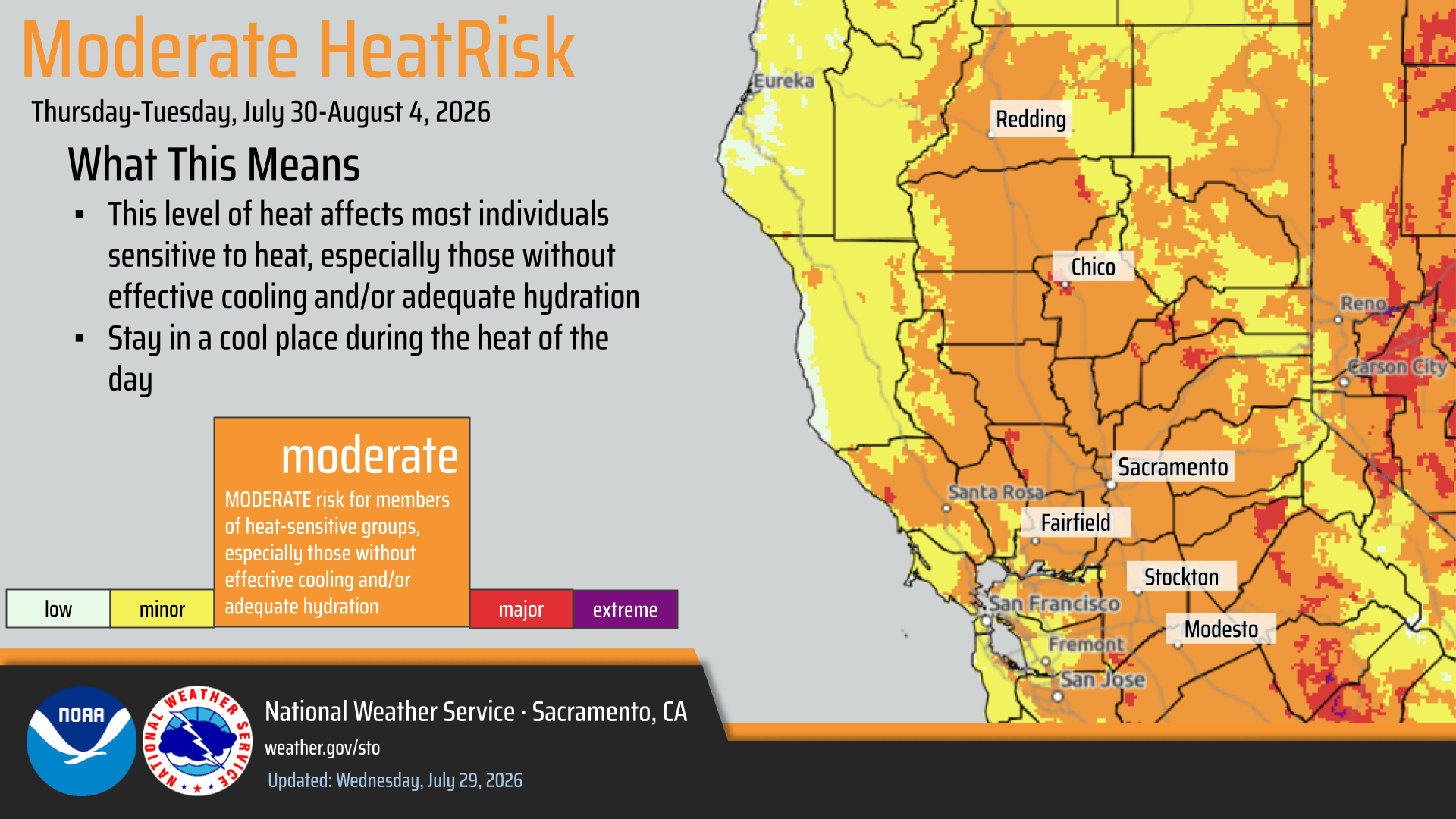
- Areas of Moderate HeatRisk on Thursday, with widespread Moderate HeatRisk Friday and into next week.
- Probabilities remain high for triple digit temperatures in the Valley, especially in the northern Sacramento Valley.
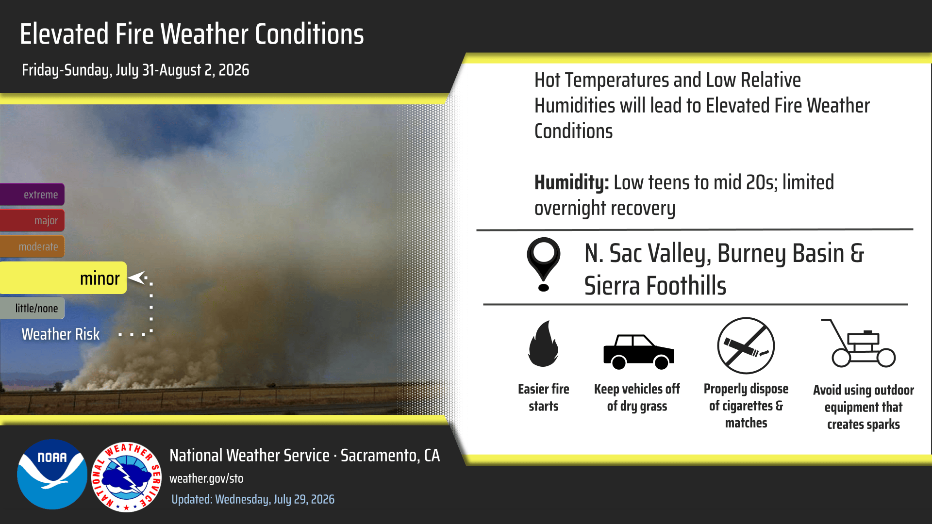
- Elevated Fire Weather Conditions are expected Friday through Sunday in the Burney Basin, northern Sacramento Valley, and Sierra Foothills due to the hot and dry weather.
- There was a slight increase in winds out of the north along the I-5 Corridor Sunday afternoon/evening.

July 29, 2026 at 10:18 PM All units are clear from the Mercury incident. No fire, electrical or otherwise, just a skunk.
July 29, 2026 at 10:11 PM Mercury IC can handle with units at scene, canceling all staged resources.
July 29, 2026 at 10:08 PM First unit at scene on Mercury recommends staging all incoming units at their present location. No flames or smoke visible, they’re investigating.
July 29, 2026 at 10:03 PM Smell of electrical and burning plastic on Mercury Drive off Hwy 174 in Grass Valley.
July 29, 2026 at 5:50 PM Dozer is working their way around the Wells incident, crews are working their way into the fire. Air Attack is back at Grass Valley Air Attack Base.
July 29, 2026 at 5:45 PM Tanker 70 has ben released from the Wells incident, will be on a load and hold at the airport.
July 29, 2026 at 5:42 PM Firefighters will have completed a hoseline around the Wells fire shortly. Air Attack estimates it at less than 1/4 acre.
July 29, 2026 at 5:35 PM First unit with direct access to the fire reports a 1/4 acre in heavy brush and timber. Hand crews and a dozer requested to respond.
July 29, 2026 at 5:25 PM Two full loads of retardant on the Wells incident. Best access for engines is likely through the old Loma Rica ranch property and a two track dirt access road.

July 29, 2026 at 5:17 PM All resources to stage on Brunswick Road at Sutton Way until the best access is ascertained. Tanker drop on the fire which will be the Wells incident.

July 29, 2026 at 5:15 PM First engine is arriving at scene of the Brunswick fire, guided in by Air Attack.
July 29, 2026 at 5:13 PM Tanker 70 is overhead with Air Attack.
July 29, 2026 at 5:10 PM Report by Air Attack 230 of a vegetation fire on top of Brunswick Road near the intersection with Idaho-Maryland Road, full wildland dispatch on order for the 40 by 20 spot.

July 29, 2026 at 5:04 PM Firefighters have checked the Hwy 174 corridor, unable to locate any smoke.
July 29, 2026 at 5:03 PM Tankers have been released from the vehicle fire, Air Attack is leaving now.
July 29, 2026 at 4:54 PM Smoke check on Hwy 174 and Meadow Drive for Peardale Chicago Park units.
July 29, 2026 at 4:49 PM Firefighters have a hoseline around the Ranch incident.
July 29, 2026 at 4:32 PM Air Attack 230 is over the Ranch fire, reports 1/2 to 3/4 of an acre only, burning at a slow to moderate rate of spread. The fire is surrounded by dirt roads.
July 29, 2026 at 4:31 PM Pliocene IC reports the dozer is making good progress.
July 29, 2026 at 4:25 PM First unit at scene of the Ranch fire reports vehicle fire into the vegetation, 5-10 acres, burning in oak woodland. Potential for 20 acres. All resources dispatched to continue in.
July 29, 2026 at 4:23 PM Three water tenders requested to the passenger vehicle fire.
July 29, 2026 at 4:17 PM Full wildland dispatch to a passenger vehicle fire with threat to the vegetation on Indiana Ranch Road above Dobbins.
July 29, 2026 at 4:03 PM Change in access to the Pliocene fire, now Alleghany Road to Pliocene to Table Mountain Road.
July 29, 2026 at 3:58 PM Air Attack 17 reports the best access to the fire is from Table Mountain Road, the fire is on the ridgetop, partially obscured by canopy. Estimated at 1/2 to one acre, the fire is burning at a moderate rate of spread. One additional tanker and a helicopter requested.
July 29, 2026 at 3:52 PM Air Attack 17 and Tanker 89 are departing Grass Valley.
July 29, 2026 at 3:51 PM Helicopter 514 is lifting to the Pliocene fire.
July 29, 2026 at 3:49 PM Units near the Pliocene fire report about one acre, burning at a moderate rate of spread in timber.
July 29, 2026 at 3:38 PM New start in the Pliocene Ridge area, southwest of Downieville in Sierra County. Full wildland dispatch on order.

July 29, 2026 at 3:01 PM Both Air Attack and the tanker have been canceled from the fire in El Dorado County and are returning back to GVAAB.
July 29, 2026 at 2:57 PM Air Attack 230 and Tanker 89 are en route to a fire in El Dorado County in El Dorado Hills.
July 29, 2026 at 12:41 PM Perimeter IC releases all resources. The fire is fully contained at 0.97 acres.
July 29, 2026 at 10:56 AM Perimeter IC reports all resources will be committed for mop-up operations lasting approximately two hours. Washington Ridge hand crew to continue in, other hand crew can cancel.
July 29, 2026 at 10:51 AM Perimeter reports the fire is holding at 1.5 acres. Dozer can cancel, all others to continue in.
July 29, 2026 at 10:48 AM There is a hoseline around the Perimeter fire, Air Attack is releasing the hold on the tankers.
July 29, 2026 at 10:44 AM Good progress being made on the Perimeter fire, tankers are on a load and hold at Grass Valley Air Attack Base.
July 29, 2026 at 10:36 AM Retardant drops have slowed the progression, Helicopter 514 will start bucket work. Perimeter IC estimates 1/4 acre only, all resources to continue in.
July 29, 2026 at 10:29 AM Helicopter 514 is approaching the Perimeter Fire, engines are at scene now.

July 29, 2026 at 10:25 AM Tankers will drop between the fire and a home. No ground resources at scene yet.
July 29, 2026 at 10:22 AM Perimeter fire is estimated at 1 acre now, Air Attack 17 is over the fire. The fire is burning in grass and oak woodlands at a moderate rate of spread.
July 29, 2026 at 10:18 AM Air Attack 17 has lifted from Grass Valley. Tankers are right behind them.
July 29, 2026 at 10:13 AM Caller reports one structure potentially threatened on the Perimeter incident.
July 29, 2026 at 10:09 AM Full wildland dispatch on order for a reported brush fire, approximately 1/4 acre, on Perimeter Road near Lake Ridge Dr.
July 29, 2026 at 10:03 AM Units at scene on Fiddyment Road report a 40 by 40 spot, being extinguished now.
July 29, 2026 at 9:59 AM Reported burn pile on Fiddyment Road in Placer County. Units dispatched.
July 29, 2026 at 9:37 AM Mind your P’s and Q’s – Nevada County Elections has assigned Measure P to the Tahoe Truckee Unified School District bond measure and Measure Q to the Nevada City short-term rental measure for the Nov. 3, 2026 General Election ballot.
July 29, 2026 at 7:07 AM Here are the NWS Sacramento forecast notes we wanted to pass along from the overnight shift:
- Slightly warmer high temperatures today with our gradual warming trend continuing. Overall Minor HeatRisk across the region today.
- Areas of Moderate HeatRisk on Thursday, then widespread Moderate HeatRisk Friday into next week, with probabilities increasing in widespread triple-digit heat across the area
- Overnight temperatures in the northern Sacramento Valley and in the foothill thermal belts will be in the 70s
Hot temperatures with continued dry conditions will lead to elevated fire weather conditions Friday through Sunday, as daytime humidity values will begin to lower into the teens. Areas of concern are the Burney Basin, northern Sacramento Valley, and the foothills of the Sierra.
July 28, 2026 at 11:49 PM Deputies at scene on Dorsey advise no fire, canceling response.
July 28, 2026 at 11:45 PM Reported small roadside fire near Dorsey Drive and East Main, units dispatched.
July 28, 2026 at 7:57 PM Heads up:
McCourtney Rd, between Mill St and Brighton St and Brighton St between McCourtney Rd and Packard Dr will be subject to traffic control for pavement sealing work on July 29, 2026. The Traffic Control System will utilize lane closures with detours intermittently between the hours of 7:00 AM and 5:00 PM. Every effort will be made to accommodate motorists in a timely manner; however delays of up to 5 minutes may be possible. Please observe all construction signs and the instructions of onsite personnel. We apologize for any inconvenience this may cause and appreciate your patience.
July 28, 2026 at 6:38 PM Smoke visible on the cameras in the Hammonton area.

July 28, 2026 at 5:12 PM Updates on the Combie fire will be posted on the Combie incident page.
July 28, 2026 at 5:07 PM Dozer is making good progress.
July 28, 2026 at 5:04 PM The Nevada County Sheriff’s Office has issued an EVACUATION ORDER for zone NCO-E394 on 07/28/2026 at 5:01 PM for a Wildland fire in the area of Highway 49 at Sharon Jack Rd. EVACUATE IMMEDIATELY.
July 28, 2026 at 5:02 PM Air Attack reports 5-7 acres, rapid rate of spread.
July 28, 2026 at 5:01 PM Tankers are starting retardant drops. Firefighters are engaging in structure protection and starting a hoseline.
July 28, 2026 at 4:54 PM Combie IC reports 1/4 acre, with ne structure potentially threaened. The fire is located on Hwy 49.
July 28, 2026 at 4:54 PM Air Attack and tankers are lifting from Grass Valley, TNF Helicopter is leaving White Cloud.
July 28, 2026 at 4:52 PM The Combie incident is located close to Hwy 49.
July 28, 2026 at 4:49 PM Now a full wildland dispatch for a fire potentially started by mowing. Approximately 1/2 acre.

July 28, 2026 at 4:45 PM Smoke check on Combie Road, possible roadside spot at the corner of Hwy 49.
July 28, 2026 at 3:14 PM Dozer line around the Hungry incident in Lincoln. Air Attack 17 is leaving the Loa incident.
July 28, 2026 at 3:08 PM Electrical hazard on the Loa incident, down power lines. Two CAL FIRE engines to continue in, all others can cancel.
July 28, 2026 at 3:05 PM Firefighters are making progress on the Loa incident.
July 28, 2026 at 3:02 PM Air Attack 17 reports 3/4 acre now in timber understory.
July 28, 2026 at 3:01 PM First engine at scene, reports a 50 by 50 spot. One trailer in the vicinity now immediately threatened.
July 28, 2026 at 3:00 PM Air Attack 17 is over the Loa incident, helicopter is inbound.
July 28, 2026 at 2:51 PM Air Attack 230 is diverting a helicopter from the Hungry incident to the Loa incident. Estimates 1/4 acre at this time.
July 28, 2026 at 2:48 PM Reported vegetation fire, small roadside spot on Loa Court off Old Emigrant Trail in the Chicago Park area. Full wildland dispatch on order.

July 28, 2026 at 2:43 PM Reported vegetation fire on Virginiatown Road near Hungry Hollow Road in Lincoln, full wildland dispatch on order.
July 28, 2026 at 9:46 AM 161 PG&E customers are out of power along Hwy 20 from Pine Needle Lane to Lupine Road.
July 28, 2026 at 8:27 AM Watch Elisa Parker’s interview with Sol Risers’ Becca and Colby Kauk about the origin of the fire spinners, community and friendship alongside their performance art. Don’t miss their performance at Wednesday’s Hot Summer Nights in Nevada City.

July 28, 2026 at 6:26 AM McCourtney Rd, between Mill St and Brighton St and Brighton St between McCourtney Rd and Packard Dr will be subject to traffic control for pavement sealing work between 7:00 AM and 5:00 PM today.
July 28, 2026 at 6:21 AM Here are your NWS Sacramento forecast notes for the morning:
- Temperatures will remain near normal today but a warming trend will bring widespread Moderate HeatRisk by the end of the week and into next week
- Widespread chances at triple digit highs in the Valley and lower foothills as well, highest chances in the northern and central Sac Valley
- Overnight temperatures in the northern Sac Valley and under thermal belts in the foothills will remain quite warm, into the 70s
After a brief influx of moisture today and Wednesday, a drying trend will accompany the warming trend and bring especially dry humidities by the end of the week.

July 27, 2026 at 9:17 PM High voltage lines are deenergized, the fire is contained and the building has been ventilated in Alleghany.
July 27, 2026 at 6:56 PM Units are still at scene of the reported fire in Alleghany, a building near high voltage lines is showing smoke. As it is unknown at this time if the power to these high voltage lines is off, this presents a life safety hazard for firefighters.
July 27, 2026 at 6:09 PM The outage due to fire in Alleghany is affecting 213 PG&E customers in Sierra and Nevada counties.
July 27, 2026 at 5:57 PM Reported vegetation fire in Alleghany on Miners St, power went out and fire may already be extinguished.
July 27, 2026 at 5:50 PM Air ambulance has been canceled on the Lime incident.
July 27, 2026 at 5:41 PM Lime IC requesting one air ambulance and two engines to continue in.
July 27, 2026 at 5:38 PM Lime IC reports they have knockdown on the fire. One engine to continue in, medic and CHP to continue responding.
July 27, 2026 at 5:35 PM First unit at scene on McCourtney reports one car on fire and a small spot of vegetation. Law enforcement reuqested to shut down the road and a medic.
July 27, 2026 at 5:33 PM Reported vehicle fire after a collision with threat to the vegetation on McCourtney at Lime Kiln Road. Full wildland dispatch on order.
July 27, 2026 at 4:59 PM Reader Merrill took this photo of the a excited Leon exploring the Truckee River with his family.

July 27, 2026 at 4:53 PM The entry of pleas for Jamie Jones and Chris Wackerly has been postponed to August 24th. The defense is waiting on transcripts and a substitution of attorney may be forthcoming.
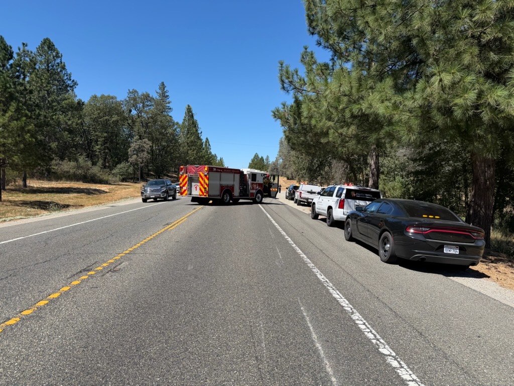
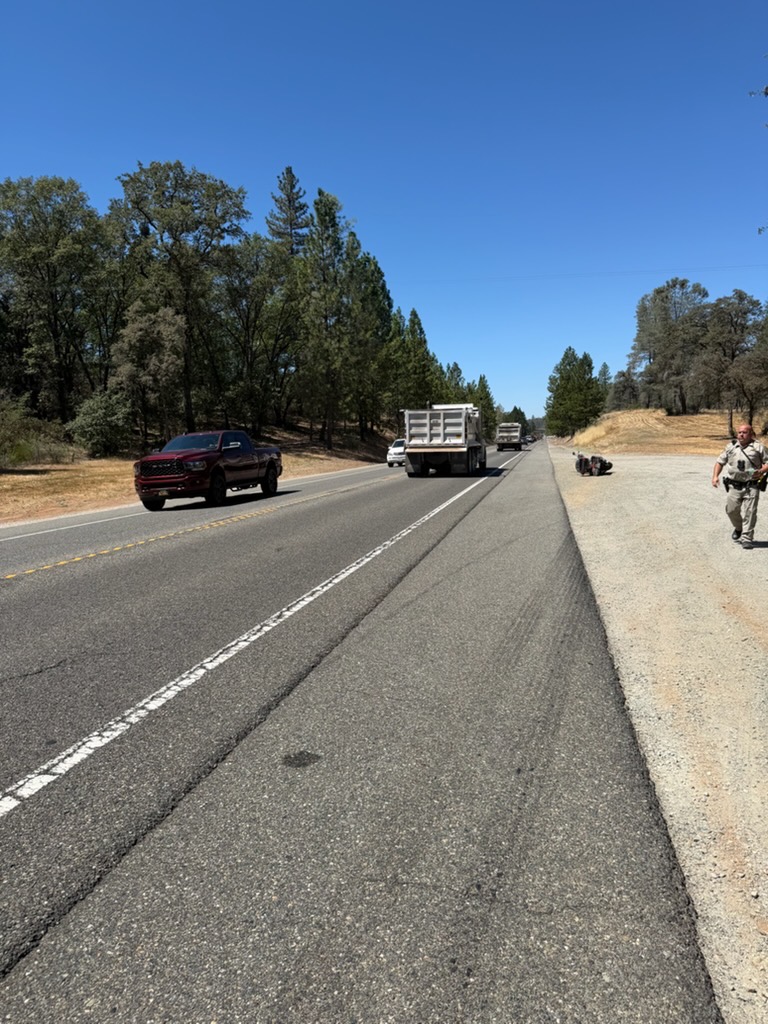
July 27, 2026 at 1:55 PM CHP update on the crash on Hwy 20:
At just after 1120 this morning, a 65 year old man from Penn Valley was riding his black Harley Davidson on Highway 20, westbound, west of Brighton St. The rider was travelling at normal highway speeds when for an unknown reason braked hard and was ejected over the handlebars of the Harley. The rider sustained major injuries as a result of this crash and was flown via CalStar to Sutter Roseville Medical Center. No other vehicles were involved in the crash and Highway 20 was closed for approximately 30 min while emergency personnel tended to the victim. Due to the seriousness of the rider’s injuries, his identity is going to be withheld at this time until family can be notified.
July 27, 2026 at 12:42 PM Hwy 20 is fully open again.
July 27, 2026 at 11:44 AM Air ambulance responding to te accident on Hwy 20.
July 27, 2026 at 11:41 AM Traffic is at a standstill on westbound Hwy 20 near McCourtney after a motorcycle accident. Units are at scene, use an alternate route if possible.
July 27, 2026 at 11:34 AM Tankers have been released from a small roadside fire along Hwy 49 in Sierra County and are returning to Grass Valley.
July 27, 2026 at 10:19 AM For those who don’t check the incident pages regularly: The Chute Fire is 80% contained.
July 27, 2026 at 6:11 AM Here are your morning NWS Sacramento forecast updates:
- Dry weather will continue into the weekend
- Near normal temperatures continue today and Tuesday before a warm-up begins mid-week, and above normal highs with widespread Moderate HeatRisk are expected by the end of the week
- Widespread chances for triple digit highs Friday through Sunday in the Valley (generally 60-95%, highest in the northern Sac Valley)
- Overnight lows in the northern Sac Valley and in the foothills will be quite warm, into the 70s, during the same time frame, so overnight relief will be limited in these areas
- Gusty west to southwest winds linger today, which paired with low humidities means elevated fire weather conditions continue today
- Slightly higher daytime humidities Tuesday and Wednesday before a drying trend returns through next weekend

July 26, 2026 at 5:10 PM Now Hwy 49 at the bridge over the Yuba is blocked by cars parked over the lines and in the No Parking zones. Tow trucks are on the way.
July 26, 2026 at 4:51 PM Forward progress stopped on the Roble fire at 3-4 acres.
July 26, 2026 at 4:49 PM Helicopter 514 has been released from the Roble fire, returning to White Cloud. Fire behavior is moderating, retardant box is complete. Evacuations are complete.
July 26, 2026 at 4:32 PM Air Attack has canceled two of the four tankers, additional ground resources to stage at Vista Roble Dr.
July 26, 2026 at 4:27 PM Kemper Road and Mount Vernon south of the fire have evacuation warnings. CAL FIRE NEU is in unified command with Placer County Sheriff’s Office. Additional resources ordered up.
July 26, 2026 at 4:22 PM Evac orders and warnings going out in the Vista Robel area.
July 26, 2026 at 4:13 PM Air Attack has returned to the Roble fire, requesting additional tankers and helicopter.

July 26, 2026 at 4:06 PM North Bloomfield near Edwards has cars parked in the No Paring zone, again.
July 26, 2026 at 3:57 PM First unit at scene on Marysville Road reports the fire has been extinguished.
July 26, 2026 at 3:55 PM Reported vehicle fire on Marysville Road and Oregon Hill Road, units dispatched.
July 26, 2026 at 3:48 PM Roble IC requesting three engines and one crew to continue to the 1/8th of an acre on Vista Roble. All others can cancel. Locals report the fire as extinguished.
July 26, 2026 at 3:43 PM Air Attack has lifted to the Roble incident.
July 26, 2026 at 3:34 PM Reported vegetation fire on Mount Vernon Rd near Vista Roble Dr in Placer County. Units in the area attempting to locate.
July 26, 2026 at 12:48 PM Air Attack and two tankers have lifted for a fire in Butte County, the Hurleton incident near Lake Wyandotte.

July 26, 2026 at 12:36 PM Air ambulance is landing at Bridgeport, ground crews have reached the patient.
July 26, 2026 at 12:22 PM CHP Helicopter is arriving at the Buttermilk incident.
July 26, 2026 at 12:15 PM Buttermilk IC is requesting a precautionary air ambulance.
July 26, 2026 at 12:02 PM Rescue at Buttermilk is for a person that jumped onto a rock, possible broken leg after a 20ft jump. Empire Mine is heat exhaustion.
July 26, 2026 at 12:00 PM Medical rescue on the Buttermilk Trail and a medical rescue at Empire Mine. Units dispatched.
July 26, 2026 at 6:46 AM Here are the NWS Sacramento forecast notes for the morning:
- Slightly less gusty winds Monday, though humidities remain very low, so areas of elevated fire weather conditions may linger into Monday
- Dry weather forecasted to continue through at least next weekend
- Near normal temperatures linger today through Tuesday, with a warming trend bringing above normal temperatures and widespread Moderate HeatRisk by the end of the week
- Gusty west to southwest winds continue this afternoon and evening, particularly in the Delta, mountains, and Burney Basin
- Combined with low humidity, this brings elevated fire weather conditions to the Burney Basin and northeast foothills today

July 25, 2026 at 3:37 PM First unit at scene on Shannon Way can handle.
July 25, 2026 at 3:31 PM Extinguished trailer fire reported on Shannon Way in Grass Valley. Units dispatched to check.
July 25, 2026 at 3:03 PM Homeowner on the Dixon incident has been issued an LE-38 ticket.
July 25, 2026 at 2:38 PM Air Attack reports a 30 by 30 spot, now extinguished. Releasing all aircraft. Dixon IC requests one engine to continue in, all others can cancel.
July 25, 2026 at 2:37 PM Dixon IC is at scene, requesting everyone to stage on the main road.
July 25, 2026 at 2:31 PM Air Attack and two tankers have lifted from Grass Valley to the Dixon fire.
July 25, 2026 at 2:24 PM HelCo confirms locals have contained the escaped pile.
July 25, 2026 at 2:22 PM Now a full wildland dispatch for the escaped debris burn. HelCo from the Chute Fire is overhead, reports the fire is mostly out.
July 25, 2026 at 2:17 PM Vegetation fire, 1/4 acre in the timber understory on Dixon Hill Road near Wilder Lane in the Oregon House area. Burning at a slow rate of spread. Local are starting to work on it, making progress.
July 25, 2026 at 1:41 PM Patient is out of the water and alert, canceling the air ambulance.
July 25, 2026 at 1:36 PM Water rescue, long fall at the Buttermilk Bend, North San Juan and Penn Valley dispatched. Helicopter H20 requested.
July 25, 2026 at 12:54 PM Accident on Hwy 174 at Cedar Ridge Dr, units dispatched.
July 25, 2026 at 11:54 AM From a reader: There are 2 dog loose on McCourtney. Looks like a Doberman and a French bulldog. They were just up almost to animal place and the transfer station with folks trying to get them in a car to safety, but they ran off again and are headed away from town in the direction of Indian Springs road on McCourtney.
July 25, 2026 at 7:18 AM Here’s your morning NWS Sacramento forecast update:
- Dry weather continues through next week
- Near normal temperatures through early next week and only Minor HeatRisk, followed by warming temperatures reaching above normal around mid-week and widespread Moderate HeatRisk by the end of the week
- Gusty west to southwest winds still expected through this weekend, especially for the Delta, mountains, and Burney Basin
- These winds, along with low humidity will bring elevated fire weather conditions to the Burney Basin and northeast foothills today and Sunday


July 24, 2026 at 9:20 PM Accident on Dog Bar Rd near Wheeler acres Rd, no injuries reported.
July 24, 2026 at 3:09 PM Nope, I got nothing. It’s amazing, can we keep it that way?
July 24, 2026 at 10:52 AM Paradise IC is canceling all incoming resources.
July 24, 2026 at 10:50 AM The fire is held in check on two sides by roads, forward progress has been stopped by units at scene.
July 24, 2026 at 10:48 AM First unit at scene reports the fire is about a 100 by 100 spot, burning at a slow rate of spread in the grass, next to solar panels.
July 24, 2026 at 10:47 AM All resources dispatched are acknowledging the electrical hazard. Aircraft are lifting from Grass Valley. First unit is arriving at scene.
July 24, 2026 at 10:43 AM Reported as a fire under solar panels on Paradise Drive off Gleko Road and Valley Drive in the Rough & Ready area. Life safety hazard due to electrical involved.

July 24, 2026 at 10:40 AM Reported vegetation fire on Paradise Drive in Penn Valley. Full wildland dispatch on order.
July 24, 2026 at 8:57 AM Be advised that due to a mechanical issue the 9:00 AM River Shuttle departure from the Government Center is canceled. All other trips will run normally
July 24, 2026 at 8:47 AM Non-injury accident on Wolf Road at Hwy 49, the roadway is clear.
July 24, 2026 at 6:18 AM Here is the latest NWS Sacramento forecast update:
- Dry weather expected into next week as monsoonal moisture remains well to the east of the area.
- Seasonable high temperatures continue into the middle of next week with mainly Minor HeatRisk.
- Areas of Moderate HeatRisk may develop late next week as temperatures trend a little higher.
- Gusty west to southwest winds are expected into the weekend, especially for the Delta, mountains, and Burney Basin.
- The increased winds along with low humidity will bring elevated fire weather conditions to the Burney Basin and possibly the northeast foothills today through Saturday, and may linger into Sunday.


July 23, 2026 at 9:10 PM The backburn operation on the Chute Fire is underway, that’s what a lot of folks are seeing across the canyon.

July 23, 2026 at 7:47 PM Aircraft dispatched to a fire in El Dorado County have been canceled and are returning to Grass Valley.
July 23, 2026 at 6:06 PM Accident on East Main Street in Grass Valley, units are at scene.
July 23, 2026 at 5:23 PM PG&E crew at scene on Spenceville Road explains it’s only compressed air coming out, they are performing testing on the line.
July 23, 2026 at 5:18 PM Penn Valley Fire checking valve caps on PG&E lines after a strong smell of gas was reported on Spenceville Road. So far they’ve found two, PG&E has been advised.
July 23, 2026 at 4:00 PM Backwoods IC reports forward progress stopped at 0.4 acres, resources at scene will be committed for one to two hours.
July 23, 2026 at 3:48 PM Units at scene on Hwy 49 report the fire has been extinguished, canceling all incoming units.
July 23, 2026 at 3:43 PM Passenger vehicle fire on Hwy 49 near Rincon. Units dispatched for smoke coming from a truck with camper shell.
July 23, 2026 at 3:09 PM Backwoods Air Attack is releasing all the tankers.
July 23, 2026 at 3:06 PM Backwoods IC reports they have a hoseline around the fire, dozers, one crew and prevention to continue in. All others can cancel.
July 23, 2026 at 3:03 PM Units at scene on the Washington incident report a 40 by 50 spot, smoldering at a very slow rate of spread on Maybert Road. Due to the poor road conditions only small wildland engines will be able to access. One helicopter and one Air Attack requested.
July 23, 2026 at 3:02 PM Air Attack is keeping Tanker 89 in orbit a little longer over the Backwoods Fire.
July 23, 2026 at 2:57 PM Ground resources at scene of the Backwoods fire are making good progress.
July 23, 2026 at 2:51 PM Reported new start near the town of Washington. Full wildland dispatch on order. Air Attack 17 is launching.
July 23, 2026 at 2:46 PM The drops have taken the heat out of the fire, smoke production has slowed.
July 23, 2026 at 2:40 PM Three helicopters are working the Backwoods fire. Tanker 89 is back from Grass Valley. Ground resources are making access now, from North Canyon Road. The fire is holding at 1/2 acre for now, still trying to burn uphill at a moderate rate of spread.
July 23, 2026 at 2:34 PM Air Attack recommends an additional three wildland engines and three dozers due to the remote location.
July 23, 2026 at 2:30 PM Tanker 89 has dropped on the fire, returning to Grass Valley for a reload.

July 23, 2026 at 2:26 PM Air Attack reports 1/2 acre in timber understory, one structure in the area. Ordering up more air resources.

July 23, 2026 at 2:24 PM Aircraft are over the Backwoods incident.
July 23, 2026 at 2:20 PM Aircraft have launched from Grass Valley and White Cloud.
July 23, 2026 at 2:19 PM The fire is on North Canyon Road, per HelCo.
July 23, 2026 at 2:18 PM HelCo reports 1 acre burning at a moderate rate of spread, one structure threatened.
July 23, 2026 at 2:14 PM Now reported as a quad on fire, HelCo from the Chute is over the fire.

July 23, 2026 at 2:11 PM Passenger vehicle fire with possible threat to vegetation on Backwoods Road off North Canyon Road near North Columbia. Full wildland dispatch on order.
July 23, 2026 at 2:10 PM Traffic on both Hwy 49 and Hwy 20 are impacted by the one-lane traffic on westbound I-80 after a car fire near the Secret Town off ramp. Pack a lot of patience, or delay your trip if you can.
July 23, 2026 at 12:52 PM Forward progress stopped, the dozer will build some exra access lines for future incidents. Crews at scene are mopping up.
July 23, 2026 at 12:45 PM Railroad units are making good progress, canceling all aircraft. Ground resources and the dozer are sufficient.
July 23, 2026 at 12:42 PM Three engines, one crew and one dozer are assigned to the Railroad incident. Tankers 89 and 70, Helicopter 514 are overhead with Air Attack.
July 23, 2026 at 12:41 PM There is no immediate threat to structures, Air Attack 230 and Tanker 89 are lifting from Grass Valley as a precautionary measure.
July 23, 2026 at 12:39 PM Units on the Railroad incident can only make access with smaller engines. Starting a hoselay now.
July 23, 2026 at 12:34 PM Railroad IC has made access to the fire, reports 1/4 acre burning at a slow rate of spread in timber litter. The head of the fire is held in check by a road. Best access is off Railroad.
July 23, 2026 at 12:32 PM Units in the area estimate this is in the Union Jack/Bennett area.

July 23, 2026 at 12:30 PM Now a full wildland dispatch for the reported smoke check. Smoke now visible on the cameras, possibly on the East Bennett side.

July 23, 2026 at 12:28 PM Report of smoke in the area of Railroad Ave behind Hills Flat, units dispatched.
July 23, 2026 at 11:18 AM Car on fire on westbound I-80 near Boreal. Units dispatched.
July 23, 2026 at 8:37 AM Here’s a suggestion. Penn Valley merchants have been hit pretty hard with serial fires/evacs and power outages. If you can, take a trip to PV and support local businesses.
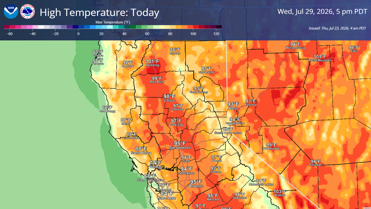
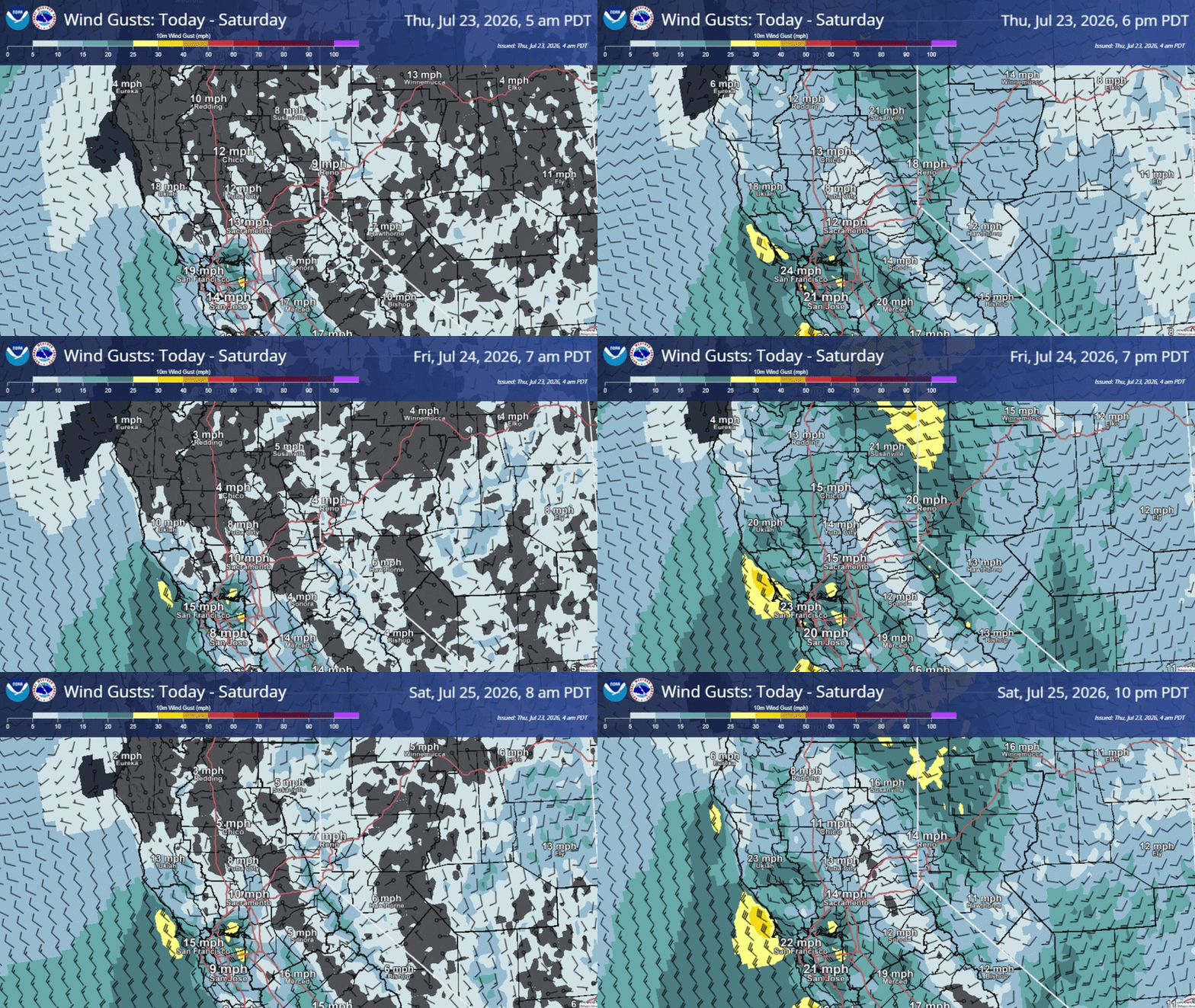
July 23, 2026 at 6:28 AM Here is the latest NWS Sacramento forecast update:
- Dry weather expected into next week as monsoonal moisture has shifted eastward out of the area.
- Breezy onshore winds have brought low temperatures around 10 degrees cooler this morning than yesterday.
- High temperatures will warm to more seasonable levels today and continue this way into early next week with mainly Minor HeatRisk.
- Areas of Moderate HeatRisk possible by next Wednesday as temperatures trend a little higher.
- Gusty west to southwest winds and low humidity will bring elevated fire weather conditions to the Burney Basin and possibly into the northeast foothills Friday and Saturday.
July 22, 2026 at 4:10 PM Rollover on Hwy 20 near Brighton Street. Units dispatched.
July 22, 2026 at 4:06 PM Ridge IC reports the fire is contained.
July 22, 2026 at 3:59 PM First unit at scene on Ridge Road reports a 10 by 10 wood shed on fire, they are working on knockdown now.
July 22, 2026 at 3:55 PM Structure fire, a 10 by 12 shed on fire, on Ridge Road, units dispatched.
July 22, 2026 at 3:23 PM Verizon tower in Penn Valley is experiencing “Network disruption” likely due to the power outage. If you are in the area, text messages are more likely to go through than calls. Thanks to reader Thomas for alerting us.
July 22, 2026 at 2:58 PM PG&E estimates a 5:15 pm time of restoration for the power outage on both sides of Hwy 20.
July 22, 2026 at 2:17 PM 4,125 PG&E customers in the Penn Valley and Rough & Ready area have lost power.

July 22, 2026 at 2:04 PM Updates on the Mooney Fire are on the incident page.
July 22, 2026 at 1:45 PM Additional evaluation warnings issued. The fire has the potential to impact Hwy 20.
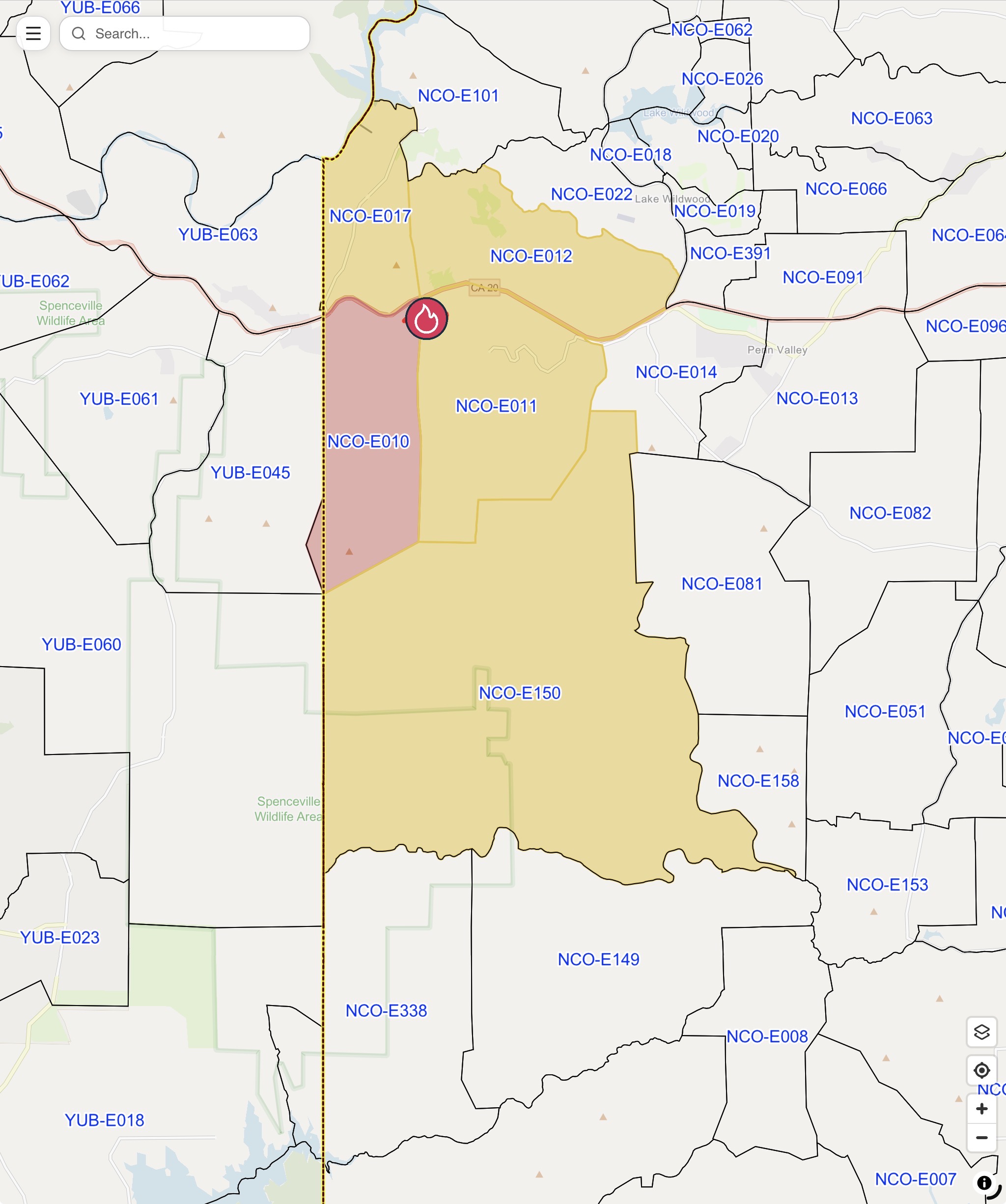
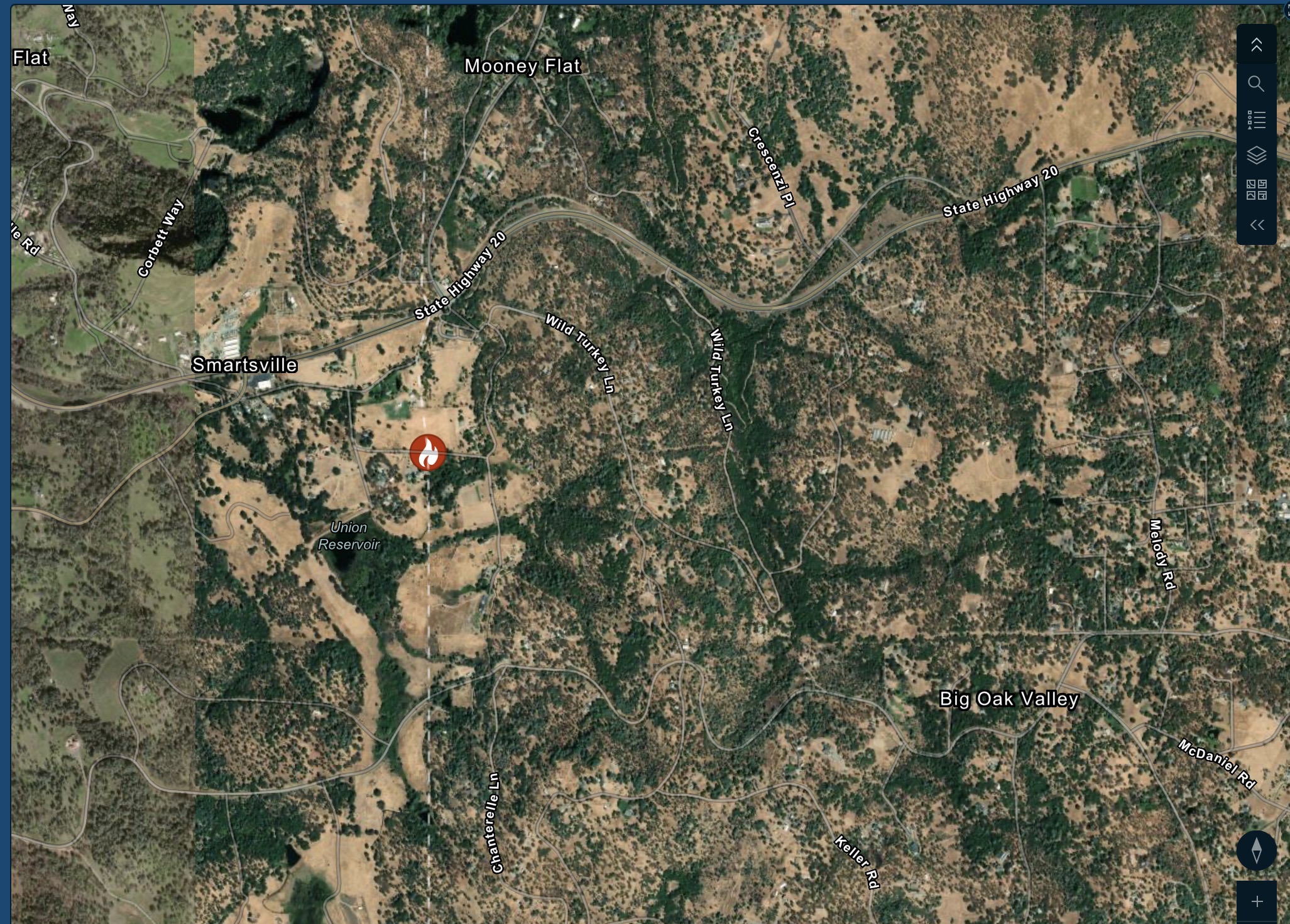
July 22, 2026 at 1:39 PM The Nevada County Sheriff’s Office has issued an EVACUATION ORDER for zone NCO-E010 on 07/22/2026 at 1:37 PM for a wildland fire in the area of Lombardi Dr. and Kirk Way, Smartsville. EVACUATE IMMEDIATELY. Check https://protect.genasys.com/ for updates and available shelter locations. Immediate threat to life. This is a lawful order to leave now. The area is lawfully closed to public access.
July 22, 2026 at 1:38 PM Augmented dispatch and evacuations coming.
July 22, 2026 at 12:24 PM Mooney Fire, Kirk Way and Lombardi off Hwy 20 in Big Oak Valley, 1 acre, spotting in front of structures. Full wildland response.
July 22, 2026 at 9:24 AM Look who’s back and brought a friend. A squirrel jumping from a tree into the grass sent both running.

July 22, 2026 at 7:18 AM Here is the latest NWS Sacramento forecast update:
- Monsoonal moisture will shift south and east of the area, with mainly dry weather expected today.
- Temperatures will be cooler today and Thursday, with breezy onshore winds at times.
- High temperatures will warm to more seasonable levels late this week into early next week, but overall, the forecast has trended a little cooler, with mainly Minor HeatRisk now expected.
- Gusty west to southwest winds and low humidity bring elevated fire weather concerns to the Burney Basin Friday and Saturday.

July 22, 2026 at 6:41 AM Accident on eastbound Hwy 20 at Rough and Ready Hwy, units at scene report minor damage only.
July 22, 2026 at 6:17 AM Caprine stroll alert: A report of 100 goats in the road on Lime Kiln at Duggans.
July 21, 2026 at 8:32 PM Reported small structure fire, now extinguished, on Lakeshore North in Lake of the Pines. Units dispatched.
July 21, 2026 at 5:23 PM Accident on Rough and Ready Hwy at Mills Rd, no injuries reported. Car into a ditch.
July 21, 2026 at 5:09 PM Accident on northbound Hwy 49 at McKnight, the off ramp is blocked and units have been dispatched.
July 21, 2026 at 4:30 PM Power back on in Penn Valley too. 241 customers remain out of power along Indian Springs Road.
July 21, 2026 at 4:27 PM One-way traffic control on Indian Springs from Spenceville to Maidu Trail until all fire resources have departed.
July 21, 2026 at 4:23 PM Some power has been restored to the Rough and Ready area, belying the 1:45 am predicted restoration time.
July 21, 2026 at 4:20 PM Units at scene of the Rattlesnake incident in Placer County can handle with one additional water tender.
July 21, 2026 at 4:07 PM New start on Shirland Tract Road and Rattlesnake Road in the Newcastle area in Placer County, full wildland dispatch on order.

July 21, 2026 at 4:02 PM 2,160 PG&E customers are out in the single outage. Note it might be related to the Springs incident.

July 21, 2026 at 3:56 PM PG&E informs us that 2,075 customers are now without power from Rough and Ready and Penn Valley to Maidu Trail.
July 21, 2026 at 3:53 PM A homeowner on Peardale Road was doing weed control, with a torch. Firefighters report everything’s extinguished now.
July 21, 2026 at 3:46 PM Power outage in Rough and Ready, reported by reader David. PG&E map will catch up, eventually.
July 21, 2026 at 3:42 PM Air Attack 17 is leaving the Springs incident.
July 21, 2026 at 3:37 PM Springs IC states fire is holding at 1/2 acre. They can handle with one additional crew and resources at scene.
July 21, 2026 at 3:35 PM Tankers have been released back to the Chute Fire.
July 21, 2026 at 3:34 PM CHP arriving at scene on Indian Springs, it will be a hard closure in both directions of travel.
July 21, 2026 at 3:32 PM Springs IC reports no structures threatened at this time.
July 21, 2026 at 3:30 PM Air Attack 17 estimates the Springs incident at 2 acres, slow to moderate rate of spread.
July 21, 2026 at 3:25 PM Both Tankers 94 and 181 are over the Springs incident. Air Attack 17 is arriving overhead. IC reports a power pole in the area is compromised, requesting PG&E notification and CHP for traffic control.
July 21, 2026 at 3:22 PM Units at scene report 1/4 acre in grass burning at a slow rate of spread and bumping Indian Springs Road. All units to continue in.
July 21, 2026 at 3:19 PM Tankers are diverting from the Chute Fire to the Indian fire.
July 21, 2026 at 3:16 PM New start now visible on the cameras. Approximate location is Indian Springs Road near Forrest Ranch Road.

July 21, 2026 at 3:12 PM Possible new start in the Indian Springs Road area Air Attack reports 1/8th of an acre with structures threatened.
July 21, 2026 at 1:35 PM Reported vegetation fire has been extinguished by locals. One engine to continue in, all others can cancel.
July 21, 2026 at 1:31 PM Reported vegetation fire on Hammonton-Smartsville Road, units dispatched. Full wildland dispatch on order.
July 21, 2026 at 9:02 AM Updates on the Chute fire will continue to be posted on the Chute incident page.
July 21, 2026 at 6:43 AM Here is the latest NWS Sacramento forecast update:
- Monsoonal moisture will continue to bring chances for wet/dry thunderstorms in the mountains today through Wednesday, mainly over the Sierra south of Interstate 80, with best chances today.
- Afternoon high temperatures will be warmer today, with areas of Moderate HeatRisk in the Valley.
- Breezy afternoon and evening onshore winds will bring some cooling Wednesday and Thursday, especially to Delta breeze influenced areas.
- Temperatures trend higher late week into early next week, with areas of Moderate HeatRisk returning Sunday into Monday.


July 21, 2026 at 6:13 AM No change in evacuations orders, warnings or advisories. Crews worked through the night to establish control lines while the Chute fire remained active and is now estimated at 60 acres.

July 20, 2026 at 5:38 PM Now reported as a small extinguished grass fire, on Annie Drive. Sparks from a BBQ flew into the grass and were extinguished.
July 20, 2026 at 5:36 PM Report of a possible grass fire on Brewer and Annie Dr. Could be the same jerky smoker from this morning, units dispatched.
July 20, 2026 at 4:50 PM Non-injury accident on Hwy 49 at the Colfax Ave off ramp, the roadway is clear.
July 20, 2026 at 4:13 PM An EVACUATION WARNING has been issued for evacuation zones NCO-E327 and NCO-E329 due to Chute Fire burning in Yuba County west of the Sebastopol area. Prepare for evacuation or leave if extra time is required. Follow the directives of Law Enforcement in the area.
July 20, 2026 at 4:05 PM All passenger vehicles on westbound I-80 are being turned around at Blue Canyon. Multi-car accident has closed westbound I-80.
July 20, 2026 at 1:39 PM Sierra College: Due to a water service disruption, classes are cancelled and the Child Development Center is closed at Sierra College’s Nevada County Campus (NCC). Normal operations are expected to resume tomorrow.
July 20, 2026 at 10:48 AM There are no evacuations on the Nevada County side due to the Chute Fire. The fire is on the Yuba County side of the river.
July 20, 2026 at 7:30 AM Peardale-Chicago Park Fire has made contact with the maintenance crew at the school. They are testing the system, this is a confirmed false alarm.
July 20, 2026 at 7:29 AM Fire alarm sounding at the Chicago Park Elementary School, units dispatched. Single report from the alarm company.
July 20, 2026 at 6:19 AM Units in the area of Brewer report this is a false alarm. Smoker with jerky is the culprit of the faintly visible smoke.
July 20, 2026 at 6:12 AM Smoke check in the area of Brewer Road and Annie Drive, units dispatched.
July 20, 2026 at 5:57 AM Firefighters are at scene of a flare-up on the Chute Fire on Marysville Road. Smoke is visible from Englebright, Bullards and surrounding areas.
July 19, 2026 at 7:03 PM A black and white dog is running in the roadway on Lake Vera/Purdon near Alder Way. Is your pup safe?
July 19, 2026 at 6:17 PM The Marysville fire has been fully contained and mapped at 1.07 acres.
July 19, 2026 at 3:45 PM Marysville IC reports forward progress stopped at approximately one acre.
July 19, 2026 at 3:38 PM Marysville IC requests three engines and one crew to continue, all other resources can cancel.
July 19, 2026 at 3:34 PM Units at scene are starting to make good progress.

July 19, 2026 at 3:26 PM Marysville IC is requesting CHP for traffic control on Marysville Road.
July 19, 2026 at 3:21 PM Units at scene on Marysville Road just past Collins Lake report a 50 by 100 spot now, all units to continue in.

July 19, 2026 at 3:18 PM Debris check for Dobbins Fire for a possibly extinguished burn pile on Marysville Road near Leahs Way.
July 19, 2026 at 2:34 PM The Miners Fire in the area of Miners Valley and Salmon Falls Road in the Pilot Hill area is now reported at 40 ares.
July 19, 2026 at 2:26 PM After reviewing the camera footage from the aircraft, dispatch has determined this is smoke from the Miners Fire in El Dorado County.
July 19, 2026 at 2:18 PM Smoke check in the Penn Valley Area, reported by a passing aircraft. Units dispatched.
July 19, 2026 at 2:08 PM The Miners Fire south of Pilot Hill on Salmon Falls Rd in El Dorado County is growing at a rapid rate of spread. Burning in grass and brush. Both tankers from Grass Valley, Air Attack and numerous helicopters on scene to support ground resources.

July 19, 2026 at 2:05 PM Burda IC reports forward progress stopped at 1/2 acre. Hand crew to continue in, other incoming units can cancel.
July 19, 2026 at 2:01 PM Firefighters are making good progress on the Burda incident.
July 19, 2026 at 1:57 PM Units at scene are starting hoseline and checking on threat to strucures.
July 19, 2026 at 1:53 PM Air Attack reports 1/2 acre burning at a slow rate of spread, one structure potentially threatened. Aircraft will depart to a new start on the Amador El Dorado unit.
July 19, 2026 at 1:51 PM Reported location of the Burda Fire.
July 19, 2026 at 1:49 PM Air Attack and tankers have lifted from the air base to the Burda fire.
July 19, 2026 at 1:45 PM The Burda incident is now visible on the cameras.

July 19, 2026 at 1:42 PM Full wildland dispatch for a reported vegetation fire on Burda Lane off Tyler Foote Crossing Road on the San Juan Ridge.
July 19, 2026 at 12:50 PM Units are at scene of the car fire on I-80, reporting a fully involved pickup and a detached trailer. Firefighters have knockdown on the fire. One engine to continue in, all others can cancel. Aircraft overhead are also being canceled.
July 19, 2026 at 12:43 PM Caller reports the vehicle fire near Blue Canyon is confined to the pickup truck for now.

July 19, 2026 at 12:38 PM Full wildland dispatch for a truck towing a trailer on eastbound I-80 on mile east of Blue Canyon. Reported as an engine compartment fire.
July 19, 2026 at 12:28 PM Power has been restored in the Greenhorn area according to ready Amy. One customer still out, after the trouble crew found an object making contact with the power line.
July 19, 2026 at 12:07 PM False alarm near Pioneer Park, smoky BBQ only.
July 19, 2026 at 11:48 AM Report of a possible small campfire in the Pioneer Park area, caller smells smoke. Units dispatched.
July 19, 2026 at 10:18 AM Power outage affecting 676 PG&E customers in the Greenhorn area. Estimated time of restoration is 2:15 pm

July 19, 2026 at 9:53 AM Reported small vegetation fire, campfire smoldering, on Foresthill Road near Robinson Flat Road. Units dispatched.
July 19, 2026 at 8:05 AM Here are the overnight NWS Sacramento forecast updates:
- Seasonable temperatures and periodically breezy onshore winds expected to continue today and into the week ahead
- Persistent monsoonal moisture coupled with a brief period of remnant tropical moisture Today-Monday will introduce shower/thunderstorm chances into the week ahead
- A slight chance (10-15%) for showers and isolated thunderstorms is possible later this afternoon into Monday morning, with highest chances generally north of Interstate 80, including portions of the Valley and foothills
- Additionally, mountain thunderstorm chances (10-25%) are anticipated Today-Wednesday, with highest chances Tuesday-Wednesday along the Sierra crest south of Highway 50
- Primarily wet thunderstorms are anticipated, especially with the overlap of monsoonal/tropical remnant moisture Today-Monday, but a mix of wet/dry thunderstorms cannot be completely ruled out dependent upon the timing and coverage of the moisture sources
A return to drier and breezier weather is anticipated late in the week.

July 18, 2026 at 4:37 PM Confirmed false alarm on Joerschke.
July 18, 2026 at 4:33 PM Audible alarm in one of the offices on Joerschke, still no sign of fire.
July 18, 2026 at 4:29 PM Units at scene on Joerschke report nothing showing, they will investigate.
July 18, 2026 at 4:28 PM Building on Joerschke is showing no sign of fire or smoke but has been evacuated.
July 18, 2026 at 4:25 PM Commercial fire alarm on Joerschke Dr near Maltman, units dispatched.
July 18, 2026 at 4:08 PM Providence IC reports the fire is fully contained at 0.01 acre.
July 18, 2026 at 3:51 PM Fowler IC reports the 40 by 20 spot is fully contained. Mop-up will take about 20 minutes.
July 18, 2026 at 3:40 PM Units at scene on Providence Mine Road have contained the small roadside spot.
July 18, 2026 at 3:35 PM Air Attack 230 is landing at Grass Valley Air Attack Base.
July 18, 2026 at 3:27 PM Units at scene on Providence Mine Road can handle with one additional engine.
July 18, 2026 at 3:26 PM Reported roadside spot on Providence Mine Road, full wildland dispatch on order. Air Attack had lifted already for the previous fire.
July 18, 2026 at 3:22 PM Units at scene report a 10 by 10 spot in the grass on Fruitvale, one engine to continue in, all others can cancel.
July 18, 2026 at 3:15 PM Reported vegetation fire on Fowler Rd near Fruitvale in Virginiatown in Placer County, roadside fire. Full wildland dispatch on order.

July 18, 2026 at 2:22 PM Firefighters have thoroughly checked the area, unable to locate a fire or burn pile.
July 18, 2026 at 2:10 PM The smoke check has turned into a debris check (aka a burn pile.)
July 18, 2026 at 2:05 PM Smoke check for Higgins Fire, Wolf Road and Garden Bar. Units dispatched.
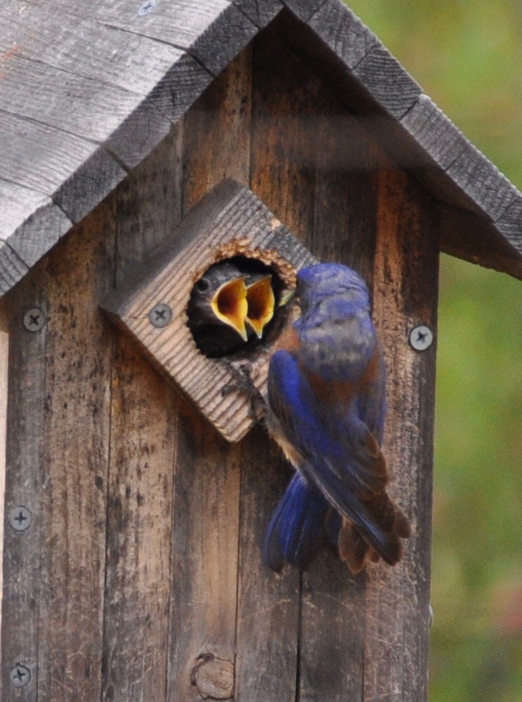
July 18, 2026 at 12:15 PM Reader George contributes to our Bluebird theme.
July 18, 2026 at 7:28 AM Here are the overnight NWS Sacramento forecast updates:
- Seasonable temperatures are expected to continue into next week
- Ahead of the broader monsoonal moisture push this weekend, breezy winds and low daytime RH are expected to result in a few hours of Elevated Fire Weather conditions for portions of the northern Sacramento Valley and northeast foothills
- Increasing monsoonal moisture coverage remains on track later today into next week with shower and isolated thunderstorm chances anticipated
- Sierra crest: 10-15% chance Sunday-Wednesday, highest chances generally south of Highway 50
- Valley/foothills: 5-10% chance of showers/isolated thunderstorms Sunday-Monday, with highest chances from I-80 northward
- Primarily wet thunderstorms are expected through the event, but a mix of wet/dry thunderstorms may be possible at times

July 17, 2026 at 6:31 PM The exhausted parent watching the juveniles raid the pantry. Raise your hand if you know the feeling!

July 17, 2026 at 2:24 PM All resources dispatched to the commercial vehicle fire on I-80 are being canceled with the exception of one engine.
July 17, 2026 at 2:17 PM Full wildland dispatch for a commercial vehicle fire, semi with brakes on fire, on westbound I-80 near the Hwy 174 off ramp.
July 17, 2026 at 11:42 AM Power has been restored, according to our readers.
July 17, 2026 at 11:10 AM a total of 62- PG&E customers affected by the outage. No estimated time of service restoration yet.
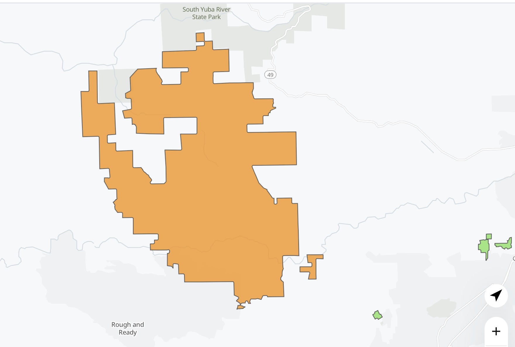
July 17, 2026 at 11:00 AM Reader report of a power outage on Jones Bar.
July 17, 2026 at 10:26 AM Traffic hazard on Dog Bar Rd near Rattlesnake.
July 17, 2026 at 7:29 AM Reader Mike’s Hollyhock Powder Puffs are looking fabulous.

July 17, 2026 at 6:05 AM Here are the NWS Sacramento overnight forecast updates:
- Seasonable temperatures continue through the weekend and into next week
- Breezy winds and low daytime humidity today will continue to result in elevated fire weather conditions across the Valley and foothills
- Most pronounced conditions are anticipated across the northern Sacramento Valley and northeast foothills
- Monsoonal moisture is expected to gradually build in through the weekend and into next week
- Low chances (10-15%) for isolated mountain thunderstorms remain possible, with highest chances forecast along the Sierra crest south of Highway 50
- Notable uncertainty remains with respect to the coverage of subtropical moisture toward interior NorCal, but there is some low (<5%) potential for Valley showers

July 16, 2026 at 9:42 PM FOUND CAT – young black cat with some unique features. Near Bitney Springs. Very skinny, hungry and thirsty, but no obvious injuries. Very sweet! Contact 530-615-6344 if she is your kitty.

July 16, 2026 at 9:40 PM Magnolia Road is fully open again.
July 16, 2026 at 7:56 PM Forward progress of the extension to the vegetation has been stopped and firefighters have mostly knockdown on the vehicle fire. Air Attack is releasing all aircraft from the incident.
July 16, 2026 at 7:55 PM Magnolia IC requesting a second ambulance for an additional patient.
July 16, 2026 at 7:53 PM Air Attack 230 has lifted from Grass Valley to the Magnolia incident.
July 16, 2026 at 7:51 PM Air ambulance requested for the accident on Magnolia Rd.

July 16, 2026 at 7:50 PM First unit at scene on Magnolia reports a fully involved vehicle and some extension to the wildland, approx. 10 by 20 ft spot.
July 16, 2026 at 7:45 PM Reported vegetation fire on Magnolia Road near Adamson Dr after a car into a tree. Units dispatched.
July 16, 2026 at 5:38 PM From reader Maurya: Attached is a picture taken from my back patio @ 4.02 pm on Tuesday, July 14 at the start of the Kearney fire. We were evacuated. While the fire torched our property line and about 30′ of the property Calfire did an AMAZING job. They were on our property until ~11 pm Tuesday. They were on site yesterday and again today. We can’t praise their efforts enough.

July 16, 2026 at 4:49 PM Tanker 89 now assigned to a fire in the Butte unit of CAL FIRE.
July 16, 2026 at 4:39 PM Tanker 89 is committed to a fire in Lassen County.
July 16, 2026 at 12:22 PM If it fits, I sits – bear-style. The wild critters need water too!

July 16, 2026 at 10:39 AM The southbound East Main Street on ramp on Hwy 49 is not an approved green waste dump site. Nevertheless, branches and small log in the roadway. Unless you are driving a chipper, use extreme caution in the area.
July 16, 2026 at 6:28 AM Here are the overnight NWS Sacramento forecast updates:
- Temperatures trend more seasonable through the end of the week and into next week
- Breezy winds and low daytime humidity continue over the next few days, with brief periods of elevated fire weather concerns in the Valley and Delta
- Limited overnight humidity recovery expected across mountains, foothills, and portions of the northern Sacramento Valley
- Monsoonal moisture remains on track to return over the weekend with slight chances (10-15%) for mountain thunderstorms from Sunday into next week
- Highest chances at this time are anticipated early to mid next week and along the Sierra crest from Highway 50 southward

July 15, 2026 at 7:43 PM Air ambulance requested to North San Juan Station 3.
July 15, 2026 at 4:55 PM Accident on Rollins Lake Road, units are at scene. Traffic is at a standstill, according to a reader report.
July 15, 2026 at 4:24 PM Juvenile Bluebirds are messy eaters!

July 15, 2026 at 2:18 PM Duncan Peak is seeing light smoke from the structure fire on Sierra Park lane, Air Attack 230 is training over the Colfax area.
July 15, 2026 at 2:13 PM Smoke report from Duncan Peak and Air Attack on the way for a possible fire in the Colfax area.
July 15, 2026 at 2:08 PM Air Attack is over yesterday’s Kearney Fire to check for any residual smoke.
July 15, 2026 at 11:46 AM Smoke check in the Bald Eagle Court area in Placer Hills. Units dispatched. Could be dust from the quarry.
July 15, 2026 at 11:12 AM A reminder: The Veterans Health & Wellness Fair is underway right now until 3:00 pm at the Grass Valley Vets Hall. “Our goal is to bring veterans, family members, and service providers together in one place so people can easily learn about the resources available to them,” said Nevada County Veterans Service Officer David West. “We want every veteran and their family to have access to the support they need to thrive. We encourage everyone to attend, connect with services, and enjoy the day.”
July 15, 2026 at 8:11 AM Caprine stroll alert, a small herd of goats is wandering on Lime Kiln near Duggans. Animal control has been notified, meanwhile the goats are providing free vegetation management along the roadside. Do give them a wide berth.
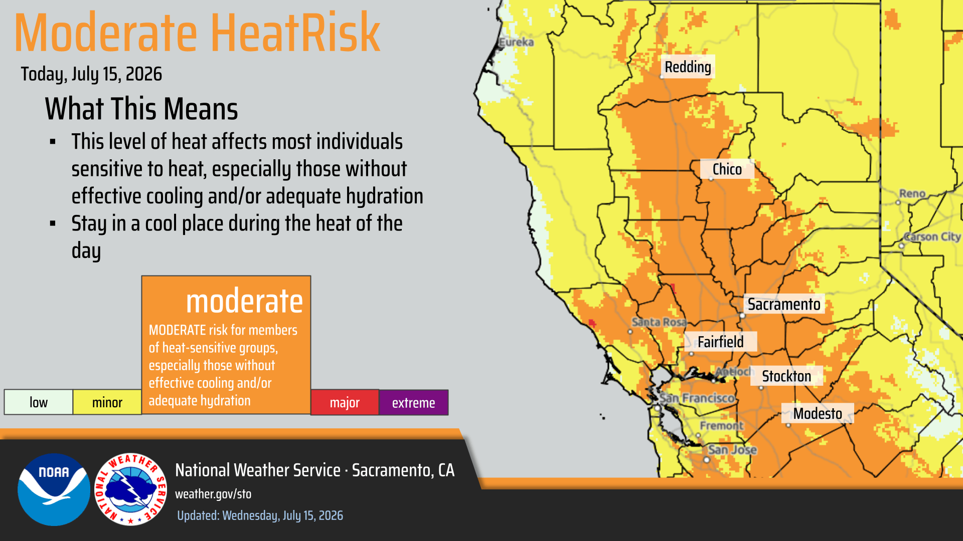
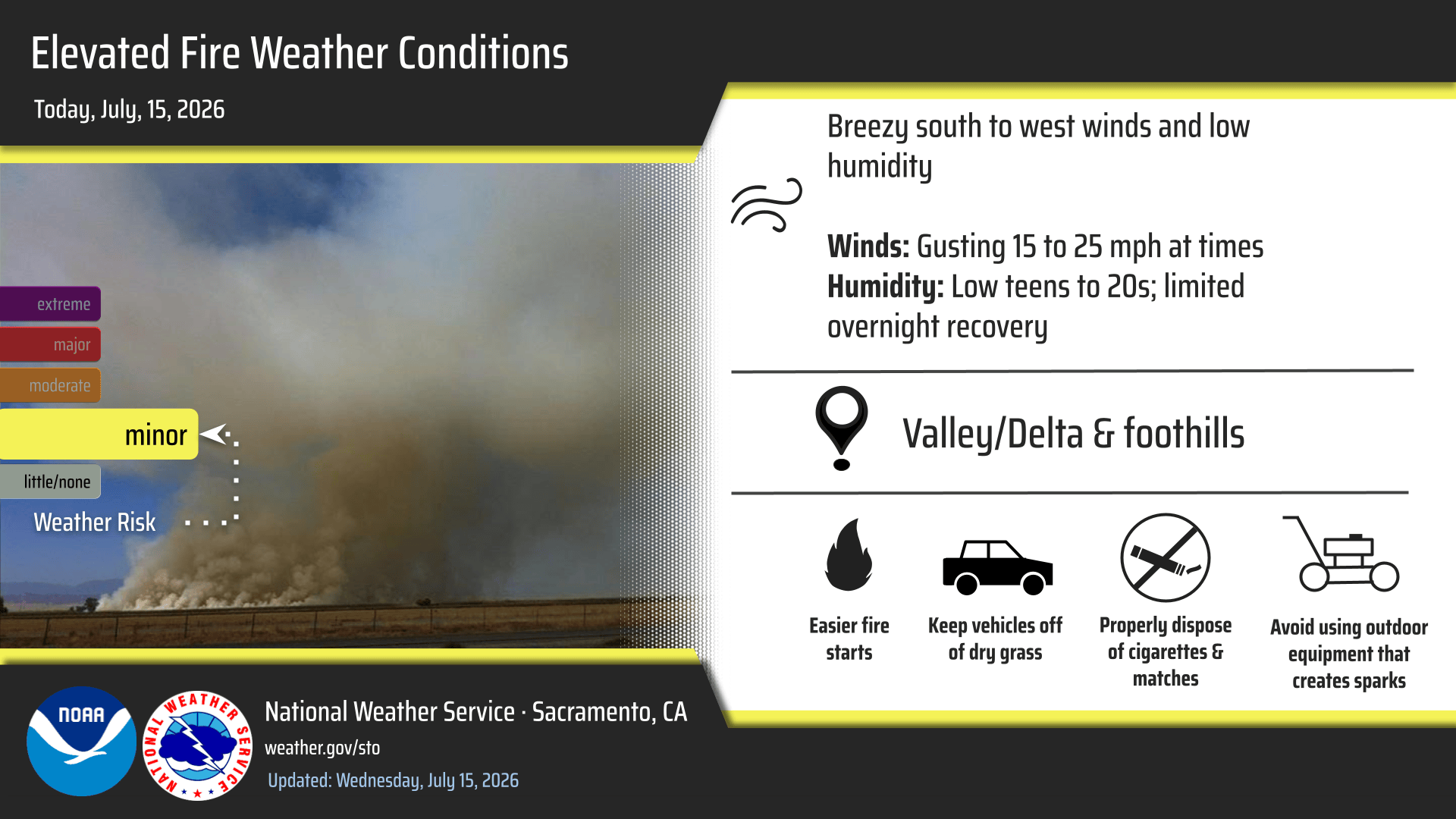
July 15, 2026 at 6:16 AM Here are the overnight NWS Sacramento forecast updates:
- Hot temperatures and widespread Moderate HeatRisk persist today, followed by a gradual cool down to more seasonable weather heading into the weekend
- Breezy and dry conditions today and through the end of the week will result in some periods of elevated fire weather concerns
- Limited overnight humidity recovery expected across the mountains, foothills, and portions of the northern Sacramento Valley
- Mountain thunderstorm chances return as another surge of monsoonal moisture arrives this weekend into early next week
- Some forecast timing and coverage uncertainty exists, but highest thunderstorm potential is currently anticipated along the Sierra crest from Interstate 80 southward
July 14, 2026 at 7:23 PM Reader report of power restoration in Penn Valley.
July 14, 2026 at 5:13 PM Power outage affecting 4,125 PG&E customers between Big Oak Valley and Rough & Ready Hwy due to the fire.

July 14, 2026 at 4:39 PM Updates will be posted on the Kearney incident page.
July 14, 2026 at 4:29 PM Evacuations are coming for the area. If you need additional time to leave, please prepare now.

July 14, 2026 at 4:17 PM Augmented dispatch for the Kearney Fire, additional engines dispatched.
July 14, 2026 at 4:16 PM Law enforcement is arriving at scene of the Kearney Fire in Big Oak Valley.
July 14, 2026 at 4:10 PM The Kearney Fire is now 5 acres, multiple structures threatened.

July 14, 2026 at 4:05 PM Air Attack is reporting some short-range spotting, requesting additional aircraft.

July 14, 2026 at 4:02 PM Vegetation fire, west of Smartsville, approximately 1/2 acre in the grass burning at a slow to mediate rate of spread. Air Attack is overhead the Kearney incident
July 14, 2026 at 3:46 PM Arrowhead IC is releasing some resources. Resources at scene can handle the 1/4 acre fire. Air Attack is releasing all aircraft.
July 14, 2026 at 3:44 PM Forward progress has been stopped, tanker is leaving the incident.
July 14, 2026 at 3:41 PM Tanker drop has taken the heat out of the fire.

July 14, 2026 at 3:32 PM Vegetation fire on Arrowhead Road in the Chicago Park area. Tankers are at scene, helicopter inbound.
July 14, 2026 at 12:23 PM Election season update: Ricki Heck won’t seek reelection to NID.
July 14, 2026 at 11:44 AM Overturned aircraft at the Auburn Airport, no injuries reported. Units dispatched.
July 14, 2026 at 11:41 AM Accident on Wolf Road at Duggans, units dispatched.
July 14, 2026 at 11:29 AM PG&E has announced likely PSPS outages for the Coast. No PSPS planned in the Sierra region at this time.
July 14, 2026 at 8:25 AM No fire near Hobart Mills, just drift smoke.
July 14, 2026 at 8:13 AM Reported vegetation fire along Hwy 89 near Hobart Mills. Units dispatched.
July 14, 2026 at 8:07 AM Reader-reported power outage on Hubbard Rd in Nevada City.
July 14, 2026 at 6:59 AM A pallet in the roadway on eastbound Hwy 20 at the South Ponderosa overcrossing is trying to waylay cars in the slow lane. Use caution and also, tiedowns.
July 14, 2026 at 5:57 AM Here are the latest NWS Sacramento key messages:
Thunderstorms Chances Today over the Mountains, Foothills, and Northern Sacramento Valley
- Isolated thunderstorm/shower chances for the northern Sacramento Valley (10-15%)
- Highest chances for wet/dry mix of thunderstorms over the mountains


Moderate HeatRisk Today-Wednesday; Lowering RHs in the Valley & Breezier Winds Mid to Late Week

- Widespread Moderate HeatRisk thru Wednesday, with triple digit heat in the Valley.
- Daytime RHs trend lower through the end of the week alongside breezier winds.
Potential Resurgence of Monsoonal Moisture This Weekend
- Thunderstorm chances return to the mountains this weekend, although uncertainty persists regarding thunderstorm coverage and monsoonal moisture influence.
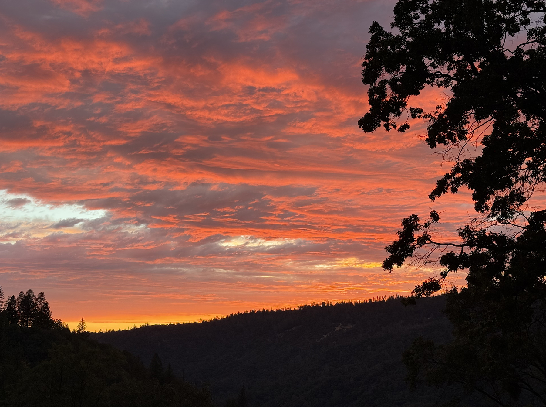
July 13, 2026 at 8:41 PM Go outside and look at that sunset!
July 13, 2026 at 7:45 PM Flood Advisory for Nevada County, CA, Placer County, CA. Flooding caused by excessive rainfall is expected.
Portions of east central and northeast California, including the following counties, in east central California, Nevada and Placer.
Some locations that will experience flooding include: Prosser Creek Reservoir, Boca Reservoir, Glenshire-Devonshire Cdp, Hirschdale, Floriston, Truckee, Lakeside Campground, Hobart Mills, Boca Campground, Alpine Meadows Campground, Truckee-Tahoe Airport, Glenshire-Devonshire, Boca Rest Campground, Ca 89 At Nevada-Sierra Co Line, Ca 89 At Placer- Nevada Co Line, Granite Flat Campground and Donner Memorial Campground.

July 13, 2026 at 7:02 PM Tree into a propane tank on Carrie Drive, units dispatched.
July 13, 2026 at 2:57 PM Unusual. A full second bloom on the neighbor’s wild Dogwood.

July 13, 2026 at 1:31 PM Whoever dumped an old couch across from the canal on Pittsburg Mine Rd near Merrill Ct obviously has no problem with their friends and family recognizing the furniture… Meanwhile, the roadway is partially blocked with this fly-tipped [as the brits would say] debris.

July 13, 2026 at 12:19 PM The Chute Fire is in Yuba County, but Nevada County Airport is busy supporting the incident.


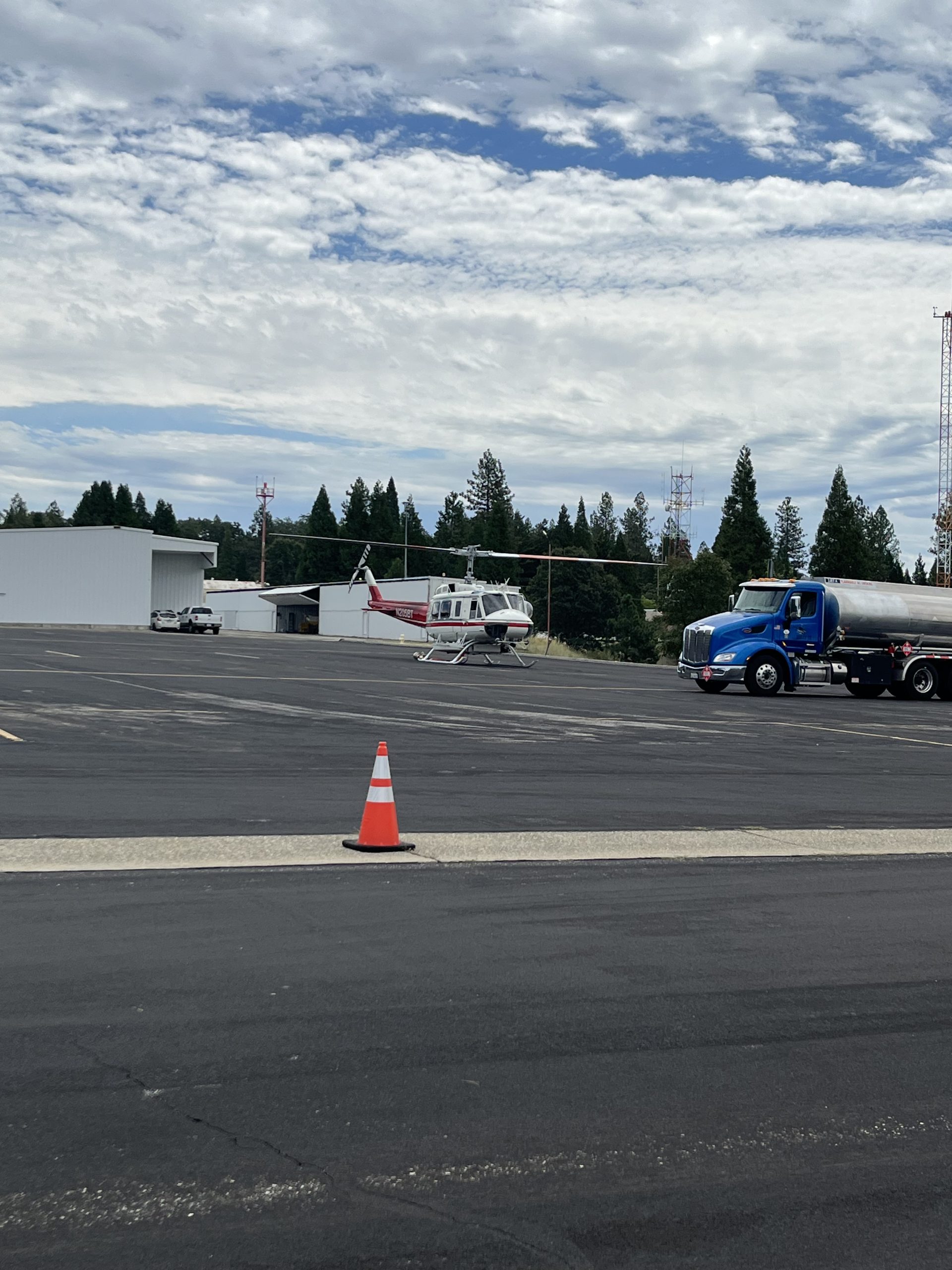
July 13, 2026 at 12:02 PM Traffic hazard on Banner Lava Cap at Gracie, broken down vehicle somewhat blocking the westbound lane.
July 13, 2026 at 10:28 AM Updates on the Chute Fire will be posted on the Chute incident page.

July 13, 2026 at 10:16 AM Tanker has dropped on the ridgeline to slow spread towards the uphill side, then start on the retardant box to give ground resources time to hike in through very inaccessible terrain.

July 13, 2026 at 10:10 AM Tanker 89 has lifted from Grass Valley Air Attack Base to the Chute incident.
July 13, 2026 at 10:07 AM Air Attack is requesting a tanker to respond, Chute IC is requesting a full wildland response, with five additional engines, two dozers, four crews. Staging will be at the Bullards Bar Skippers Cove.
July 13, 2026 at 10:03 AM Chute Air Attack is requesting an additional Firehawk to respond.
July 13, 2026 at 9:59 AM Air Attack 230 is over the Chute incident, Air Attack 17 is handing over the fire to them and returning to refuel, then onto the Elephant fire.
July 13, 2026 at 9:45 AM Air Attack is requesting tankers to the Chute incident, the plan is to paint the ridgeline to keep the fire from going uphill. The fire is 1/4 acre for now but has continuous fuel to the ridgeline.

July 13, 2026 at 9:37 AM Chute Air Attack is requesting Helicopter 5BT to respond to the fire.
July 13, 2026 at 9:33 AM Chute IC is requesting two crews.

July 13, 2026 at 9:24 AM Possible vegetation fire on the Middle Yuba on the Yuba County side, Air Attack 17 is overhead. Small spot only, given the steepness of the terrain a water or retardant drop is not advised. Ground resources will have to make their way down from Marysville Road down to a sheer cliff. This is the Chute incident, a 50 by 50 spot for now.
July 13, 2026 at 8:43 AM A reminder: Eastbound Hwy 20 is closed between the Omega Scenic Overlook and the junction with I-80 through 9 a.m. Friday, July 17. Motorists looking to connect to I-80 will detour southbound on SR 49 to connect with I-80 in Auburn or southbound on State Route 174 to connect with I-80 in Colfax. Large trucks are directed to only use SR 49. The SR 20 on-ramp to westbound I-80 remains closed until further notice due to bridge construction activities. Eastbound I-80 off-ramp to State Route 20 (SR 20) is closed until Friday, July 17. Motorists will detour along eastbound I-80 to Eagle Lakes Road, then head back westbound on I-80 and take the off-ramp to westbound SR 20.
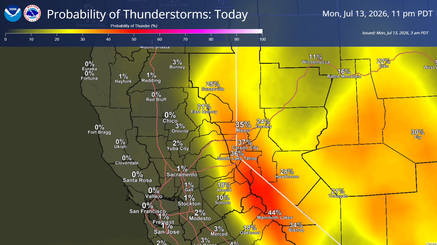
July 13, 2026 at 6:25 AM Here are the latest NWS Sacramento key messages.
- Elevated Fire Weather Conditions Today-Tuesday Due to Mountain Thunderstorms
- Thunderstorms trending wetter today-Tuesday, rather a mix of wet & dry. However dry lightning cannot be ruled out.
- Moderate HeatRisk Today-Wednesday
- Areas of Moderate HeatRisk today in the foothills
- Widespread Moderate HeatRisk Tuesday & Wednesday with triple digit Valley high temperatures
- Lowering Relative Humidities & Breezy Onshore Winds Mid to Late Week
- Daytime RHs lower into the teens to low 20s Wednesday-Friday, alongside breezier onshore winds
A resurgence of monsoonal moisture will reintroduce chances for showers/mountain thunderstorms Saturday into early next week

July 12, 2026 at 6:03 PM Reported vegetation fire north of Sugar Pine Reservoir in Placer County on the Tahoe National Forest, units dispatched.
July 12, 2026 at 5:03 PM Air Attack reports nothing showing in the Kingvale area, cameras show no smoke or fire.
July 12, 2026 at 4:57 PM Aircraft are diverting to a new reported start at Kingvale.
July 12, 2026 at 4:52 PM First engine at scene on I-0 at Blue Canyon reports one fully engulfed passenger vehicle and no extension to the wildland. One engine to continue in, all others can cancel. All aircraft returning to their bases.
July 12, 2026 at 4:50 PM Air Attack 230 is over the car fire, CHP reporting all occupants are out of the vehicle.
July 12, 2026 at 4:47 PM Reported car fire on eastbound I-80 at Blue Canyon. Air Attack and tanker have lifted to the incident.
July 12, 2026 at 1:26 PM Air Attack 230 is over the West incident, Camp Far West campground. Reporting 1/4 acre in grass burring at a slow rate of spread, held by a road. Tanker 89 and a helicopter overhead are being canceled. West IC requests only two lead engines to continue in, all others can cancel. Resources at scene have it.
July 12, 2026 at 8:51 AM Debris check on Hwy 20, units dispatched. Reported as two smoldering logs about 1/2 mile down the mountain bike trail of Hwy 20.
July 12, 2026 at 8:35 AM You are not hallucinating like AI so frequently does, those are raindrops!
July 12, 2026 at 7:55 AM The NWS Sacramento forecast remains on track this morning, here are the latest highlights.
- Scattered high-based showers/virga are moving across the area this morning, with no measurable precipitation being observed.
- Elevated fire weather concerns today – Wednesday
- Mountain thunderstorm chances remain at 10-30%, with greatest potential Monday-Tuesday over the Sierra.
- 10% or less chance for thunderstorms over the Coast Range and Shasta County mountains on Tuesday.
- Thunderstorms forecast to be a mix of wet/dry.
- Highest Uncertainty: Valley thunderstorm potential; Nocturnal convection Monday night into Tuesday AM
- Moderate HeatRisk in the Valley/Foothills Sunday-Thursday, with the most widespread coverage and warmest temperatures expected Tuesday & Wednesday
- Temperatures begin to cool off Thursday onward into next weekend
- Looking ahead to next weekend (July 18-19), models are indicating a resurgence of monsoonal moisture moving into the region which will bring additional mountain shower/thunderstorm chances to the Sierra.


July 11, 2026 at 9:00 PM Might as well let the cat out of the bag, we launched the YubaNet app. Soft launch, it’s free course and you can log in with your YubaNet account or create one right there. Let us know how you like it.
Android version and Apple version available.

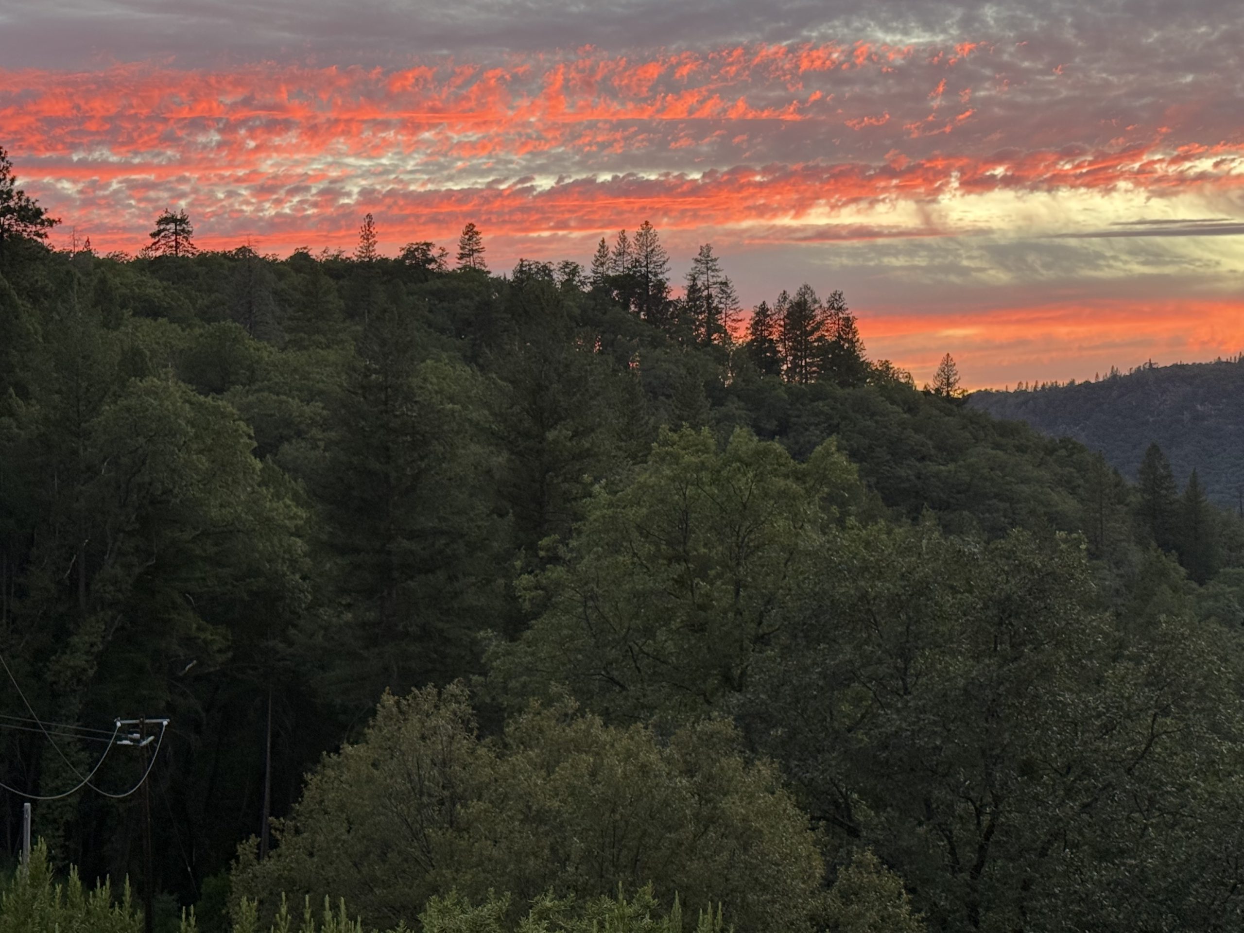
July 11, 2026 at 8:58 PM Interesting sunset.
July 11, 2026 at 7:09 PM The Elephant Fire east of Loyalton on the Tahoe National Forest started this afternoon. 2,300 acres and 8% contained. Updates on the Elephant incident page.
July 11, 2026 at 6:32 PM Homeowner on Gautier claims ignorance.
July 11, 2026 at 6:26 PM Units at scene on Gautier have extinguished an unattended burn pile. No words.
July 11, 2026 at 6:11 PM Debris check on Gautier Drive in the Higgins area, units dispatched.
July 11, 2026 at 5:11 PM 617 PG&E customers have lost power due to the Mystic Fire. Lines have been de-energized as a safety measure.
July 11, 2026 at 5:00 PM Reader report of a power outages on Jones Bar.
July 11, 2026 at 4:33 PM Updates on the Mystic Fire will now post on the Mystic incident page.
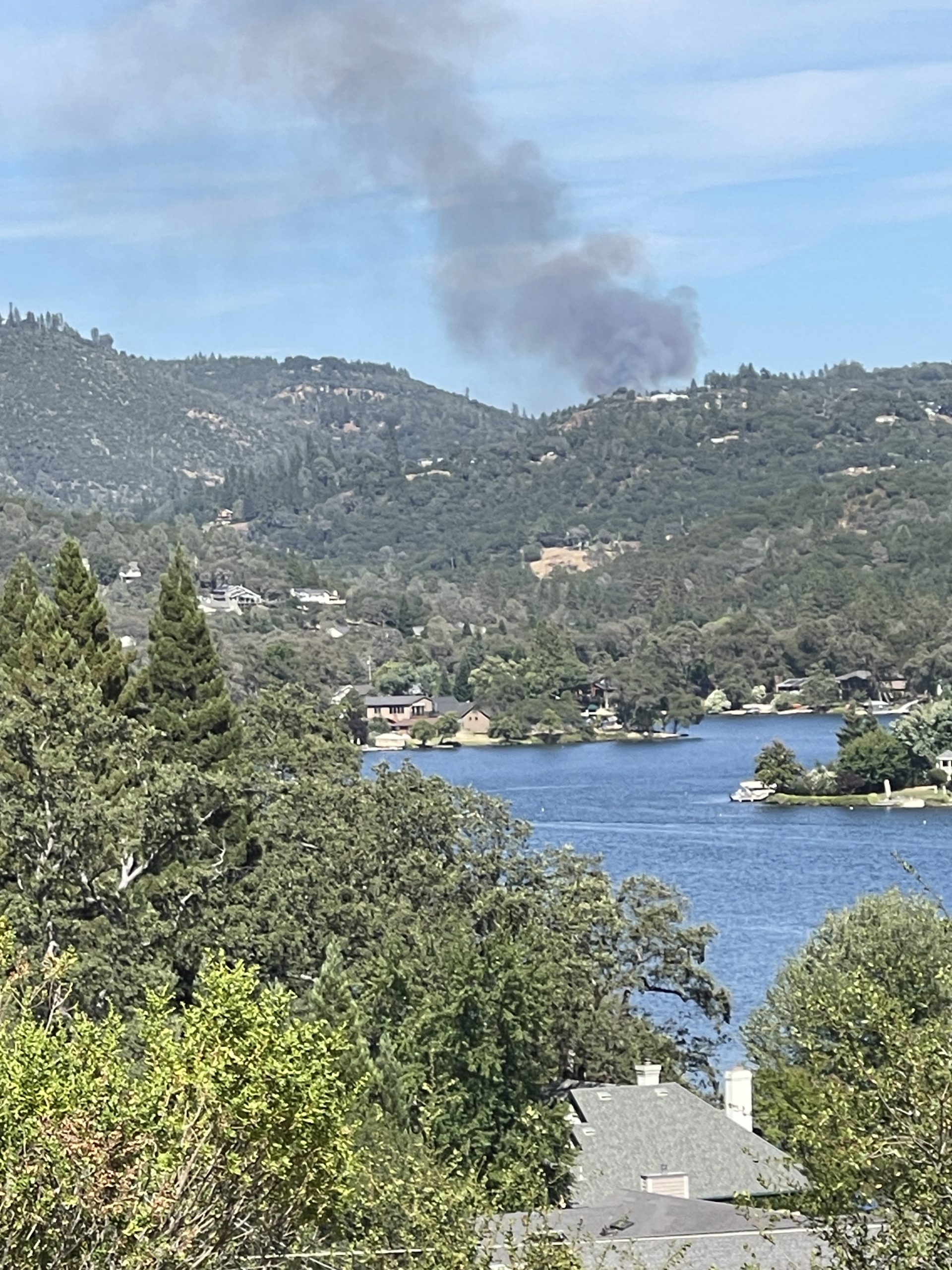
July 11, 2026 at 4:27 PM Air Attack is requesting an additional helicopter.
July 11, 2026 at 4:25 PM The Mystic Fire is approximately 2 acres, burning at a moderate rate of spread.
July 11, 2026 at 4:23 PM Air Attack 230 has lifted and requesting additional tankers. Two structures immediately threatened.
July 11, 2026 at 4:21 PM Units at scene report 1/2 to 1 acre grass and oak woodland. Some structures threatened.
July 11, 2026 at 4:14 PM Units arriving on the Mystic incident in Rough and Ready.

July 11, 2026 at 4:09 PM Reported vegetation fire on Mystic Court and White Canoe Lane, full wildland dispatch on order.
July 11, 2026 at 3:33 PM A beautiful German Shepherd, wearing a braided collar, is looking pretty lost on Wolf Rd near Retrac Way. Is your pup safe?
July 11, 2026 at 2:27 PM Wolf IC reports the fire has been fully extinguished, 5 by 5 spot only.
July 11, 2026 at 2:12 PM Units are at scene of the Wolf incident near Cameron Way.
July 11, 2026 at 2:06 PM Washington Ridge crew dispatched to the vegetation fire near Loyalton.
July 11, 2026 at 2:02 PM Reported vegetation fire on Wolf Road, units dispatched. Reported as a small spot, already extinguished.
July 11, 2026 at 2:01 PM A bridgade has lost at least one bucket on northbound Hwy 49 at Alta Sierra Dr, said bucket is now causing a traffic hazard.
July 11, 2026 at 1:54 PM Accident on Sutton and Brunswick, car vs retaining wall. Units dispatched.
July 11, 2026 at 1:33 PM Full wildland dispatch for a reported vegetation fire just east of Loyalton in Sierra County.

July 11, 2026 at 1:32 PM Hwy 49 at Lime Kiln is fully open again.
July 11, 2026 at 12:44 PM One patient has been extricated, firefighters working on the second extrication.
July 11, 2026 at 12:40 PM Oh hey, welcome back Tanker 89.
July 11, 2026 at 12:36 PM Both northbound lanes are blocked, firefighters working on extrication.
July 11, 2026 at 12:29 PM Accident on Hwy 49 at East Lime Kiln Road, extrication required. Air ambulance on order.
July 11, 2026 at 10:55 AM Peardale and Chicago Park have rejoined the utility-powered club.
July 11, 2026 at 9:28 AM Changed their tune: “There is an unplanned outage in your area. Our team is evaluating the electrical system to identify damaged sections and make necessary repairs in order to safely turn the power back on.” Estimated time of restoration is noon.

July 11, 2026 at 9:11 AM Here we go, 852 PG&E customers out of power from Rollins to Burma Road. No estimated time of restoration yet, however PG&E calls it a planned outage?
July 11, 2026 at 9:05 AM Power out in Peardale, according to a reader. According to PG&E, all systems go – let’s see how long it takes their system to catch up.
July 11, 2026 at 8:48 AM Here are the latest updates to the NWS Sacramento forecast.
- Elevated Fire Weather Conditions due to mountain thunderstorm potential Sunday-Wednesday; Highest potential on Monday & Tuesday south of I-80 in the Sierra
- Chances for isolated showers in the Valley Sunday, Monday, and Tuesday
- Moderate HeatRisk in the Valley & Foothills Sunday-Wednesday
- Mainly in the foothills Sunday-Monday
- Widespread coverage Tuesday and Wednesday (warmest days of the week)

July 10, 2026 at 9:05 PM Vehicle accident, McCourtney at Kilaga Springs Rd, law enforcement and fire at scene.
July 10, 2026 at 7:42 PM Traffic hazard on Greenhorn Rd at Baccarat Court, lanes are partially blocked – but we don’t not by what.
July 10, 2026 at 6:30 PM Elisa Parker talks to magicians Bruce Gauthier, Joshua Ray and Chris Hall. Bruce, founder of the Nevada County Magicians Guild says “the price of admission into our magicians’ guild is an interest in magic,” Chris reveals there will be a Goblin Market at the North Star House this Saturday, and you don’t want to miss Joshua’s props. Join them on Saturday, July 11 for a whimsical afternoon filled with magic, music, family fun, and a touch of fairy-tale charm. The Mid-Summer Festival will bring together local performers, playful activities, and community gathering on the historic grounds of the North Star House from 11:00 AM – 4:00 PM.

July 10, 2026 at 12:34 PM Crews will be committed for a couple hours to mop up the Springs incident.
July 10, 2026 at 12:19 PM All aircraft are off the Springs incident.
July 10, 2026 at 12:09 PM Springs Air Attack is releasing the tankers, reports ground crews are making good progress, there is line all around the fire. Helicopter will remain in the area.

July 10, 2026 at 12:01 PM Springs IC reports the fire is holding at about 3 acres and ground resources are making good progress. Three additional water tenders requested and one additional crew. Fire behavior is starting to moderate.
July 10, 2026 at 11:56 AM Small spot fire will be picked up by the helicopter.

July 10, 2026 at 11:43 AM Units on Oak Ridge are working to make their way to the fire, helicopter is working inside the fire. Heavy tanker 120 from McClellan is over the fire. Tanker 78 is returning from a reload at Grass Valley Air Base.
July 10, 2026 at 11:42 AM Springs IC reports they are still trying to make access, incoming units to stage on Oak Ridge Road.
July 10, 2026 at 11:38 AM Air Attack now reporting 2-3 acres, buring at a moderate rate of spread.
July 10, 2026 at 11:37 AM The Springs Fire is burning in grass and Oak woodlands. Tankers have started retardant lines. Still no immediate threat to structures.
July 10, 2026 at 11:33 AM Firefighters are attempting to make access to the fire from Maidu Trail, the fire is adjacent to the road. Access will be via Oak Meadow.
July 10, 2026 at 11:31 AM Air Attack is over the fire, reporting 1-2 acres, some structures in the acrea but not immediately threatened.
July 10, 2026 at 11:25 AM Updated location for the fire is on Maidu Trail and Indian Springs Road.
July 10, 2026 at 11:21 AM Reported vegetation fire on Indian Springs Road and McCourtney. Full wildland dispatch on order.

July 10, 2026 at 11:03 AM Run for something. Candidate Filing Opens Monday, July 13 in Nevada County.
July 10, 2026 at 7:55 AM From a reader: A black German Shepherd with whitish feet, no collar, is running north on Dog Bar Road near Lori. Is your pup safe?
July 10, 2026 at 7:31 AM Here are the latest NWS Sacramento updates:
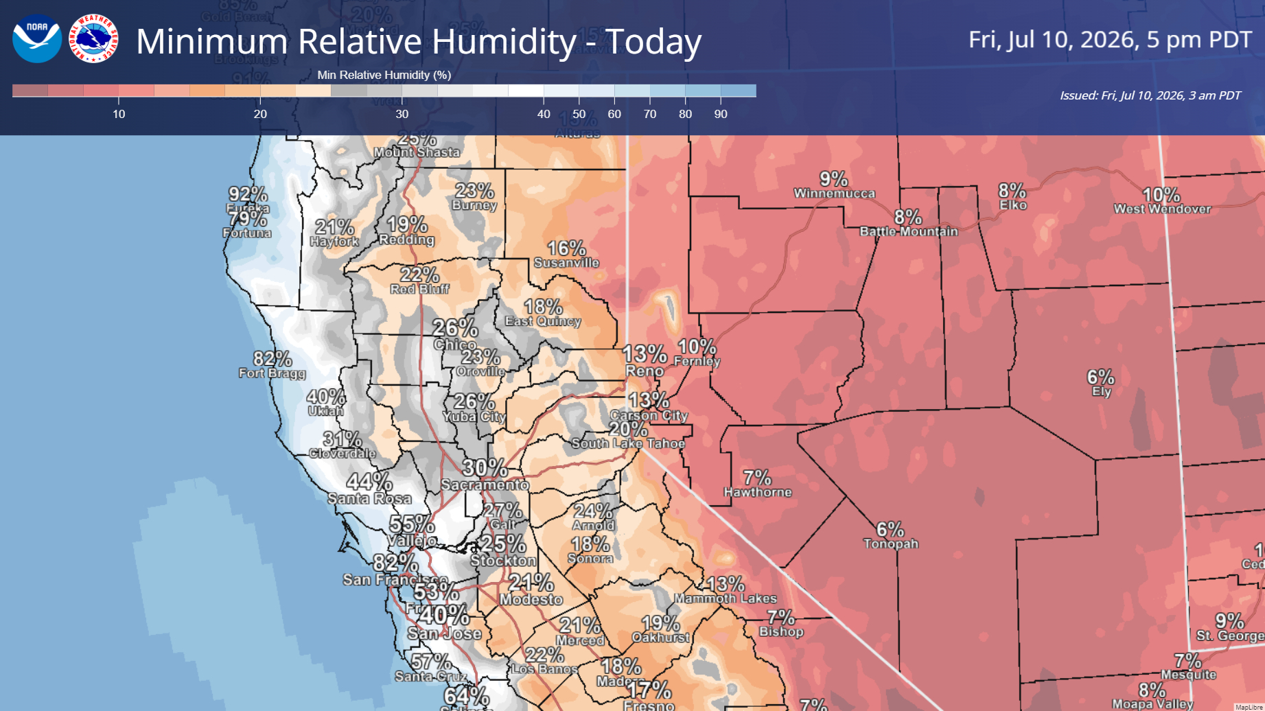
- Elevated fire weather conditions today due to marginally low daytime RHs and gusty onshore winds.
- Thunderstorm chances and subsequent elevated fire weather concerns remain on track for next week, with increased potential on Thursday as well. Still uncertain on timing and coverage, but the highest potential for wet/dry thunderstorms remains over the Sierra crest with additional chances for overnight convection Sunday & Monday nights.
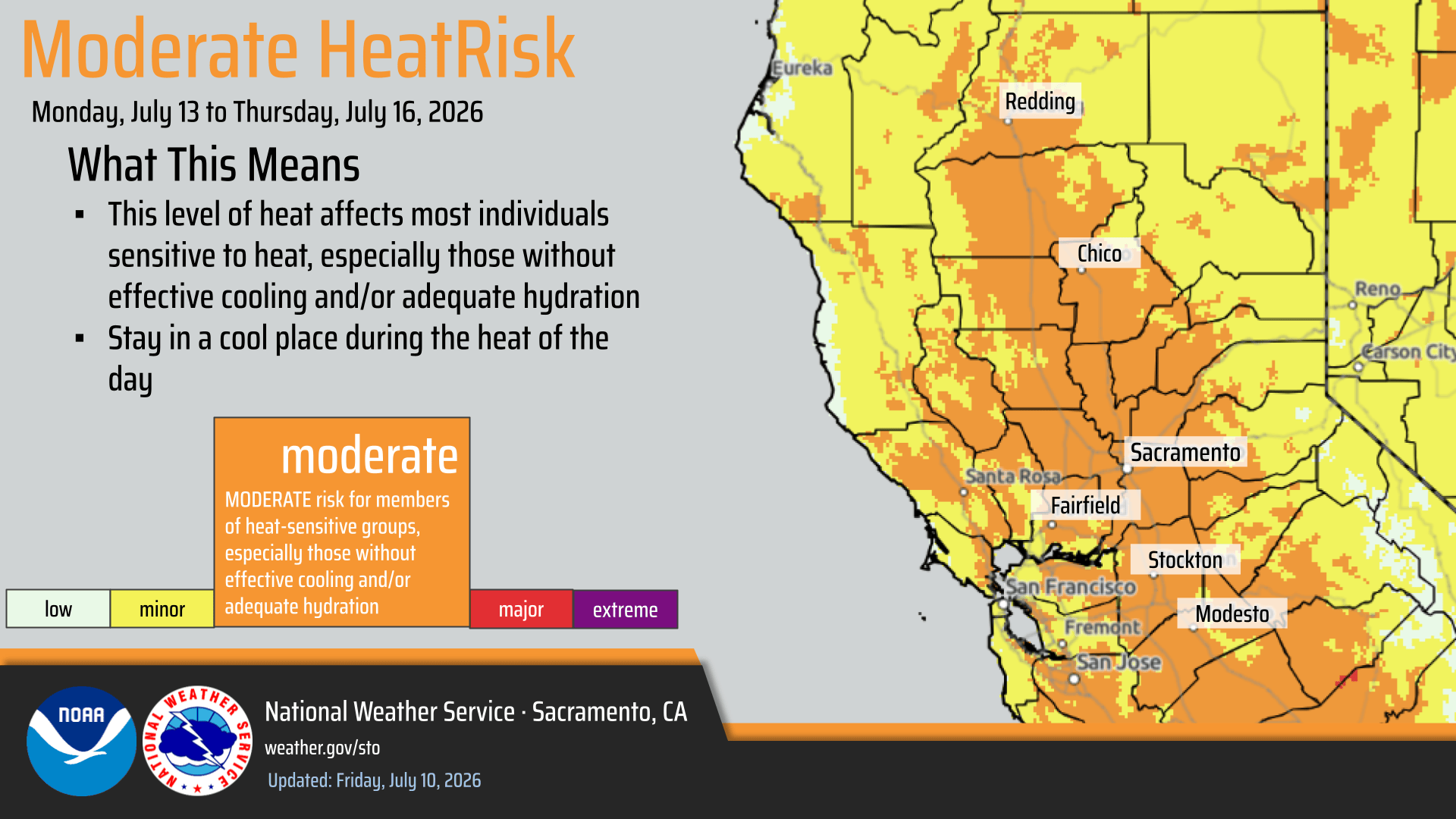
- Temperatures warm up throughout next week with areas of Moderate HeatRisk in the Valley Monday-Thursday. Periodically breezy onshore winds are expected to continue during this time.
July 9, 2026 at 8:52 PM Reported gas hazard on Dog Bar Road, caller reports odor and has shut off gas appliances. Units dispatched.
July 9, 2026 at 7:23 PM Units are at scene for a call on Neal and Mill in Grass Valley.
July 9, 2026 at 1:19 PM Cedar IC reports final fire size is 0.34 acres, crews are continuing with mop-up operations.
July 9, 2026 at 12:32 PM TNF Helicopter 514 has picked up their crew and is leaving the Cedar incident, going back to White Cloud.
July 9, 2026 at 12:00 PM Forward progress of the Cedar incident has been stopped. Aircraft are being released.
July 9, 2026 at 11:58 AM Air Attack reports the retardant box around the fire is complete. Fire activity has greatly diminished.
July 9, 2026 at 11:55 AM Dozer is making access to fire, Air Attack is coordinating helicopter drops with Cedar IC.
July 9, 2026 at 11:47 AM Tankers are continuing to widen the retardant lines, difficult access to the fire for ground equipment.
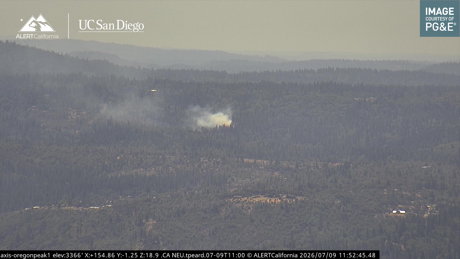
July 9, 2026 at 11:35 AM Cedar IC is reporting the fire is holding within the retardant lines. Crews are still making access to the approximately 1/4-acre fire
July 9, 2026 at 11:34 AM Both helicopters continue to work the incident, tanker from Chico will reinforce the retardant line.
July 9, 2026 at 11:31 AM The Cedar incident is holding at approximately 1/2 acre.
July 9, 2026 at 11:29 AM Tanker 78 and Air Attack 230 remain overhead, helicopter doing some bucket work.
July 9, 2026 at 11:17 AM reported vegetation fire on Cedar Way in Grass Valley, units are at scene and making good progress scene
July 9, 2026 at 10:17 AM Motorcycle accident on southbound Hwy 49 at Delphine Lane and Rush Creek. Units dispatched.
July 9, 2026 at 6:38 AM Here is your early morning NWS Sacramento forecast update:
- Dry weather is expected through Saturday.
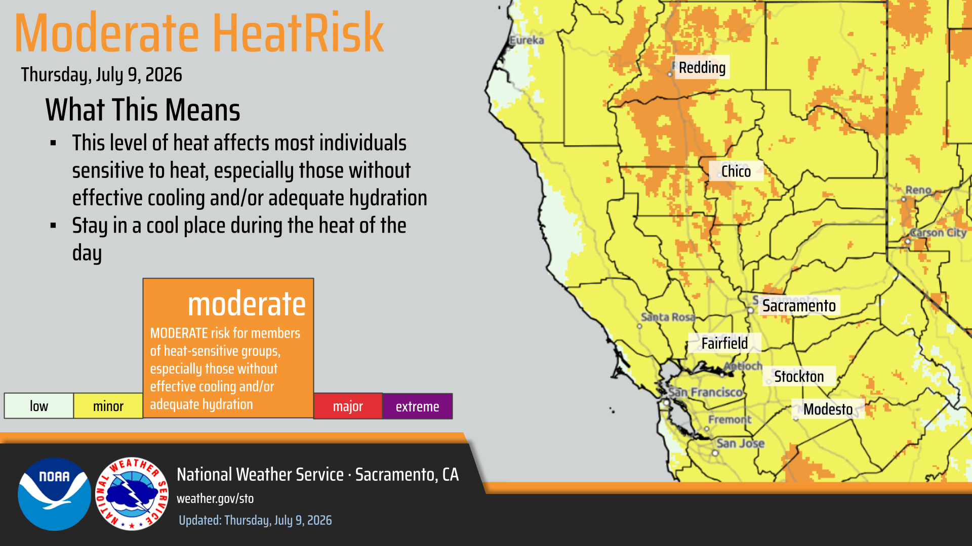
- Temperatures increase today with some areas of Moderate HeatRisk, mainly over the northern Sacramento Valley, with a slight decrease in onshore winds.
- Warm, seasonable temperatures expected through the weekend, with further increase early next week and widespread Moderate HeatRisk.
- Confidence is increasing for mountain showers and thunderstorms early to mid-next week as monsoonal moisture moves in, though uncertainty remains in timing and extent. The highest potential for thunderstorms is currently forecast over the Sierra south of I-80.
- A mix of wet and dry thunderstorms is expected, possibly overnight.
- Potential for new fire starts from lightning outside of rain cores.
- Lightning, gusty winds, and small hail could impact outdoor activities.

July 8, 2026 at 8:04 PM Accident on Tyler Foote Road, reported as a solo vehicle collision. Units dispatched.
July 8, 2026 at 6:36 PM Daniela Fernández has been unanimously elected as mayor of Nevada City, Gary Petersen unanimously elected as vice-mayor.
July 8, 2026 at 6:22 PM Coyote IC reports knockdown on the fire, they’re checkng for any extension.
July 8, 2026 at 6:21 PM Small roadside spot on Coyote Street near Hwy 49, mostly extinguished by locals. Units at scene.
July 8, 2026 at 4:17 PM Forward progress has been stopped on the Dornes incident. Resources will be committed for approximately 90 minutes.
July 8, 2026 at 4:07 PM All aircraft has been canceled from the Dornes incident, one dozer and two engines only to continue in.
July 8, 2026 at 3:57 PM Reported vegetation fire on Dornes Road off Riosa Road in Placer County. Small roadside spot at this time.
July 8, 2026 at 2:33 PM Fire engine at scene on Moonshine Road will deal with the down tree.
July 8, 2026 at 2:28 PM Tree across the roadway on Marysville Road near Kelly Road and Dark Day Road. Public Works notified.
July 8, 2026 at 11:41 AM Lakeshore IC reports this is a false alarm, contractor working on the system.
July 8, 2026 at 11:39 AM Units at scene of a commercial fire alarm sounding on Lakeshore North in Lake of the Pines report nothing showing, they’ll investigate.
July 8, 2026 at 8:58 AM TNF Helicopter 514 will make the rounds in the Bullards area to make sure it’s really just dust from a mastication/roadwork in the area.
July 8, 2026 at 8:31 AM Those ground squirrels are everywhere!

July 8, 2026 at 8:22 AM Reported fire near Bullards is likely just dust from roadwork.
July 8, 2026 at 8:02 AM Reported vegetation fire near Burnside Way near Bullards Bar, numerous resources dispatched.
July 8, 2026 at 7:59 AM From CDFA: July 8 is National Blueberry Day, and California has a lot to celebrate. In 2025, the Golden State harvested 81.47 million pounds of blueberries, which is a remarkable milestone that reflects the hard work, care, and dedication of growers, harvesters, packers, shippers, and everyone who helps bring this delicious crop from the field to families across California and beyond. Here’s to a berry good National Blueberry Day – and to the people behind every pound harvested.

July 8, 2026 at 6:15 AM Here is the latest NWS Sacramento forecast update:
- Dry weather is expected for the rest of the week.
- Temperatures remain a little below normal today, with onshore winds/Delta Breeze bringing cooling temperatures at night. This continues to moderate low temperatures for the rest of this week.
- By late week, warmer temperatures and some areas of Moderate HeatRisk are anticipated with a slight decrease in onshore winds. Further increase expected early next week.
- There is some potential for Sierra showers and thunderstorms early to mid next week as Monsoonal moisture moves in, though uncertainty remains in timing and extent.
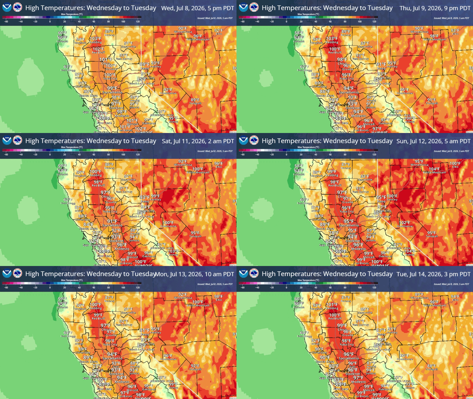
July 7, 2026 at 9:33 PM Dog Bar Road at the Bear River remains closed after a semi with a trailer slid off the roadway.
July 7, 2026 at 8:35 PM From reader Jenn: This year’s new arrival, mama’s doing a good job hiding it in our log pile.

July 7, 2026 at 4:47 PM A total of five cars are involved in the accident, with a total of seven patients. Air ambulance has been canceled.
July 7, 2026 at 4:46 PM Air Ambulance will be landing at Western Gateway.
July 7, 2026 at 4:41 PM Accident on Hwy 20 at Pleasant Valley Road, units are a scene, requesting an air ambulance.
July 7, 2026 at 2:12 PM Reported vegetation fire, already extinguished per the caller, on Val Verde Rd in the Loomis area. Three engines to continue in, all others can cancel.
July 7, 2026 at 12:29 PM Solo vehicle accident on Dark Horse Dr, units arriving at scene. One lane is blocked.
July 7, 2026 at 11:12 AM NID crews have isolated the water main break, no more water running down Hughes Rd and water service has been restored to the Sierra College area.
July 7, 2026 at 10:35 AM Water main break on Hughes Road in Grass Valley, thanks to reader Laurel for the tip.
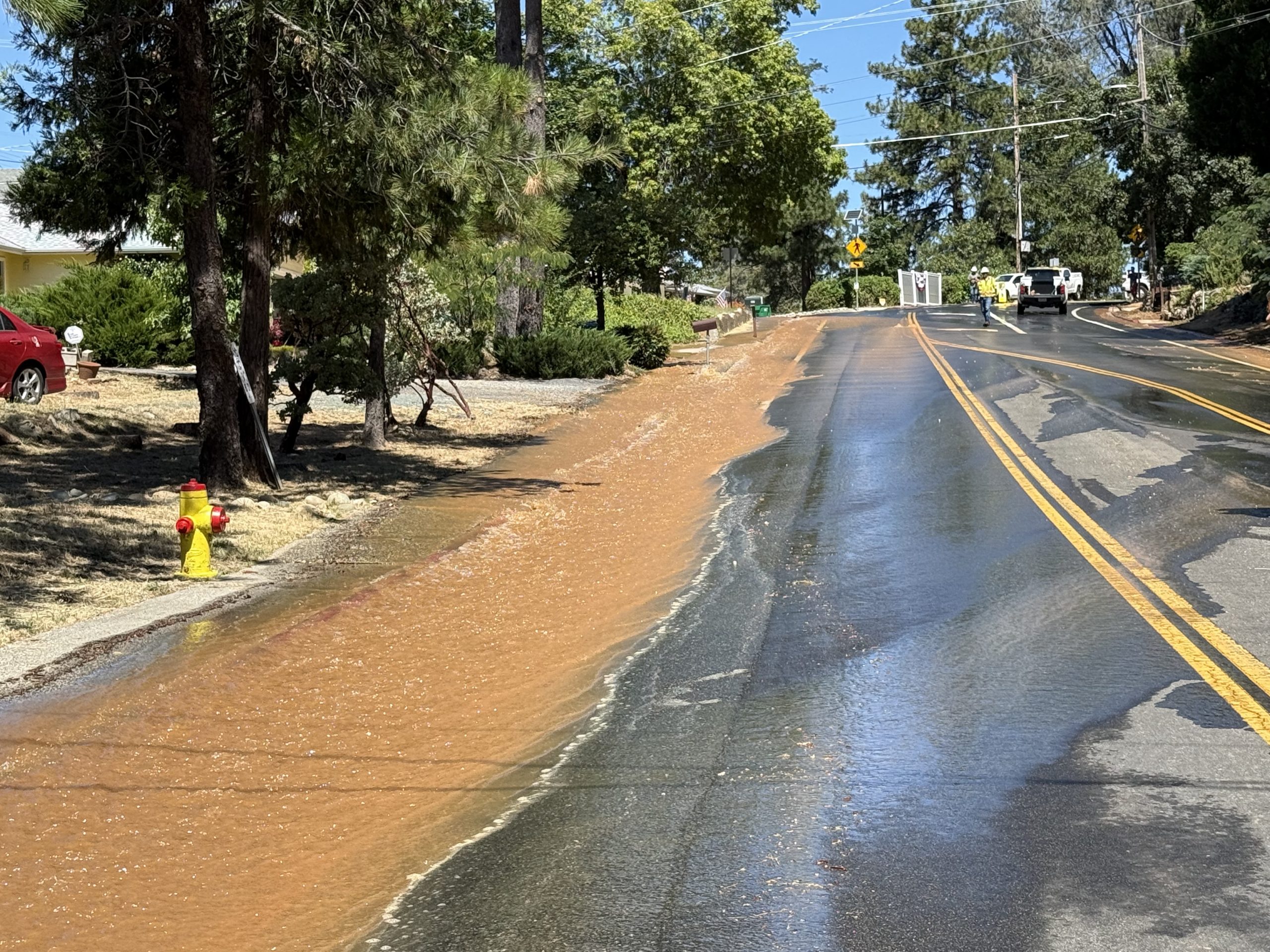
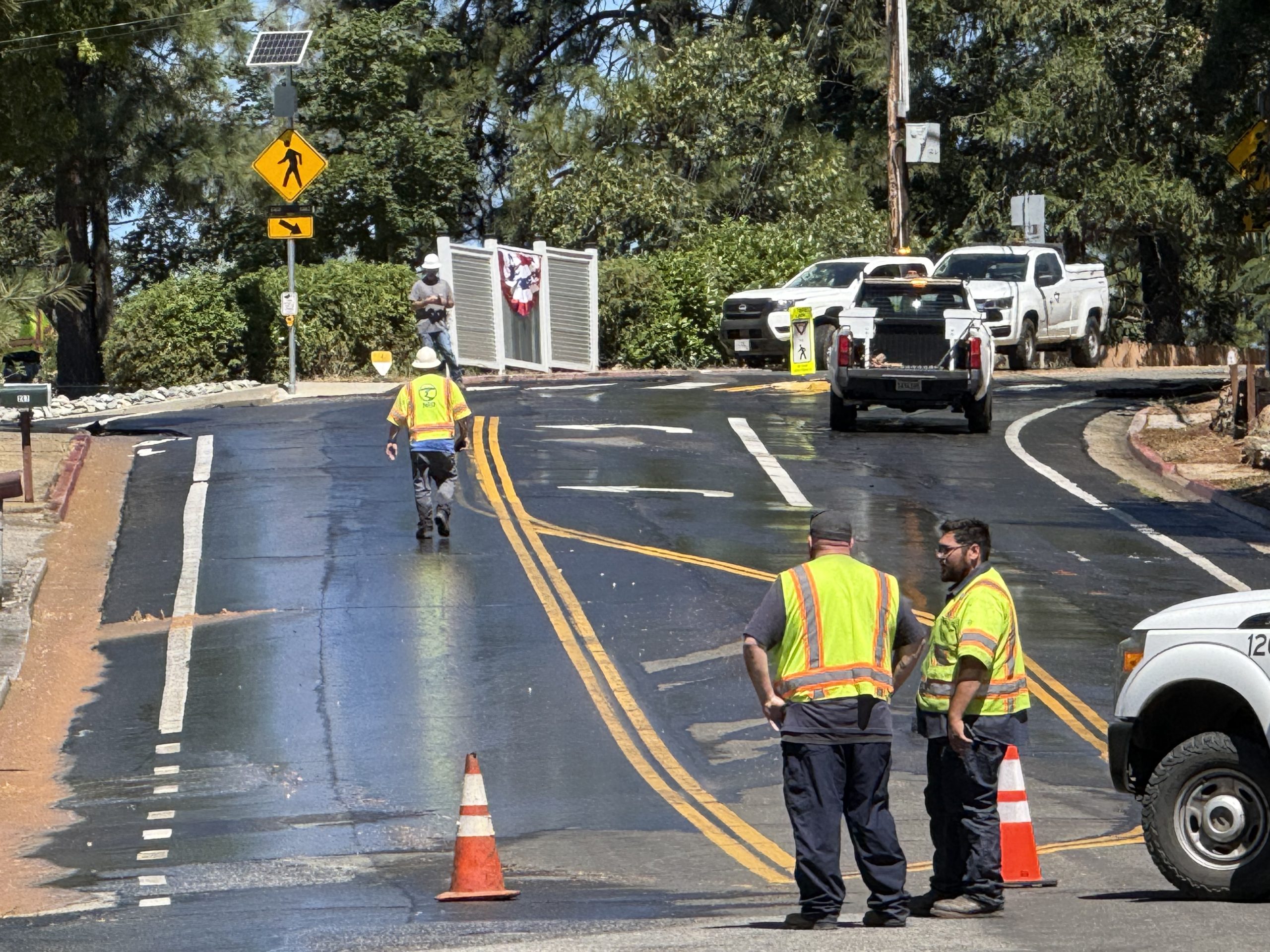
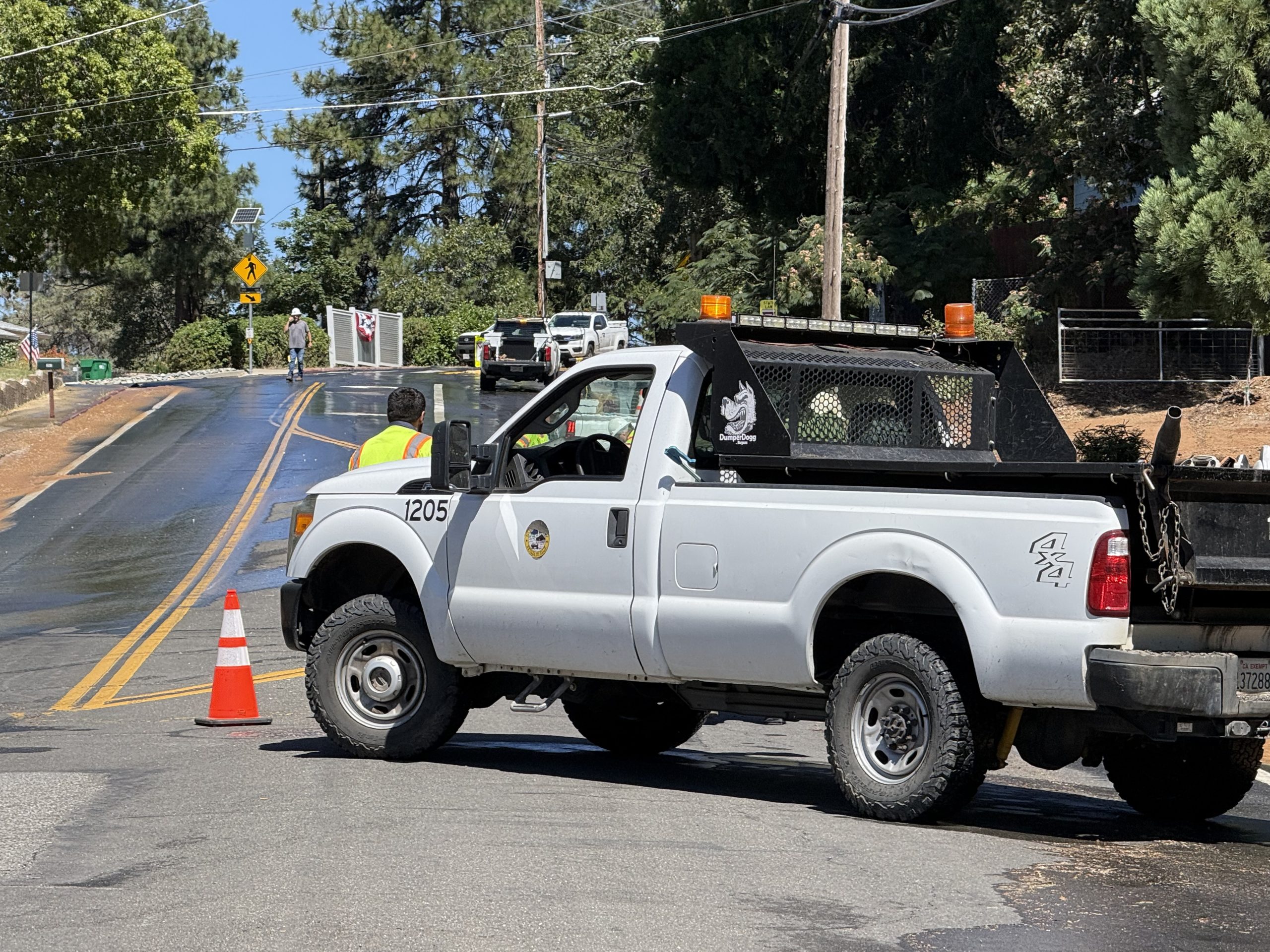
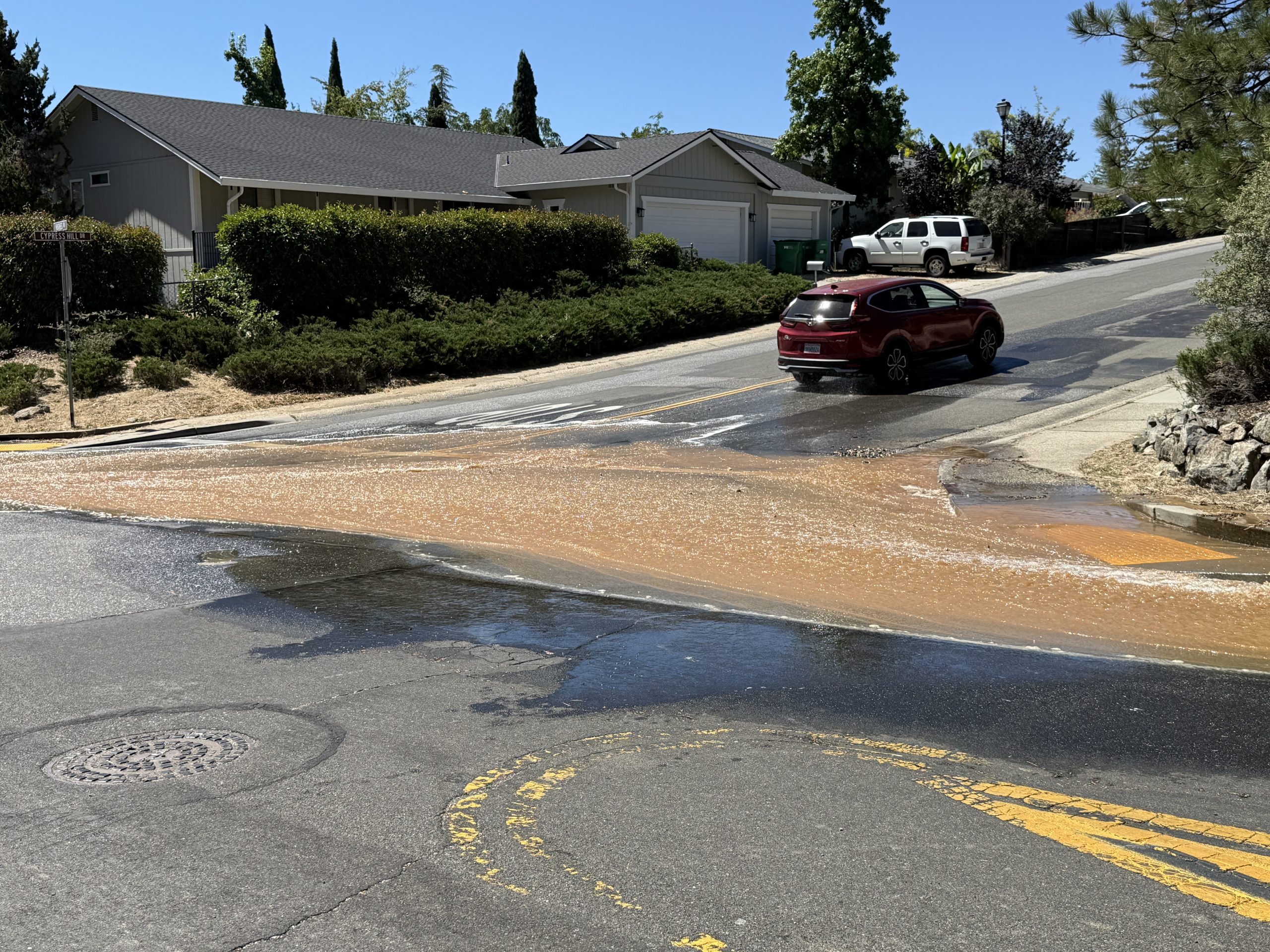
July 7, 2026 at 8:59 AM Two-car accident on Hwy 174 at Cedar Ridge Dr, units dispatched.
July 7, 2026 at 7:54 AM Solo vehicle accident on eastbound Hwy 20 at the South Ponderosa overcrossing. Overturned vehicle off the roadway, units dispatched.
July 7, 2026 at 7:27 AM Units at scene on Lazy Valley report a small fire inside the home, already extinguished. Canceling all incoming resources with the exception of one engine.
July 7, 2026 at 7:24 AM Units at scene on Lazy Valley report nothing showing, reduce all incoming units to code 2.
July 7, 2026 at 7:17 AM Reported possible residential structure fire (secondhand report) on Lazy Valley Rd and Sweetbriar Lane in Penn Valley, units dispatched.
July 7, 2026 at 7:03 AM The semi on East Bennett Rd was just making deliveries, not stuck and no longer in the area.
July 7, 2026 at 6:49 AM A semi is stuck in a sharp turn on East Bennett Rd near Old Mine Rd.
July 7, 2026 at 6:47 AM Here are the latest NWS Sacramento forecast updates:
- Dry weather is expected for the rest of the week.
- High temperatures remain a little below normal today, with onshore winds/Delta Breeze bring cooling temperatures nights into early mornings, moderating low temperatures this week.
- By mid to late week, warmer temperatures and areas of Moderate HeatRisk are anticipated with a slight decrease in onshore winds.
- There is some potential for Sierra showers and thunderstorms early next week as Monsoonal moisture moves in.
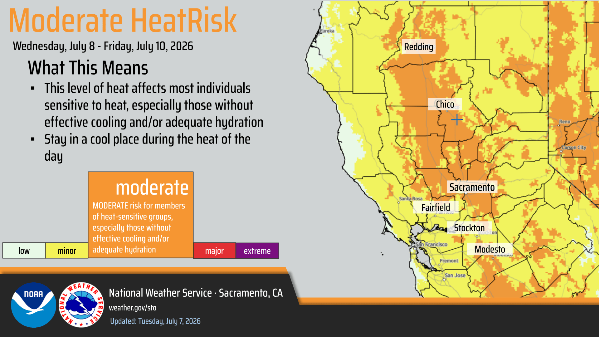
July 6, 2026 at 9:44 PM Non-injury accident on Hwy 174, just north of Brunswick.
July 6, 2026 at 5:21 PM Air Attack and all aircraft are leaving the Bella incident.
July 6, 2026 at 5:11 PM Bella IC requests two water tenders, resources at scene will be committed for approximately two hours.
July 6, 2026 at 5:08 PM Air Attack 230 is releasing the incoming helicopters.
July 6, 2026 at 5:07 PM Bella IC reports they are making good progress, forward progress has been stopped at 1-2 acres and the structure threat has been mitigated.
July 6, 2026 at 4:59 PM Units at scene on Bella Vita report 1-2 acres in the grass, burning at a moderate rate of spread, all units to continue in.

July 6, 2026 at 4:50 PM Reported vegetation fire on Lone Star and Bella Vita Pl in Placer County near the county line. Units dispatched.

July 6, 2026 at 3:56 PM Reported accident on Hwy 49 just south of Lime Kiln Road via automatic crash notification. Units dispatched.
July 6, 2026 at 1:53 PM Semi truck with a 53-ft sleeper loaded on the trailer is unable to make the turn from Crestview Dr onto Hwy 49 without some assistance. Can’t see if the load is making the turn safely. Expect a short delay.
July 6, 2026 at 8:14 AM First unit at scene on Rough and Ready Hwy reports light smoke and no fire. All units are being canceled with the exception of one engine.
July 6, 2026 at 8:11 AM Vehicle fire on Rough and Ready Hwy at Penn Valley Drive, units dispatched.
July 6, 2026 at 7:17 AM Nevada City’s Engineering & Public Works Departments will temporarily shut off water on July 8, 9 am–4 pm, for waterline work on Railroad Avenue. Please plan ahead and flush your water line after service returns.

July 6, 2026 at 5:52 AM Here are the latest NWS Sacramento forecast updates:
- Lingering isolated mountain thunderstorm chances remain possible along and east of the Sierra crest this afternoon, with drier weather anticipated the remainder of the week.
- Temperatures remain a little below normal through Tuesday with a Delta Breeze bring cooling at night.
- By mid to late week, warmer temperatures and areas of Moderate HeatRisk are anticipated with a slight decrease in onshore winds.
- There is some potential for unsettled weather early next week.

July 5, 2026 at 1:29 PM Air ambulance will meet the first responders at the Diamond Arrow campground.
July 5, 2026 at 1:02 PM Units at Edwards have made contact with the patient, assessing now.
July 5, 2026 at 12:32 PM Person stuck on a rock at Edwards Crossing, units dispatched.
July 5, 2026 at 10:28 AM All engines dispatched to the car fire are canceled, mechanical issue nly.
July 5, 2026 at 10:27 AM Smoke coming from a car on Hwy 20 near the Brighton St overcrossing, units dispatched.
July 5, 2026 at 7:58 AM Here are the NWS Sacramento overnight forecast updates:
- A slight chance for light showers and an isolated thunderstorm remain possible through this morning across the Delta, Valley, and foothills south of I-80, with higher thunderstorm chances up to 15% along the Sierra crest by the afternoon.
- Lingering mountain thunderstorm chances remain possible along the Sierra crest through Monday, with drier weather anticipated the remainder of the week.
- Temperatures trend cool to seasonable today into the early week ahead with a reinforcing Delta Breeze returning.
- By mid to late week, warmer temperatures and areas of Moderate HeatRisk are anticipated with a slight decrease in onshore winds.
- Some uncertainty remains in the forecast heading toward next weekend, but a trend toward more seasonable temperatures and a returning Delta Breeze are looking likely at this time, with some potential for unsettled weather.

July 4, 2026 at 9:40 PM 2026 Fourth of July Parade – the photo gallery is live.
July 4, 2026 at 9:30 PM Fireworks have started on the Dorsey Drive overpass.

July 4, 2026 at 8:46 PM Before the communal fireworks begin, please make sure your pets are safe.
July 4, 2026 at 7:05 PM Accident on Hwy 174 at Orchard Springs, at least one overturned vehicle. Units at scene.
July 4, 2026 at 5:56 PM All aircraft are returning to their respective bases.
July 4, 2026 at 5:52 PM Units at scene at the Range incident report the car fire has been extinguished, no threat to the vegetation. They can handle with two additional engines. All others can cancel.
July 4, 2026 at 5:43 PM Now a full wildland dispatch for the car fire at the Spenceville shooting range, threat to the vegetation.

July 4, 2026 at 5:41 PM Reported passenger vehicle fire at the Spenceville shooting range, units dispatched.
July 4, 2026 at 4:50 PM Idaho-Maryland Road is open in both directions of travel again.
July 4, 2026 at 3:50 PM The full Nevada City July 4th Parade. Happy Independence Day!

July 4, 2026 at 3:46 PM Additional medics and air ambulance requested to the accident on Idaho-Maryland.
July 4, 2026 at 3:40 PM Accident on Idaho-Maryland Road at Silk Tassle Circle, one mile from Brunswick. Roadway is shut down by emergency services.
July 4, 2026 at 8:00 AM

July 3, 2026 at 6:13 PM It’s getting late for these adorable “kids” to be running around unsupervised in Rough & Ready. Contact 530-392-1518 if your herd is missing this pair.

July 3, 2026 at 12:54 PM Pro tip: Do not go to the Yuba today. Between the lack of parking and [insert term of your choice] people who decide to partially block the roadways, it’s not worth it. Law enforcement is out in force writing tickets but still, this is not safe for anyone. May we suggest a lake or your own backyard?
July 3, 2026 at 10:11 AM Smoke check in the area of Buck Ridge Rd, units dispatched.
July 3, 2026 at 9:10 AM Ready for tomorrow’s festivities? Here’s everything you need to know about all the events in Nevada City and Grass Valley. Also, Farmers Market in Nevada City will happen – on Sunday! Many thanks to the Nevada County Historical Society for the photos of bygone eras.

July 3, 2026 at 9:08 AM Nevada County Connect update: Be advised that Nevada County Connects and Nevada County Now paratransit services are closed today in observance of the 4th of July holiday. We hope you have a wonderful holiday weekend. Normal service will resume on July 4th.
July 3, 2026 at 9:05 AM Willow IC reports minor injuries to one patient only, ambulance to continue, all others can cancel.
July 3, 2026 at 9:01 AM Solo vehicle accident on Willow Valley Road at Hill Creek Drive, car vs embankment. Units dispatched.
July 3, 2026 at 6:33 AM Here are the NWS Sacramento overnight forecast updates:
- A slight warming trend begins today into the holiday weekend with some triple digit readings in the northern Sacramento Valley.
- Isolated mountain thunderstorm chances will be possible along the Sierra crest this afternoon, with highest chances from I-80 southward.
- Slight chances for Sierra crest thunderstorms are currently forecast to continue through Monday.
- Temperatures trend more seasonable Sunday into early next week as onshore flow becomes a bit breezier.
- Some potential exists for a gradual warm up mid to late next week, but details remain a bit uncertain at this time.
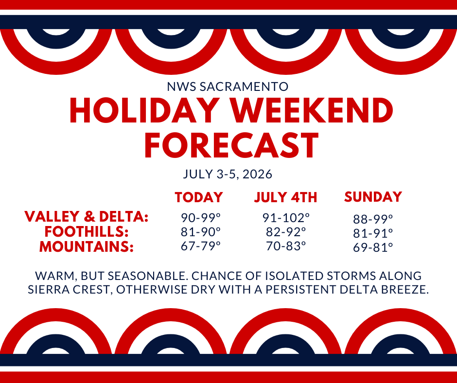
July 2, 2026 at 5:47 PM Bridgeport IC advises patient is being transported to hospital now.
July 2, 2026 at 5:13 PM Air ambulance has landed at Bridgeport.
July 2, 2026 at 4:48 PM Units are at scene, precautionary air ambulance requested.
July 2, 2026 at 4:40 PM Patient has been brought to land 1/2 mile upstream from Bridgeport. Additional engine requested.
July 2, 2026 at 4:37 PM River rescue near Bridgeport, water rescue team from Penn Valley dispatched.
July 2, 2026 at 3:53 PM Moonpie, the wayward Pomeranian, has been reunited with his human. All is well.
July 2, 2026 at 3:51 PM Power has been restored in the Peardale/Chicago Park area with the exception of six customers who have to wait until the power line is reapired. A tree fell onto the lines.
July 2, 2026 at 1:49 PM Power outage affecting 2,130 PG&E customers in the Peardale/Chicago Park area. No estimated time of restoration yet, no cause either.
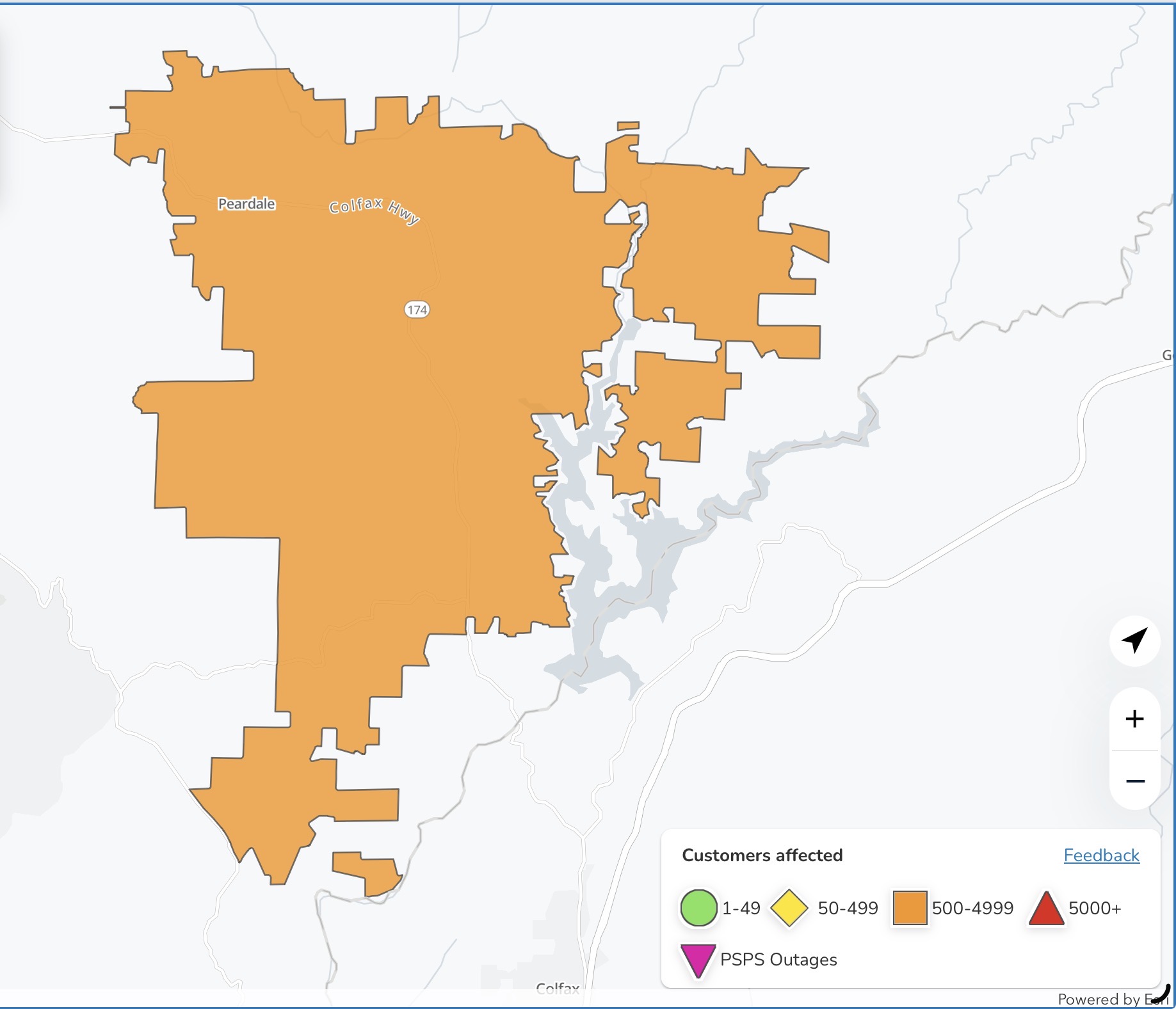
July 2, 2026 at 1:19 PM Missing pup alert: Missing Pomeranian, called Moonpie, got out on Mainhart Drive and South Auburn St. He’s approximately 4 years old and very friendly. Please contact 808-346-6485 if you’ve seen him.

July 2, 2026 at 1:10 PM A reminder: Nevada County Connects is offering free fares on all routes Thursday, July 2 and Saturday July 4, to help folks enjoy the High Sierra Music Festival at the Nevada County Fairgrounds as well as the Fourth of July holiday!
Nevada County Connects will operate its normal schedules and routes, and all passengers can ride free of charge on July 2 and July 4. Route 3 – Grass Valley loop offers direct service to Brighton Street at Gate 8 of the fairgrounds at :08 after every hour from 7:08 a.m. – 7:08 p.m. on Thursday and Friday, and from 8:08 a.m. – 4:08 p.m. on Saturday.
Nevada County Connects transit will not be operating on July 3 due to County observance of the July 4 holiday.
July 2, 2026 at 12:37 PM Yes, we’re here. No, nothing exceptional to report.
July 2, 2026 at 7:20 AM The Burnt Flat prescribed burn by CAL FIRE is underway.

July 2, 2026 at 6:41 AM CAL FIRE/Placer County Fire Department is implementing a live fire operation around Burnt Flat adjacent to Steven’s Trail and Iowa Hill Road. Weather conditions permitting, the burn will begin on Thursday, July 2nd, at 6:00 am. Smoke may be visible in Colfax and surrounding areas.
July 2, 2026 at 6:37 AM From NWS Sacramento, here are the overnight forecast updates:
- Seasonable temperatures persist through the end of the week alongside periodically breezy onshore winds.
- A slight warming trend arrives into the holiday weekend with some triple digit high temperatures expected on the 4th in the northern Sacramento Valley.
- High temperatures remain warm to seasonable moving into next week, although slightly breezier onshore flow is expected to bring continued overnight relief.
- Isolated mountain thunderstorm chances remain generally 10% or less through the holiday weekend and into next week.
- Highest chances are currently anticipated Sunday-Tuesday along the Sierra crest

July 1, 2026 at 11:18 PM Alexandra Way is fully open again.
July 1, 2026 at 10:39 PM Fire is at scene, confirming the road is completely blocked by the large tree. They are removing the tree now. County Public Works will be notified to dispose of it.
July 1, 2026 at 10:26 PM Tree down, blocking the roadway on Alexandra Way at Norlene in Alta Sierra, units dispatched.
July 1, 2026 at 5:56 PM A scared, medium-sized, black and brown dog is looking very lost on Hwy 49 at the Yuba bridge. Is your pup safe?
July 1, 2026 at 1:28 PM Accident on Newtown Rd near Pleasant Hill Ct, car vs pole.
July 1, 2026 at 1:02 PM A large piece of sheet metal on southbound Hwy 49 at La Barr Meadows is completely blocking the roadway and walling off the view.
July 1, 2026 at 12:21 PM Units at scene on Sisley are making good progress, forward progress has been stopped. All aircraft lifted from Grass Valley and any additional resources are being canceled.
July 1, 2026 at 12:15 PM Units at scene in Penryn report about 1/4 acre in brush and grass, all resources dispatched to continue in.
July 1, 2026 at 12:10 PM Full wildland dispatch on order for a vegetation fire in Penryn on Sisley Rd.
July 1, 2026 at 12:04 PM Confirmed false alarm at Hilltop Commons, tech working on alarm.
July 1, 2026 at 12:00 PM Fire alarm sounding at Hilltop Commons, units dispatched.
July 1, 2026 at 10:17 AM Units are at scene of an accident with a single patient on Genes Rd in Grass Valley.
July 1, 2026 at 8:17 AM One lane on eastbound Hwy 20 from Penn Valley Dr to Deadmans Flat (Ponderosa Way) is closed for guardrail work until 6:00 pm.
July 1, 2026 at 8:15 AM From a reader: The T-Mobile cell service on the San Juan Ridge area and Oregon Peak is down, estimated outage time is six hours.
July 1, 2026 at 6:34 AM Here are the overnight forecast updates from NWS Sacramento:
- Cool to seasonable temperatures continue through the end of the week.
- While a slight warming trend is anticipated over the weekend, temperatures remain largely seasonable through the holiday weekend and into next week.
- Periodically breezy onshore winds persist with strongest winds in the Delta and vicinity.
- Mostly dry weather continues with isolated thunderstorm chances along the Sierra crest remaining generally 10% or less at this time.
July 1, 2026 at 6:31 AM You can find last month’s log here.