
Happening Now brings you community news, updates and announcements throughout the day.
Send your photos and updates to 530-478-9600.
September 30, 2026 at 1:07 PM Tankers have dropped on the Tyer incident and are returning to Grass Valley.

September 30, 2026 at 12:50 PM Ground resources dispatched to the Tyler incident. Air Attack has requested both tankers from Grass Valley to respond due to the remote location. Helicopter 514 is arriving over the incident shortly.
September 30, 2026 at 12:42 PM Air Attack has located a 50 by 50 spot, on private property, unable to see if it is attended. This will be the Tyler incident located on Holden Ridge Drive above North Columbia.
September 30, 2026 at 12:36 PM Units in the area are waiting for Air Attack 230 to be overhead. Slight smoke showing on the cameras.
September 30, 2026 at 12:26 PM Air Attack will lauch to attempt to locate a possible fire on the San Juan Ridge in the Cruzon Grade area.
September 30, 2026 at 11:21 AM Hwy 174 from E Empire St to Partridge Rd is on one-lane traffic control until 6:00 pm due to tree work. Delays ensue.
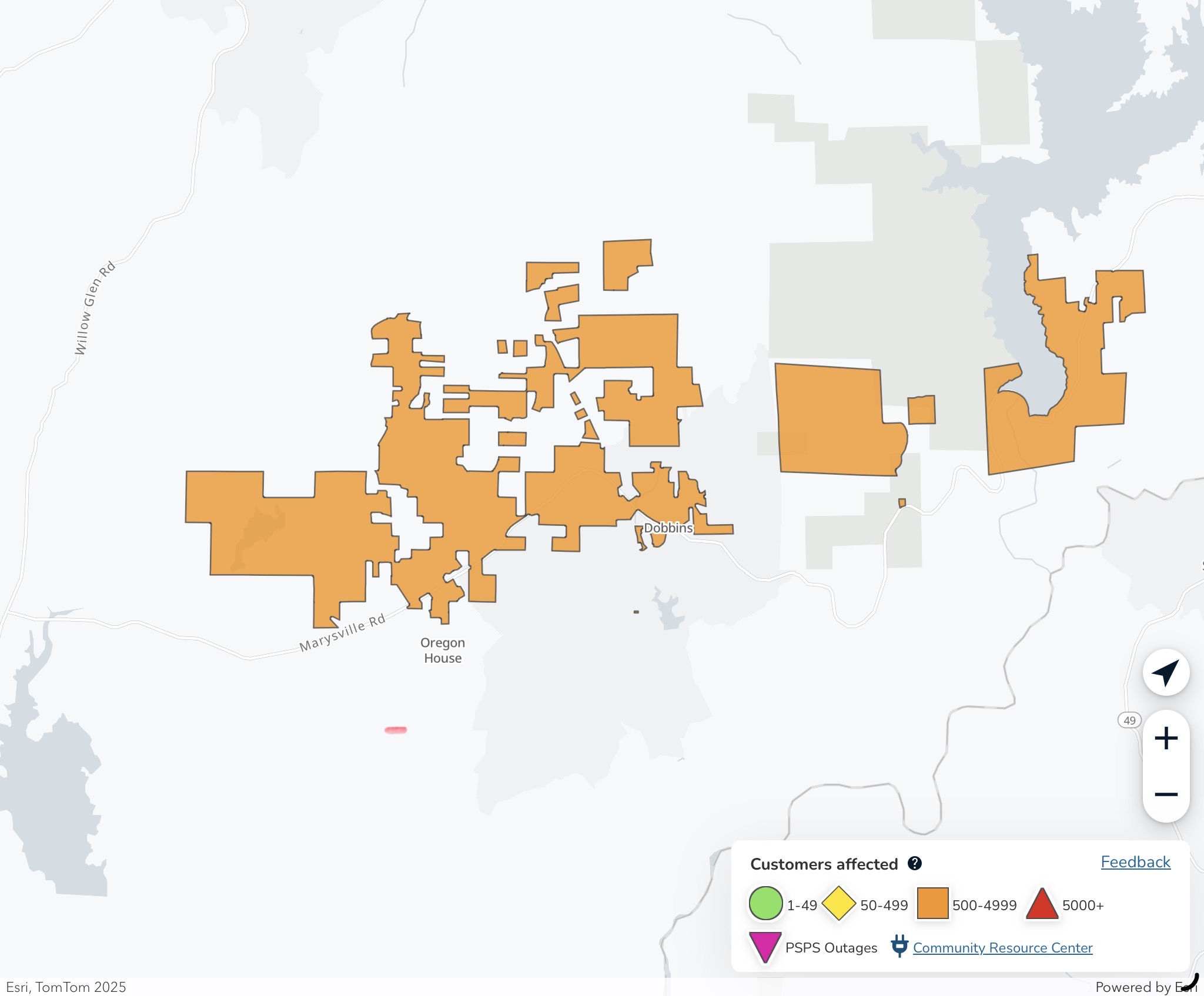
September 30, 2026 at 7:05 AM The power outage in Oregon House and Dobbins is now expected to be restored by 11:00 am.
September 30, 2026 at 6:52 AM Here are the overnight NWS Sacramento forecast highlights:

- Elevated Fire Weather Conditions continue through Thursday AM
- Strongest north to east winds are expected through this morning, then remaining breezy into Thursday
- Daytime humidity in the teens to low 20s are forecast with poor to limited overnight recoveries
- Unseasonably warm temperatures are expected to persist over the next 7 days across interior NorCal
- High temperatures remain in the 90s; hottest temperatures currently forecast over the weekend and into next week
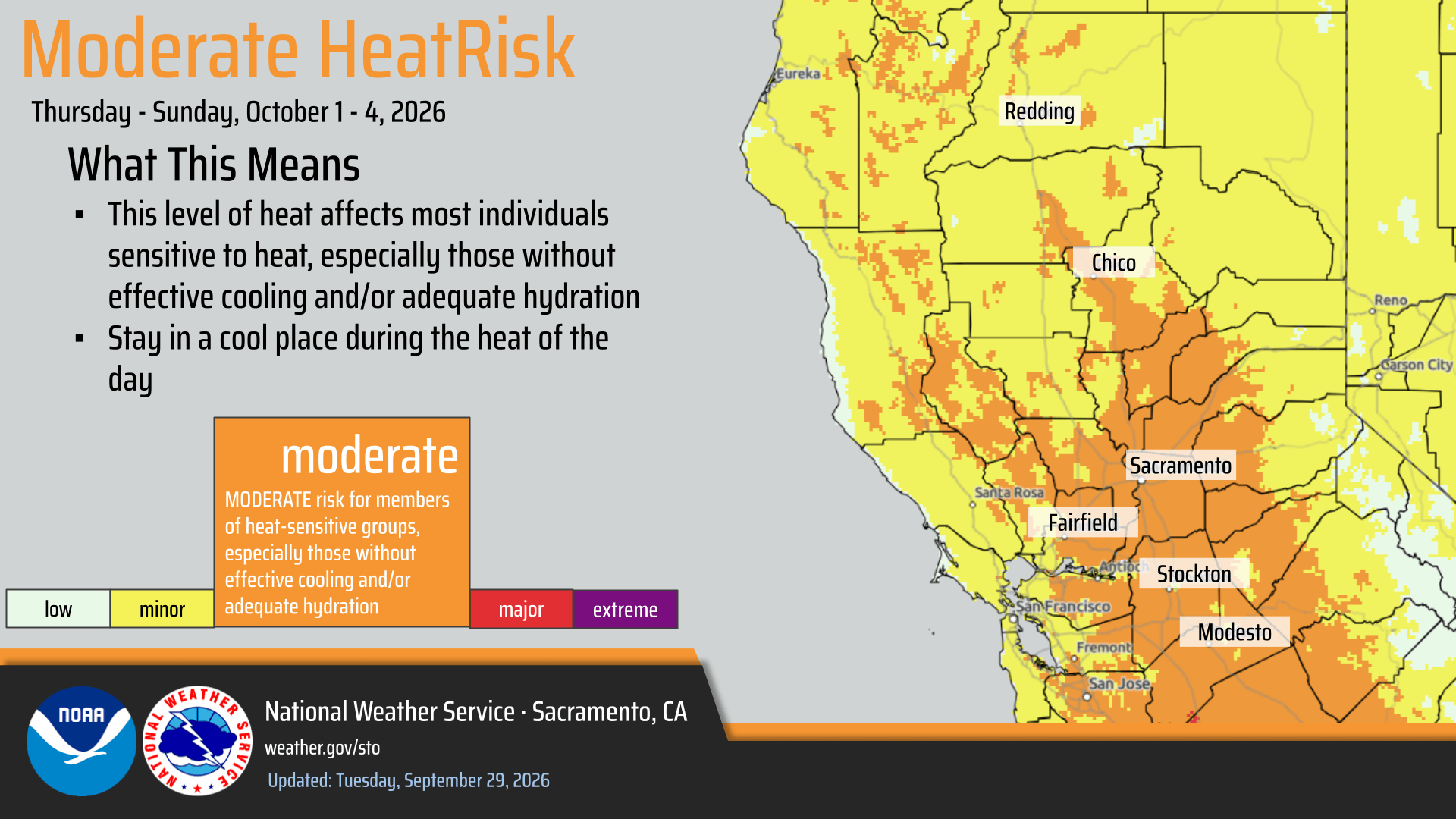
- Areas of Moderate HeatRisk south of I-80 through the end of the week expand northward into the weekend
September 30, 2026 at 1:16 AM Power outage affecting 510 PG&E customers in the Oregon House area. Tree into the lines given as the cause of the outage. Estimated time of restoration is 3:15 am.
September 29, 2026 at 3:01 PM First unit at scene reports approximately 1/4 acre of grass, very slow rate of spread. They can handle with units at scene. All incoming units are canceled.
September 29, 2026 at 2:57 PM Fire on Tokayana is reported as a hillside on fire across from Moffet Ranch Road. Nothing visible on the cameras yet.
September 29, 2026 at 2:55 PM Reported vegetation fire on Tokayana Way in Colfax. Units dispatched.
September 29, 2026 at 1:40 PM Canceling incoming units to the reported car fire on Bitney Springs. Fire is extinguished.
September 29, 2026 at 1:40 PM Full wild land dispatch for a vehicle fire on Bitney Springs Road and Rough and Ready Highway. All occupants are out of the vehicle.
September 29, 2026 at 9:48 AM An update from NID: Scotts Flat Reservoir will host Race 3 of the 2026 California DIRT Mountain Bike Series on Oct. 3 and 4. To accommodate race staging and event safety, the Scotts Flat boat launch during the event weekend.
September 29, 2026 at 7:10 AM Two dogs running in the roadway at Indian Springs and Spenceville Road. The pups are having a great time running and playing, please watch out for them.
September 29, 2026 at 6:19 AM Here are the NWS Sacaramento highlights:
- Elevated Fire Weather Conditions continue through early Thursday AM
- Today through Thursday AM: North to east winds gusting 15-25 mph in the Sacramento Valley; 30-40 mph in the higher terrain. Daytime humidity values in the low teens to low 20s.
- Strongest winds and lowest humidity values are expected today in the Valley, along and west of the I- corridor. 30 to 40 mph wind gusts in the higher terrain will continue into Wednesday morning.
- Areas of Moderate HeatRisk across the Sacramento Area and into the Delta Tuesday, expanding to portions of the Sacramento Valley (south of I-80) and foothills Thursday through the weekend
September 28, 2026 at 5:36 PM Tankers returning, fully loaded, to Grass Valley Air Attack Base from the commercial vehicle fire on I-80 at Blue Canyon. No extension to the vegetation.
September 28, 2026 at 4:20 PM Accident on Rough and Ready Rd, units disptched.
September 28, 2026 at 1:06 PM Smoke visible on the Jones Ridge camera possibly in the Clipper Creek area. This is from a prescribed burn, not a vegetation fire.

September 28, 2026 at 1:05 PM All tankers and helicopters have been released from the Karchner incident. The fire is still at 1/2 acre and holding.
September 28, 2026 at 12:59 PM Ground resources at scene of the Karchner incident report approx. 1/4 acre burning at a slow rate of spread. Two tankers and two helicopters are over the incident with Air Attack. Karchner IC is canceling the incoming dozer and all other units to stage at Karchner and McCourtney.
September 28, 2026 at 12:52 PM Tankers are arriving over the Karchner incident. This appears to be in the day use area, 1/2 acre. Slow rate of spread in grass.
September 28, 2026 at 12:42 PM The Karchner incident is visible on the cameras.

September 28, 2026 at 12:39 PM Reported vegetation fire in the Thermalands on McCourtney and Karchner in Placer County. Full wildland dispatch on order.
September 28, 2026 at 10:07 AM Vehicle off the roadway and into a ditch on Dog Bar Rd and Alta Sierra.
September 28, 2026 at 10:05 AM Debris in the roadway on eastbound Hwy 20 betwenn Mooney Flat and Melody.
September 28, 2026 at 9:59 AM Creek IC is canceling all air resources and incoming resources with the exception of one water tender.
September 28, 2026 at 9:56 AM Units are at scene of the Creek incident in Sierra County, aircraft are over the incident.
September 28, 2026 at 9:31 AM Reported small white column near Joubert Rd in the Henness Pass Rd area in Sierra County. Full wildland dispatch on order.
September 28, 2026 at 8:07 AM Power has been restored in the Banner Crest neighborhood.
September 28, 2026 at 7:45 AM Reported power outage affecting 1,177 PG&E customers in the Banner Mountain area.

September 28, 2026 at 6:06 AM Your morning NWS Sacramento forecast updates:

- Forecast remains largely on track as we transition into warmer and drier weather this week
- Elevated Fire Weather Conditions Monday through Wednesday
- Monday into Wednesday: North to east winds gusting 15-25 mph in the Sacramento Valley; 30-40 mph in the higher terrain
- Slight mountain shower chances (5-10%) this afternoon in the Sierra with a rumble of thunder or two, best chances south of HWY-50
- Areas of Moderate HeatRisk across the Sacramento Area to the Delta Tuesday and Wednesday, then expanding to the foothills and Valley areas south of I-80 this weekend
September 27, 2026 at 8:51 PM Harvest Moon by reader Adrienne.
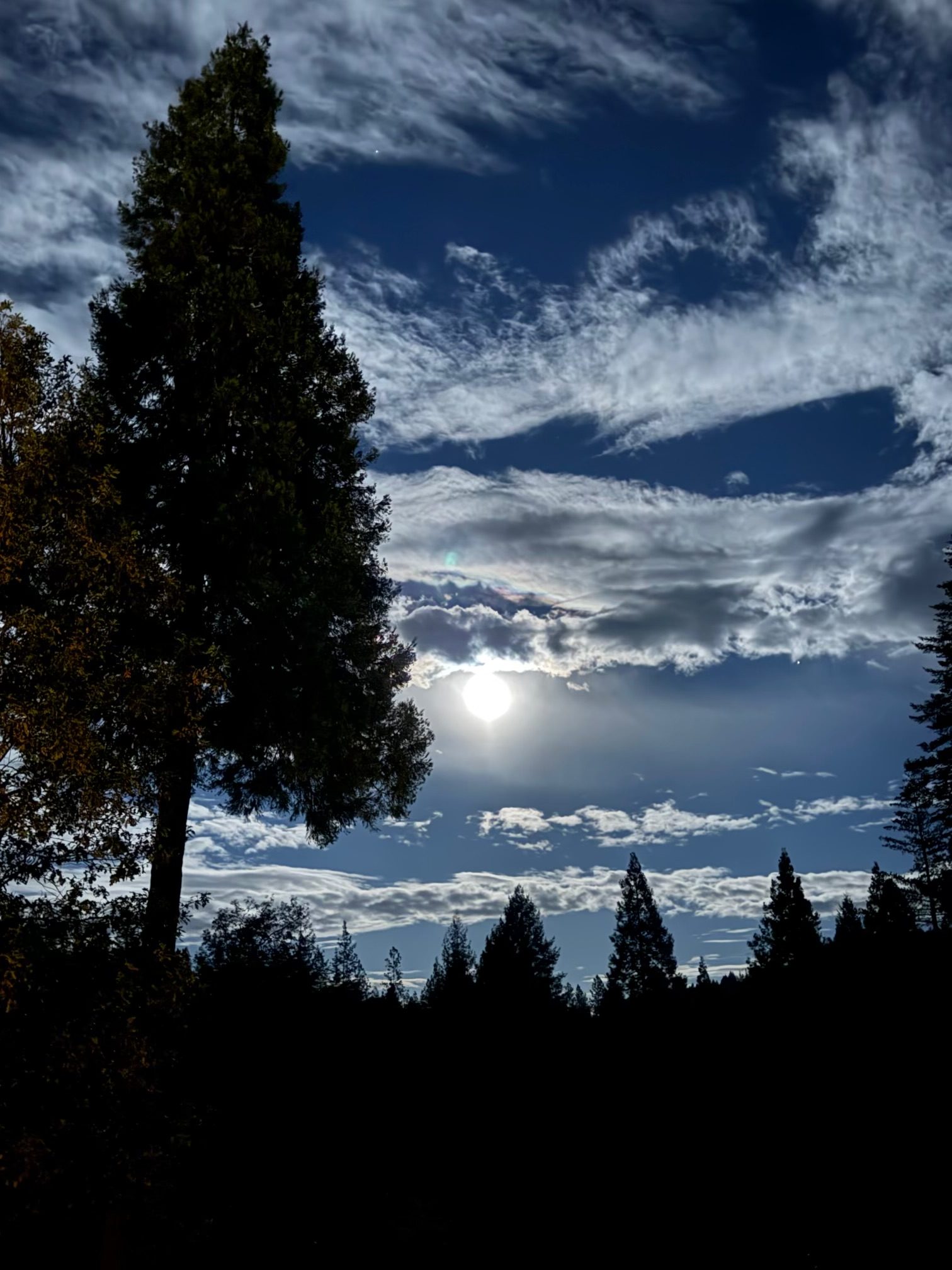
September 27, 2026 at 7:02 PM A sunset view sent by a reader in the Newtown area.

September 27, 2026 at 3:31 PM Per CHP, no threat to the vegetation, all units are canceled.
September 27, 2026 at 3:28 PM Full wildland dispatch for a semi with brakes on fire and threat to the vegetation on westbound I-80 at the Whitmore Grade just left of the runaway ramp
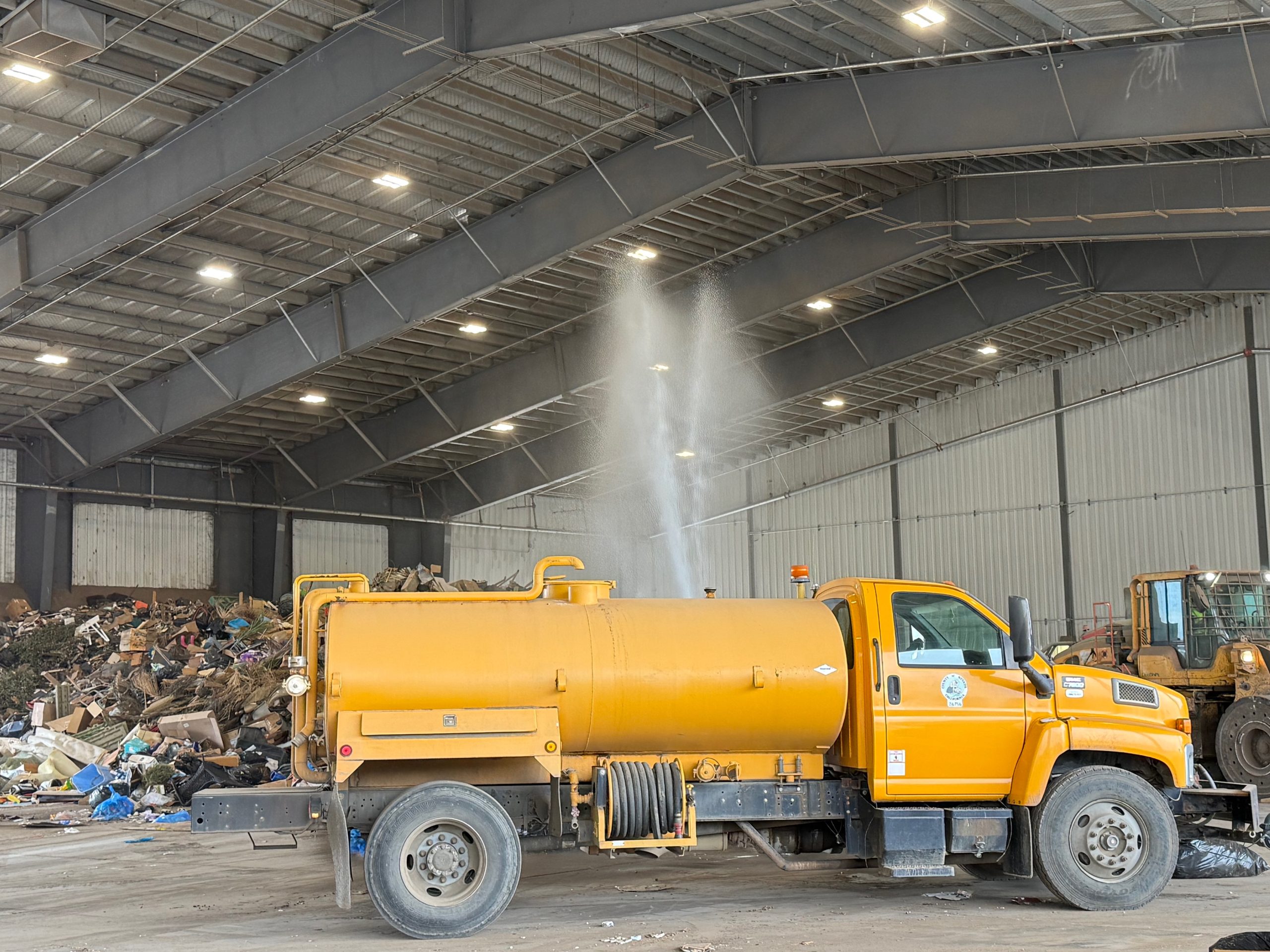
September 27, 2026 at 10:38 AM Let’s talk trash. The MRTS aka the dump had a longer than usual line of people waiting earlier today. Staff had to extinguish the small fire caused by batteries in the trash. Batteries don’t go in the trash! They go in a plastic bag on top of your trash can on pickup day.


September 27, 2026 at 8:47 AM Debris check, residential burn pile in the area of Alta Sierra Ranchos.
September 27, 2026 at 6:18 AM Here are the latest NWS Sacramento forecast updates:
- There is a slight mountain thunderstorm chances (up to 10%) on Monday along the Sierra, with highest chances remaining south of Highway 50
- Cooler weather today, with warming to above normal temperatures and warmest on Tuesday
- Areas of Moderate HeatRisk now on Tuesday across Sacramento Area to Delta
- Elevated Fire Weather Conditions continue into next weekend due to breezy winds and low relative humidity
- Sunday: Breezy onshore winds gusting up to 25-35 mph will bring elevated fire weather conditions over the Sierra
- Monday into Tuesday : North to east winds gusting 15 to 25 mph develop through the Sacramento Valley and up to 30-40 MPH over higher terrain
- Midweek – Late Week: Lingering dry conditions over the northern Sacramento Valley, foothills, and mountains into next weekend with Min RH values as low as low to mid teens

September 26, 2026 at 6:06 PM What a lovely day, uneventful as weekends should be! Here’s a photo by reader Doug to remind us that we live in a pretty amazing place – nature shows up in all its beauty pretty much everywhere.

September 26, 2026 at 7:16 AM Here are the latest NWS Sacramento forecast updates:
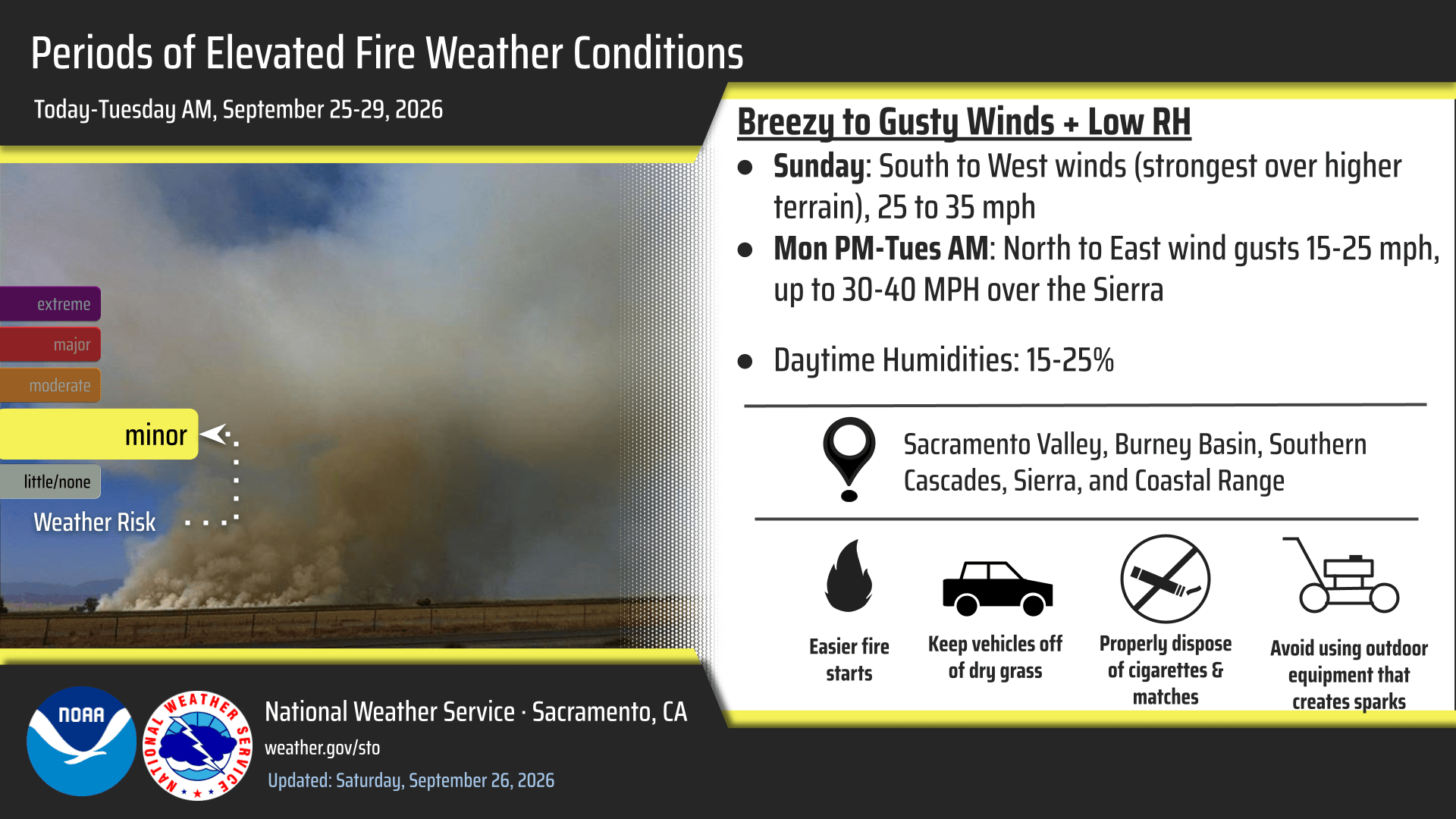
- Cooler weather this weekend, with warming back to near average/seasonable temperatures and warmest on Tuesday
- Periods of Elevated Fire Weather Conditions continue into next weekend morning due to breezy winds and low relative humidity
- Sunday: Breezy onshore winds gusting up to 25-35 mph will bring elevated fire weather conditions over the Sierra
- Monday PM into Tuesday AM: North to east winds gusting 15 to 25 mph develop through the Sacramento Valley and up to 30-40 MPH over higher terrain
- Midweek – Late Week: Lingering dry conditions over the northern Sacramento Valley, foothills, and mountains into next weekend with Min RH values as low as low to mid teens
- There is a slight mountain thunderstorm chances (up to 10%) on Monday along the Sierra, with highest chances remaining south of Highway 50

September 25, 2026 at 5:43 PM Car into a ditch on Searls Ave near Argyll Way in Nevada City. Units at scene reporting accident is in a parking lot, no injuries reported.
September 25, 2026 at 4:23 PM The power outage in Penn Valley is still affecting 266 PG&E customers. Estimated time of restoration now 2:00 am.

September 25, 2026 at 1:52 PM Happy Dolly Parton Day. Now an official day in California.
September 25, 2026 at 10:44 AM First a drink, then a bath.

September 25, 2026 at 6:47 AM Here are the latest NWS Sacramento forecast updates:
- Warmer and more seasonal temperatures are expected to return early next week
- Seasonable temperatures expected today, then cool down to below normal over the weekend
- Periods of Elevated Fire Weather Conditions continue through Thursday morning due to breezy winds and low relative humidity

Tonight – Saturday AM: North to west winds gusting 20 to 30 mph will lead to elevated fire weather conditions through the northern Sacramento Valley, Burney Basin, Southern Cascades, Sierra, and Coast Range
Sunday: Breezy onshore winds gusting to 35 mph will bring elevated fire weather conditions over the Sierra
Monday PM into Tuesday AM: North to east winds gusting 15 to 25 mph develop through the Sacramento Valley and higher terrain
There is a slight mountain thunderstorm chances (up to 10%) on Monday along the Sierra, with highest chances remaining south of Highway 50

September 24, 2026 at 7:07 PM All aircraft has left the Cooper incident. Firefighters on the ground will be committed for approximately three hours once they’ve all made access.
September 24, 2026 at 6:50 PM Helicopters and tankers have cooled and lined the fire. Ground resources have made access to the burnt-out vehicle. IC is reporting a 50 by 50 spot of vegetation was involved. One engine and one dozer to continue in.
September 24, 2026 at 6:34 PM TNF Helicopter 514 is arriving over the fire and will drop off their crew at the fire. A dozer will attempt to open access for engines. Tanker 88 will drop at the head of the fire to stop the uphill spread.
September 24, 2026 at 6:29 PM The fire is located on the south side of the river, closer to Enterprise Mine Rd and Kilham Mine Rd.
September 24, 2026 at 6:21 PM Air Attack 17 to the Cooper IC: Has located the smoke, dark smoke from a car fire, units to continue in. No real road access.
September 24, 2026 at 6:19 PM Car on fire might be down a dirt road, firefighters are attempting to locate.
September 24, 2026 at 6:11 PM Nothing visible on the cameras in the Cooper Road area. Caller reported a Jeep possibly on fire.
September 24, 2026 at 6:09 PM Air Attack 17 is lifting off to the Cooper incident. Air Attack 230 and both tankers 88 and 89 have been dispatched to a fire in Butte County.
September 24, 2026 at 6:07 PM Reported car fire with threat to the vegetation on Cooper Rd near Barn Hollow Rd in Nevada City. Full wildland dispatch on order.
September 24, 2026 at 5:22 PM Non-injury accident on Hwy 49 at Oakhurst Dr. Two cars involved, units are at scene.
September 24, 2026 at 4:51 PM HOYT’s IC is releasing all units.
September 24, 2026 at 3:44 PM Medical rescue off Hoyt’s trail, units arriving at scene.
September 24, 2026 at 9:48 AM Obstacle alert. An extension ladder in the fastlane of southbound Hwy 49 at Brunswick is trying to make cars sverve.
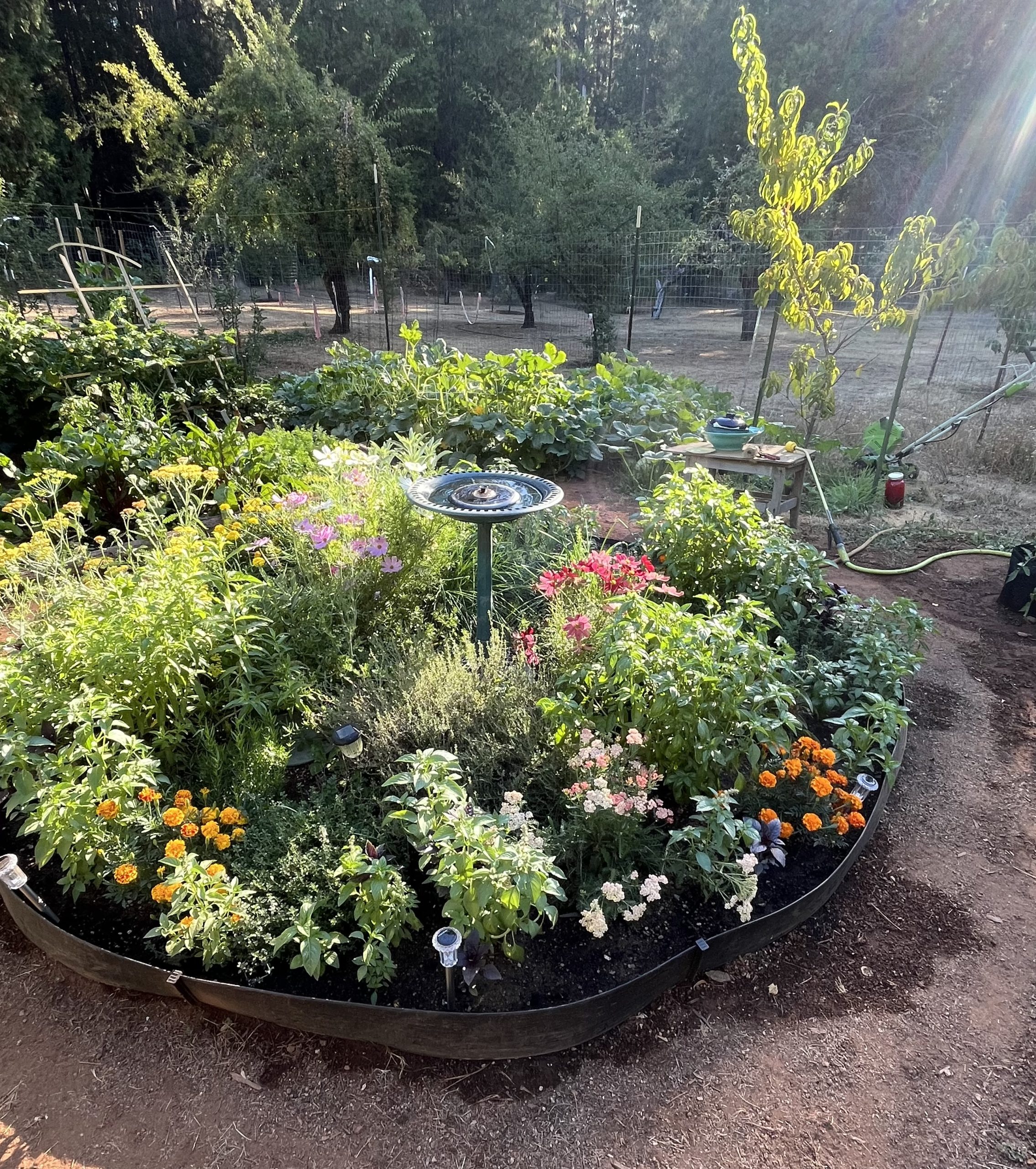
September 24, 2026 at 9:44 AM Some great pictures from the Clemens community garden by Tim and Dave. Look at that bounty!

September 24, 2026 at 8:00 AM First Rain Land Stewardship Services will be conducting a prescribed burn on September 24th between the hours of 8am and 6 pm. The burn location is 17215 Sweetwater Trl, Grass Valley, CA 95945 and a total of 7.3 acres are involved. This burn is in a douglas fir and interior live oak dominated fuel type with a substantial dead and down component. The goal is to reduce hazardous fuels and to improve the fire-resilience of the forest, while supporting the overall ecological function of the ecosystem. After completion of ignitions the perimeter of the burn will be mopped up and an overnight patrol will begin.
September 24, 2026 at 6:12 AM Here are the latest NWS Sacramento forecast updates:

Today – Sunday
- Dry and warm conditions today, with highs in the upper 80s to 90s
- Areas of Moderate HeatRisk across portions of the northern San Joaquin Valley
- Elevated fire weather concerns today and Friday into Saturday due to low relative humidity and breezy to gusty winds
- Breezy south winds today over the northern Sacramento Valley and northeastern foothills
- Breezy to gusty winds in portions of the Sacramento Valley and adjacent terrain (Coastal Ranges, Burney Basin, and Cascades), shifting to the north Friday night into Saturday
- Cooling trend over the weekend, with more seasonable highs returning early next week.
Looking Ahead (Monday–Tuesday)
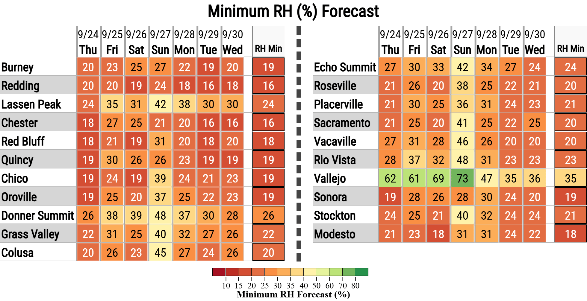
- Potential for elevated fire weather concerns Monday into Tuesday due to breezy northerly winds and low relative humidity in the northern Sacramento Valley and Sierra foothills.
September 23, 2026 at 9:29 PM Firefighters have located and extinguished a 4 by 4 pile off Lowell Hill Rd. Releasing all engines.
September 23, 2026 at 8:48 PM Smoke check on the Lowell Hill Rd in the Dutch Flat Powerhouse area, units reporting a possible bonfire.
September 23, 2026 at 6:52 PM From a reader: Just found this girl running down the middle of Highway 49 on the Camptonville side of North San Juan. She has been recently spayed. If she is your dog please call 415-309-4837.

September 23, 2026 at 1:58 PM Tanker 89 is back and available at the Grass Valley Air Attack Base.
September 23, 2026 at 1:01 PM Motorcycle accident, solo rider down, on McCourtney Rd just south of Indian Springs Rd. Units dispatched.
September 23, 2026 at 10:25 AM Trouble crew beat the estimated time of restoration for the remaining PG&E customers in Grass Valley. Everyone’s been restored.
September 23, 2026 at 10:15 AM The Grass Valley outage has been reduced to 954 customers.
September 23, 2026 at 9:49 AM Power outage in Grass Valley, 1,567 PG&E customers affected.

September 23, 2026 at 6:36 AM Here are the latest NWS Sacramento forecast updates:
Today & Thursday
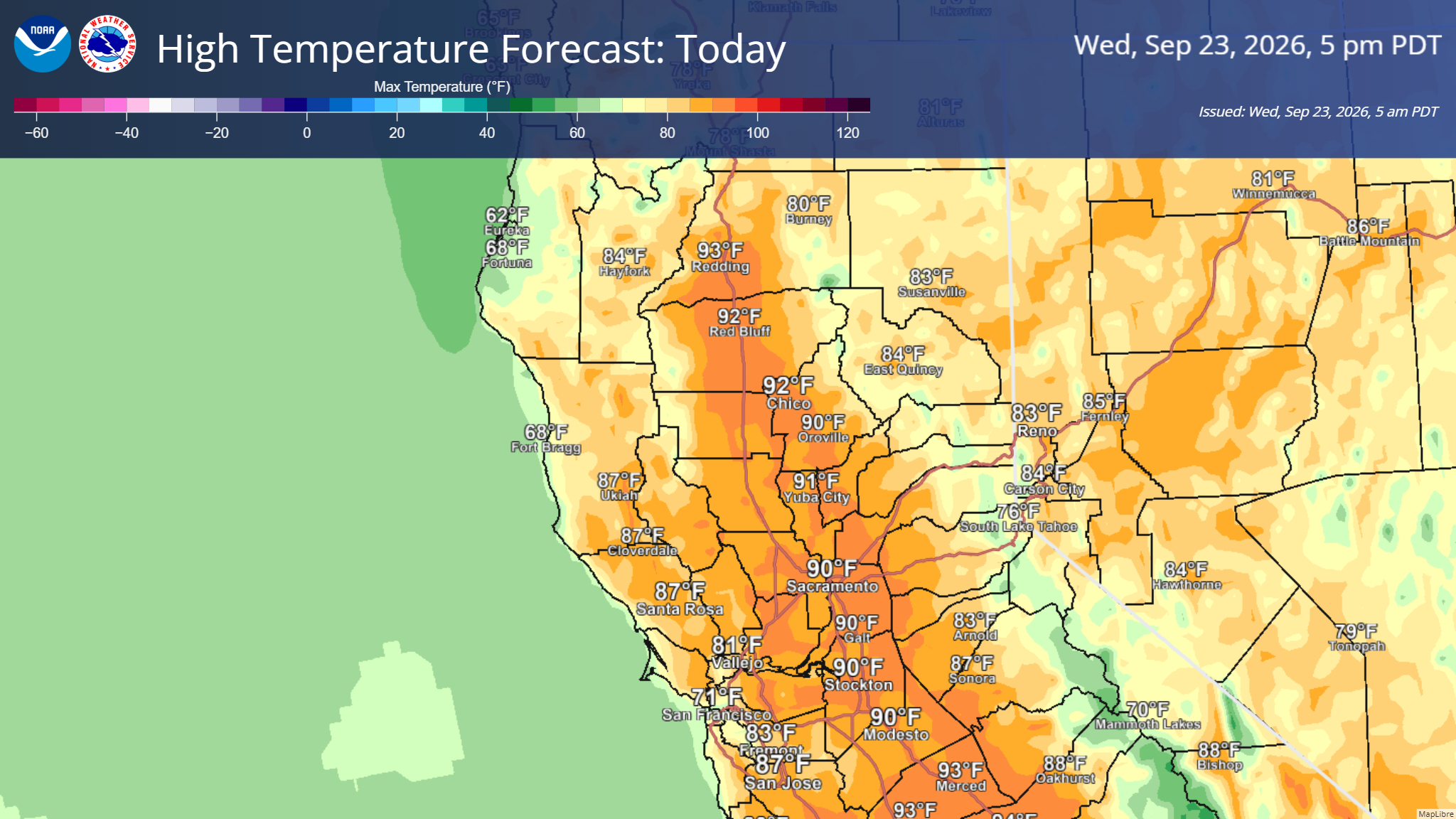
- Warmer and drier conditions today and Thursday, with highs in the upper 80s to mid 90s.
- Areas of Moderate HeatRisk are focused across portions of the northern San Joaquin Valley.
- Breezy onshore flow is expected to increase on Thursday.
- Elevated Fire Weather concerns over the northeastern foothills on Thursday due to breezy south winds and low RH values in the upper teens to low 20s.
Friday & the Weekend
- Dry weather is expected to prevail across interior Northern California through the middle of next week.
- Cooler, slightly below-normal temperatures are expected Friday through the weekend.
- Onshore flow strengthens through the Delta and Valley, bringing elevated winds over the mountains on Friday.
- Breezy to gusty north winds will develop across the Sacramento Valley Friday night into Saturday, with the strongest winds along the I-5 corridor.
September 22, 2026 at 8:51 PM Solo vehicle accident, car into a ditch, on Empress Rd at Newtown Rd in Nevada City. The roadway is clear.
September 22, 2026 at 7:39 PM Reader Mike sent the prefect equinox photos.


September 22, 2026 at 5:05 PM Welcome to Fall Season. Happy autumnal equinox!
September 22, 2026 at 2:50 PM If you have a rooster and live near the new Bear River bridge, check your coop. Caller reports a rooster walking and crowing near the bridge.
September 22, 2026 at 2:15 PM The power outage has been resolved, everyone in the area can experience modern conveniences again.
September 22, 2026 at 2:05 PM Progress continues, now 774 PG&E customers “only” affected by the power outage, mostly north of Deer Creek.
September 22, 2026 at 1:48 PM Power has been restored to 300+ PG&E customers affected by the outage in Rough and Ready. 1,545 are still waiting for the wonders of the light electric.

September 22, 2026 at 11:42 AM Canceling all resources dispatched to the Ponderosa call, unable to locate a fire.
September 22, 2026 at 11:41 AM Both fire and law enforcement (CHP) are unable to locate a fire along Hwy 20 between Grass Valley and Penn Valley.
September 22, 2026 at 11:37 AM Units in the area of Hwy 20 are attempting to locate the fire. Staging the dozer and holding aircraft on base for now.
September 22, 2026 at 11:34 AM So far single report of possibly white smoke behind the guardrail. Caller estimated a 1 by 1 ft spot.
September 22, 2026 at 11:32 AM Reported vegetation fire, grass fire on eastbound Hwy 20 at South Ponderosa Way or Rough and Ready Hwy. Units dispatched.
September 22, 2026 at 10:07 AM The unplanned outage has an estimated time of restoration of 7:45 p.m. – way too long to keep food safe in a fridge by the way. The planned outage right next to it is set to be over at 2:00 p.m.
September 22, 2026 at 9:45 AM Power outage affecting 1,846 customers in Rough and Ready, Bridgeport and Penn Valley.

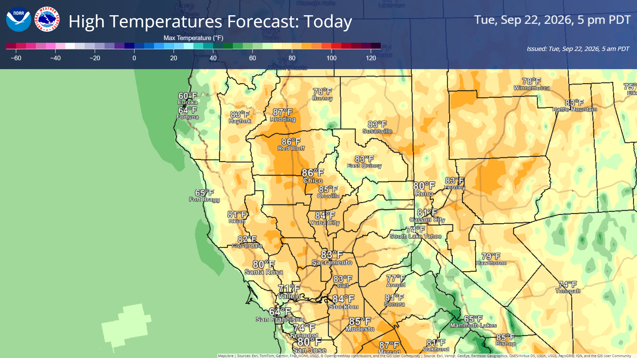
September 22, 2026 at 6:40 AM No significant changes from the overnight forecast.
Today
- Dry and seasonable weather continues.
Wed–Thu
- A warming and drying trend is expected, with slightly above-normal temperatures
- Temperatures are forecast to peak in the upper 80s to mid 90s on Thursday, alongside low RH values in the 20s.
- Areas of Moderate HeatRisk still possible for parts of the southern Sacramento and northern San Joaquin Valleys on Thursday.
Friday & Weekend
A push of marine moisture is expected toward the Valley Thursday night into Friday.
Another upper-level trough approaches late in the week, bringing a return to cooler, seasonable temperatures Friday into the weekend.
There is a low chance (15%) for mountain showers in northern Shasta County between late Thursday night and Friday morning
Onshore flow strengthens through the Delta and Valley, bringing elevated gap flow winds through the Coast Range.
September 21, 2026 at 2:10 PM Minimal changes to the forecast were seen today with showers & nonzero thunderstorm chances (5-10%) still expected over the mountains this afternoon and evening then transitioning into warm and drier weather.
Midweek Peak (Wed–Thu)
- A warming and drying trend midweek.
- Temperatures are forecast to peak in the 90s on Thursday, alongside low RH values in the 20s.
- Moderate HeatRisk expected mainly across the northern San Joaquin Valleys on Thursday.
Late Week & Weekend
- Another upper-level trough approaches late in the week, bringing a return to cooler, seasonable temperatures Friday into the weekend.
- Onshore flow strengthens through the Delta and Valley, bringing elevated gap flow winds through the Coast Range.
- A push of marine moisture is expected toward the Valley Thursday night into Friday.
September 21, 2026 at 1:04 PM The traffic hazard has disappeared from the CHP log as quickly as it appeared.
September 21, 2026 at 12:48 PM Traffic hazard on Rattlesnake Rd at Brooks Rd.
September 21, 2026 at 11:37 AM On this last full day of summer, the state agencies kicked off the first El Niño – State of Emergency Media Briefing. You’ll hear a lot more in the coming months, but start thinking about excessive rainfall and possible flooding.
September 21, 2026 at 8:24 AM A large tree branch is blocking the southbound lane on Hwy 49 at the N. Bennett St off ramp.
September 21, 2026 at 7:17 AM Updates on the Mineral Fire west of Iowa Hill will be posted on the Mineral incident page. The murder suspect is deceased after an early-morning shootout.
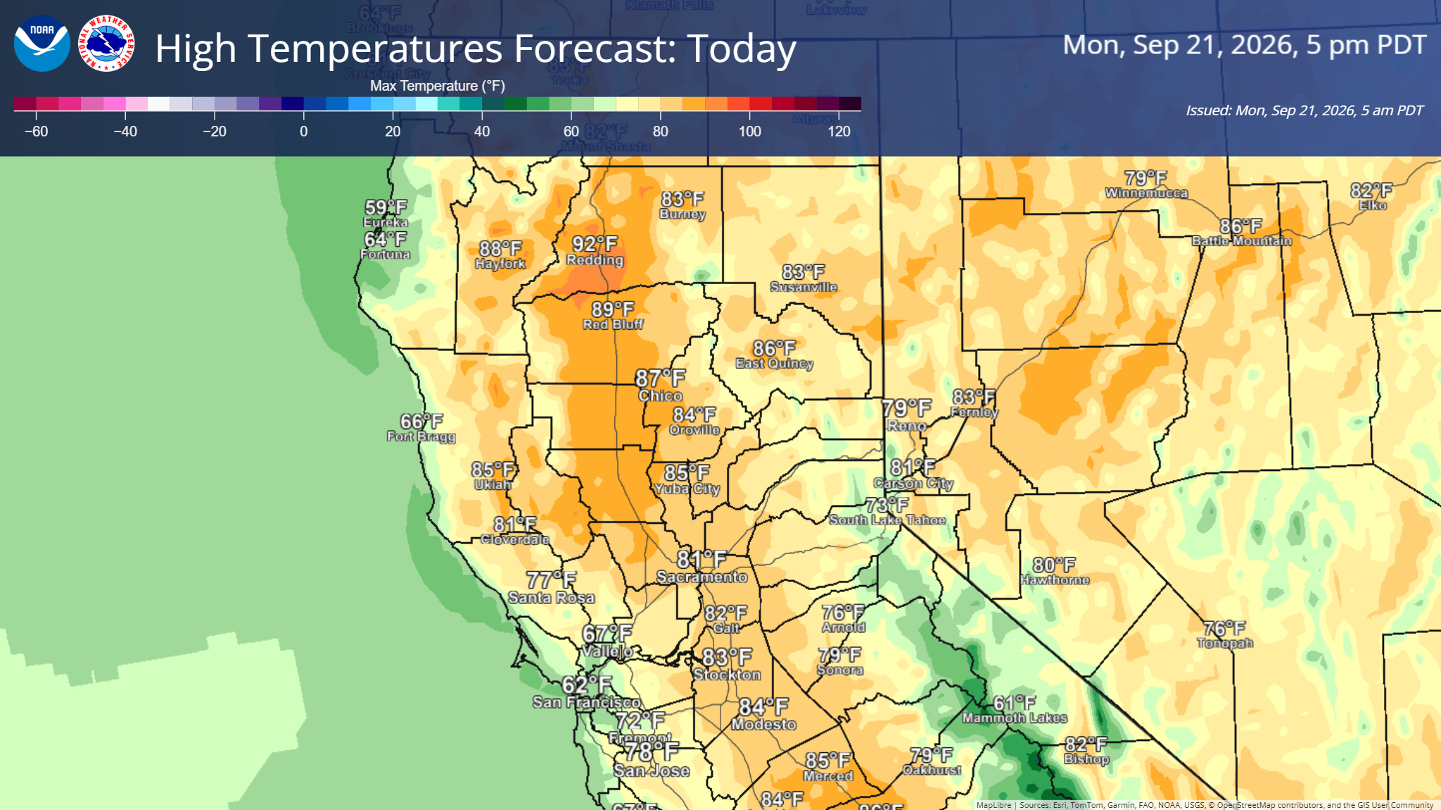
September 21, 2026 at 6:18 AM Here are the latest forecast NWS Sacramento updates:
Today & Tuesday
- Dry and seasonable weather continues.
- Slight chance (up to 10%) of isolated mountain thunderstorms this afternoon over the Sierra crest, mainly south of Highway 50.
Midweek Peak (Wed–Thu)
- A warming and drying trend is expected by midweek.
- Temperatures are forecast to peak in the 90s on Thursday, alongside low RH values in the 20s.
- Moderate HeatRisk is possible for parts of the southern Sacramento and northern San Joaquin Valleys on Thursday.

Late Week & Weekend
- Another upper-level trough approaches late in the week, bringing a return to cooler, seasonable temperatures Friday into the weekend.
- Onshore flow strengthens through the Delta and Valley, bringing elevated gap flow winds through the Coast Range.
- A push of marine moisture is expected toward the Valley Thursday night into Friday.
September 21, 2026 at 5:00 AM Firefighters staged at the Mineral Bar campground, in conjunction with Placer County Sheriff, are re-engaging with the incident on Iowa Hill Road.
September 21, 2026 at 4:47 AM Per Placer County Sheriff: The search continues for 44-year-old Derek Spencer in the Iowa Hill area. The search area is very large, with dense forest and steep, rugged terrain making the search challenging.
As tactical teams worked to clear a home where Spencer had been earlier in the search, they located an adult female who had been shot and killed inside the home. At this point in the investigation, it’s believed Spencer murdered the woman before fleeing into the surrounding forest.
A significant number of resources are assisting with the search, including tactical teams from the El Dorado County Sheriff’s Office, Nevada County Sheriff’s Office, and Roseville and Rocklin Police Departments. The California Highway Patrol, California State Parks, and Grass Valley Police Department are also assisting.
Teams will continue searching throughout the night and will not slow down as we work to locate this armed and very dangerous individual.
September 20, 2026 at 7:19 PM Firefighters on the ground are making good progress on the Arctic incident. Air Attack 17 is returning to Grass Valley.
September 20, 2026 at 7:13 PM Air Attack 17 is releasing the helicopter back to Truckee.
September 20, 2026 at 6:52 PM Air Attack is releasing both tankers from the Arctic incident.
September 20, 2026 at 6:37 PM The dozer will not be able to cross the bridge at Canyon Creek. Additional units are at the staging area. Tanker 89 is on a load and hold in Grass Valley.
September 20, 2026 at 6:28 PM Air Attack 17 reports one fire pickup truck is almost at the fire. The smallest engines (wild fire engines) can make access. All others to stage at Golden Quartz. The fire has retardant across the heel and the head. Fire size is unchanged.
September 20, 2026 at 6:24 PM TNF Helicopter 514 is at scene on the Arctic incident.
September 20, 2026 at 6:15 PM Air Attack 17 has located the fire, 1/4 acre burning at a slow rate of spread in brush and timber off Arctic Mine Road. Fire is located at the bottom of a draw, difficult access.
September 20, 2026 at 6:13 PM Firefighters are attempting to locate the reported fire. Aircraft are in the area.
September 20, 2026 at 6:00 PM Reported fire near the town of Washington, units dispatched. Pike County lookout reports nothing showing.
September 20, 2026 at 4:53 PM Additional resources dispatched to the staging area at the Mineral Bar campground.
Placer County Sheriff’s Office deputies are searching the Iowa Hill area for a suspect who is armed and dangerous.

The suspect, 44-year-old Derek Spencer, is wanted for several felonies, including pointing a firearm at victims in Placer County earlier today. While searching for Spencer, deputies located him in the Iowa Hill area. Spencer then rammed a Placer County Sheriff’s Office patrol vehicle and fled the area, prompting the ongoing search. Spencer has fired shots at law enforcement and at law enforcement helicopters.
Everyone in the Iowa Hill area is urged to lock your doors and remain inside.
September 20, 2026 at 4:45 PM Not too many changes to pass along from NWS Sacramento this afternoon.
- Dry and breezy weather continues early this week
- Chances for light showers and isolated thunderstorms in the Sierra on Monday continues to fall below 10%. Best potential remains south of US 50.
- Onshore flow is expected today, with locally breezy conditions through the Delta.
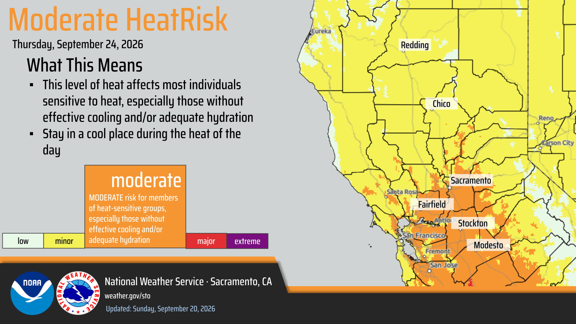
- Temperatures are still on track to trend warmer as we approach the middle of the week as onshore winds weaken, with areas of Moderate HeatRisk in the Valley on Thursday.
- Models continue to highlight the potential shift towards an unsettled weather pattern late this week into the weekend.
- Temperatures trend cooler Friday into the weekend.
- Onshore flow increases through the Delta/Valley, with increased gap flow winds through the Coast Range.
- Precipitation potential remains uncertain.
September 20, 2026 at 3:27 PM The ongoing law enforcement operration on Iowa Hill Rd in Placer County now includes a 20 by 10 spot on fire. All fire resources to stage at the Mineral Bar campground.
September 20, 2026 at 2:04 PM This little dog is called Pogo and was lost on Zion Street in Nevada City, contact 415-341-5266 if you’ve seen or have the pup.

September 20, 2026 at 2:02 PM The Newtown incident is in mop-up.
September 20, 2026 at 1:49 PM All aircraft has been released from the fire. Line is complete around the incident.
September 20, 2026 at 1:41 PM Newton IC reports the dozer is now lining the fire. Making engines available to respond to future incidents. Fire is holding at less than 1/2 acre.
September 20, 2026 at 1:34 PM Air Attack and one helicopter remain over the Newtown incident as a precautionary measure, firefighters are working to complete the line around the fire.
September 20, 2026 at 1:31 PM Newtown Air Attack is canceling the incoming helicopter. The fire is at 1/2 acre and not spreading.
September 20, 2026 at 1:25 PM Tankers have dropped in front of the structure and on the opposing flank. Units at scene are making good progress.
September 20, 2026 at 1:20 PM Air attack reporting 1/4 acres in the brush, slow rate of spread. One structure potentially threatened.
September 20, 2026 at 1:19 PM Fire now visible on the camera.

September 20, 2026 at 1:14 PM Units are in the area, attempting to locate.
September 20, 2026 at 1:14 PM Two reports now for the fire on Newtown Road in Nevada City.
September 20, 2026 at 1:12 PM Full wildland dispatch for a reported vegetation fire on Newtown Road, near Beckville Road.
September 20, 2026 at 8:05 AM Don’t miss the Famous Merching Presidents today and the Constitution Day Parade at 2:00 pm on Broad Street in Nevada City! If you can send us photos of the parade, that would be fabulous.
September 20, 2026 at 6:42 AM The NWS Sacramento forecast remains on track with minimal changes from yesterday. Here are the forecast notes:

- Dry and seasonable weather continue through the early part of this week
- Mountain thunderstorm and rain shower chances remain in the forecast, generally less than 10% on Monday afternoon and evening, best chances south of HWY-50
- Onshore flow returns to the area, with locally breezy conditions at times in the Delta and surrounding area
- Warm up remains on track for Wednesday and Thursday when onshore winds will weaken. Thursday looks to be the warmest day, with Moderate HeatRisk in the Delta, central/southern Sacramento Valley, and northern San Joaquin Valley.
- We are still tracking a potential pattern change late this week, however precipitation chances are falling, with the main impact being cooler/seasonable high temperatures returning by Friday. We will continue to track the pattern change and keep you updated!
September 19, 2026 at 7:12 PM Firefighters have thoroughly checked the area. so far nothing showing. Good.
September 19, 2026 at 6:59 PM Debris check in the area of Newtown Rd. Please people, remember we’re not out of the woods as far as fire season goes.
September 19, 2026 at 3:00 PM Back online, catching up.
September 18, 2026 at12:05 PM Not really a surprise, Grass Valley City Council voted unanimously to appoint Alex Gammelgard as the new city manager.
September 18, 2026 at 11:31 AM Sorry, have to take an unscheduled break in updates while being poked and prodded.
September 18, 2026 at 8:25 AM Units at scene on Siesta Dr report the pile is being extinguished. One engine to continue in.
September 18, 2026 at 8:19 AM Debris check on Siesta Dr off Hilltop Rd in Penn Valley, units dispatched. Reported as an illegal burn pile.
September 18, 2026 at 7:55 AM Blip in utility power at HQ, anyone out of power in or around Nevada City?
September 18, 2026 at 6:20 AM The NWS Sacramento forecast notes:
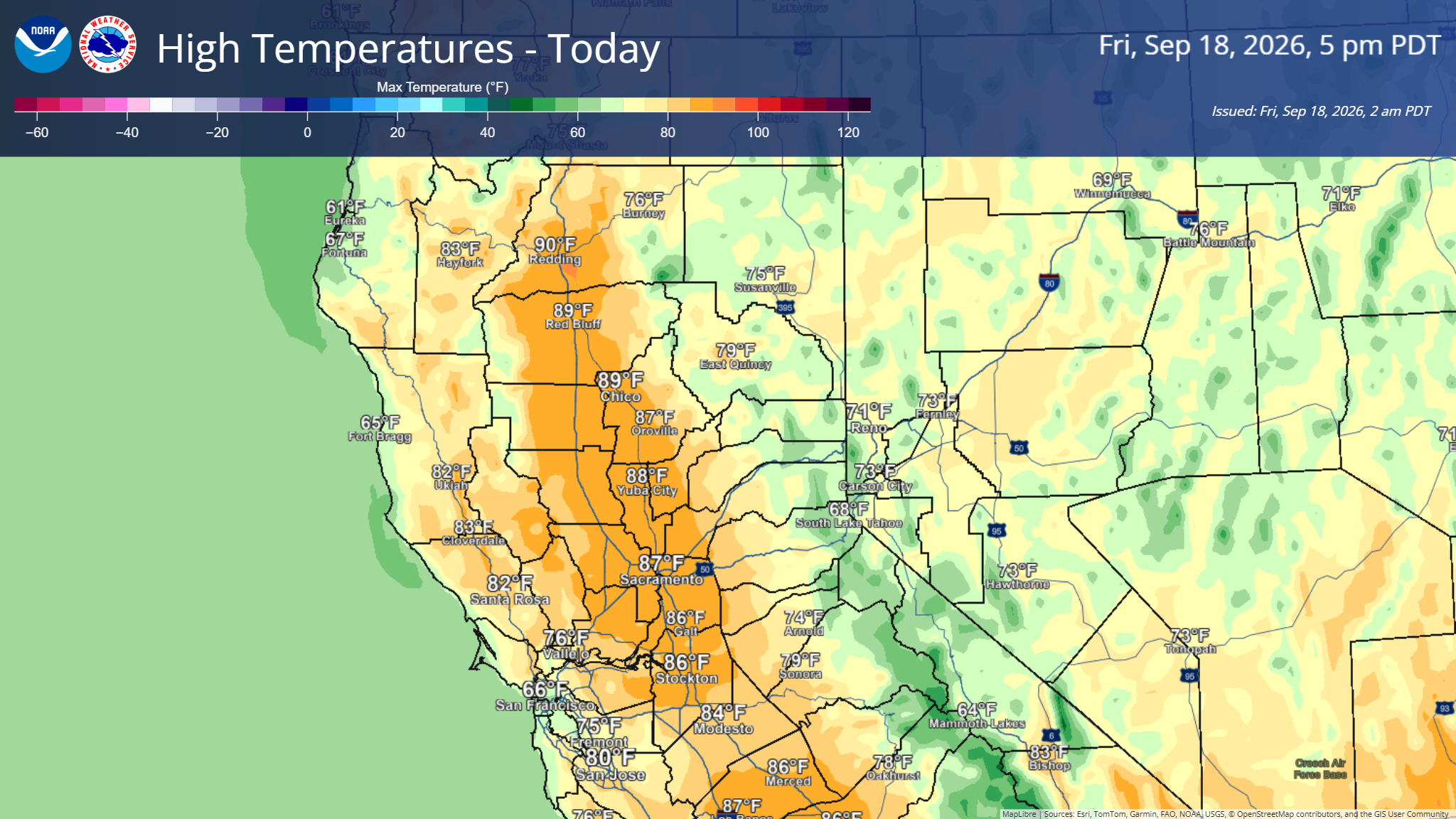
- Warming high temperatures today, with continued gradual warming as we move into the weekend and next week with mainly Minor HeatRisk
- Locally breezy north winds today across most of the area, with gusts around 10 to 20 mph
- Mostly dry conditions in the forecast for the weekend and next week
- Non-zero chance (5-10%) of an isolated thunderstorm in the mountains, mainly south of HWY-50, on Monday. Confidence is low on any storm development at this time
September 17, 2026 at 4:22 PM For your weekend plans, here’s a preview of the 2026 Draft Horse Classic with Andrew and Katie.

September 17, 2026 at 3:59 PM Units at scene on Torrey Pines Dr report a small leak from a battery tha tiped over. No fire, no gas leak and they can handle.
September 17, 2026 at 3:51 PM Report of a marine lithium-ion battery leaking fluid, possible gas hazard. Near Lakeshore North and Torrey Pines Dr in Lake of the Pines. Life/safety alert issued for the responders.
September 17, 2026 at 1:39 PM Very useful info from reader Deni: Highway 267 between Truckee and Kings Beach as seen from a Martis Valley rest area. Due to Highway 80 west closure at Floriston, northbound traffic between Truckee and Tahoe is backed up as far as the eye can see.

September 17, 2026 at 9:14 AM The Floriston Fire is 640 acres and 5% contained. Full details on the incident page.
September 17, 2026 at 6:02 AM Here are the forecast notes from the NWS Sacramento night shift:

- Low stratus clouds in the Valley this morning, with some reduced visibilities for the morning commute possible
- Slight chance (10-15%) of an isolated thunderstorm in northern Shasta County, Coast Range, and southern Cascades this afternoon and evening. Best chances look to remain north of our area.
- High temperatures will continue to be unseasonably cool today, then a warming trend will begin Friday and into the weekend with seasonable temperatures early next week
- Periods of breezy onshore winds expected today and through the weekend
September 16, 2026 at 7:27 PM The fire on Old Mill is fully contained at 0.09 acres.
September 16, 2026 at 6:54 PM Units a scene report 1/4 acre in brush and garbage. One vehicle is fully involved. No measurable rate of spread, they can handle with units at scene.
September 16, 2026 at 6:43 PM Units are trying to make access to the reported fire, now possibly in the Jackass Flats area.
September 16, 2026 at 6:35 PM Smoke check on Tyler Foote Crossing Road and Old Mill Road on the San Juan Ridge. Units dispatched for a single report of smoke seen.
September 16, 2026 at 1:16 PM Ahead of Saturday’s Farmers Market, how about some tips with local chef Mielle? Local Picks gets cooking.

September 16, 2026 at 11:20 AM Updates on the Floriston Fire will be posted on the incident page.
September 16, 2026 at 11:10 AM The Nevada County Sheriff’s Office has issued an EVACUATION WARNING for zone NCO-E379 on 09/16/2026 at 10:58 AM for a wildland fire in the area of Highway 80 at Floriston. Those who require additional time to evacuate, and those with pets and livestock should consider leaving now. Check https://protect.genasys.com/ for updates and available shelter locations
September 16, 2026 at 11:08 AM A spot fire towards the Nevada state line is also moving uphill.

September 16, 2026 at 10:53 AM Floriston IC is setting up staging at Hirschdale and I-80 for all resources coming up westbound I-80. The fire is estimated at 10 acres.

September 16, 2026 at 10:49 AM The Floriston Fire is moving uphill at a moderate rate of spread. Tahoe Hotshots have mobilized and are responding to the fire.
September 16, 2026 at 10:46 AM Floriston IC is ordering additional water tenders and engines to the incident. Floriston Air Attack is requesting one additional helicopter and one additional tanker.
September 16, 2026 at 10:34 AM Air Attack 230, Tankers 88 and 89 are arriving at the Floriston incident to assist the two helicopters and ground resources already on scene.
September 16, 2026 at 10:31 AM Additional resources dispatched to the Floriston Fire outside of Truckee. Smoke is impacting I-80.

September 16, 2026 at 7:33 AM Here is the latest NWS Sacramento forecast update:
Precipitation/Thunderstorms: A few showers were observed overnight in far northeastern Shasta County. There remains a slight chance of showers and thunderstorms this afternoon and evening over the Coastal Range, Shasta County, and the southern Cascades. A few thunderstorms remain possible Thursday afternoon as well.
Winds: Periods of breezy winds are expected through Monday.
Temperatures: Cooler weather continues today and Thursday, with below-normal temperatures.

Weekend Outlook: A return to seasonable warmth and drier weather is expected over the weekend.
September 16, 2026 at 7:04 AM Units at scene on Hwy 49 at Reader Ranch can handle with one additional engine. No injuries reported.
September 16, 2026 at 7:01 AM Units have located a solo vehicle, blocking the southbound lane. They’re assessing now.
September 16, 2026 at 6:59 AM Reported acciden on northbound Hwy 49 at Reader Ranch, units in the area are attempting to locate.
September 15, 2026 at 8:40 PM Units at scene on Santos Dumont report a small spot, mostly extinguished. One engine to continue in, all others can cancel.
September 15, 2026 at 8:32 PM Locals are working to extinguish the fire in Brownsville, reported to be the size of a car now.
September 15, 2026 at 8:29 PM Reported small spot on fire on Santos Dumont Way in Brownsville, units dispatched.
September 15, 2026 at 4:44 PM PG&E trouble crew beats the automatic estimate for restoration of the Peardale outage. Utility power has been restored per our readers.
September 15, 2026 at 4:06 PM PG&E has caught up to the current reality (see what I did there?) and added 2,117 customers to the outage reports. Estimated time of restoration is 6:45 pm.

September 15, 2026 at 3:41 PM Reader-reported power outage in Peardale. Must be Tuesday… PG&E is reporting 446 customers along Dog Bar Road out of power.

September 15, 2026 at 2:30 PM Units at scene report a 50 by 50 spot with locals working on it. Looks like forward progress has been stopped by them. Two engines, one water tender to continue in, all others can cancel.
September 15, 2026 at 2:27 PM Now a report of multiple horse stables threatened by the Wolf incident.
September 15, 2026 at 2:25 PM Reported as a 50 by 20 ft grass fire.
September 15, 2026 at 2:22 PM Reported vegetation fire on Wolf Road and Quarterhorse Dr. Full wildland dispatch on order.

September 15, 2026 at 12:16 PM Secretary for Environmental Protection Yana Garcia announced the passing of Sen. Byron Sher. In 1999, Senator Sher authored SB 496, designating 39 miles of the South Yuba as State Wild & Scenic.
September 15, 2026 at 12:01 PM Tanker 89 is training over the area, there is no wildfire in Western Nevada County – only one Rx burn.
September 15, 2026 at 10:59 AM A reminder, if you see smoke in the Nevada City area, that is the Rx burn in the Cement Hill area.

September 15, 2026 at 8:52 AM Non-injury accident on Penn Valley Dr at Dollar General store, the roadway is clear.
September 15, 2026 at 7:23 AM First Rain Land Stewardship Services will be conducting a Rx burn on Tuesday September 15th. This is an understory timber burn with the goal of achieving fuels reduction and improving forest health.
When: Tuesday September 15th, 8am-5pm
Where: 14071 Mt. Auburn Circle Nevada City, CA
Acres: 5.3
September 15, 2026 at 6:53 AM Here is the latest on the NWS Sacramento forecast:

- Seasonable temperatures continue today, followed by cooler conditions on Wednesday and Thursday
- Increased onshore flow is expected through the Delta and valleys tonight through Wednesday
- There is a slight chance (10%) of thunderstorms for the Coastal Range, Shasta County, and the southern Cascades on Wednesday and Thursday. This will lead to fire weather concerns regarding potential lightning ignitions
- Dry and warmer conditions are likely to return Friday through the weekend
September 14, 2026 at 8:51 PM Reported solo vehicle accident, rollover on Sun Forest Dr in Lake Wildwood. Units arriving at scene.
September 14, 2026 at 5:03 PM Non-injury accident on Countryside Ranch Rd and Garden Bar Road in south county. Solo vehicle vs telephone pole.
September 14, 2026 at 4:37 PM It’s Monday so of course there’s a power outage in Rough and Ready and portions of Penn Valley. 1,072 PG&E customers are affected by the outage that has an estimated time of restoration of 2:30 am. Let’s hope the trouble crews beat that deadline by a wide marging.

September 14, 2026 at 3:41 PM Where we were this morning: Dog Bar Bridge – wider, safer and officially open. During a ribbon cutting ceremony today, county officials recognized county staff and project partners Viking Construction, HDR Construction Group and Dokken Engineering for replacing the original single lane bridge, designed by the Forest Service in 1934, with a two-lane bridge that includes a pedestrian walkway.

September 14, 2026 at 12:30 PM Units at scene report a smoldering fire in a small fire pit only. Homeowner is fully extinguishing it now.
September 14, 2026 at 12:21 PM Debris check for a possible smoldering bonfire from last night on North Day Rd off Hwy 174 in the Chicago Park area. Units dispatched.
September 14, 2026 at 6:42 AM Here is the latest on the NWS Sacramento forecast.
- Red Flag Warning: Remains in effect until 5 PM PDT today due to gusty winds and low RH for portions of the Sacramento Valley and northern foothills
- North-northeast winds will continue through this morning and early afternoon with gusts around 20-30 mph. The strongest winds are expected along the I-5 corridor
- Seasonable temperatures will continue through Tuesday
- Wednesday–Thursday: An upper-level trough is projected to drop into NorCal, resulting in cooler temperatures, increased onshore winds, and a low chance (10%) of isolated mountain showers/thunderstorms
- Dry and warmer conditions are likely to return Friday through the weekend

September 13, 2026 at 2:01 PM There have been several reports of burn barrel usage and small burn piles. Bad move all around in every single instance.
September 13, 2026 at 9:10 AM Power outage affecting 609 PG&E customers in Sierra County.

September 13, 2026 at 8:40 AM Forward progress stopped on the Lake incident. One engine to continue in, all others can cancel.
September 13, 2026 at 8:39 AM Units at scene report a 15 by 15 spot in dense brush, burning at a slow rate of spread. Best access is off Sycamore Ct.
September 13, 2026 at 8:35 AM Reported fire is close to a house, residents are evacuating now. This will be the Lake incident on Torrey Pines Dr.

September 13, 2026 at 8:32 AM Reported possible vegetation fire on Lakeshore North and Torrey Pines Dr in Lake of the Pines. Units dispatched.
September 13, 2026 at 6:59 AM No significant changes to the NWS Sacramento overnight forecast.

- A Red Flag Warning remains in effect until 5 PM PDT Monday due to gusty winds and low RH for portions of the Sacramento Valley and northern foothills.
- Today: Winds gradually weaken and shift to the north-northeast, becoming breezy in the afternoon.
- Tonight – Monday: North-northeast winds strengthening in the Valley, with gusts around 20-30 mph. The strongest winds are expected along the I-5 corridor.
- Below-normal temperatures today, followed by near-normal temperatures and dry conditions for next week.
September 12, 2026 at 8:18 PM Units in the Bridgeport area have done a thorough search, nothing located.
September 12, 2026 at 8:09 PM Units in the Bridgeport area are attempting to locate the reported fire, so far nothing visible.
September 12, 2026 at 7:54 PM Debris check, in the Bridgeport area towards North San Juan. Several people around a fire, unknown reason. Units dispatched.
September 12, 2026 at 2:31 PM Report of an overturned skid steer that is now on fire at the Riverview Sports Park in Truckee. Units dispatched.
September 12, 2026 at 1:30 PM PG&E began de-energizing targeted areas of Nevada and Placer counties on Saturday, September 12, impacting approximately 1,300 customers.

September 12, 2026 at 10:10 AM The Red Flag Warning duration has been extended to 5:00 pm Monday.
September 12, 2026 at 9:13 AM There has been no change in scope for the potential Public Safety Power Shutoff (PSPS) in our area. As of right now, no shutoff has occured along I-80.
September 12, 2026 at 6:20 AM There are no significant changes in the NWS Sacramento overnight forecast.
A Red Flag Warning is in effect from 11 AM this morning to 11 AM PDT Monday due to gusty winds and low RH for portions of the Sacramento Valley and northern foothills.

- South to southwest winds will strengthen this afternoon, with gusts from 20 to 35 mph expected.
- Winds will become breezy and gradually shift to the north this evening into Sunday.
- Breezy north to northeast winds up to 20-30 mph will develop across the Valley Sunday evening through Monday, with the strongest gusts along and west of the I-5 corridor.
- Temperatures will cool down this weekend, dropping below normal on Sunday.
- Dry weather continues through next week, with temperatures trending more seasonal early in the week.
September 11, 2026 at 7:50 PM Car on northnound Hwy 49 at Tyler Foote Rd partially blocking a lane.
September 11, 2026 at 7:44 PM Accident on northbound Hwy 49 at the Empire St overcrossing. Units dispatched.
September 11, 2026 at 1:50 PM Today is a day of remembrance and mourning. For the people killed in terrorist attacks of September 11, 2001 and all those who lost their lives in the aftermath.
Locally, it is also the anniversary of the 49er Fire that started on this day in 1988. This story was originally published on Sept. 11, 2008.
September 11, 2026 at 12:38 PM A Red Flag Warning is in effect for portions of the Sacramento Valley and adjacent foothills from 11 AM Saturday until 11 AM Monday, September 12-14.
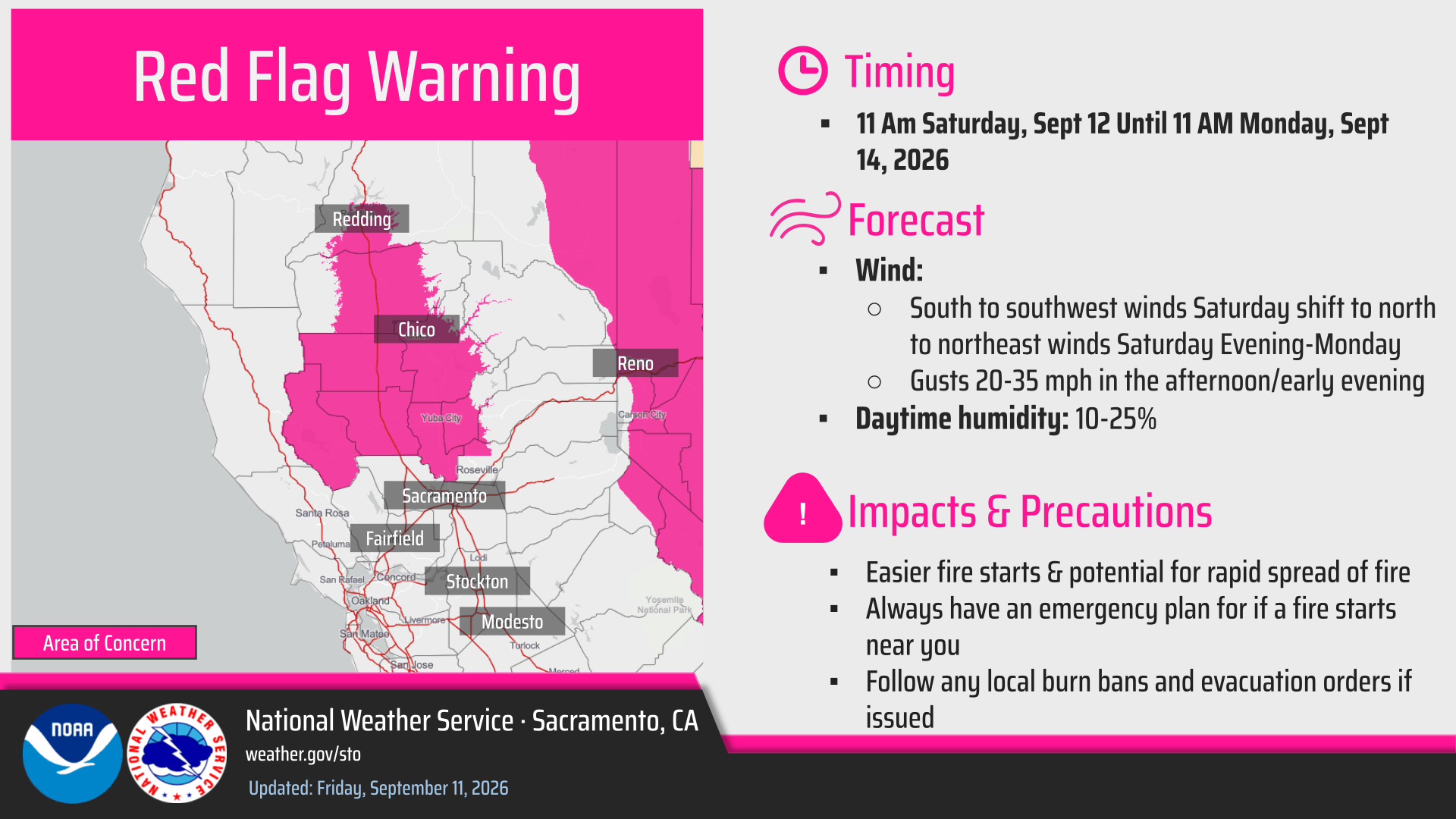
- Two periods of breezy to gusty winds are expected, in conjunction with low daytime humidities, limited overnight recovery, and available fuels.
- Timing of Winds:
- Saturday morning/afternoon: south to southwest winds gusting 20-35 mph
- Sunday morning/early afternoon: Winds begin to shift out of the north, becoming breezy by the evening.
- Sunday evening into Monday morning: Increasing north to northeast winds through the Valley gusting 20-30 mph, with the strongest gusts along and west of the I-5 corridor. Lowest daytime humidities expected on Monday.
Dry weather continues through next week, with temperatures trending more seasonal to slightly below-normal.
September 11, 2026 at 10:04 AM The Fire Weather Watch has been upgraded to a Red Flag Warning from 11 am Saturday to 11 am Monday due to gusty winds and low relative humidity.
September 11, 2026 at 7:51 AM Smoke and haze seen and smelled in the area is from the Lucas Fire near Upper Lake in Lake County.
September 11, 2026 at 7:18 AM The two pups near Mill St have been reunited with their human. All is well.
September 11, 2026 at 7:10 AM Here is the latest on the NWS Sacramento forecast.
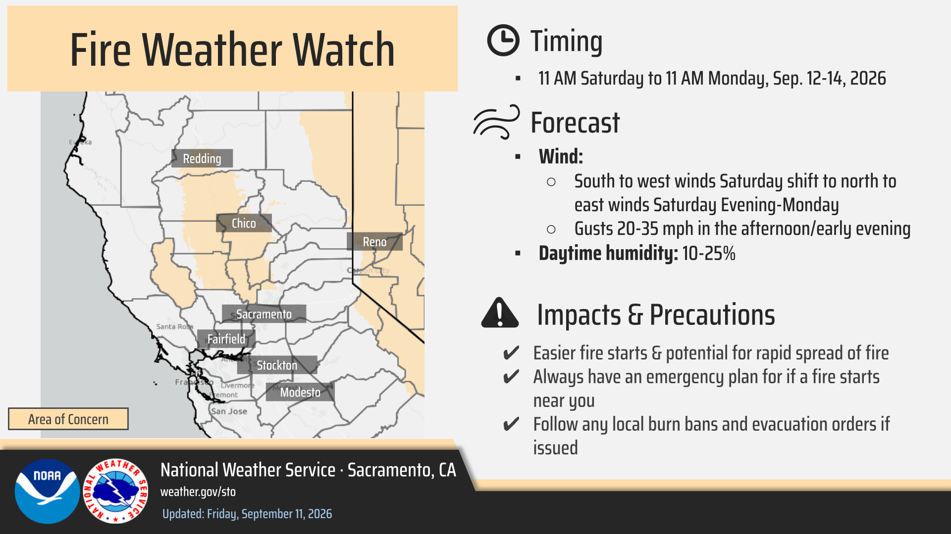
- Cooling temperatures today and into the weekend, with a return to more seasonal averages across the area. Highs today will be in the 90s, with the 80s over the weekend.
- Fire Weather Watch is in effect 10AM Saturday through 10AM Monday.
- This is due to the Low Relative Humidity combined with breezy northerly winds.
- Breeziest conditions will be on Saturday afternoon and evening, with chances to see up to 40mph wind gusts in parts of the Valley along and west of I-5.
- Dry conditions continue into next week, with onshore flow.
September 11, 2026 at 6:41 AM Two loose dogs in Grass Valley near Mill St. making new friends. Are your pups safe?

September 10, 2026 at 5:04 PM Fire Weather Watch and Potential PSPS this weekend. Periods of gusty winds are expected alongside low daytime humidity and limited to poor overnight recoveries. South to west winds on Saturday shift toward north to east winds Saturday night – Monday.
September 10, 2026 at 1:48 PM Two small dogs on the side of eastbound Hwy 20 at Penn Valley Drive. Watch out for the pups!
September 10, 2026 at 11:31 AM The National Weather Service in Sacramento CA has issued a Fire Weather Watch from Saturday morning through Monday morning due to gusty winds and low relative humidity for portions of Northern California.
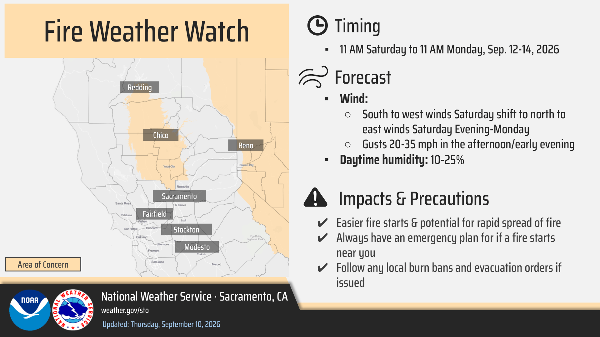
September 10, 2026 at 11:22 AM Counties or portions of counties under Elevated Risk. PG&E is monitoring weather conditions for a possible Public Safety Power Shutoff to help prevent wildfire:
El Dorado
Lassen
Nevada
Placer
Plumas
Shasta
Sierra
Tehama
September 10, 2026 at 11:07 AM The outage along McCourtney has been reduced to 757 customers.
September 10, 2026 at 10:55 AM Possible PSPS (Public Safety Power Shutoff) coming to the area on September 12 and 13. We’re working on details.
September 10, 2026 at 10:37 AM A large cardbox box is sprawling in the slow lane on Hwy 49 just past the Idaho-Maryland offramp. Somebody ignored the “Cover your load” sign again.
September 10, 2026 at 10:18 AM Reader-reported power outage on McCourtney Rd, looks like the outage is affecting at least 1,410 PG&E customers.

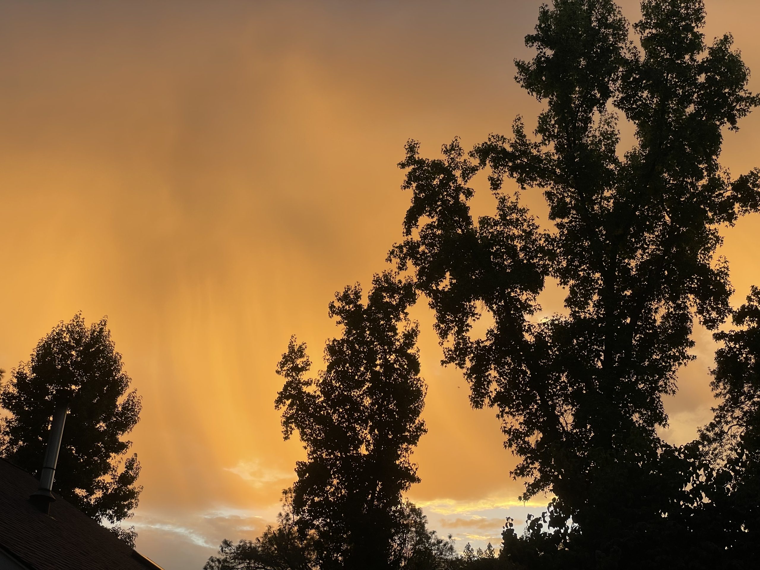
September 10, 2026 at 7:06 AM From a reader, this morning’s view from Dog Bar Rd.
September 10, 2026 at 7:02 AM Here is the latest update to the NWS Sacramento forecast:
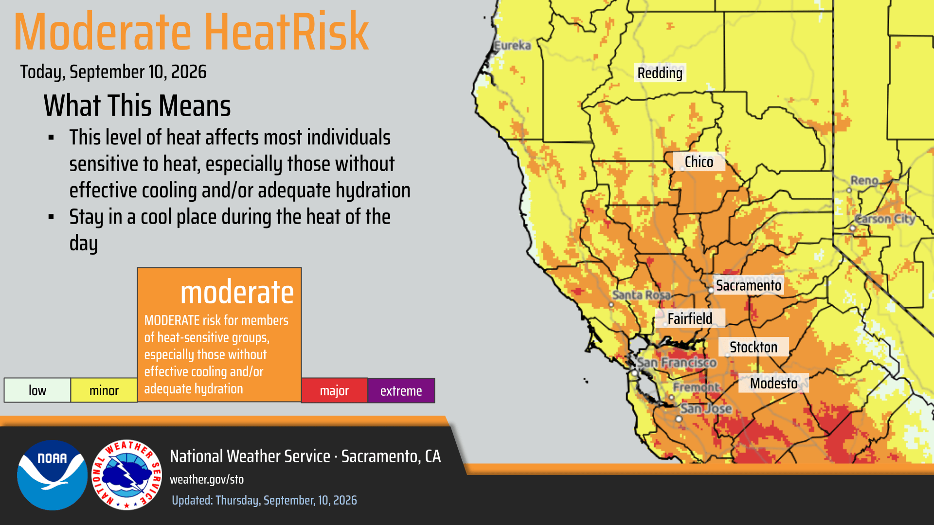
- Heat Advisory is in effect through 10PM this evening, with Moderate HeatRisk expected. Isolated Major HeatRisk in a few areas around the Sacramento Metro.
- Triple digit high temperatures today, with a cool down as we head into the weekend.
- Elevated Fire Weather Concerns today due to low humidity and breezy winds at times for the Valley, Delta, and Foothills
- Further Elevated Fire Weather Concerns Saturday through Sunday as we will see stronger northerly winds combined with low RH values.
- Slight chance for a shower or isolated storm in the Sierra (south of I-80) this afternoon and evening.

September 10, 2026 at 6:58 AM Report of smoke see by a single passerby off Hwy 20 on Idlewild Dr near Deadmans Flat. units dispatched.
September 9, 2026 at 7:04 PM No fire or smoke located.
September 9, 2026 at 6:55 PM Report of smoke coming from the left side of the roadway on eastbound Hwy 20 at the South Ponderosa overcrossing. Units dispatched.
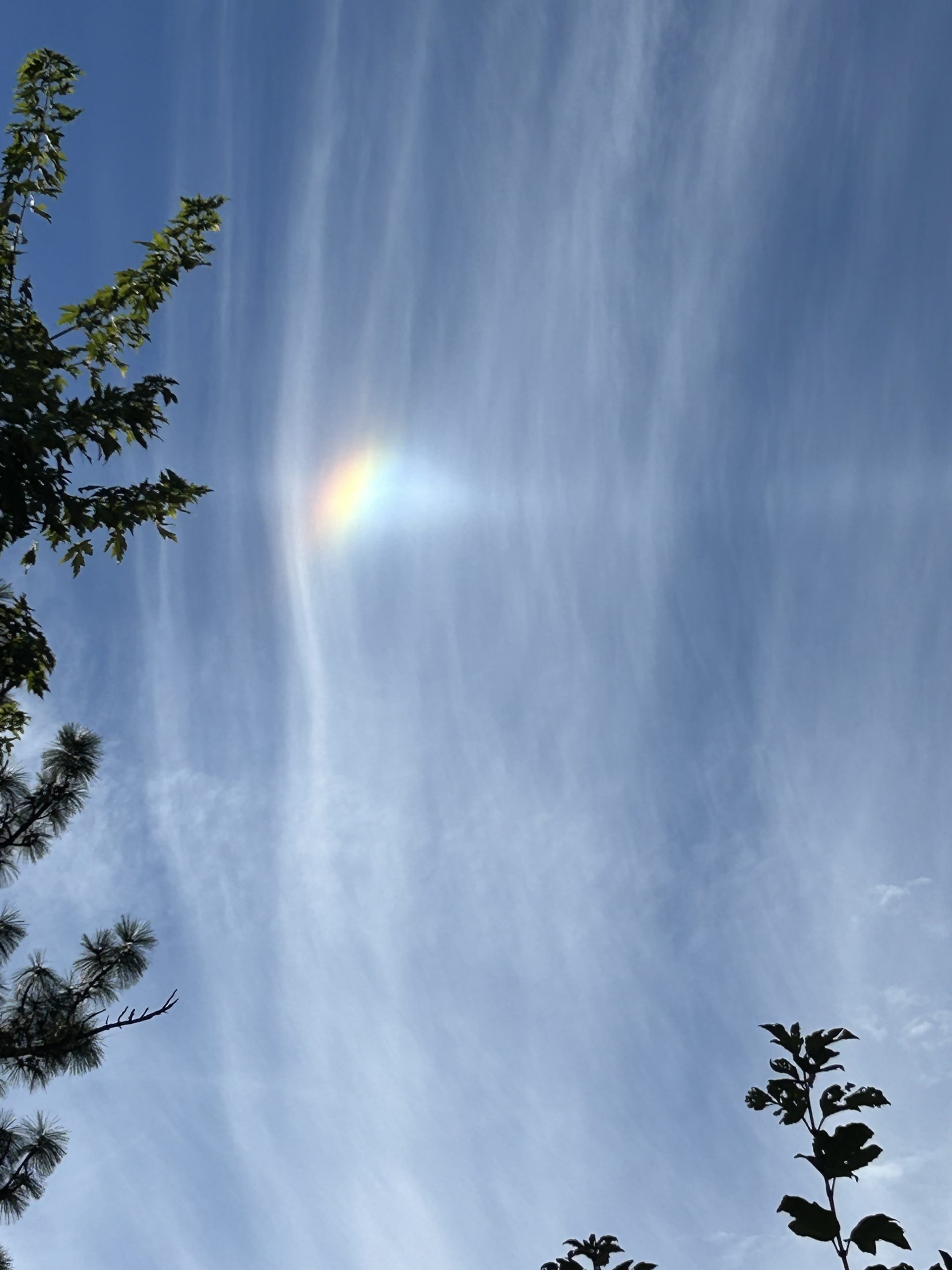
September 9, 2026 at 6:34 PM Reader Bob watched virga struggle and not quite reach the ground, thus living up to its name. Thanks for sharing the photo.
September 9, 2026 at 5:46 PM First unit at scene on Lake Forest Dr reports large construction trailer with very light smoke showing from smoldering cardboard. They can handle with resources at scene. Canceling all incoming units.
September 9, 2026 at 5:39 PM Reported trailer fire near Lake Wildwood Dr, units dispatched. Smoldering debris inside the trailer only, no extension to wildland.
September 9, 2026 at 5:12 PM The trouble crew beat the estimated time of restoration, all 129 customers have utility power back on.
September 9, 2026 at 3:58 PM Power outage affecting 129 PG&E customers in the Tiger Lily Ln area. Trouble crew is on site. Estimated time of restoration is 7:30 pm.

September 9, 2026 at 3:26 PM Power has been restored to the 90 customers in Grass Valley.
September 9, 2026 at 3:04 PM Follow-up to yesterday’s award story. We got questions as to why only four Supervisors (Swarthout, Hoek, Hall and Bullock) were depicted in our photos. Supervisor Robb Tucker was absent with no explanation. Maybe this photo from the local GOP social media channel explains why he wasn’t there to recognize staff.

September 9, 2026 at 1:49 PM Tree into power lines leaves 90 PG&E customers still out of power in the Squirrel Creek and South Ponderosa area in Grass Valley until 6:00 pm, according to the utility’s estimate. Everyone else has been restored.
September 9, 2026 at 11:00 AM Happy Admission Day, California. 176 years ago, California became the 31st state in the Union. Your history factoid for the day.
September 9, 2026 at 8:50 AM Reported accident on Day Rd off Hwy 174 in the Peardale area. Units dispatched.
September 9, 2026 at 8:40 AM Accident on Prospector Rd off Rough and Ready Hwy.
September 9, 2026 at 6:54 AM Here is the latest NWS Sacramento update:
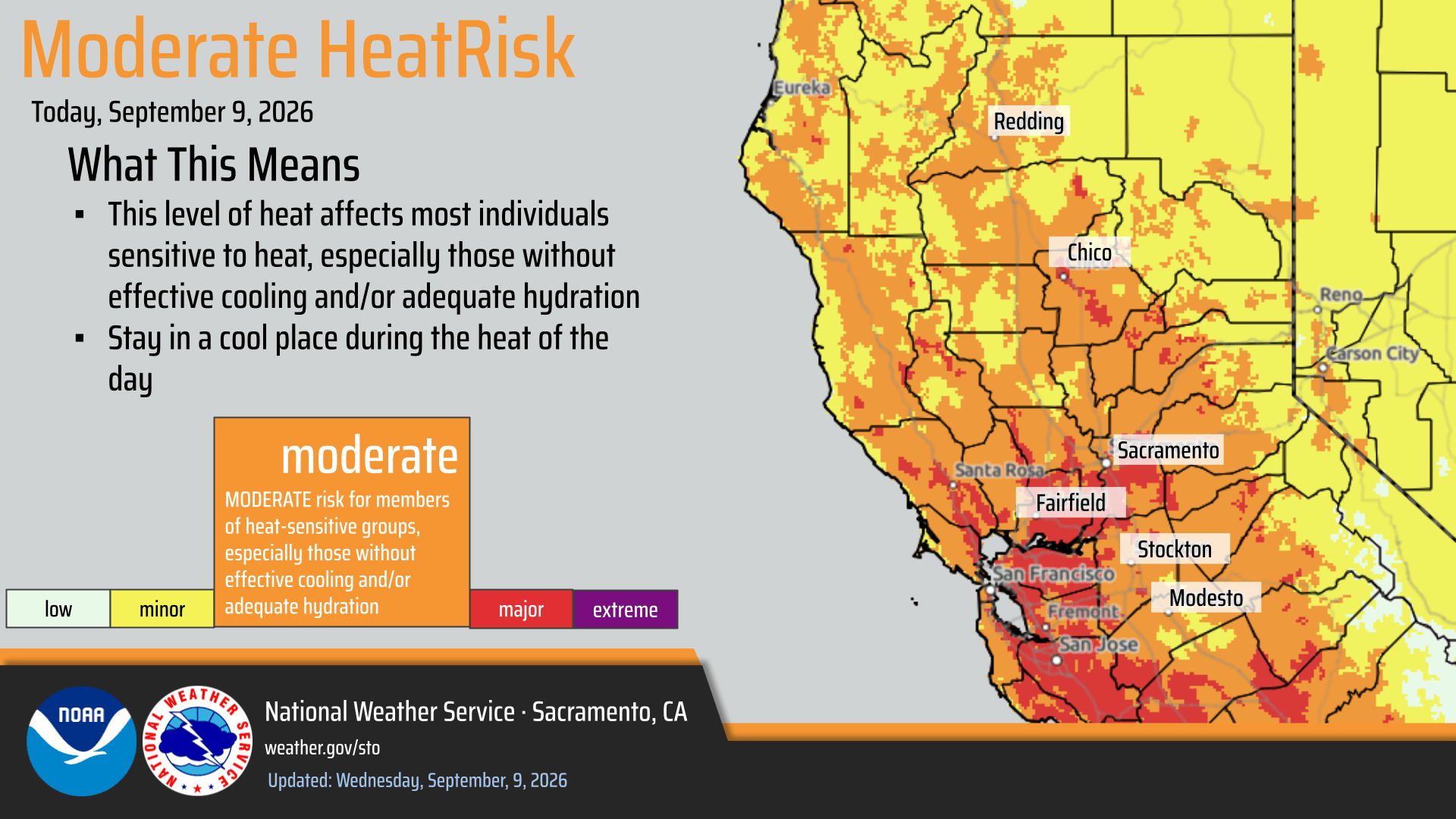
- Moderate HeatRisk today and Thursday for the Valley, Delta, and Foothills, with areas seeing triple digit temperatures.
- Elevated Fire Weather Conditions through Thursday due to low relative humidity, poor overnight recoveries, and breezy winds at times for the Valley, Delta and Foothills.
- Slight chance for an isolated shower within the Sierra south of Highway 50 Thursday afternoon and evening.
- Onshore flow returns this weekend cooling down temperatures across the area.
- Potential for Gusty Northerly Winds over the weekend and into next week.
September 8, 2026 at 10:59 PM Here’s a story I look forward to publishing every year, recognizing those that do the work. The Nevada County 2026 Employee Awards highlight some of the county staff that work for all the residents of Nevada County.
September 8, 2026 at 8:44 PM Unit at scene on Brock reports a large burn pile. One more engine to continue in, all others except prevention officer are canceled.
September 8, 2026 at 8:42 PM Vegetation fire reported by a single caller on Brock Rd in Nevada City. Caller reports 10-ft flames seen, numerous units dispatched.
September 8, 2026 at 7:24 PM Firefighters have knockdown on the fire.
September 8, 2026 at 7:16 PM Andressen IC reports approximately one acre of grass, burning at a slow rate of spread in light flashy fuels.
September 8, 2026 at 7:11 PM Units at scene on Andressen report this was a trailer fire extending to the structure and the wildland.
September 8, 2026 at 7:01 PM Residents on Andressen advise they have evacuated the house. Incoming units request two additional water tenders and a breathing support module.
September 8, 2026 at 6:57 PM Full wildland dispatch, no aircraft at this time, for a barn and house on fire burning into the vegetation on Andressen Rd in the Sheridan area of Placer County.

September 8, 2026 at 6:54 PM The German Shepherd has been reunited with her human. All is well.
September 8, 2026 at 5:35 PM This pup was found on New Rome Rd off Lake Vera/Purdon. She is very friendly and most definitely misses her human, Contact 443-844-6348 is she’s your pup.


September 8, 2026 at 4:46 PM Accident on Hwy 20 at Sloping Oaks Rd, no injuries and the roadway is clear.
September 8, 2026 at 4:45 PM Accident on Hwy 20 at Pleasant Valley Road, two cars involved. The roadway s clear and emergency services have been dispatched.
September 8, 2026 at 10:51 AM Doodle Dexter’s mom came and picked him up yesterday, he is home safe. All is well.
September 8, 2026 at 8:54 AM Longer delays than usual reported due to the ongoing construction work on Hwy 49. Pack patience along with snacks.
September 8, 2026 at 6:34 AM Here is the latest NWS Sacramento update to the forecast.

- Heat Advisory is in effect from 10AM Wednesday through 10PM Thursday for portions of the Sacramento Valley, Delta, and adjacent foothills.
- Moderate HeatRisk both Wednesday and Thursday, with the warmest temperatures on Thursday.
- Elevated Fire Weather Conditions Today through Thursday from dry and hot conditions along with breezy northerly winds and poor overnight recoveries.
- The main area of concern is the Valley, Delta, and adjacent foothills.
- Precipitation chances have diminished for both Wednesday and Thursday, with only a less than 5 percent chance at this time.
- Conditions begin to cool off by the weekend as onshore flow returns to the region.

September 7, 2026 at 7:19 PM Reader Liz went to Empire Mine State Park on this beautiful day. Thanks for sharing the sights.


September 7, 2026 at 5:19 PM The reported overturned trailer is from a previous incident, no new accident.
September 7, 2026 at 5:13 PM Accident on northbound Hwy 49 right before the Sacramento St off ramp. Units dispatched. Reported as an overturned trailer off the embankment.
September 7, 2026 at 3:12 PM This small-ish “Doodle” was found on Pittsburgh Mine Road in the Banner Mountain vicinity this morning. He is very friendly but was tired and hungry and full of burrs. He has a green and red collar – no name. Contact 760-802-7480 if this is your dog.

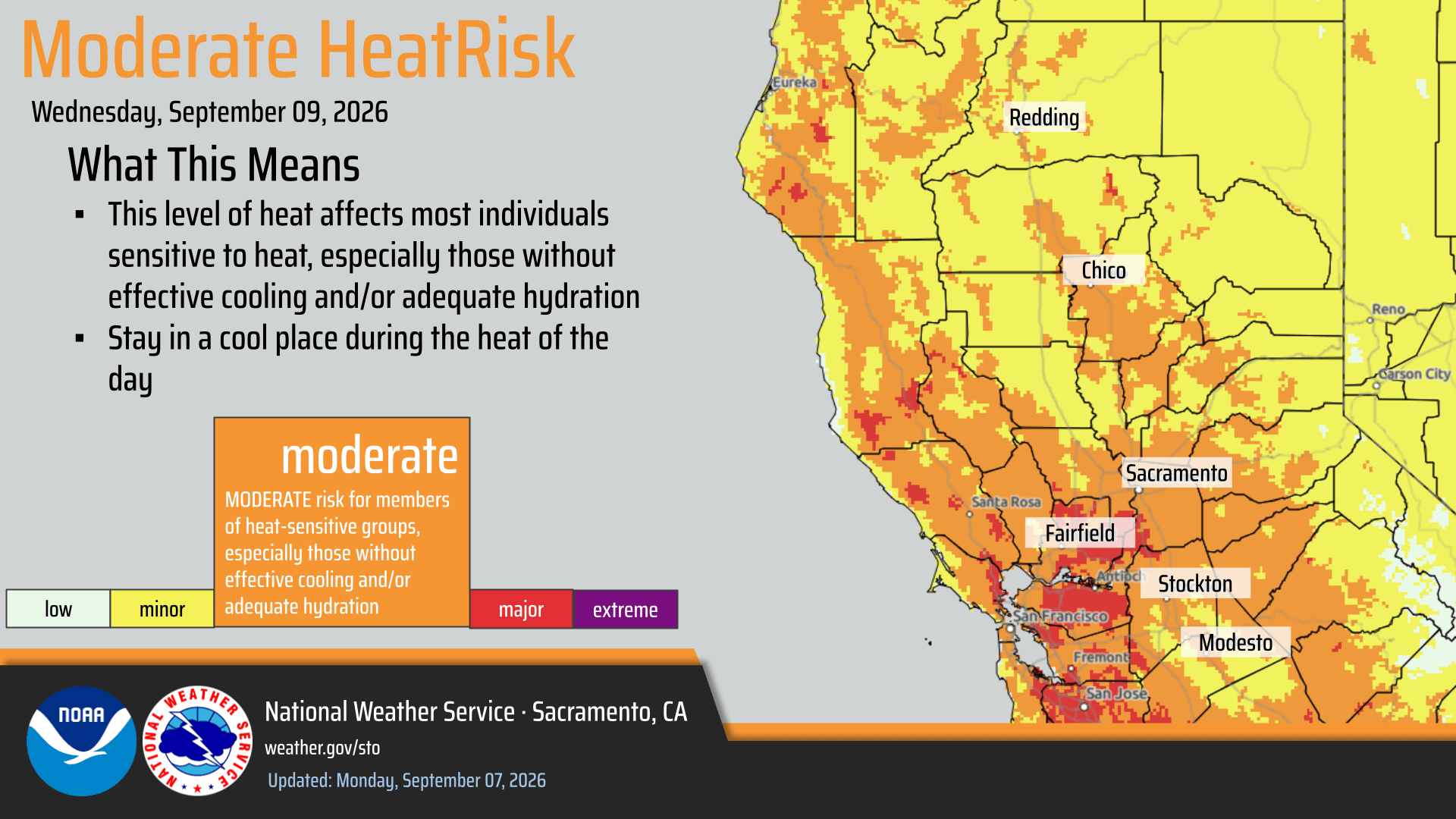
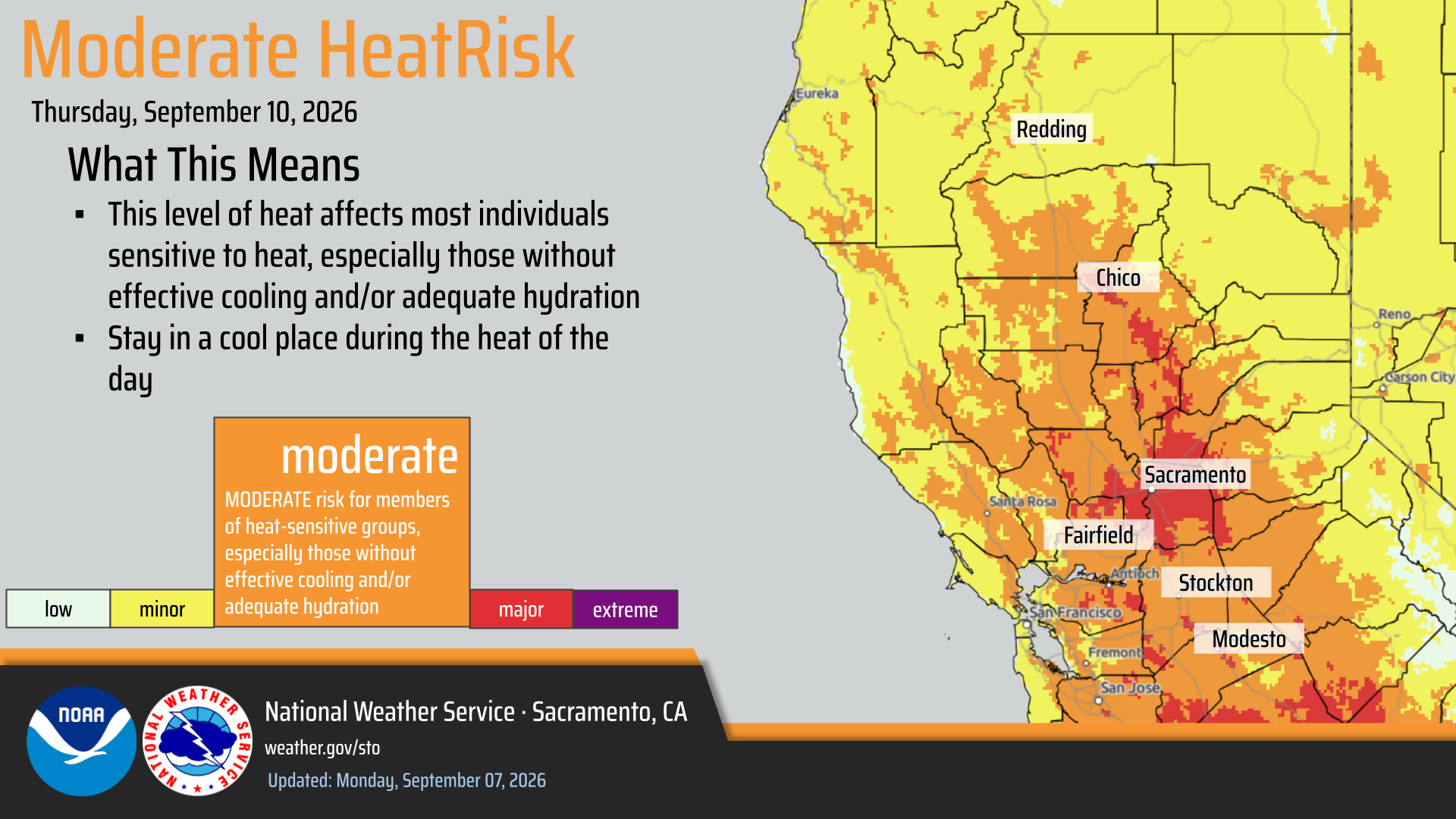
September 7, 2026 at 1:50 PM A Heat Advisory has been issued for portions of the Sacramento Valley, Delta, and adjacent foothills from 10 AM Wed through 10 PM Thu (Sep 9-10)

- High temperatures of 97-102°F, with overnight lows around 65-75°F
- Hottest day expected on Thursday with areas of Major HeatRisk over the Sacramento area
September 7, 2026 at 1:48 PM Air Attack is leaving the Vernon incident, everything’s looking good.
September 7, 2026 at 1:43 PM Vernon Air Attack has released both tankers back to Grass Valley and will leave the incidnt shortly.
September 7, 2026 at 1:33 PM Vernon IC reports reports forward progress has been stopped. Prevention, one water tender and a hand crew to continue in, all others can cancel.
September 7, 2026 at 1:32 PM Vernon Air Attack is releasing all helicopters back to their bases.
September 7, 2026 at 1:29 PM Air Attack is releasing the incoming helicopter. Ground resources are making good progress, hoselay is almost complete.

September 7, 2026 at 1:27 PM Tankers have dropped on the Vernon incident. [Correction: Tankers did not drop]

September 7, 2026 at 1:16 PM Vegetation fire on Mt. Vernon Rd in North Auburn, Air Attack and tankers arriving at scene. Approximately 1/2 acre, burning at a slow rate of spread.
September 7, 2026 at 10:58 AM Reported accident, non-injury, dirt bikes vs car on La Barr Meadows near Hillsdale Ct, units dispatched.
September 7, 2026 at 7:21 AM Here are your NWS Sacramento overnight forecast updates:
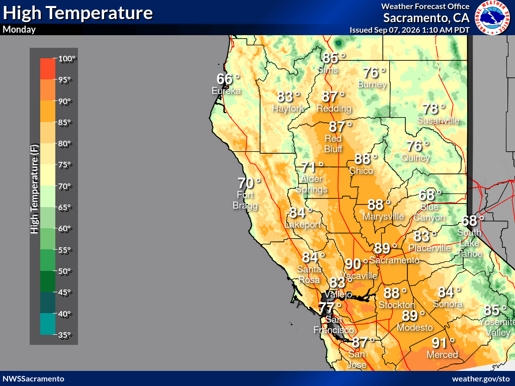
- Dry weather with locally breezy north winds today with gusts up to 20-25 MPH: strongest winds along the I-5 corridor
- Mid-week precipitation chances have continued to trend lower again, with no accumulating preciptation at this time
- Temperatures have trended warmer with above-normal highs still expected by Wednesday
- Areas of Moderate HeatRisk Wednesday and Thursday with portions of Major HeatRisk over the Sacramento area Thursday
- Cooldown in the forecast as we move into the weekend
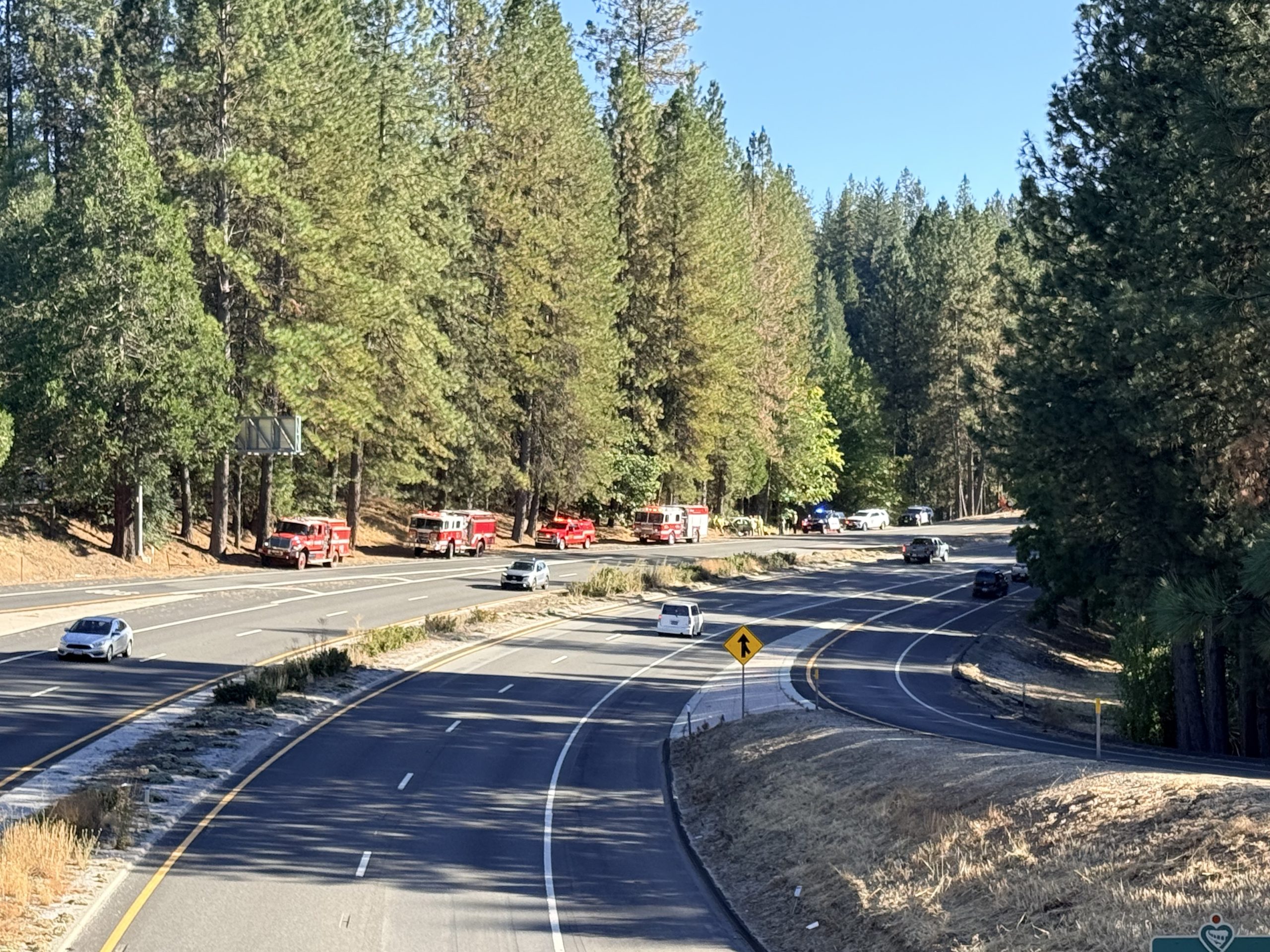
September 6, 2026 at 5:18 PM SUV vs tree on northbound Hwy 49 at the Sacramento St off ramp. Units are at scene.
September 6, 2026 at 12:07 PM Report of a power pole on fire, units dispatched.
September 6, 2026 at 10:45 AM Tanker 88 is off Grass Valley to a vegetation fire in the Concow area in Butte County.
September 6, 2026 at 6:58 AM Here are the NWS Sacramento overnight forecast updates:

- Similar afternoon highs today in the 70s and 80s ahead our warm up this week with temperatures reaching above normal temperatures by Tuesday-Wednesday of this week
- Light showers and isolated thunder chances this afternoon and evening for northern Shasta County but best chances are north and northeast of our forecast area.
- Increasing confidence in dry weather early this week with breezy north winds on Monday (Up to 20-25 MPH) along the I-5 corridor with midweek precipitation chances decreased to just a slight chance (5-15%) south of Hwy. 50 on Thursday
September 5, 2026 at 3:23 PM Smoke check in the area of You Bet and Hound Dog, light smoke visible on the camera. Not smart or firewise in the least. Units dispatched.

September 5, 2026 at 3:00 PM Possible burn pile on Shannon Way in Nevada City, units dispatched.
September 5, 2026 at 12:10 PM Accident on Dog Bar at Alta Sierra Dr. Units at scene.
September 5, 2026 at 11:41 AM Report of a car into a tree on Hwy 49 at West Empire, units dispatched. Tree may be blocking he roadway.
September 5, 2026 at 10:19 AM Accident on La Barr Meadows at Dog Bar Rd, reported as a vehicle vs motorcycle accident. Units dispatched.
September 5, 2026 at 10:10 AM Smoke check, small column of white smoke in the arra of Jouberts Rd off Hwy 49 above Camptonville in Sierra County. Units dispatched.
September 5, 2026 at 9:51 AM The traffic light on Brunswick Rd at Loma Rica Dr is defective. The left turn lane light is stuck on red.
September 5, 2026 at 7:54 AM Burnpile on Sweetland Road, engine at scene. Pile is being extinguished.
September 5, 2026 at 7:21 AM Here are the overnight NWS Sacramento forecast updates:
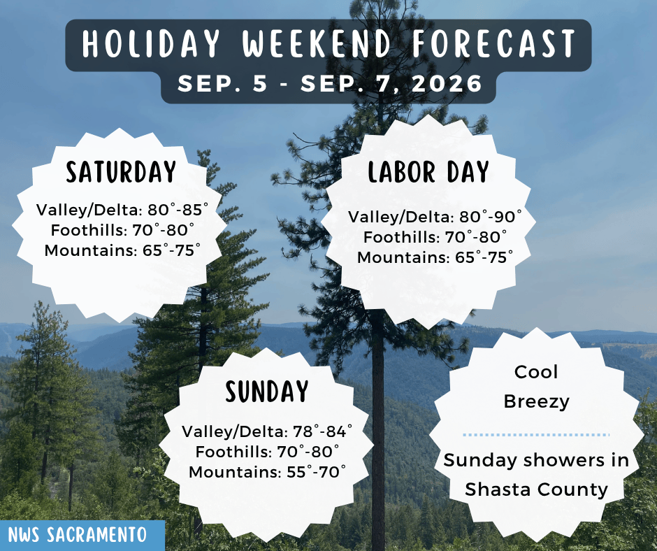
- Below normal temperatures continue today but warmer than Friday
- High temperatures in the 70s to 80s today, warmest over the northern San Joaquin Valley
- Near freezing early morning temperatures persist in the mountains above 7000′
- Fairly dry weather expected today with chances for showers and thunderstorms across northern Shasta County and nearby high terrain on Sunday but best chances north and northeast of Shasta County.
- Breezy Valley north winds with gusts up to 20-25 MPH on Monday, strongest along the I-5 corridor
- Unsettled weather returns Wednesday-Thursday of next week with Sierra showers and isolated thunderstorms chances around 5-20%

September 4, 2026 at 7:06 PM One lane of Lake Vera Purdon is blocked near the intersection with North Bloomfield. Units ae at scene.
September 4, 2026 at 7:05 PM Aircraft in the Lincoln area is in a field, not on the highway.
September 4, 2026 at 7:00 PM Report of a small aircraft down on Hwy 65 in the Lincoln area, units dispatched.
September 4, 2026 at 6:02 PM Homeowner has been educated about current burn restrictions, fire has been extinguished, fine issued.
September 4, 2026 at 5:51 PM Firefighters have located a burn barrel with trash being burned.
September 4, 2026 at 5:44 PM Possible burn pile on Cruzon Grade near Indigo Way. Units dispatched. Just because we had an inch of rain doesn’t mean you can light your burn pile.
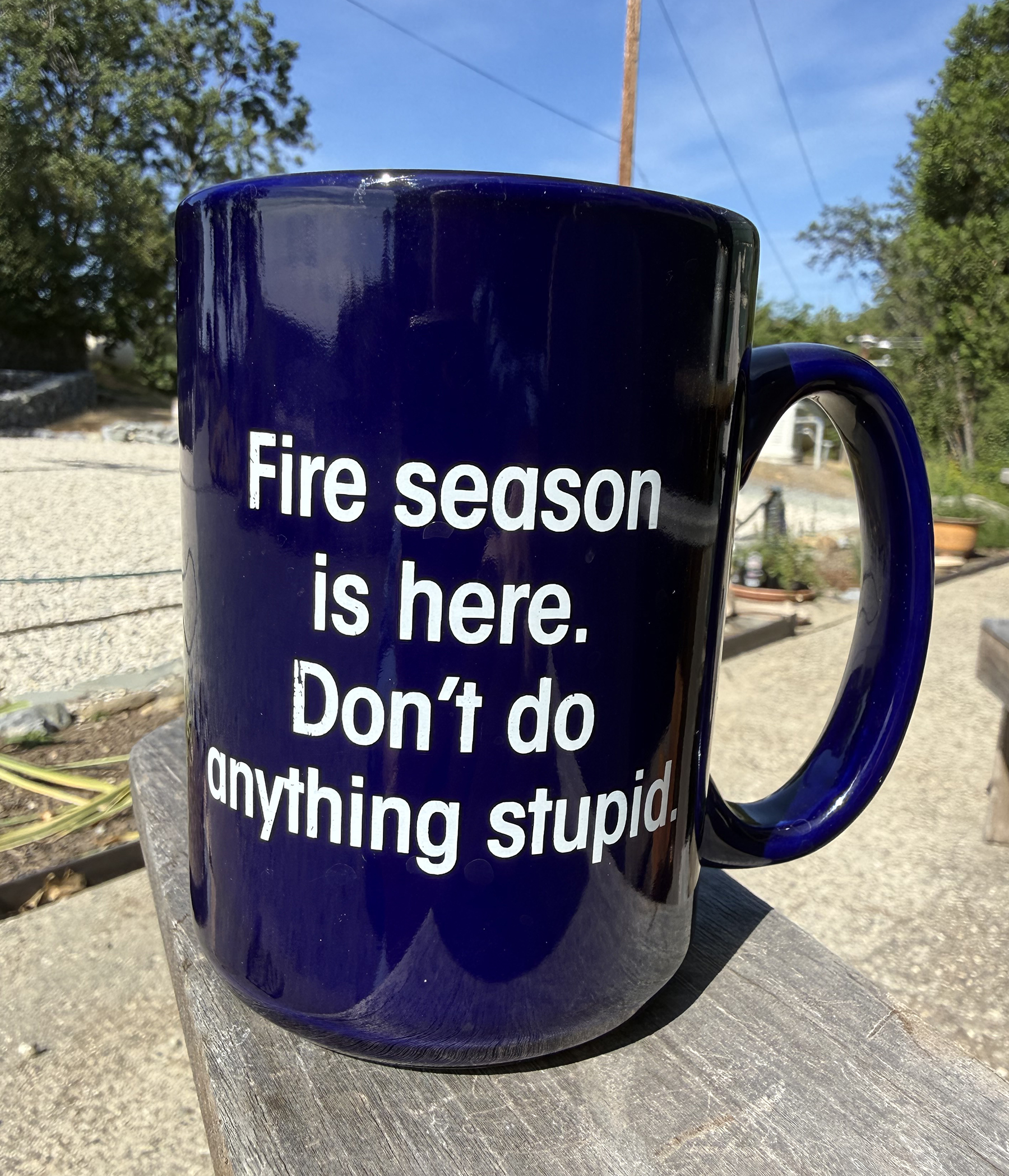
September 4, 2026 at 4:41 PM Firefighters have extinguished the smoldering spot along Hwy 49, all units availabe.
September 4, 2026 at 4:13 PM Debris check near Flume Street on Hwy 49 on the San Juan Ridge, possible cooking fire in the brush.
September 4, 2026 at 12:28 PM The turn lane on Rodeo Flat at Combie Rd is blocked by a stalled sedan.
September 4, 2026 at 8:38 AM Utility power has been restored at HQ.
September 4, 2026 at 8:33 AM PG&E informs us that 3,544 customers are currently out of power in Nevada City and the area north of town.
September 4, 2026 at 8:21 AM Power outage at YubaNet HQ, generator’s humming.
September 4, 2026 at 8:03 AM Reported electrical hazard on Red Dog Rd, possible power or comm lines down. Units dispatched.
September 4, 2026 at 7:42 AM Rough and Ready Hwy is fully open again.
September 4, 2026 at 6:51 AM Units at scene report this is a head-on collision with minor injuries. One medic to continue in, all others can cancel.
September 4, 2026 at 6:50 AM Two-car accident on Rough and Ready Hwy in front of the fire station, one lane is blocked. Units dispatched.
September 4, 2026 at 6:21 AM Here are the overnight NWS Sacramento forecast updates:
- Below normal temperatures and breezy winds continue today and into the weekend
- High temperatures in the 60s to 70s again today warm slightly toward the 70s to lower 80s over the weekend
- Near freezing early morning temperatures persist in the mountains above 7000′
- While the upper level pattern remains active over the next 7 days, mostly dry weather is anticipated heading into early next week with a potential return to unsettled weather mid to late next week
- Mountain showers linger through the morning with drier weather then on track into Saturday
- Showers and isolated thunderstorms remain possible on Sunday as a quick disturbance moves through, but best potential (10-15% chance) is expected across the Shasta County mountains at this time alongside generally light accumulations
- Dry weather prevails elsewhere today into early next week
- Confidence in tropical remnant moisture details remains low at this time although there is growing ensemble consensus for a northward moisture push and increasing precipitation potential for NorCal around the middle of next week; high uncertainty persists though
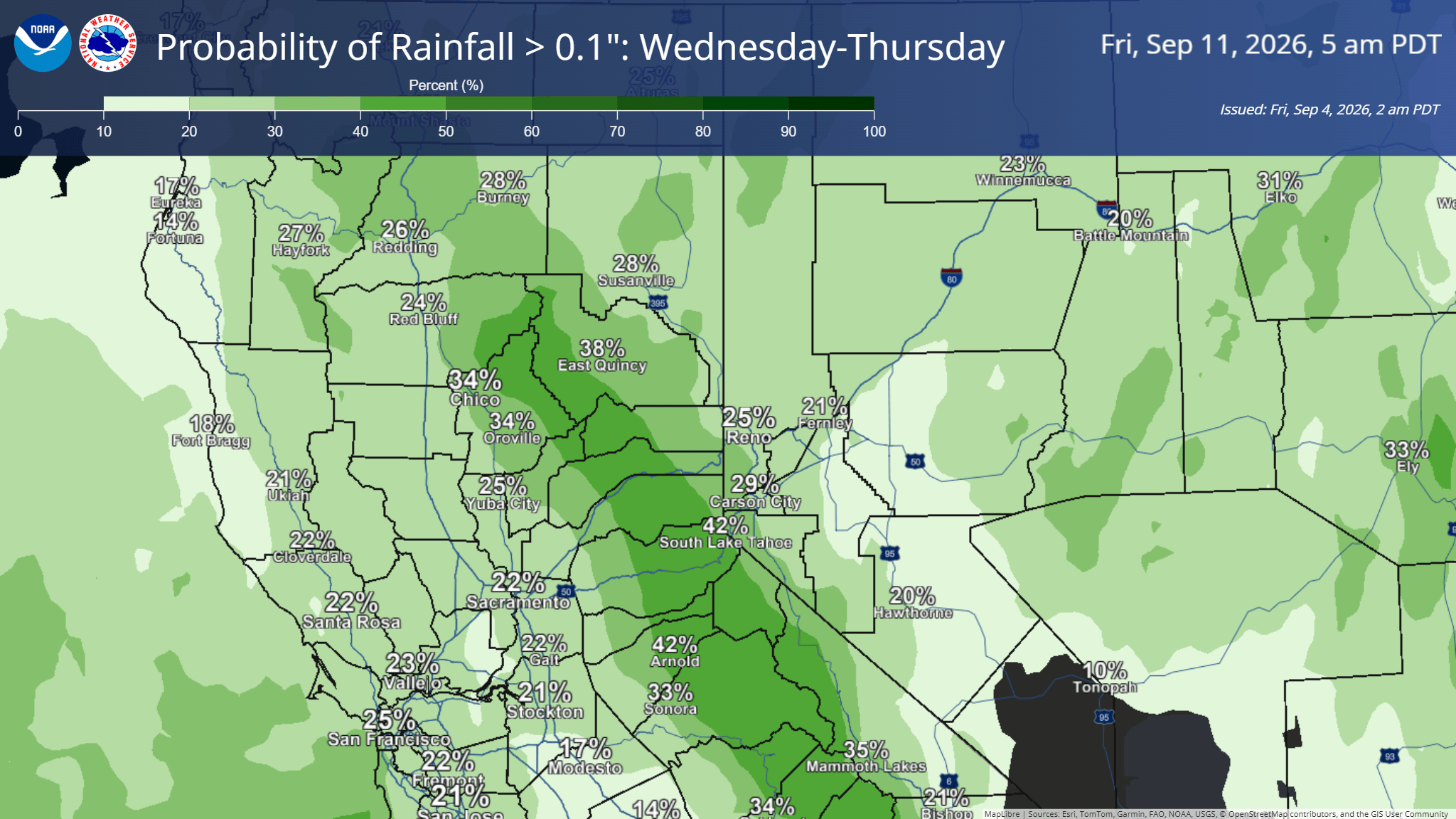
September 3, 2026 at 4:42 PM Non-injury accident on Hwy 20 at West Empire, units dispatched.
September 3, 2026 at 4:16 PM Since it’s been a while since we had precip that can qualify as rain, here’s a timely reminder: Turn your car’s headlights on.
September 3, 2026 at 9:52 AM A reminder to the Lake Vera/Round Mountain Firewise Community members: Meeting at the Community Room in the Madelyn Helling Library today from 10:30 to noon. Come for Susan Benson’s cookies and stay for the updates.
September 3, 2026 at 6:48 AM Here are the overnight NWS Sacramento forecast updates:
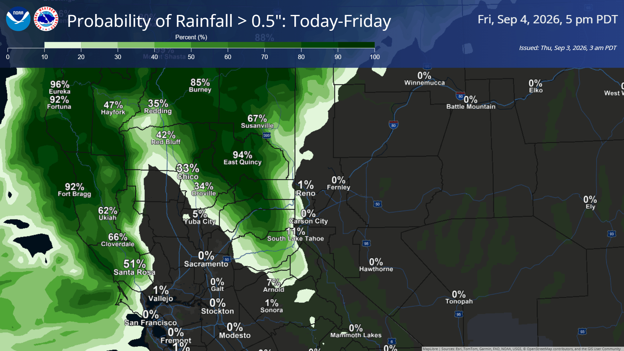
- Cool temperatures and breezy winds continue through the end of the week and into the weekend
- High temperatures in the 60s to 70s today and Friday warm toward the 70s to 80s on Saturday and Sunday
- Near freezing early morning temperatures remain possible above 7000′ through Saturday AM
- An active upper level pattern will keep unsettled weather in the forecast over the next 7 days, although confidence remains low on details into next week
- Today: Periods of light to moderate rainfall from I-80 northward; 15% thunderstorm chances across the mountains
- Friday – Saturday: Lingering light mountain showers Friday with drier weather elsewhere into the weekend
- Sunday – Next Week:
- Rain and isolated thunderstorm chances around 10-15% north of the I-80 corridor on Sunday
- Trend toward drier weather through early next week with temperatures becoming more seasonable
- Potential for tropical remnant moisture to result in active weather by the middle of next week, but high uncertainty continues

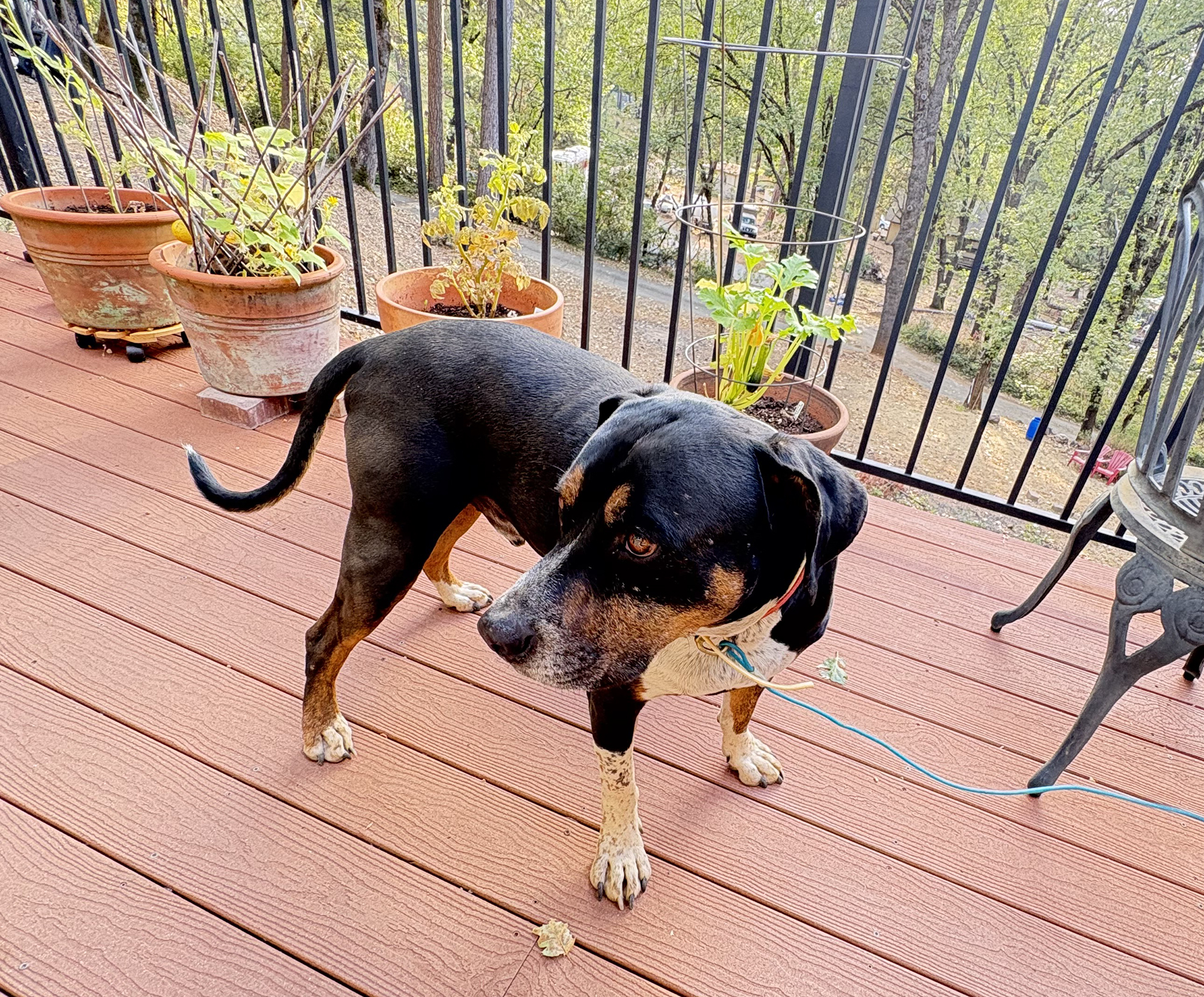
September 3, 2026 at 6:39 AM Lost dog found on Hwy 174 in Colfax across from old Colfax Veterinarians Hospital. Looks like a mix between a lab and a beagle. Found at approximately 6 pm, September 2, 2026. Call – 530.575.2639 or 530.615.7252
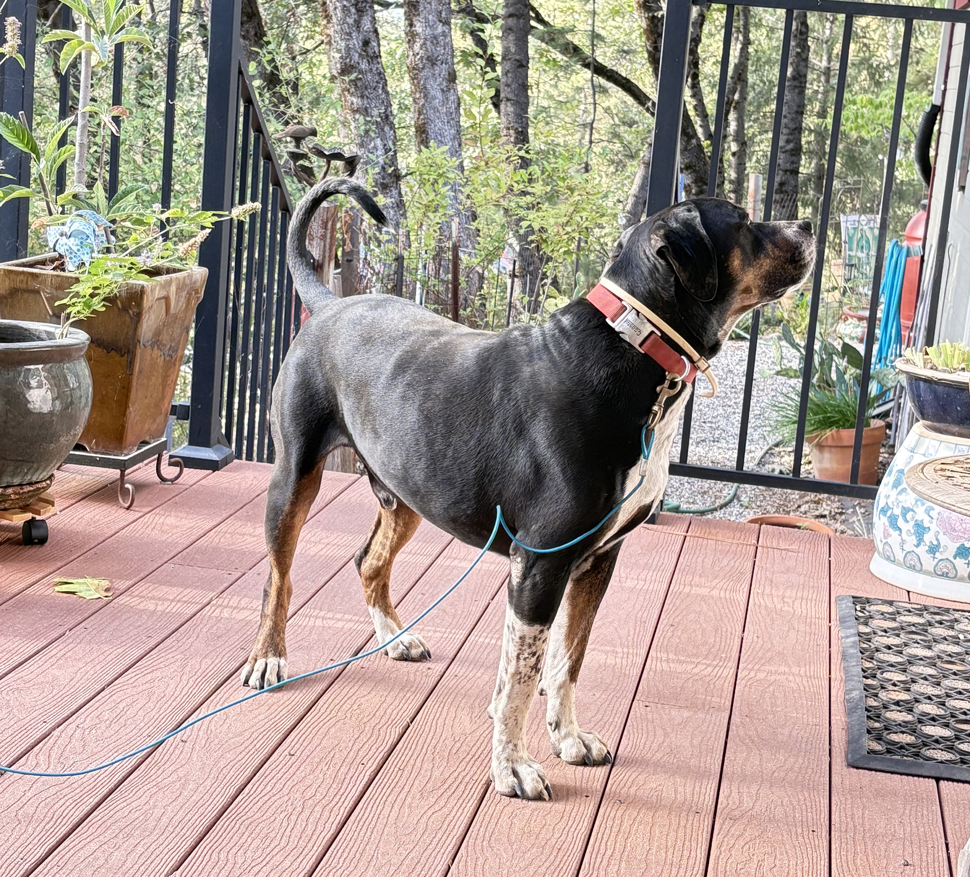
September 2, 2026 at 12:42 PM Two-car accident on Ballantree Ln off McCourtney Rd, units dispatched.
September 2, 2026 at 12:35 PM Two black Yorkies are running in the roadway on Bitney Springs near Personeni Lane. Are your pups safe?
September 2, 2026 at 10:32 AM First Rain Land Stewardship Services is conducting a prescribed burn to achieve fuels reduction and forest health improvement.
Where: Selby Lane Nevada City, CA
When: September 2nd, 2026
Time: 11am – 5pm
Acres: 8.3
This burn has been approved by Calfire and is being conducted by a California Prescribed Fire Burn Boss (CARx)
September 2, 2026 at 7:30 AM NWS Sacramento forecast update:

- Unsettled weather pattern remains in place through the middle of the week
- Today: Light rain showers north of I-80, with best chances across Shasta County and surrounding terrain
- Thursday:
- Shower chances expand toward the I-80 corridor (including the Sacramento metro) Thursday morning
- Isolated thunder chances for northern Sacramento Valley and surrounding terrain
- Periods of moderate rain rates with potential rainfall totals 1″+ for mountain locations
- A brief shift toward drier weather with a slight warming trend follows Friday into Saturday
- Unsettled and wetter weather returns in some capacity Sunday into early next week, but exact details remain uncertain
September 2, 2026 at 6:35 AM Power outage affecting 737 PG&E customers in the Oregon House and Collins Lake area. Estimated time of restoration is 10:15 am.

September 1, 2026 at 8:10 PM The Jackson fire is now contained and has a handline around the entire perimeter.
September 1, 2026 at 6:56 PM Firefighters are at Catfish Lake and have a hoselay around the fire which has been knocked down. They are mopping up and building a handline around it.
September 1, 2026 at 6:37 PM Some additional resources from the Truckee Ranger District are responding to the fire south of Jackson Meadows, near Catfish Lake.
September 1, 2026 at 6:19 PM Air Attack 17 has lifted to the reported Jackson fire, near Jackson Lake on Meadow Lake Rd.
September 1, 2026 at 6:04 PM Three-car accident on La Barr Meadows Rd and Dog Bar, units dispatched.
September 1, 2026 at 3:54 PM Tankers are going south to a vegetation fire in the Midpines area.
September 1, 2026 at 1:46 PM An update from the local strike team on the Plaskett Fire.

September 1, 2026 at 1:25 PM Possible fire, smoke seen, in an I-80 culvert near Eagle Lakes Rd. Units dispatched.
September 1, 2026 at 11:05 AM I like September so far, very… cool!
September 1, 2026 at 7:00 AM Downtown Grass Valley Public Parking Lots will be closed to traffic intermittently for pavement striping work September 1st through September 3rd, 2026.
The work will take place between the hours of 7:00 AM and 12:00 PM.
Please observe all construction signs and the instructions of onsite personnel. We apologize for any inconvenience this may cause and appreciate your patience.
The current construction schedule (subject to change) proposes the following closure dates:
- Tuesday 9/1 – Church St Parking Lot
- Wednesday 9/2 – Church St Parking Lot & City Hall Parking Lot
- Thursday 9/3 – City Hall Parking Lot
September 1, 2026 at 6:39 AM Here are the overnight NWS Sacramento forecast updates:
- Low clouds throughout the Valley and lower foothills this morning are expected to gradually diminish through the morning
- Well below normal temperatures and persistent south to west winds continue through the end of the week
- High temperatures in the 70s to lower 80s; overnight low temperatures nearing freezing at high elevations (above 7000′)
- Onshore winds gusting 20 to 35 mph at times, strongest on Wednesday in northern Sacramento Valley/Burney Basin/northeast foothills and along Sierra crest
- Unsettled weather pattern remains in place through the end of the week
- Tonight – Wed: Low chance (<10%) of isolated thunderstorms across western Shasta County tonight into Wednesday morning; light showers north of I-80 remainder of Wednesday
- Thursday: Shower chances expand toward the I-80 corridor (including the Sacramento metro) Thursday morning; isolated thunder chances for northern Sacramento Valley and surrounding terrain
- Friday: Shower/Isolated Thunder chances shift back to areas north of the Interstate 80 corridor
- A trend toward drier and gradually warmer weather is looking more likely through the weekend
- Significant uncertainty remains in the extended forecast regarding a potential return to unsettled weather across NorCal early next week

September 1, 2026 at 6:36 AM You can find last month’s log here.