
Happening Now brings you community news, updates and announcements throughout the day.
Send your photos and updates to 530-478-9600.
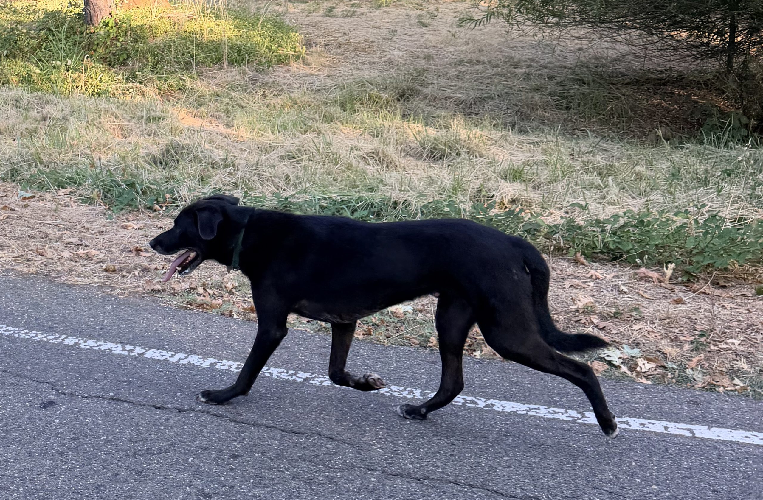
August 31, 2026 at 6:13 PM Now a reader report of a black lab on Alta Sierra Dr near Tippy. Very skittish but friendly. Is your pup safe?
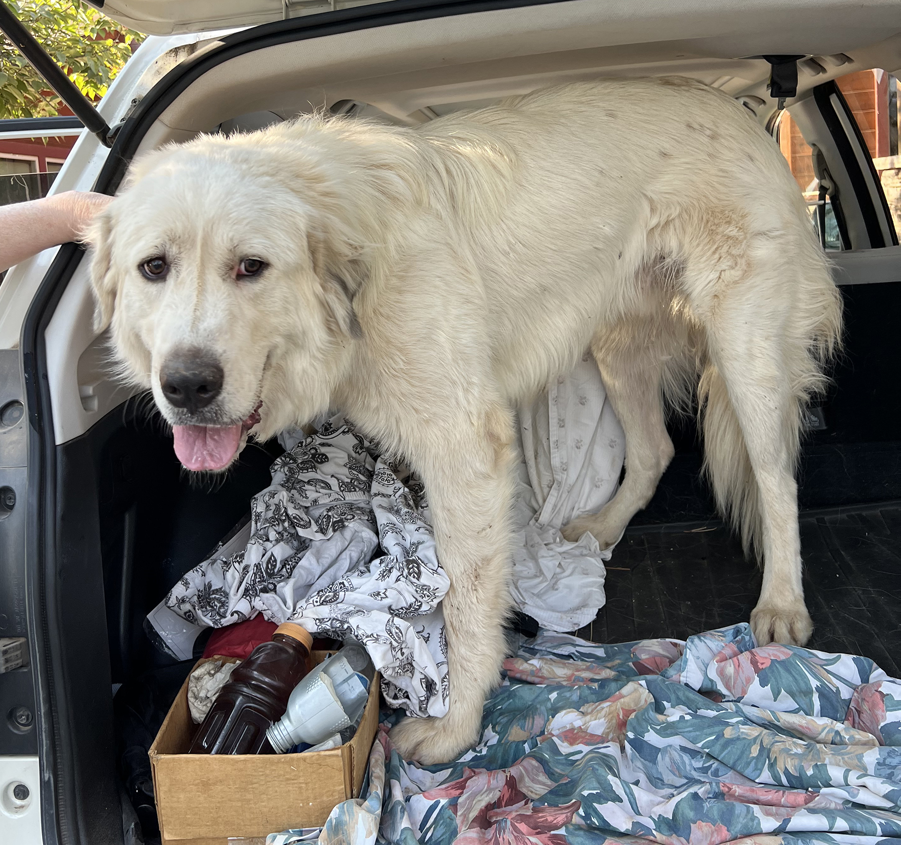
August 31, 2026 at 5:55 PM A big, white unneutered male dog was found on Dog Bar Rd and Wolf Creek. The good samaritans took the pup to be checked for a microchip, no luck. If this is your pup, contact the Nevada County Animal Shelter.
August 31, 2026 at 3:33 PM Two-car accident on Scotts Flat Road, units dispatched.
August 31, 2026 at 1:50 PM Motorcycle down on northbound Hwy 49 at the Brunswick, units arriving at scene.
August 31, 2026 at 1:24 PM Resources staged at Jones Bar can cancel.
August 31, 2026 at 1:22 PM Units at scene on Jones Bar report locals working on it, the spot is being extinguished. All units continue to stage.
August 31, 2026 at 1:02 PM Engines dispatched to Jones Bar Road for a small smoldering 12 by 12 spot on Jones Bar Road near McKitrick Ranch Rd. There was a “ceremonial” burn last night apparently.
August 31, 2026 at 10:45 AM In case you’ve noticed smoke and haze this morning in the sky, it is mainly coming from the Timber and Plaskett wildfires in the Big Sur area, moving northward into our area due to onshore winds. Much of this smoke is aloft, but some may also reach the surface, especially in the mountains and foothills.

August 31, 2026 at 10:40 AM Aircraft may be leaving Grass Valley Air Attack Base for a fire on La Porte Rd in Bangor, Butte County. Washington Ridge crew also dispatched.

August 31, 2026 at 9:03 AM Non-injury accident on Rough and Ready Hwy at Adam Ave, the roadway is clear.
August 31, 2026 at 6:29 AM Here are the overnight NWS Sacramento forecast updates:
- Below normal temperatures and breezy to gusty onshore winds are anticipated today
- Elevated Fire Weather conditions today for wind gusts 20 to 30 mph and daytime humidity teens to lower 20s across the Northern Sacramento Valley/Northeast foothills/Burney Basin
- An unsettled weather pattern unfolds through the remainder of the week as unseasonably cool temperatures become widespread through the middle of the week
- Breezy onshore winds persist with winds gusting 15 to 25 mph at times
- High temperatures in the 70s to lower 80s; overnight low temperatures nearing freezing at high elevations (above 7000′) through midweek
- Shower and isolated thunderstorm chances increase from late Tuesday onward with highest potential expected north of the Interstate 80 corridor
- Tue PM – Wed: Low chance (<10%) of isolated thunderstorms across western Shasta County Tuesday evening into Wednesday morning
- Wed – Fri: Periodic chances for showers (40-60%) and isolated thunderstorms (10-15%) each day; primarily wet thunderstorms and accumulating rainfall anticipated
- This unsettled weather pattern is generally expected to continue into the weekend and next week, and while additional precipitation chances remain possible, there is significant uncertainty in the accompanying details at this time
August 30, 2026 at 8:01 PM Unless a Transformer was in a hurry, somebody lost several large vehicle parts on eastbound Hwy 20 near the Brighton St off ramp. Do you know where your bumper is?
August 30, 2026 at 2:49 PM Wayward Skout has been reunited with his human. Al is well.
August 30, 2026 at 2:03 PM Escape artist Skout got out off of Squirrel Creek and Cedar Ave. No collar on her and no chip yet. Super friendly pup! Contact 530-277-5656 if found.

August 30, 2026 at 11:38 AM Bovine stroll alert on Birchville Road on the San Juan Ridge. Beautiful day to go on a walk, but watch out for the livestock.
August 30, 2026 at 8:17 AM The latest forecast update by NWS Sacramento:

- Elevated Fire Weather Conditions on Monday due to breezy onshore winds and low humidity in the northern Sac Valley, NE Sierra Foothills, & Burney Basin
- Breeziest winds expected on Monday, with periods of breezy onshore winds through the week
- Cooler, below-normal temperatures through much of this week after today
- Temperatures have trended slightly cooler with the latest update
- Valley highs in the upper 70s to low 80s
- Potential for near freezing overnight low temperatures in the mountains
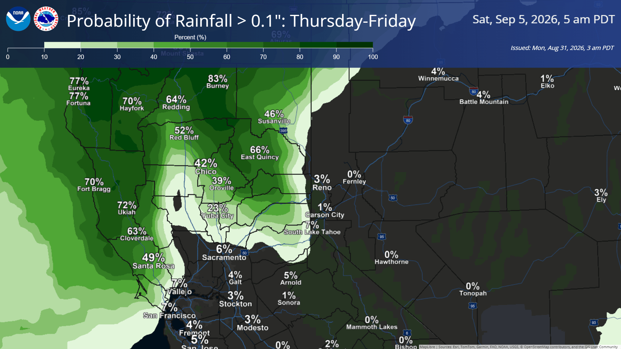
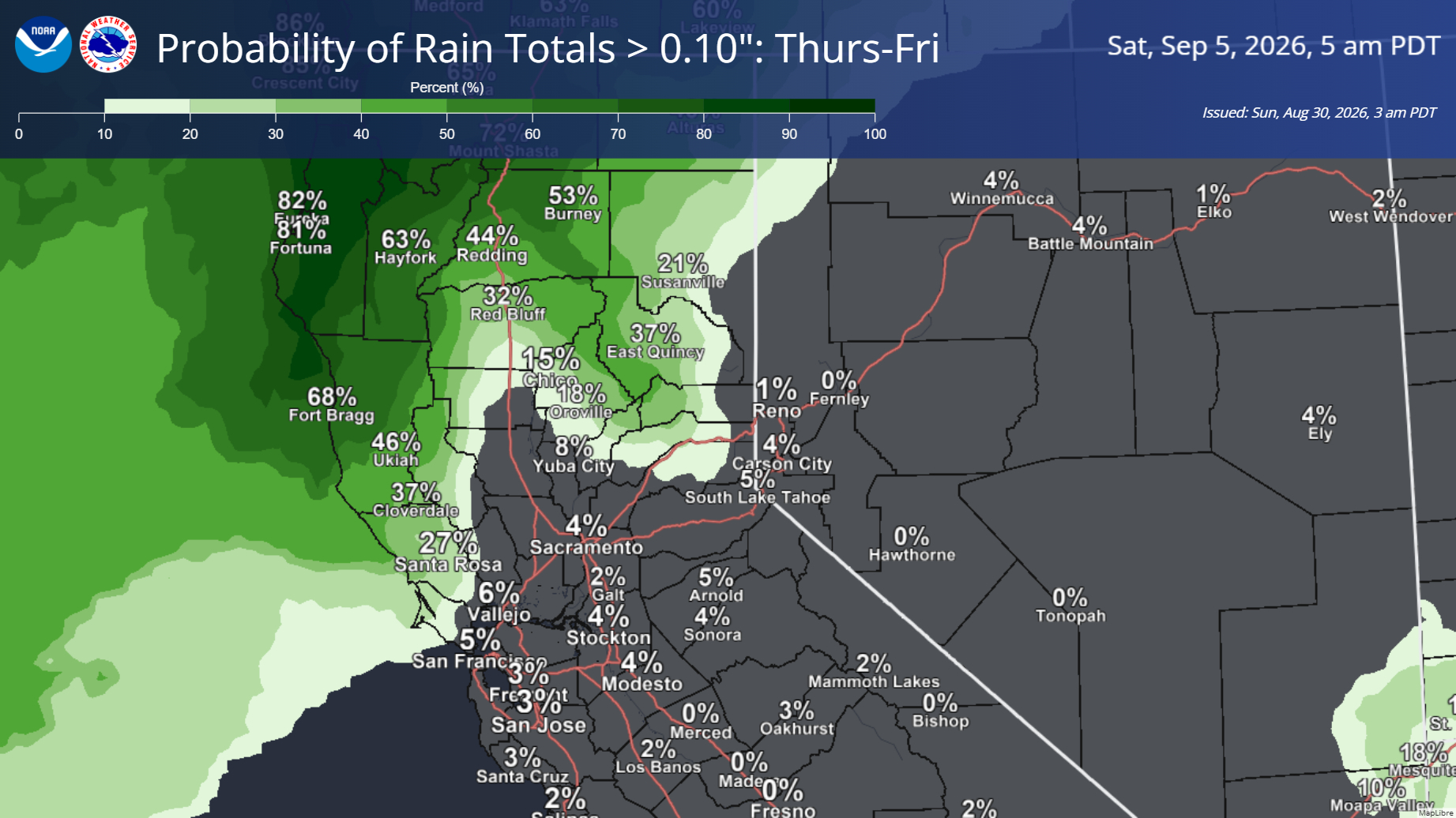
- A weather system will bring the potential for light showers mid to late this week. Models have fallen into better agreement with the latest update to the forecast, but timing and impacts are still subject to change as we move through the week.
- Current Timeframe: Thursday-Friday
- Impacted Locations: Shasta County, Northern Sacramento Valley, and the mountains north of I-80
August 30, 2026 at 7:52 AM Still a few PG&E customers on Fawn Hill off You Bet Rd affected by the power outage that began last night at 10:08 pm. Their estimated time of restoration is noon today. At the start of the outage, all of Peardale took a trip back to the Dark Ages.
August 29, 2026 at 6:39 PM Units at scene on Sunset Ridge Drive can handle, faulty electric.
August 29, 2026 at 6:30 PM Reported residential structure fire, smoke coming from an ac vent, on Sunset Ridge Drive, Higgins. Units dispatched.
August 29, 2026 at 4:52 PM Air Attack 230 and Tanker 88 were committed to a fire in El Dorado County near Balderson Station on Wentworth Springs Road. The tanker was canceled midflight and is returning to Grass Valley.
August 29, 2026 at 1:07 PM If you see smoke in the area off Vintage Drive on Lime Kiln Road, that is not a structure fire, it’s charcoal making.
August 29, 2026 at 9:09 AM Reader report: Two chicken are trying to cross the road, repeatedly, on Laurrine Way near Stinson Dr in Alta Sierra.
August 29, 2026 at 8:05 AM Here are the latest NWS Sacramento key messages:
- Dry weather continues through the weekend and into early next week, with periods of breezy onshore winds. Breezier onshore winds expected on Monday, especially through the Delta.
- Cooler temperature this weekend followed by noticeably cooler, below-normal temperatures next week.
- Potential for overnight lows in the mid to upper 30s in the high elevations of the Sierra mid next week.
- Valley highs in the low 80s and upper 70s.
- Models continue to be in disagreement over a potential return to unsettled weather mid to late next week. And as such, uncertainty remains on timing and potential impacts of any precipitation.
- That being said, cooler weather and breezy conditions will continue through next week as we remain under troughing influence.

August 29, 2026 at 7:32 AM Air Attack 230 and Tanker 88 are training only just above Scotts Flat.
August 29, 2026 at 7:27 AM Reader Maggie reports power is back on on Lone Lobo in Rough and Ready.
August 29, 2026 at 7:13 AM To start the day, 618 PG&E customers in the Jones Bar/Newtown and Bitney Springs area are still out of power. Estimated time of restoration is 1:00 pm.

August 28, 2026 at 8:20 PM Sunset in Lake Wildwood by reader Laurie.

August 28, 2026 at 5:53 PM This is a new one. A semi trailer is blocking all lanes on Combie Rd at Oak View. The semi tried to turn around and ended up in a ditch. Alternate routes highly encouraged.
August 28, 2026 at 4:05 PM An update from PIO Ramey: Yesterday evening Nevada County sent an immediate need Type-3 Engine Strike Team to the Plaskett Fire in Monterey County. Crews drove all night to the incident and reported to briefing at 0700. The Strike Team consists of engines from Peardale Chicago Park Fire, Penn Valley Fire, North San Juan Fire, West Stanislaus Fire, and Burbank Paradise Fire Protection District. Strike Team Leader is Battalion Chief Jon Pitts of Penn Valley Fire.

August 28, 2026 at 3:03 PM Someone really didn’t want to fold the laundry and just left the whole basket in the northbound lane of McCourtney near Clear Creek Place.
August 28, 2026 at 11:34 AM Daisy has been reunited with her humans. Al is well.
August 28, 2026 at 11:14 AM A white and caramel colored beagle-ish dog has been found on Penn Valley Drive. She has a collar, named Daisy, but the phone number is not active. Anyone know who this little one belongs to??? We are asking around the neighborhood. You can call 530.432.3600


August 28, 2026 at 6:23 AM Here are the latest NWS Sacramento key messages:
- Elevated fire weather conditions are expected today across portions of the Valley and NE foothills due to dry and breezy conditions
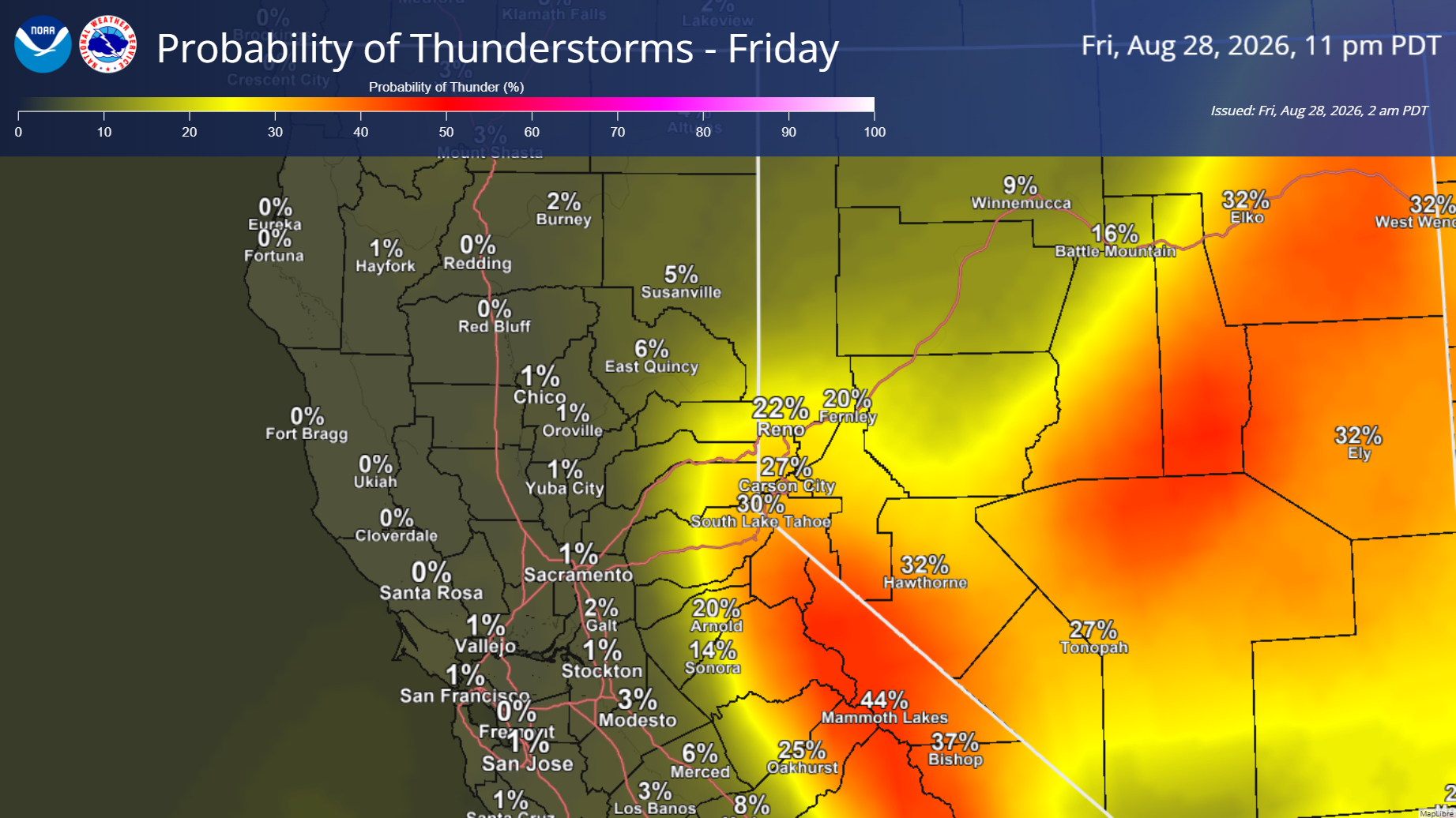
- Subtropical moisture will bring chances for light showers across much of the area today. Along with chances for isolated thunderstorms along the Sierra and south of I-80
- Additional elevated fire weather conditions for lightning potential with any thunderstorms that develop in the Sierra and the nonzero (less than 5%) chance of Valley t-storms south of I-80
- Highest chances (30-40%) over the mountains where storms will be primarily wet, but any lightning outside the main precipitation core may result in fire starts
- Confidence is low regarding any dry lightning in the Valley
- Additional elevated fire weather conditions for lightning potential with any thunderstorms that develop in the Sierra and the nonzero (less than 5%) chance of Valley t-storms south of I-80
- Seasonable temperatures continue into the weekend, with noticeably cooler weather and below-normal temperatures next week
- Chances for unsettled weather mid to late next week, but there is still a high amount of uncertainty regarding timing and potential impacts

August 27, 2026 at 4:33 PM Motorcycle stuck in Greenhorn Creek on Buckeye Rd, not starting back up again after the rider fell off. No injuries to the rider.
August 27, 2026 at 1:55 PM Tanker 88 was dispatched to assist the Plumas National Forest with a new incident off Hwy 70 just outside Quincy but has been canceled and is returning to Grass Valley.
August 27, 2026 at 11:41 AM Reader Keith captured these signs, which leave us scratching our heads ever so slightly.

August 27, 2026 at 11:13 AM Forward progress stopped, there is a hoseline around the fire.
August 27, 2026 at 11:11 AM Firefighters at scene can handle, Air Attack is releasing the tankers from the Rich incident.
August 27, 2026 at 11:08 AM Retardant drops on the open flank of the Rich fire have taken the heat out of the fire. Three of the flanks have been extinguished. One outbuilding reportedly fully involved.
August 27, 2026 at 11:05 AM The fire is about 1/4 acre in flashy fuels, burning at a slow rate of spread, per Rich IC. There is no threat to structures.
August 27, 2026 at 11:01 AM Aircraft are arriving over the Rich incident.
August 27, 2026 at 10:57 AM The Rich fire is now visible on the camera.

August 27, 2026 at 10:53 AM Full wildland dispatch for a reported fire started by weedeating on a hillside on Richmar Lane off Lime Kiln Rd in the Higgins area.
August 27, 2026 at 10:21 AM Tonight, don’t forget to look up! A partial (96.3%) lunar eclipse will be visible. Full details here.
August 27, 2026 at 8:33 AM Accident on Wolf Rd near Hwy 49, bicyclist down in the roadway.
August 27, 2026 at 8:10 AM Non-injury accident, school bus vs car on McCourtney at Massachusetts Hill in Grass Valley. The roadway is partially blocked.
August 27, 2026 at 8:08 AM Gas hazard on the 10000 block of Spenceville Road, units dispatched.
August 27, 2026 at 7:29 AM The latest from NWS Sacramento:
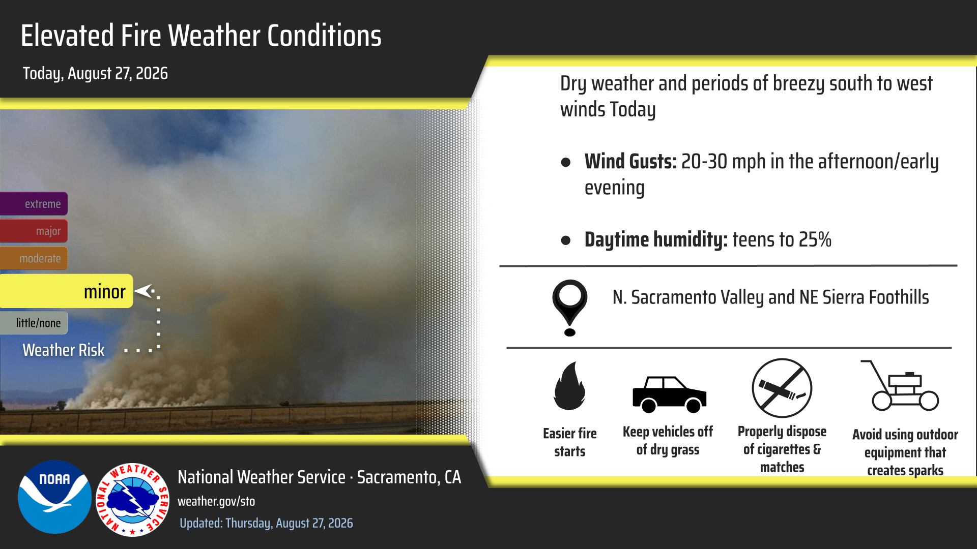
- Elevated Fire Weather Conditions Today:
- For portions of the N. Sacramento Valley, NE foothills, and N. San Joaquin Valley due to breezy winds and low daytime humidities
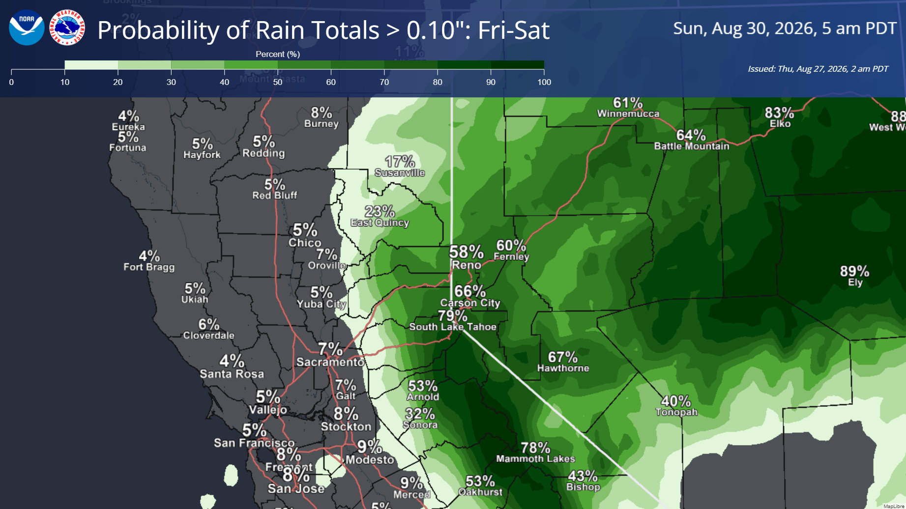
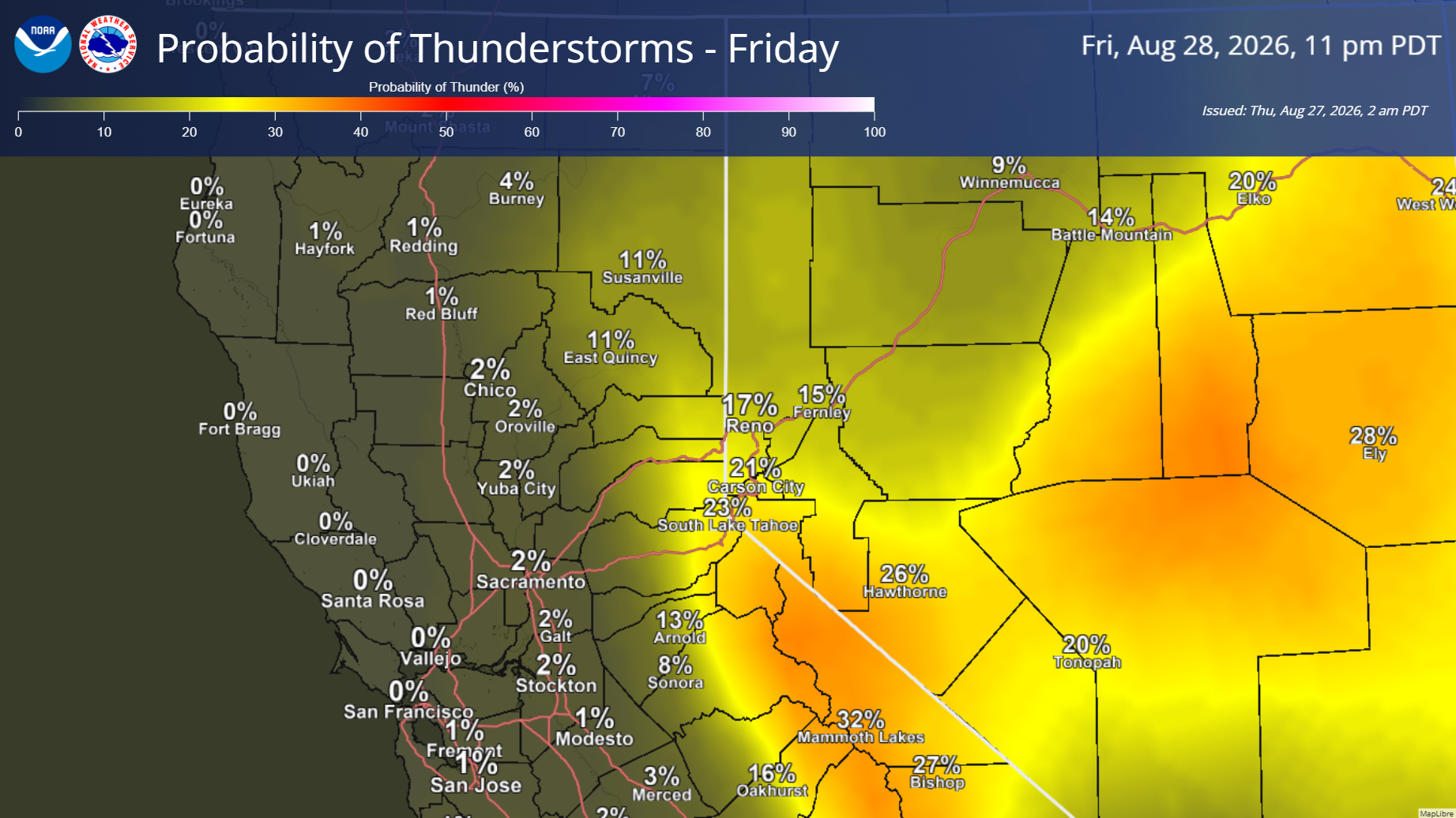
- Light Showers Today-Friday, with Isolated Mountain T-Storm Potential on Friday
- Sprinkles, virga, or an isolated shower possible today (highest potential south of I-80) as subtropical moisture enters the area
- Highest shower and mountain thunderstorm chances are expected on Friday, generally south of I-80
- Best thunderstorm chances along and east of the Sierra crest Friday afternoon/evening
- Seasonably warm temperatures continue today, before cooler temps arrive Friday and into next week
- Dry conditions return Saturday and into early next week, although we continue to monitor more unsettled weather mid to late next week
August 27, 2026 at 7:01 AM Solo vehicle vs tree on Hwy 20 in the construction zone at Chalk Bluff. No injuries reported.
August 26, 2026 at 7:59 PM An unspecified traffic hazard on Hwy 20, just past Uren St in Nevada City.
August 26, 2026 at 7:43 PM From the folks conducting the burn on Bitney Springs tonight: To clarify, this is not an acreage burn. It is an LE-5 burn covering a strip approximately 300 feet long and 8 feet wide, targeting star thistle along the fence line. We expect four to six people to be assigned to the burn, and a water tank will be on site. Ignition is planned for around 9 p.m., conditions permitting.
August 26, 2026 at 1:09 PM Dog Bar Road episode #99545: A semi with a flatbed loaded with lumber can’t make the tight turns on westbound Dog Bar Rd on the Placer County side. New bridge, old curves, same problem. Use an alternate route for now.
August 26, 2026 at 11:19 AM
Public Notice: Permitted Burn Tonight on Bitney Springs Road
Return California and 3 Suns Farm will conduct a permitted burn tonight, August 26, along a section of fence line beginning near 14560 Bitney Springs Road and continuing to the neighboring property line.
Ignition is expected to begin around 9 p.m. and burning may continue until approximately midnight, conditions permitting. A burn permit has been secured through CAL FIRE, and the burn will be actively tended and monitored.
Residents and travelers in the Bitney Springs area may see flames, smoke, and increased activity near the roadway during this time. This is a planned land stewardship burn, not a wildfire.
For questions, please contact:
Corinna Mills
Executive Director
Return California
916-208-8717
www.ReturnCA.com
Editor’s note: Yeah, really.
August 26, 2026 at 8:12 AM Wood debris in the northbound lanes of Hwy 49 at Cheery Creek.
August 26, 2026 at 6:17 AM Here are the NWS Sacramento forecast updates for today:

- Seasonable temperatures will continue through Thursday, followed by cooler temperatures Friday through the weekend and into early next week.
- Elevated fire weather concerns today and Thursday for the northern Sacramento Valley, northern San Joaquin Valley, and northeast Sierra foothills due to breezy winds combined with low daytime humidity.
- Confidence continues to increase for beneficial rain over the Sierra as a plume of subtropical moisture brings shower and isolated thunderstorm chances on Friday and Saturday. Highest chances remain from I-80 southward for both days. Exact rainfall amounts and timing are still unclear.
- Looking further ahead, the Climate Prediction Center’s 6–10 day outlook continues to favor below-normal temperatures and leans toward above-normal precipitation for much of California.


August 25, 2026 at 8:06 PM Reader Ron has the best sunsets.

August 25, 2026 at 7:54 PM Solo vehicle accident, car off the road, on Wolf Road at Hawkeye Lane.
August 25, 2026 at 5:53 PM Accident on Hwy 49 at Brewer Rd, units dispatched.
August 25, 2026 at 5:23 PM All resources dispatched to the reported fire in Forbestown have been canceled. No fire, just dust.
August 25, 2026 at 5:19 PM The smoke check on Wolf Road has yielded no smoke or fire.
August 25, 2026 at 5:17 PM Reported vegetation fire on New York Flat Road in Forbestown in Yuba County near the Butte County line.
August 25, 2026 at 5:12 PM Smoke check on Wolf Road in the Higgins area, units dispatched.
August 25, 2026 at 4:26 PM Granholm IC reports a large section of line down, requesting PG&E to expedite their dispatch.
August 25, 2026 at 4:23 PM Power lines reportedly down after an accident on Granholm Lane in Nevada City. No arcing or sparking reported.
August 25, 2026 at 3:08 PM To the lone customer still out of power in south county: hang in there!
August 25, 2026 at 2:04 PM Here’s hoping the 8:00 pm restoration time for the 967 PG&E customers is only an estimate.
August 25, 2026 at 1:07 PM Reader reported power outage on Wolf Road, McCourtney Road, Lime Kiln. PG&E now reporting an unplanned outage affecting 967 customers. Given the reports coming in, that number is likely going to go up.

August 25, 2026 at 12:28 PM Ground resources and a helicopter have checked the Casci area, unable to locate any smoke or fire.
August 25, 2026 at 12:18 PM Debris check in the Casci Road area on Hwy 20 abover Scotts Flat. Units dispatched.
August 25, 2026 at 9:09 AM Glass and other debris in all the southbound lanes on Hwy 49 near the Hwy 20 connector.
August 25, 2026 at 7:00 AM Here are the NWS Sacramento forecast updates for today:


- Temperatures: Seasonable temperatures will continue through mid-week, followed by a slight cooling trend from Friday through early next week as a trough moves onshore.
- Winds: Expect periodic breezy conditions throughout the week, with increasing winds anticipated on Friday.
- Thunderstorms: There is a slight chance (10-20%) of showers and thunderstorms along and east of the Sierra Crest on Friday, with the highest chances south of US-50.
August 24, 2026 at 7:09 PM Accident on West Main St in Grass Valley in front of the Center for the Arts, two cars involved.
August 24, 2026 at 6:33 PM Units in the Idaho-Maryland area have checked for any fire, so far nothing located.
August 24, 2026 at 6:20 PM Reader Maggie reports a loud bang in the Mystic Mine and Pierite area in Rough and Ready.
August 24, 2026 at 6:19 PM Smoke check on Idaho-Maryland Road.
August 24, 2026 at 6:05 PM Car vs fire truck on Hwy 49 at the intersection with Hwy 20 in Nevada City. No injuries reported.
August 24, 2026 at 5:33 PM Air Attack 230 has lifted to the fire near Placerville.
August 24, 2026 at 5:29 PM Reported accident on Hwy 49 at Coyote Street. Overturned car, extrication required.
August 24, 2026 at 5:27 PM Multi-car accident on southbound Hwy 49 at East McKnight Way. One car is the fast lane, two cars on the left shoulder. Use caution in the area.
August 24, 2026 at 5:18 PM New start, vegetation fire outside of Placerville, El Dorado County. The Green fire started on Green Valley Rd.
August 24, 2026 at 4:56 PM Correction, Tankers 88 and 89 are on a new start on the Modoc National Forest near Fletcher Place and Goose Lake at the CA-OR border.
August 24, 2026 at 4:18 PM Tankers 88 and 89 have been dispatched to an out of state fire.
August 24, 2026 at 3:48 PM Livestock watered, semi rolling again, traffic break has been lifted on I-80.
August 24, 2026 at 3:32 PM A semi with a trailer loaded with livestock on westbound I-80 just west of the Rollins Lake Road off ramp is creating a traffic hazard. The livestock needs water.
August 24, 2026 at 1:29 PM Accident on Brunswick Rd near Greenhorn Rd, units dispatched.
August 24, 2026 at 11:26 AM Semi vs high-voltage power lines on Rattlesnake Road in south Placer County. Units dispatched.
August 24, 2026 at 10:01 AM 600 PG&E customers in the Colfax area are out of power with an estimated time of restoration given as 12:45 pm.

August 24, 2026 at 6:41 AM Here are the NWS Sacramento forecast updates for today:
- Temperatures: Seasonable temperatures will continue through mid-week, followed by near to slightly below-normal temperatures late in the week and through the weekend.
- Winds: Periods of breezy south-to-west winds will persist over the next 7 days, with the strongest gusts over the foothills and mountains.
- Fire Weather: There are elevated fire weather concerns today for the northern Sacramento Valley and NE Sierra foothills due to breezy winds combined with low daytime humidity.
- Thunderstorms: Isolated thunderstorms (10% chance) are expected east of the Sierra crest this afternoon into the early evening.

August 23, 2026 at 4:46 PM Report from reader Sue: 3-4 Sheep or goats on Karen Dr. in Alta Sierra. Just got a quick glimpse as we drove by. Furry quadrupeds.
August 23, 2026 at 12:55 PM NWS Sacramento projected smoke forecast into Monday afternoon with periods of smoke expected, particularly our foothills and mountain areas. The smoke comes from the Hawk and Bug fires.
August 23, 2026 at 10:06 AM Perimeter IC reports the fire is holding at 1/2 to 3/4 acre. Canceling all aircraft. One engine, one crew and one water tender to continue in.
August 23, 2026 at 10:05 AM Air Attack 17 has lifted from Grass Valley to the Perimeter fire.
August 23, 2026 at 9:58 AM First unit at scene reports 1/4 acre in grass, moving into brush. One vehicle involved. The fire is on Perimeter Rd near McCourtney Rd.
August 23, 2026 at 9:47 AM Reported vegetation fire on Perimeter Rd and White Oak in south county. Units dispatched for a 50 by 50 spot.
August 23, 2026 at 6:50 AM The NWS forecast update: Today will be another very dry day across interior NorCal, with areas of afternoon relative humidity down into the teens, especially up in the northern Sacramento Valley. Seasonably warm and dry conditions are forecast for the week ahead, with mainly Minor HeatRisk. Periods of breezy onshore flow are also anticipated, especially for the Delta vicinity.
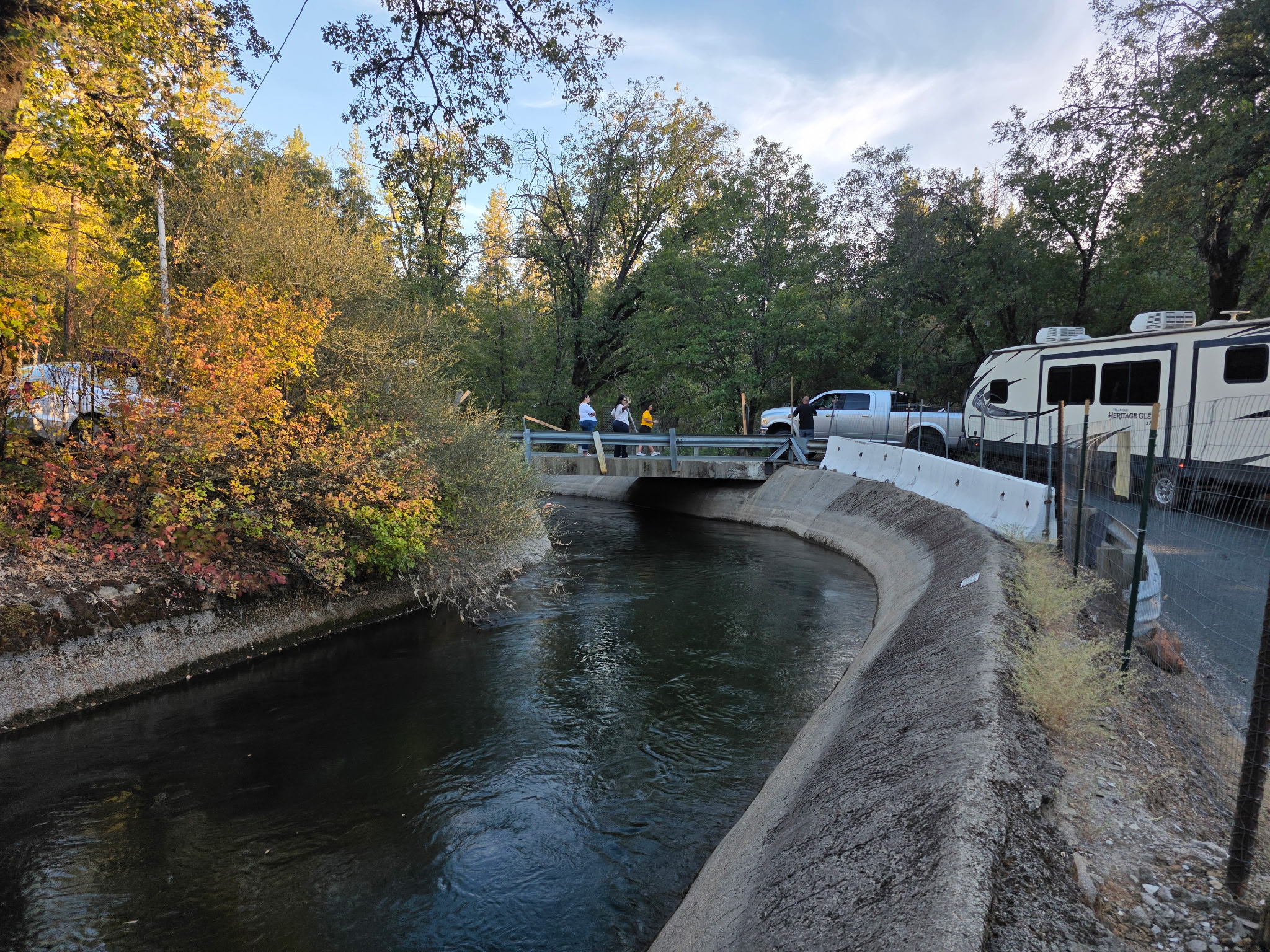
August 22, 2026 at 7:22 PM The truck and trailer on the Bear River canal bridge have backed up, with some damage to the rail and the trailer. Smaller cars can get through, but no ambulance or fire engine.
August 22, 2026 at 7:11 PM Some things never change. A pickup truck with a 30 ft trailer is stuck on the bridge over the canal on Dog Bar. Thanks to a reader for the photo.
August 22, 2026 at 5:48 PM Units at scene on South Auburn report the fire is contained to the dumpster.
August 22, 2026 at 5:43 PM Report of smoke off Hwy 49 on South Auburn St in Grass Valley, reported as a dumpster on fire. Units dispatched.
August 22, 2026 at 5:03 PM First unit at scene on Oak Canyon reports they can handle with units at scene.
August 22, 2026 at 5:02 PM Medical call at the Bridgeport Covered Bridge, patient is out of te water.
August 22, 2026 at 4:58 PM Reported passenger vehicle fire on Oak Canyon Dr across from Penn Valley Dr, units dispatched. Reported as smoke only, no flames seen.
August 22, 2026 at 1:38 PM Power has been restored to all customers affected.
August 22, 2026 at 1:25 PM Still 353 unlucky PG&E customers along Indian Springs Rd waiting for the promise of the Rural Electrification Act of 1936 to be fulfilled.
August 22, 2026 at 1:22 PM Reader Rhonda reports power has been restored in Rough & Ready.
August 22, 2026 at 1:18 PM The PG&E power outage in Penn Valley and Rough & Ready has been reduced to 1,425 customers. Still a 7:00 pm restoration time.

August 22, 2026 at 9:00 AM PG&E reports 2,160 customers are affected by the outage. Trouble crew has been dispatched to the Penn Valley and Rough & Ready area.

August 22, 2026 at 8:58 AM Power outage around Maidu Trail, reported by reader Laura.
August 21, 2026 at 2:22 PM A power outage in the fire area is affecting 1,432 customers.

August 21, 2026 at 2:19 PM Updates on the Clover Fire will be posted to the Clover incident page.
August 21, 2026 at 1:57 PM Clover IC reports the incident command post is at Kenneth Ct. The Nevada County Sheriff’s Office has issued an EVACUATION ORDER for zone NCO-E048 on 08/21/2026 at 1:45 PM for a wildfire in the area of Clover Valley Rd and Rainbow Rd. EVACUATE IMMEDIATELY. Check https://protect.genasys.com/ for updates and available shelter locations.
The Nevada County Sheriff’s Office has issued an EVACUATION WARNING for zone NCO-E050 on 08/21/2026 at 1:49 PM for a wildfire in the area of Clover Valley Rd and Rainbow Rd
. Those who require additional time to evacuate, and those with pets and livestock should consider leaving now.
August 21, 2026 at 1:46 PM Clover Fire, Clover Valley Rd fire near Alta Sierra Ranches and Dog Bar.

August 21, 2026 at 8:26 AM Reported accident on Combie Rd near Table Meadows Rd, two cars involved. Units dispatched.
August 21, 2026 at 7:48 AM Here are the NWS Sacramento forecast updates for the day:
- Temperatures: Seasonable temperatures over the next 7 days, with minor cooling today.
- Winds: Onshore winds are expected to increase today and Saturday, with the strongest winds during the afternoon into early evening hours.
- Fire Weather: Breezy westerly winds combined with low humidity (in the teens to 20s) will create Elevated Fire Weather Conditions today and Saturday for the Burney Basin/Eastern Shasta County, where winds will be downslope.

August 20, 2026 at 6:47 PM A microwave fire, now extinguished, on Starling Circle in Eskaton Village has filled a house with smoke. Firefighters will assist with ventilation.
August 20, 2026 at 3:36 PM Via City of Nevada City and Sierra Streams Instituted: E. Coli Warning at Pioneer Park. Bacteria levels recently exceeded the EPA threshold for E.Coli in Little Deer Creek at Pioneer Park. It is recommended that humans and pets avoid contact with the Little Deer Creek. If you come in contact with the stream, be sure to wash your hands thoroughly. For more information visit Sierra Streams Institute

August 20, 2026 at 2:29 PM The 133 customers still out of power in the Newtown area now possibly could have power back by 6:00 pm.
August 20, 2026 at 1:33 PM A bunch of items strewn about on southbound Hwy 49 at the Idaho-Maryland off ramp. Use caution in the area, driver is trying to retrieve the items.
August 20, 2026 at 11:12 AM The 133 customers still out of power in the Newtown area now should have power back by 2:15 pm.
August 20, 2026 at 8:32 AM Idaho IC releases all units, not a fire.
August 20, 2026 at 8:28 AM Now reported as a shipping container on Railroad Ave showing smoke.
August 20, 2026 at 8:26 AM Smoke check on Railroad and Idaho-Maryland, dark smoke seen behind concrete. Units dispatched.
August 20, 2026 at 8:04 AM Reader Mike sent an email with the subject line “Graffiti.” Indeed, great graffiti art on Hwy 49 near Running M Drive.

August 20, 2026 at 7:49 AM The outage in the Newtown area has been reduced to 133 customers. PG&E trouble crew is at scene repairing the power lines.
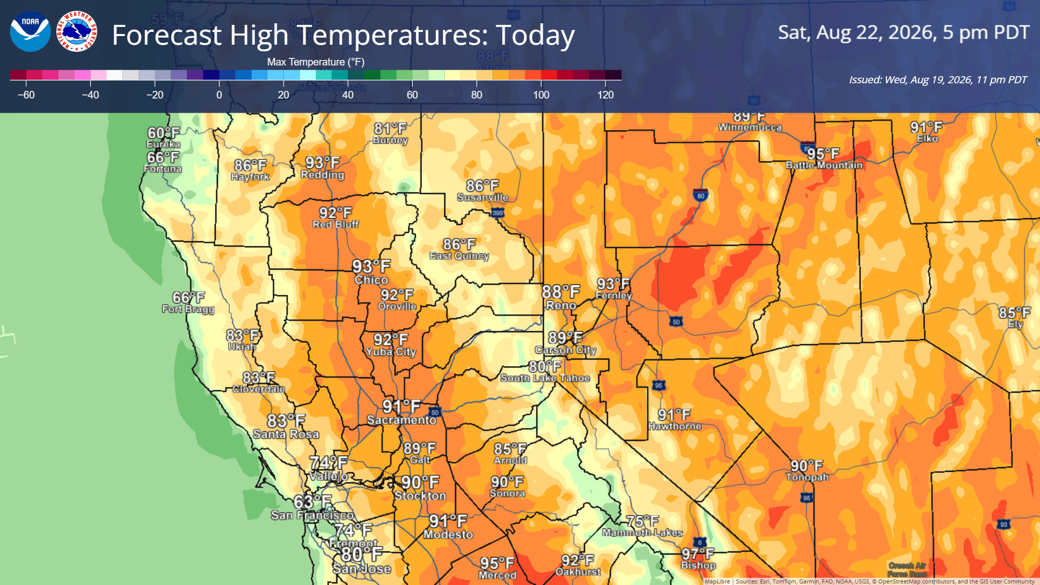
August 20, 2026 at 7:31 AM Here are the NWS Sacramento forecast updates for the day:
- Warm temperatures continue today
- A largely dry weather system for interior NorCal tracks toward the Pacific Northwest late this week bringing breezier onshore winds on Friday and Saturday
- Elevated fire weather conditions are anticipated for the Burney Basin and northern Sierra foothills due to the breezy winds and low daytime humidity
- Temperatures trend more seasonable through the weekend and into next week as dry weather persists
August 20, 2026 at 7:28 AM Power has been restored in Cascade Shores and Deer Creek Park.
August 20, 2026 at 6:47 AM Newtown Road is blocked at the accident site due to the downed power lines.

August 20, 2026 at 6:42 AM Units on Newtown Rd report power ad communication lines are down across the road. Per PG&E, the outage is affecting 536 customers in the area. The outage reached from Cement Hill to Ridge Road into Morgan Ranch.
August 20, 2026 at 6:37 AM Reported accident on Newtown Rd near Beckville Rd, units dispatched. Possible car vs pole, power is out in the area.
August 20, 2026 at 6:33 AM Another outage is still affecting 66 customers on Holland Dr and Rudd Road in the Jones Bar area. 9:30 am is the projected time of restoration.
August 20, 2026 at 6:29 AM Power outage affecting 814 PG&E customers in Cascade Shores and the Deer Creek Park area has a 9:00 am estimated time of restoration.

August 19, 2026 at 9:00 AM Reported accident on Cement Hill Rd, units dispatched.
August 19, 2026 at 7:10 AM A hydrant is missing its cap and is dripping on Patricia Way across from Norlene Way in Alta Sierra.
August 19, 2026 at 7:01 AM Here are the NWS Sacramento early morning forecast updates:
- Seasonable high temperatures continue
- High temperatures warmest today, then cooling slightly below normal for the weekend into early next week
- Breezy onshore winds at times, peaking on Friday and Saturday, gusting up to 20 to 30 mph
- Elevated fire weather concerns Friday and Saturday for the Burney Basin due to breezy westerly winds and low daytime humidity
- Dry weather persists into early next week

August 18, 2026 at 8:19 PM Brown, black and white medium shorthair dog with collar and tags running on Newtown Rd.

August 18, 2026 at 4:35 PM Nevada County Connects update: The 4:30 PM Route 4 departure from Tinloy Transit Center is cancelled due to being 30 minutes behind schedule.
August 18, 2026 at 1:04 PM Accident on Hwy 49 at School St in North San Juan. School St is blocked with emergency services and the overturned car.
August 18, 2026 at 11:15 AM The trough is still a hit. Bear had a soak to start the day.

August 18, 2026 at 10:02 AM Reader Hindy shared tis photo of last night’s Venus and a waxing crescent moon.

August 18, 2026 at 6:36 AM Here are the NWS Sacramento early morning forecast updates:
- Dry weather persists this week into early next week.
- Seasonable high temperatures continue this week.
- Temperatures warmest today and Wednesday, cooling some by late in the week.
- Breezy onshore winds at times, peaking on Friday, with winds trending a little stronger, gusting up to 20 to 30 mph.
August 17, 2026 at 10:02 PM Units in the area of Quarterhorse have thoroughly checked all the roads in the area, unable to locate any flames or even smoke.
August 17, 2026 at 9:37 PM Possible residential structure fire on Quarterhorse Dr off Wolf Rd near Dove Springs Dr, units dispatched. Single caller reporting seeing flames.
August 17, 2026 at 8:51 PM Tonight’s sunset, as seen from from Alta Sierra by reader Diane.
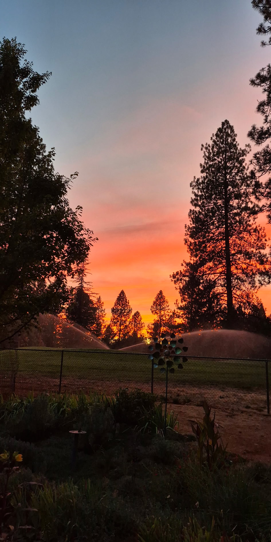
August 17, 2026 at 8:23 PM Finally sunset by reader Ron.

August 17, 2026 at 7:53 PM Michele has been located safe!

August 17, 2026 at 6:20 PM The Nevada County Sheriff’s Office and volunteers of the Nevada County’s Sheriff’s Search and Rescue team are actively looking for 81-year-old Michele Spencer. Michele is described as a Caucasian female, approximately 5’08”, 148 lbs. with white hair and blue eyes. Michele was last seen wearing a teal/grey tank top, matching pants and black shoes. She also had a tan, rolling cart for groceries in her possession. See photo from today. Michele was last seen this morning at 10:10am at the Raley’s on Freeman Lane in Grass Valley. She left her cell phone at home and does not drive. For possible sightings of Michele, please call our Sheriff’s Regional Dispatch Center at 530-265-7880.
August 17, 2026 at 4:57 PM We did it, one day without vegetation fire starts in Nevada County. Bravo!
August 17, 2026 at 9:38 AM Worth a reminder, just because high-level clouds keep temperatures down, fire danger has not decreased. The best way to stay safe is not to create sparks – please check your tow chains and don’t mow dry grass.
August 17, 2026 at 6:25 AM Here are the NWS Sacramento early morning forecast updates:
- Seasonable high temperatures this week
- Temperature trend a little warmer Tuesday and Wednesday, cooling some late in the week
- Breezy onshore winds at times, peaking on Friday
- Dry weather persists this week into the weekend
August 16, 2026 at 7:29 PM Units at scene on Wild Turkey Lane can handle, all incoming engines can cancel.
August 16, 2026 at 7:22 PM This cute male pup was found off McCourtney Road near Clear Creek School. Contact Sammie’s Friends if this is your pup.

August 16, 2026 at 7:16 PM Reported small vegetation fire, extinguished by homeowner, on Wild Turkey Lane near Lombardi in Big Oak Valley. Units dispatched.
August 16, 2026 at 2:36 PM Edwards IC reports the ambulance is transporting the patient to the landing zone. All resources available. They’ll have to wend their way through the cars parked in the No Parking zone…
August 16, 2026 at 1:47 PM Air ambulance responding to a reported fall at Edwards Crossing, medics and emergency personnel at scene.
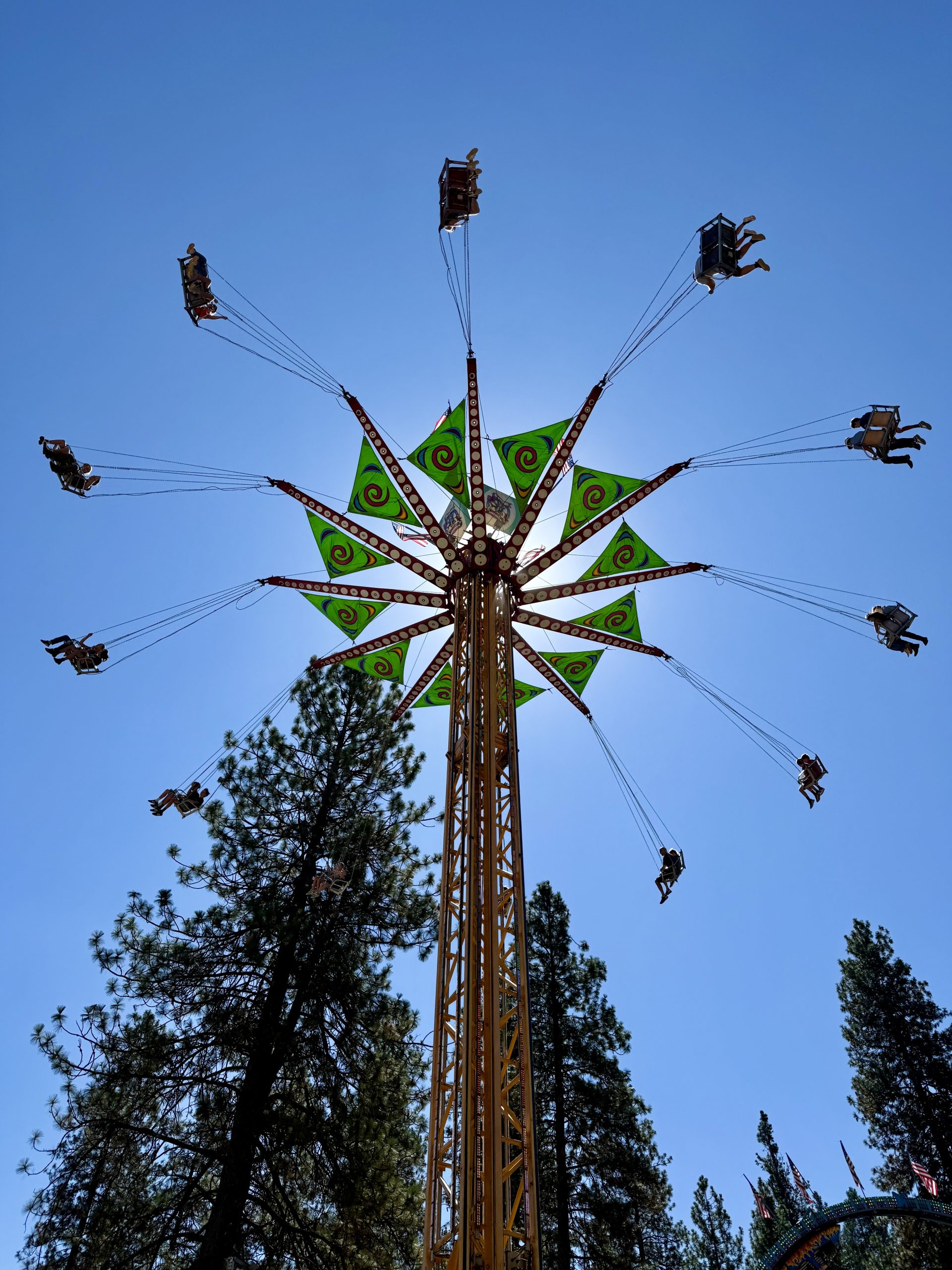
August 16, 2026 at 9:33 AM Reader Doug was at the Fair. How do we know? He sent this great photo.
August 16, 2026 at 8:44 AM Power has been restored for everyone affected by the morning outage.
August 16, 2026 at 8:22 AM Meanwhile, 2,236 customers in the Rough and Ready and Jones Bar area appear still out. A portion of Lake Wildwood is also still without utility power.

August 16, 2026 at 8:21 AM Reader Barbara reports power has been restored in Lake Wildwood.
August 16, 2026 at 8:12 AM The estimated restoration time is 2:30 pm, let’s hope the trouble crews will put that to shame again.
August 16, 2026 at 7:49 AM Now a PG&E report of 3,380 customers out of power.

August 16, 2026 at 7:47 AM Reader Mike reports power is out in Penn Valley. PG&E reports zero outages – but we’ll go with Mike’s report.
August 15, 2026 at 9:12 PM Have to share the Animal Costume Contest that took place yesterday at the Fair.

August 15, 2026 at 6:30 PM Units have checked Conservation Road, unable to locate any fire.
August 15, 2026 at 6:18 PM Debris check for a reported bonfire on Conservation Road near Rock Creek Road. Units dispatched.
August 15, 2026 at 1:37 PM Vehicle accident Wolf Creek Road near Tiger Tail Rd, units dispatched. Two cars reportedly involved.
August 15, 2026 at 7:21 AM Here are the NWS Sacramento overnight forecast updates:
- Low marine stratus clouds have again spread through the Delta and into the Sacramento area this morning. These low clouds are expected to dissipate by mid to late morning.
- Relativel cool temperatures again today, warming to near seasonable temperatures Sunday and continuing this way through next week.
- Dry weather persists into next week.


August 15, 2026 at 7:06 AM Norlene IC reports they have removed the vehicle from the garage.
August 15, 2026 at 7:01 AM Firefighters have knockdown on the car fire. IC releasing some units.
August 15, 2026 at 6:45 AM First unit at scene reports smoke in the vehicle and the garage, the house has been evacuated.
August 15, 2026 at 6:42 AM The EV on Norlene Way is reportedly full of smoke and in a garage, units arriving at scene shortly.
August 15, 2026 at 6:40 AM Reported residential structure fire, electrical car fire, on Norlene Way in Alta Sierra. Units dispatched.
August 14, 2026 at 8:38 PM Medical rescue underway on Kilham Mine Rd, additional units staging at Edwards Crossing.
August 14, 2026 at 6:27 PM PG&E’s outage map has caught up with our readers, outage shows as restored now.
August 14, 2026 at 6:15 PM Power is back on in the Ridge Road area, however the map shows still two outages – one planned and the larger unplanned outage.

August 14, 2026 at 6:12 PM Another reader on Shannon Way on Echo Ridge also reporting an outage. PG&E shows 1,497 customers sharing the same fate – map color notwithstanding.

August 14, 2026 at 6:08 PM Reader-reported PG&E power outage on Hubbard Road off Nevada City Hwy.
August 14, 2026 at 2:25 PM With cooler temperatures, it’s easy to forget hydration. Don’t. Especially if you are wandering around outside (Nevada County Fair!) take breaks, sit in the shade and consume the non-alcoholic beverage of your choice. Also, sunscreen or a hat are highly useful.
August 14, 2026 at 8:30 AM The kids (and parents) put in a lot of work for the Fair. Read all about it.

August 14, 2026 at 6:30 AM Here are the NWS Sacramento overnight forecast updates:

- Slight chances (10-20%) for isolated thunderstorms remain possible along the Sierra crest and Coast Range through this evening, although the majority of activity is expected east of the crest.
- Cool to seasonable temperatures and periodically breezy onshore winds continue through the weekend and into next week.
- Drier weather arrives area wide by the weekend, persisting into next week as well.
August 13, 2026 at 7:52 PM Units are at scene of a vehicle accident on East Lime Kiln Rd off Hwy 49 in Grass Valley, the roadway is partially blocked.
August 13, 2026 at 7:42 PM Utility power has been restored.
August 13, 2026 at 7:40 PM 495 customers are out of utility power on this circuit running from North Bloomfield to Purdon. Could be related to the utility work on North Bloomfield near Hwy 49.

August 13, 2026 at 7:33 PM Power outage at YubaNet HQ, generator is running. No idea of the total number of PG&E customers affected.
August 13, 2026 at 6:40 PM Fire Safe Council Announces Cancelation of Two Major Projects and Office Closure. The Fire Safe Council of Nevada County (FSC) announced that two major projects – the Deer Creek Canyon Shaded Fuel Break project and the Home Hardening and Retrofit Program will not move forward.
August 13, 2026 at 3:29 PM First unit at scene on Lakeview Ct reports no fire, no vegetation involved. Fire likey extinguished by locals, all units are being canceled.
August 13, 2026 at 3:24 PM Reported vehicle fire with possible threat to the vegetation on Lakeview Court near Lakeshore South in Lake of the Pines. Full wildland dispatch on order.
August 13, 2026 at 12:33 PM Power has been restored along New Rome Rd and portions of LakeVera/Purdon.
August 13, 2026 at 11:55 AM Power outage affecting 615 customers to the north of NevadaCity along Purdon Road and North Bloomfield. Estimated time of restoration is 2:15 pm. Generator running at YubaNet HQ.
August 13, 2026 at 11:42 AM One great reason to take a free Fair shuttle either from NU or the Nevada County Connect shuttle: you’ll easily shave off an hour from any of the freeway exits to the fairgrounds.
August 13, 2026 at 9:20 AM Units at scene of the Stonehedge fire off Loma Rica Road in Yuba County are making good progress. Tankers have dropped retardant and are returning to Grass Valley.
August 13, 2026 at 6:55 AM Here are the NWS Sacramento overnight forecast updates:

- A Red Flag Warning remains in effect from through 9pm this evening for the Sierra above 5000′ south of Interstate 80
- Primary concerns remain potential for new fire starts from lightning and gusty outflow winds from thunderstorms
- Below normal temperatures persist the remainder of the week, through the weekend, and into next week
- Surges of monsoonal moisture will continue to provide thunderstorm chances through Friday
- Remainder of this morning: The 5-10% chance of isolated dry thunderstorms continues across the Sierra foothills through mid morning
- This Afternoon/Evening: Thunderstorm chances increase to 15-30% along the Sierra, with a mix of wet/dry thunderstorms anticipated
- Friday: 10-15% afternoon/evening thunderstorm chances linger along the Sierra crest, potentially including the Coast Range as well
- Drier weather returns by the weekend and likely continues into next week

August 12, 2026 at 8:10 PM Tonight, the Perseid meteor shower peaks. It’s a perfect night to watch the spectacle by going outside after nightfall, let your eyes adjust and look to the northeast. Enjoy!
August 12, 2026 at 6:10 PM The Talbot Fire on the Tahoe above French Meadows is about 16 acres, fire activity has moderated and retardant lines are holding.
August 12, 2026 at 5:00 PM Due to the current Yuba Fire and a hard closure of SR49 at Nishinam Gulch, the Route 7 to North San Juan at 5:30 PM is cancelled per Nevada County Connect.
August 12, 2026 at 4:38 PM Do NOT attempt to run or circumvent the road closures in the fire area. The closures are as much for residents’ protection as they are for the firefighters working the incident. To the [insert term of your choice] that just blew past the ICP, seriously?
August 12, 2026 at 3:43 PM New start on the Tahoe National Forest near the Talbot Campground off French Meadows Road on the Middle Fork of the American River. Full wildland dispatch on order.
August 12, 2026 at 2:42 PM Updates on the Yuba fire will be published on the Yuba incident page.
August 12, 2026 at 2:34 PM Air Attack estimates the fire at 5 acres. The Emergency Operations Center has been activated.
August 12, 2026 at 2:34 PM Mandatory evacuation order issued. The Nevada County Sheriff’s Office has issued an EVACUATION ORDER for zone NCO-E075 on 08/12/2026 at 2:25 PM for a wildfire in the area of 11000 block of Yuba River Drive. EVACUATE IMMEDIATELY. Check https://protect.genasys.com/ for updates and available shelter locations.
August 12, 2026 at 2:29 PM Location of the Yuba fire. Air Attack estimates the fire at 3-5 acres, some homes in the area.

August 12, 2026 at 2:26 PM Grass fire, possibly 2 acres on Yuba Ridge Dr in the Jones Bar area. Full wildland dispatch arriving, including aircraft.

August 12, 2026 at 1:50 PM Opening Day at the Fair – photo gallery.
Got any specific Fair contest/area you want us to cover? Or, send us your photos from the Fair by emailing news@yubanet.com or text 530-478-9600.
August 12, 2026 at 1:37 PM Red Flag Warning for portions of Sierra (fire zones 136, 139) from 5 AM until 9 PM Thursday for a mix of dry and wet thunderstorms & gusty outflow winds.

August 12, 2026 at 5:55 AM Here are the NWS Sacramento overnight forecast updates:
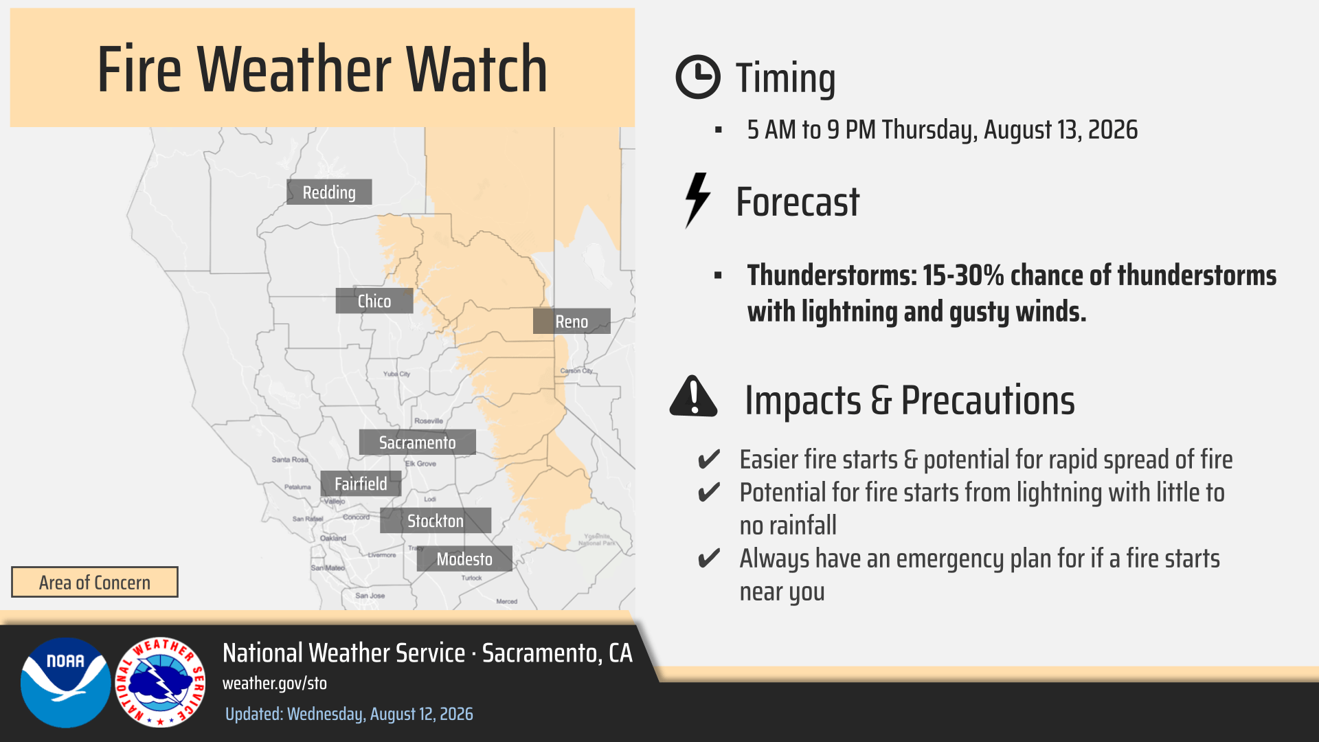
- A Fire Weather Watch remains in effect from 5am-9pm Thursday for the Serra above 3000′
- Seasonable temperatures today trend below normal the remainder of the week
- Surges of monsoonal moisture will result in thunderstorm chances through the end of the week
- Today: 10-15% chance of thunderstorms along the Sierra Crest south of Highway 50
- Overnight Tonight-Thursday AM: The 5-10% chance of dry, nocturnal thunderstorms is shifting primarily toward the Sierra foothills, with Valley chances now less than 5%
- Thursday: Thunderstorm chances increase to 15-30% along the Sierra, with a mix of wet/dry thunderstorms anticipated
- Friday: 10-15% afternoon/evening thunderstorm chances linger along the Sierra crest, potentially including the Coast Range as well
- Below normal temperatures persist through the weekend and into next with mountain thunderstorm chances decreasing to less than 10%
August 11, 2026 at 7:03 PM Grass Valley Police Department indefinitely suspends the use of fixed-point ALPR readers within City limits. A letter from Grass Valley Police to the community: Based upon our comprehensive review, a further analysis of the technological changes and unsettled future, conversations with community members, and assessment of evolving use of ALPR technology across all branches of government, the Grass Valley Police Department has decided to indefinitely suspend our use of fixed-point ALPR readers within our City limits, exercising our ability to cancel our contract with Flock Safety.
August 11, 2026 at 2:44 PM Accident on Hwy 49 at the Gold Flat off ramp, units dispatched.
August 11, 2026 at 2:31 PM No smoke visible in the Red Dog area, all resources are canceled.
August 11, 2026 at 2:28 PM Air Attack 230 and two tankers over the Red Dog area, so far nothing showing.
August 11, 2026 at 2:26 PM The reported vegetation fire is dust from blasting operations at the Parks Bar quarry near Smartsville.
August 11, 2026 at 2:24 PM New start, vegetation fire in the Sicard Flat area near Smartsville.

August 11, 2026 at 2:17 PM Reported vegetation fire, possibly a log on fire, in the Chicago Park area, near Rd Dog Rd and Greenhorn Creek. Full wildland dispatch on order.
August 11, 2026 at 12:38 PM To whet your appetite, here’s a video with Tall Pines’ Sauce Master and the full list of Fair Foods: Let’s eat! Treat Street is ready for the Fair.

August 11, 2026 at 12:24 PM Air Attack 230 and two tankers have lifted to a reported fire in Martis Creek near Big Chief Climbing area in Olympic Valley.
August 11, 2026 at 10:02 AM The National Weather Service in Sacramento has issued a Fire Weather Watch for thunderstorms and strong outflow winds, which is in effect from late Wednesday night through Thursday evening.
August 11, 2026 at 9:56 AM Car vs pole on Banner Lava Cap Rd, the roadway is partially blocked.
August 11, 2026 at 9:14 AM Units at scene on South Ponderosa report nothing showing. They’ll continue searching, incoming units to stage at teir current location.
August 11, 2026 at 9:05 AM Smoke reported on Hwy 20 near the South Ponderosa Way in Grass Valley. Could be smoke from last night’s fire. Units dispatched.
August 11, 2026 at 6:32 AM Remember 2006? Google bought YouTube, Twitter and Facebook opened to the general public, Pluto was demoted from a planet to a dwarf planet. On a more positive note, adult general admission tickets to the Nevada County Fair were $5 each. Thanks to our friends at the Nevada County Fair, you can go back in time, sortof. Today, August 11, 2026 from 8-5 only at the Fair’s box office at Gate 1 if you mention YubaNet the price will automagically be $5.

August 11, 2026 at 6:17 AM Here are the NWS Sacramento overnight forecast updates:
- A return to seasonable temperatures is anticipated today, with a more notable cool down to below normal temperatures on track late week into the weekend
- Surges of monsoonal moisture today through the end of the week are expected to introduce thunderstorm chances to the region
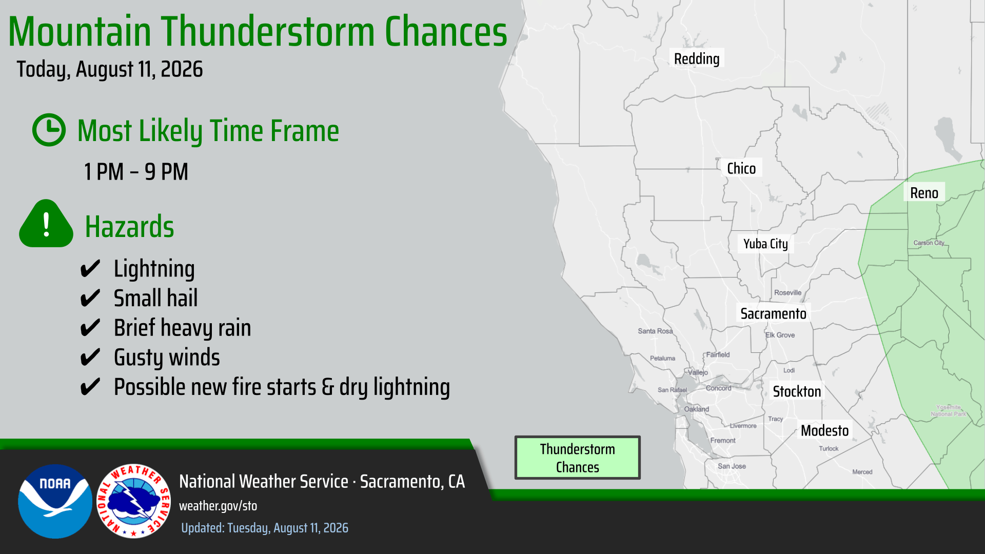
- Today & Friday: Slight chances (10-15%) of isolated thunderstorms along the Sierra crest in the afternoon/evening
- Wednesday & Thursday: Sierra thunderstorm chances increase to 15-30% in the afternoon/evening with a slight (5-10%) chance of isolated thunderstorms across the Valley/foothills late Wednesday-Thursday AM
- Highest chances Wed-Thu are generally expected from I-80 southward, but there remains some uncertainty in exact location, especially regarding the Valley/foothills potential
- Elevated fire weather conditions expected through the week with thunderstorm chances and dry fuels across the region
- Isolated thunderstorm chances begin to decrease to 10% or less along the Sierra crest heading into the weekend as below normal temperatures and drier weather settle in elsewhere
August 11, 2026 at 12:49 AM The Ponderosa incident is fully contained, all units released.
August 10, 2026 at 10:28 PM The Ponderosa incident is contained, IC releasing engines back to their stations.
August 10, 2026 at 10:15 PM Firefighters are lining the two spots on both sides of South Ponderosa, they can handle with units at scene. Drone operator is at scene to check for spots in the very thick manzanita.
August 10, 2026 at 10:08 PM Firefighters are making good progress, flame intensity is diminishing.

August 10, 2026 at 10:07 PM Incoming units to stage at the South Ponderosa overcrossing.
August 10, 2026 at 10:03 PM UAS (drone) requested to look for spots.
August 10, 2026 at 9:59 PM First unit at scene reports 1/8th of an acre, slow rate of spread, and approx. 50 by 50 spot on the other side of South Ponderosa.
August 10, 2026 at 9:52 PM Law enforcement responding to the fire. Access off South Ponderosa.
August 10, 2026 at 9:51 PM Fire is between South Ponderosa and Deadmans Flat Road, units are arriving at scene.
August 10, 2026 at 9:46 PM Reported vegetation fire, Hwy 20 and South Ponderosa overcrossing in Grass Valley. Numerous resources dispatched. CHP log lists a person set off fireworks, fire reportedly off South Ponderosa.
August 10, 2026 at 6:21 PM You have one guess to pinpoint where we were this morning.

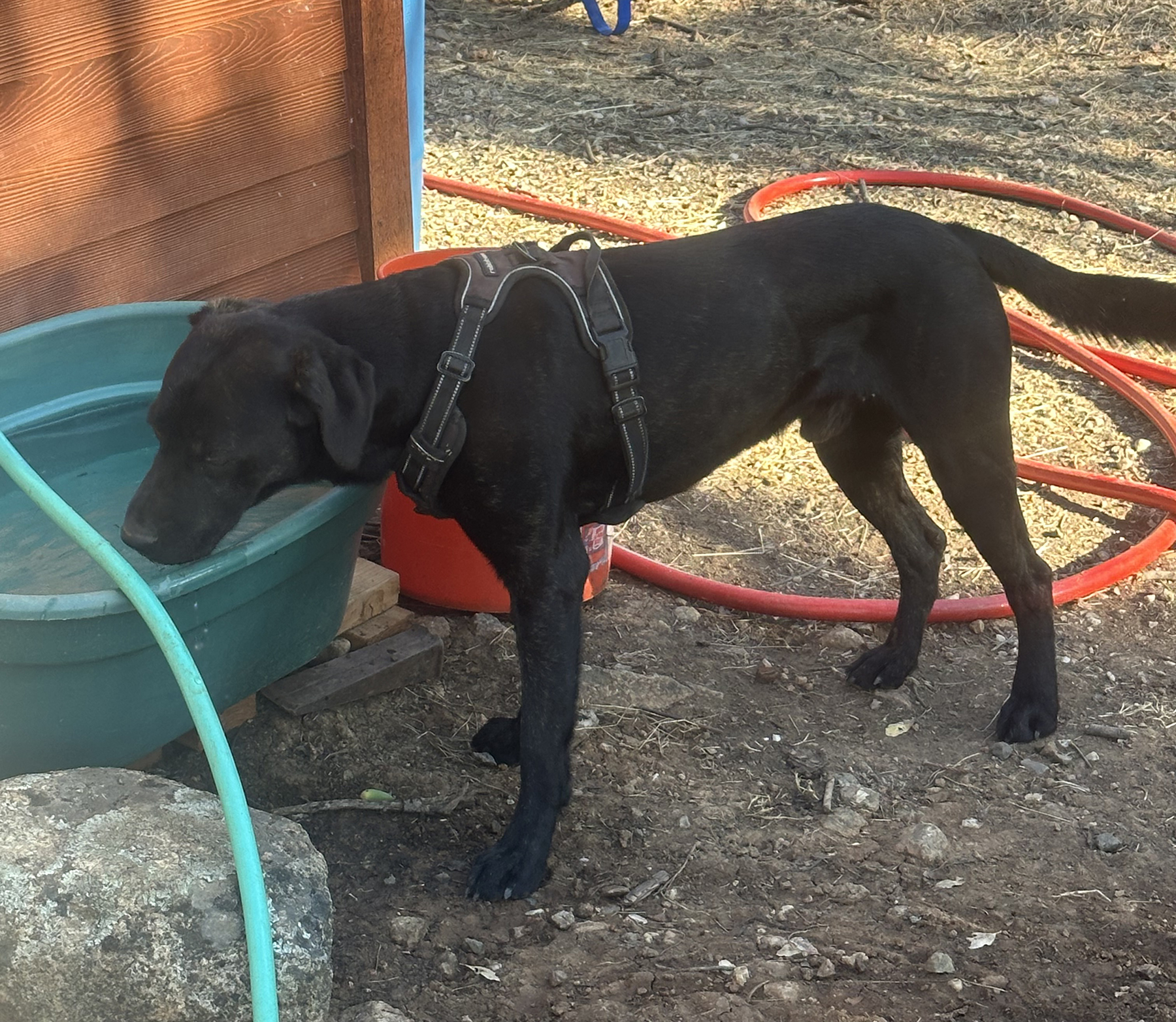
August 10, 2026 at 3:39 PM A reader found a missing young dog/big puppy on Taylor Crossing Rd in Grass Valley. The pup is wearing a harness, but no tags or collar. Contact 650-208-8341 if this is your pup.
August 10, 2026 at 3:27 PM IC is requesting building to respond to the fire for faulty solar panel wiring.
August 10, 2026 at 3:21 PM Forward progress has been stopped on the Message incident. Extensive mop-up operations have started.
August 10, 2026 at 3:19 PM Air Attack is releasing both tankers and Helicopter 514 back to their bases.
August 10, 2026 at 3:14 PM Message IC reports they have knockdown on the vehicle and the vegetation fire. Two water tenders and the ambulance to cntinue in, all others can cancel.

August 10, 2026 at 3:11 PM Message IC requests one ambulance for smoke inhalation for a civilian.

August 10, 2026 at 3:04 PM Tankers will drop directly ahead on on the fire to slow progression. IC reports the fifth wheel is fully involved and a small spot of vegetation.
August 10, 2026 at 2:59 PM Air Attack is over the Message incident, reports some vegetation involved. Two tankers and two helicopters assigned.
August 10, 2026 at 2:56 PM Aircraft have lifted from Grass Valley and White Cloud to the Message incident.
August 10, 2026 at 2:54 PM The fifth wheel on fire on Message Place is unoccupied.
August 10, 2026 at 2:48 PM Reported vehicle fire on Message Pl in the Alta Sierra area, reported as a trailer fire with possible extension to the wildland. Full wildland dispatch on order.

August 10, 2026 at 7:14 AM Nevada County Connects Transit Alert: Be advised that the Route 1B departing Tinloy Transit Center at :30 and the Eric Rood Center on the hour, is canceled today. We apologize for this inconvenience. The Route 1A departing Tinloy Transit Center on the hour is running normally.
August 10, 2026 at 5:59 AM Here are the NWS Sacramento overnight forecast updates:

Rest of the week: Thunderstorm chances and dry fuels across the Sierra; potentially including the Valley and foothills south of Interstate 80
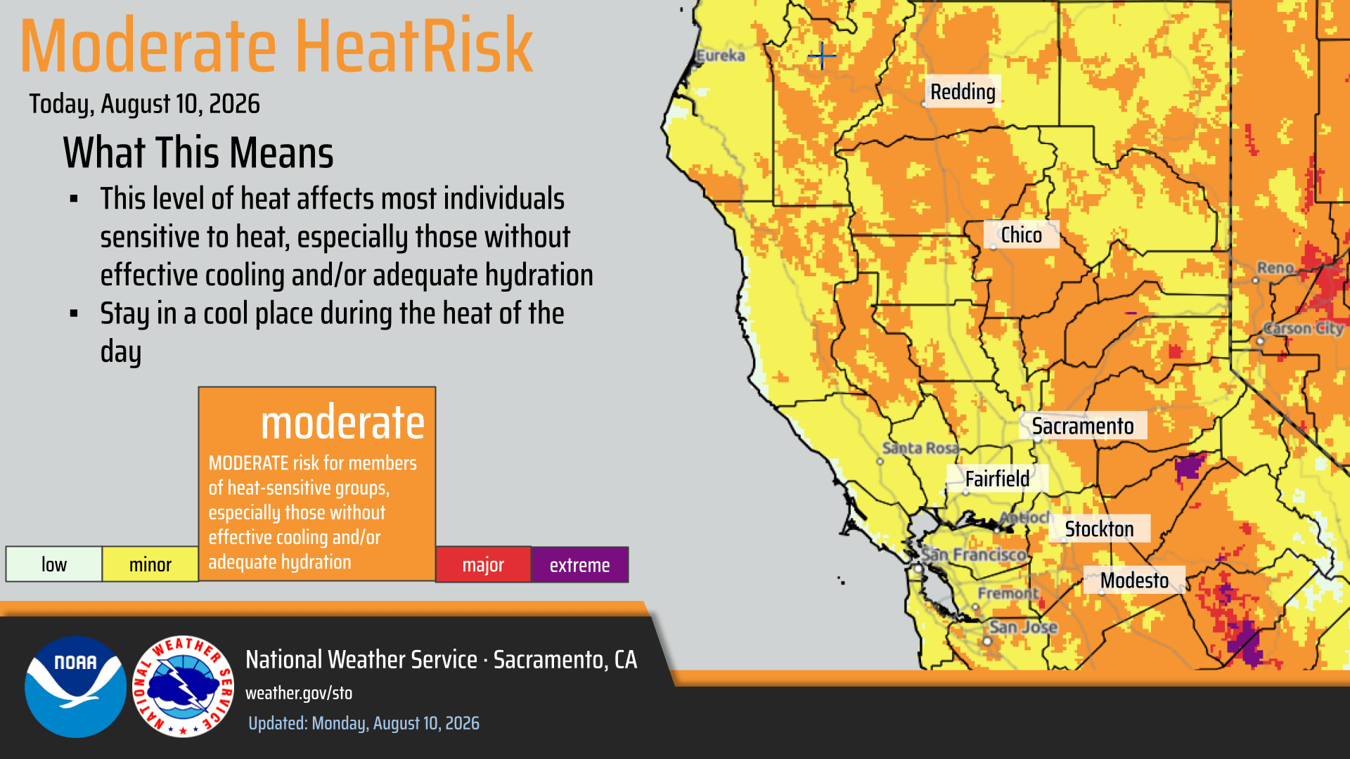
Hot and dry weather with areas of Moderate HeatRisk continues today with a weather pattern change from Tuesday onward bringing cooler temperatures to the region
Monsoonal moisture spreading through NorCal will introduce thunderstorm chances throughout the week
Thunderstorm chances around 15-30% are forecast for the Sierra on Wednesday and Thursday; Additionally, there is a low (5%) chance for isolated thunderstorms in the Valley/foothills south of Interstate 80 from Wednesday PM – Thursday morning, but there is high uncertainty on these timing/location details
Best potential for thunderstorm development (10-15% chances) otherwise remains confined to the Sierra Crest
Elevated Fire Weather Conditions continue throughout the week
Today: Hot, dry, and breezy weather across the northern Sacramento Valley and surrounding terrain, Sierra foothills, and Burney Basin
August 9, 2026 at 9:01 PM Rodeo IC reports primary search is completed. Firefighters have knockdown on the fire and contained the vegetation portion of the fire.
August 9, 2026 at 8:49 PM Additional engines and water tenders requested to the Rodeo incident. Firefighters are conducting a search of the structure.
August 9, 2026 at 8:44 PM Units at scene advise one single family home, 25% involved and a 100 by 100 spot of vegetation involved.
August 9, 2026 at 8:38 PM Reported residential structure fire with threat to the vegetation. Numerous units dispatched to Rodeo Flat off Combie Rd.
August 9, 2026 at 6:59 PM Thanks to reader Josh for the footage of the crews on the right flank of the Flat fire. The fire is 60% contained.

August 9, 2026 at 6:53 PM Air Attack 230 is returning to Grass Valley, no fire, however a lot of dust in the Dutch Flat area which aligns with the report from the lookout. All units are returning to their stations.
August 9, 2026 at 6:49 PM Units in the area are reporting nothing visible, all incoming resources to stage at China Wall. There were cars doing donuts in the China Wall Staging Area.
August 9, 2026 at 6:46 PM Air Attack 230 and Helicopter 514 are arriving over the incident.
August 9, 2026 at 6:44 PM Now a full wildland dispatch for the reported fire at China Wall. This will be the Wall incident.
August 9, 2026 at 6:36 PM Units dispatched for a smoke check/possible vegetation fire in the China Wall area on the Foresthill Divide Road.
August 9, 2026 at 3:10 PM First unit at scene on I-80 reports no fire, canceling all resources dispatched.
August 9, 2026 at 3:04 PM Passenger vehicle fire on eastbound I-80, flames seen from the undercarriage, two miles from the Blue Canyon on ramp. Units dispatched.
August 9, 2026 at 1:29 PM The Smith incident has been contained, crews will be committed for four to five hours for mop-up.
August 9, 2026 at 1:15 PM Forward progress has been stopped on the Smith incident at approx. 18 acres in grass.

August 9, 2026 at 12:49 AM Smith, Smith Road and Lima Rica Road in Yuba County. Units are at scene
August 9, 2026 at 9:29 AM First unit at scene on Rancho Vista reports a small 20 by 20 spot, extinguished by locals. One engine to continue in, all others can cancel.
August 9, 2026 at 9:27 AM Reported small vegetation fire, now extinguished, on Rancho Vista Court across from Newcastle Road in the Penryn area. Units dispatched.
August 9, 2026 at 7:42 AM The NWS Sacramento forecast remains on track this morning, here are the latest key points:
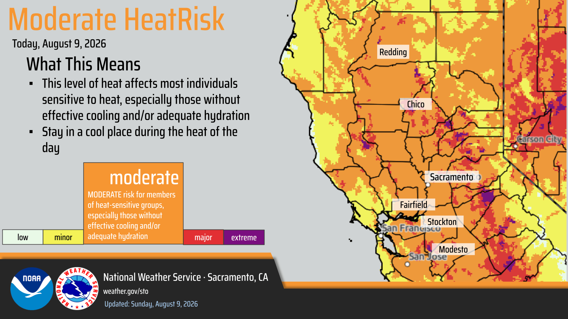

- Heat Advisory until 10 PM today for the Valley, foothills, the Coast Range, and the Sierra north of US 50
- Hot temperatures continue today with widespread Moderate HeatRisk and areas of Major HeatRisk
- Elevated Fire Weather Conditions due to:
- 1) Hot, dry, and breezy conditions thru Monday in the northern Sacramento Valley/surrounding terrain, Burney Basin, and Sierra foothills;
- 2) Chances for isolated mountain thunderstorms in the Sierra today, generally south of US 50
- Majority of activity will remain east of the Sierra crest
- Cooling trend Monday onward with periods of breezy onshore winds through the week
- A surge of monsoonal moisture will bring chances for mountain thunderstorms Tuesday-Saturday
- Uncertainty remains regarding timing and exact location of thunderstorm development
- Currently, highest thunderstorm potential is forecast for Wednesday-Friday
August 8, 2026 at 7:33 PM Units at scene on Wildflower are canceling all incoming engines.
August 8, 2026 at 7:25 PM Possible structure fire, smell of burnt electrical in the house, on Wildflower Drive in Lake Wildwood. Units dispatched.
August 8, 2026 at 3:29 PM Units at scene of the Black Bear Diner report small appliance smoking only, no structure fire.
August 8, 2026 at 3:15 PM Structure fire at the Black Bear Diner in Auburn, smoke visible. Units dispatched.
August 8, 2026 at 2:43 PM Updates on the Flat Fire in Nevada County will be posted on the Flat Fire incident page.
August 8, 2026 at 2:35 PM Air Attack, tankers and helicopters are lifting to the Flat Fire.
August 8, 2026 at 2:31 PM There is a visible column on the cameras now.

August 8, 2026 at 2:27 PM Reported vegetation fire on Lowell Hill Rd/Dutch Flat Powerhouse. Full wildland dispatch on order.
August 8, 2026 at 2:03 PM Now would be a great time to hydrate.
August 8, 2026 at 9:07 AM Power has been restored in the Peardale/Chicago Park area with the exception of 91 customers along Hwy 174 near Rollins Park. Restoration time for those unfortunate ones is 11:45am.
August 8, 2026 at 8:34 AM Power outage in Peardale, PG&E starting the weekend in style…
August 8, 2026 at 7:51 AM Your NWS Sacramento forecast:
This Weekend-Monday

A Heat Advisory remains in effect through 10 pm Sunday
- Hottest temperatures expected today and Sunday, with elevated overnight lows
- Widespread Moderate HeatRisk and areas of Major HeatRisk in the Valley & foothills
Elevated Fire Weather Conditions Due to:
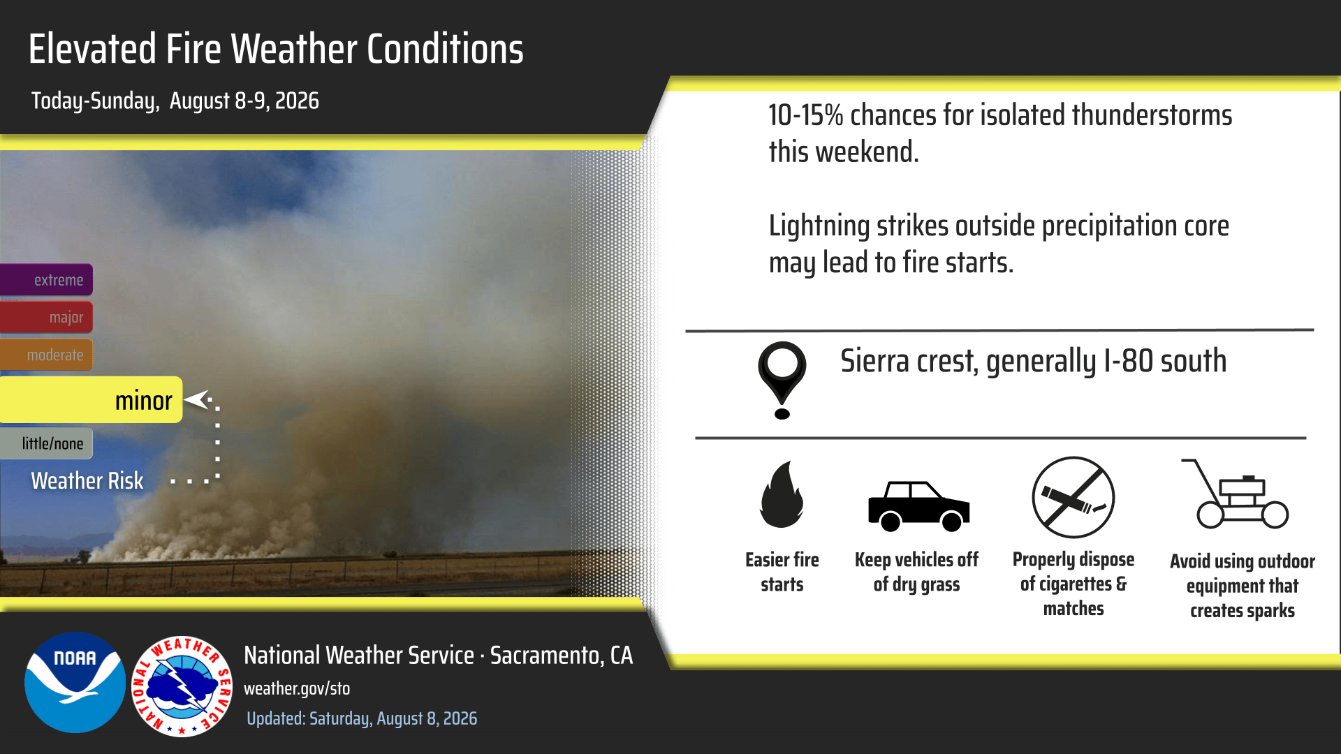
- Hot, dry, breezy conditions through Monday in the northern Sacramento Valley/surrounding terrain, Burney Basin, and Sierra foothills
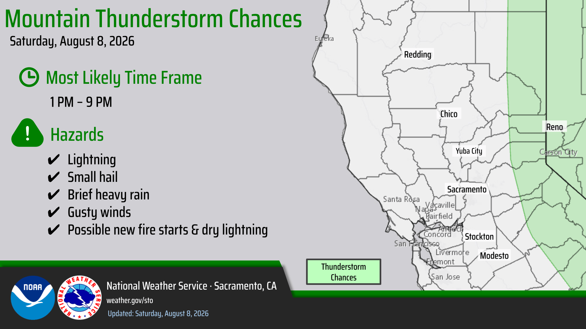
- Isolated thunderstorms along the Sierra crest this weekend. Highest potential south of I-80. Chances for overnight showers/isolated t-storm south of US 50 in the mountains.
Next Week
Cooler temperatures begin to set in Tuesday onward, with more noticeable cooling mid to late next week.
- Areas of Moderate HeatRisk remain in the Valley & foothills early to mid next week as temperatures trend cooler
- Potential for slightly below normal temperatures by end of next week
Renewed thunderstorm potential along the Sierra crest mid to late next week
- High uncertainty remains regarding an additional surge of monsoonal moisture entering the region late next week, and where thunderstorms would most likely develop
August 7, 2026 at 9:03 PM Accident on Greenhorn Access Road, golf cart vs two pedestrians. Verbatim quote from CHP log: “DOG WAS THE IN THE GOLF CART HIT GAS PEDAL AND RAN OVER THE 2 PEDS”
August 7, 2026 at 4:21 PM After eight years on the Grass Valley City Council, Mayor Hodge announces that she will not be seeking re-election. Candidate filings for two open seats is extended to Wednesday, August 12 at 5:00 pm since incumbents have not filed for reelection.
August 7, 2026 at 3:44 PM Forward progress stopped on the Los Verjeles incident. Crews will be committed for approximately two hours. One water tender to continues, all others can cancel.
August 7, 2026 at 3:34 PM Air Attack 230 concurs with the ground assessment, the fire is held by a dozer line on one side and a dirt road on the other side of Los Verjeles. Retardant drops have slowed the progression notably. Aircraft could divert to a new start in south Auburn.

August 7, 2026 at 3:32 PM Aircraft are over the Los Verjeles fire, Prevention is at scene as well and requesting Los Verjeles Rd be shut down.
August 7, 2026 at 3:30 PM The fire is on both sides of Los Verjeles Road, approx. 1/2 acre burning at a slow to moderate rate of spread. IC reports the fire is checked by existing fire lines on both sides.
August 7, 2026 at 3:24 PM Aircraft are lifting from Grass Valley and White Cloud to the incident in Loma Rica.
August 7, 2026 at 3:18 PM Reported vegetation fire, 100 by 100 spot, on Los Verjeles Road near the bridge and Loma Rica Road in Yuba County. Full wildland dispatch on order.

August 7, 2026 at 1:42 PM A Heat Advisory remains in effect through 10 pm Sunday for much of interior NorCal.

August 7, 2026 at 7:39 AM Units at scene on McKnight have stopped the forward progress, canceling all incoming units.
August 7, 2026 at 7:35 AM First unit at scene reports a 20 by 20 spot off northbound Hwy 49 in the brush. With resources at scene, they should be able to handle this rapidly. Starting a hoseline now.
August 7, 2026 at 7:34 AM Locals have mostly extinguished the small spot off Hwy 49, the fire is near the Empire Street off ramp on northbound Hwy 49.
August 7, 2026 at 7:30 AM The fire is reported as a 20 by 20 spot, locals are working to extinguish it.
August 7, 2026 at 7:28 AM Reported vegetation fire on Hwy 49 across from West McKnight Way, units dispatched. Locals are attempting to put it out.
August 7, 2026 at 6:31 AM Here is the update to the NWS Sacramento forecast:
- Hot and dry conditions continue through Monday, with a Heat Advisory in effect for the Valley, Foothills, and parts of the mountains 10AM today through 10PM Sunday.
- Hottest temperatures are expected Saturday and Sunday with triple digit high temperatures.
- Widespread Moderate to Major HeatRisk.
- Improvements to the temperatures and HeatRisk as we move into the early part of next week.
- Elevated Fire Weather Conditions through Sunday for the northern Sacramento Valley and adjacent terrain, Sierra Foothills, and through Monday for the Burney Basin.
- This is due to the hot temperatures, breezy winds, poor overnight recoveries, and low humidities
- Slight chance (less than 10 percent) for an isolated shower or storm along the Sierra Crest south of Highway 50 this afternoon/evening.
- Lingering near surface smoke continues through the weekend.
August 6, 2026 at 9:04 PM PG&E outage affecting 266 customers. Reader reports urgent repair and and estimated time of restoration is 12:17 am.

August 6, 2026 at 8:18 PM Debris check on Hwy 49 across from Turkey Trot, for an oversized bonfire with people in attendance.
August 6, 2026 at 6:50 PM Earlier today registered nurses, patients and caregivers protested planned layoffs in the Family Birth Center and reductions in Ambulatory Treatment Center hours at Sierra Nevada Memorial Hospital. Full story here.

August 6, 2026 at 5:22 PM Air Attack 17 and tankers are launching for a fire on the Plumas National Forest. This will be the Long incident, near Long Lake.
August 6, 2026 at 3:38 PM Contrary to text messages received by some Cascade Shores residents, power is not fully restored. Stay cool!
August 6, 2026 at 2:37 PM Estimated time of restoration is 5:00 pm for the Cascade Shores outage. Current temperature in the area is 94F. If only there was a datacenter nearby that was nice and cool. Oh wait, the only data centers worth visiting are open: Nevada County Libraries.
August 6, 2026 at 2:14 PM Now PG&E reports 884 customers out of power.

August 6, 2026 at 2:04 PM Power outage in Cascade Shores, Banner Quaker Hill ad Red Dog – all reader-reported.
August 6, 2026 at 12:48 PM Mopping up the Dog incident, IC is releasing engines.
August 6, 2026 at 12:22 PM One crew to continue in to the Dog incident, units at scene plus two engines can handle. Canceling all other incoming units.
August 6, 2026 at 12:18 PM First unit at scene on Dog Bar reports 1/8th of an acre, all units to continue in.
August 6, 2026 at 12:16 PM Full wildland dispatch on order for a reported vegetation fire on Dog Bar Road near Iva Circle.

August 6, 2026 at 11:41 AM A Heat Advisory is in effect for the Valley, foothills, Coast Range, and northern Sierra from 10am Friday 8/7 to 10pm Sunday 8/9. We’re expecting widespread triple digit temperatures with very little overnight relief due to high minimum temperatures. Hottest conditions on Saturday.

August 6, 2026 at 6:30 AM Here is the update to the NWS Sacramento forecast:
Continued Widespread Moderate HeatRisk through the weekend and into early next week, however coverage will diminish early next week.

Isolated areas of Major HeatRisk Friday through Sunday, coinciding with the hottest days over the next 7 days.
Elevated Fire Weather Concerns through Sunday for the northern Sacramento Valley and adjacent terrain, Burney Basin, and the Sierra Foothills. This is due to low relative humidity, hot temperatures, poor overnight recoveries, and periodic breezy conditions.

Confidence remains low, but there is a 10 percent chance for isolated thunderstorms south of Highway 50 over the Sierra Crest Friday afternoon and evening.
Lingering near surface smoke continues today and into the weekend.
August 5, 2026 at 1:11 PM Pourier IC reports both dozer and hoseline are complete, they are starting mop-up operations. Air Attack 17 is leaving the Pourier incident, both helicopters are released as well.
August 5, 2026 at 12:59 PM Pourier IC reports logging operation in the area have cut a dozerline around the fire, ground crews are starting hoseline around the fire.
August 5, 2026 at 12:56 PM The Pourier fire is estimated at two acres, IC requests two additional engines.
August 5, 2026 at 12:46 PM Kibbe IC reports the fire is contained.
August 5, 2026 at 12:45 PM Kibbe IC reports 1/4 acre of grass, held by roads. No need for aircraft or a crew.
August 5, 2026 at 12:40 PM Penn Valley Chief at scene of the reported structure fire in Penn Valley states the fire is on the corner of Lasso Loop and Horton. Light smoke showing, all units to continue in except the water tender – there are hydrants on the street.
August 5, 2026 at 12:39 PM Possible residential structure fire on Horton Street in Penn Valley, units dispatched.
August 5, 2026 at 12:35 PM Reported vegetation fire on Loma Rica Road and Kibbe Road, units dispatched.
August 5, 2026 at 12:30 PM Updated location shows the Pourier fire east of Hwy 49 and just north of Foothill Way and south of the Willow Creek campground.
August 5, 2026 at 12:28 PM Tankers are reloading at the Air Attack base and returning to the fire.
August 5, 2026 at 12:23 PM Air Attack 17 reports 1/4-1/2 acre in timber understory, slow to moderate rate of spread, one additional helicopter ordered to the fire.
August 5, 2026 at 12:22 PM Tankers have dropped on the Pourier fire, Helicopter 514 is arriving over the incident.
August 5, 2026 at 12:10 PM Air Attack 17 and tankers have lifted from Grass Valley to the Pourier fire above Camptonville.
August 5, 2026 at 12:03 PM Additional resources on order for the reported vegetation fire near Weeds Point.
August 5, 2026 at 11:57 AM Reported vegetation fire in the Pendola Road area at Weeds Point in Yuba County north of Camptonville. TNF resources dispatched. This will be the Pourier incident.
August 5, 2026 at 10:42 AM From a reader: We are missing our long hair tortoiseshell cat as of last night on Pammy Way in Alta Sierra. She is mostly black with streaky orange and a little white beard. She is quite skittish so I doubt she’d let anyone pick her up but if you see her please call us asap! 206-250-7925.

August 5, 2026 at 7:48 AM Non-injury accident on Allison Ranch Road in the Fothills CHurch plot.
August 5, 2026 at 6:33 AM Here is the latest update to the NWS Sacramento forecast:
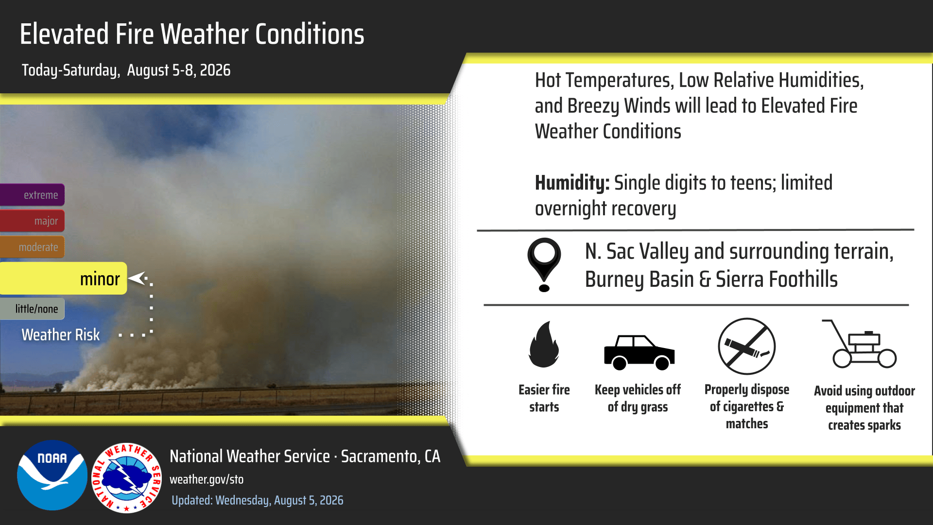
We continued the headline for elevated fire weather concerns for today through Saturday for the Burney Basin, Northern Sacramento Valley and adjacent terrain, and the Sierra Foothills.
Due to low relative humidity, hot temperatures, poor overnight recoveries, and periodic breezy conditions.

Widespread Moderate HeatRisk continues through Sunday, with improvements to temperatures by early next week.
Isolated areas of Major HeatRisk Friday, Saturday, and Sunday mainly in the Valley and Foothills.
Widespread triple digit heat, with the hottest temperatures Friday through Sunday.
Lingering near surface smoke continues today and into tomorrow.
August 4, 2026 at 6:21 PM Thanks to reader Ben for the photo of the accident on Hwy 49 near Nishinam Gulch. No injuries reported, however the roadway is blocked.

August 4, 2026 at 5:50 PM The reported vegetation fire near Mount Vernon Rd is a BBQ. Canceling all incoming resources.
August 4, 2026 at 5:44 PM Reported overturned U-Haul on Hwy 49 near Nishinam Gulch. Units dspatched.
August 4, 2026 at 5:43 PM Vegetation fire, full wildland dispatch on order for now, on Mount Vernon Road and Puzzlewood Lane in Placer County.
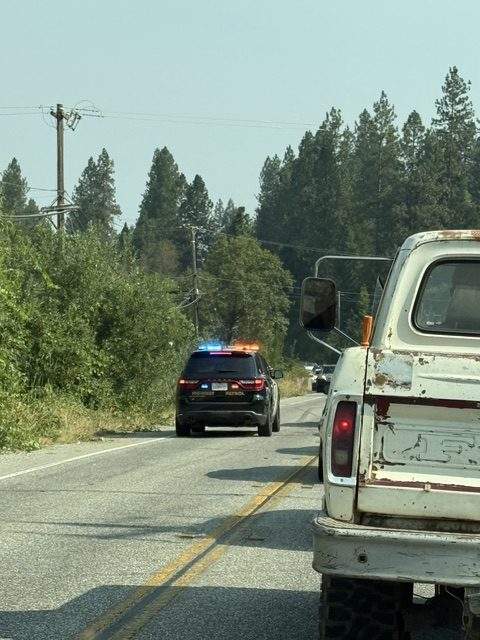
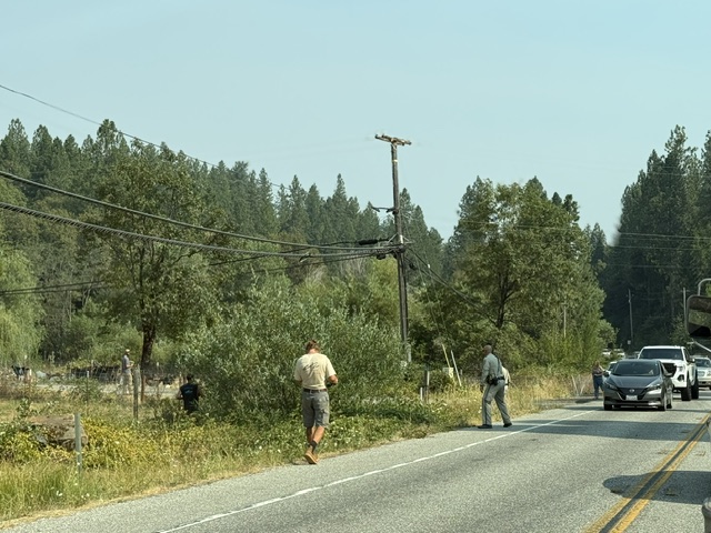
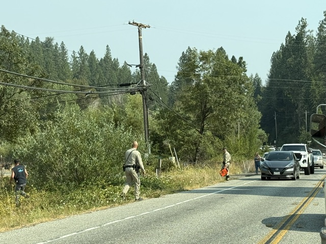
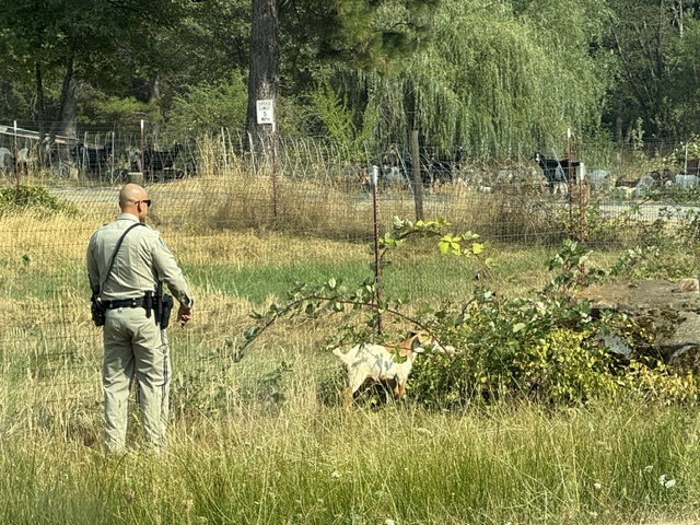
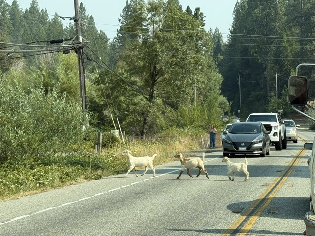
August 4, 2026 at 5:35 PM Proof #1522884 our readers rock! Reader Bonny captured the final stage of “The Great Escape.”
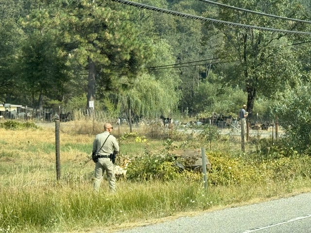
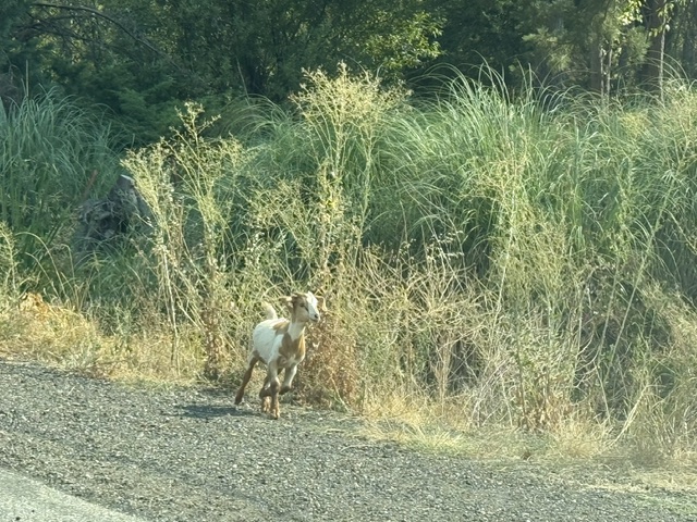
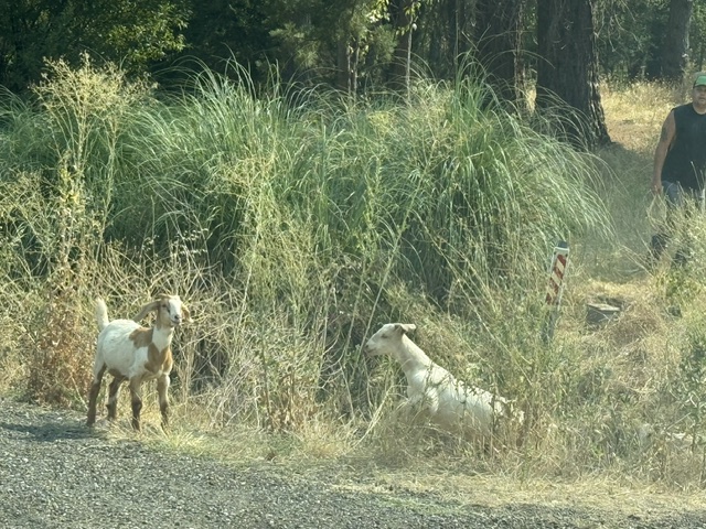
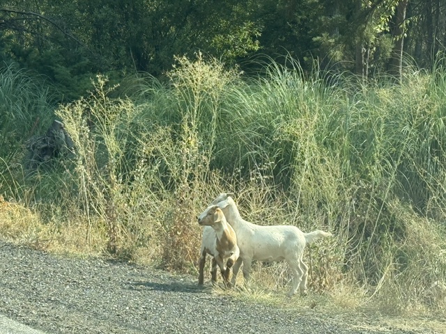
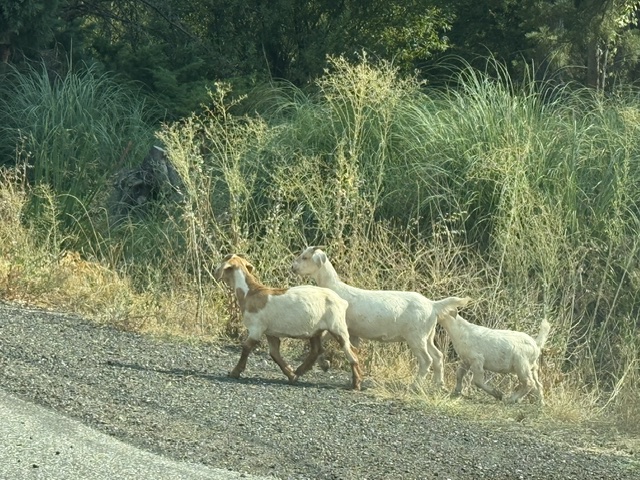
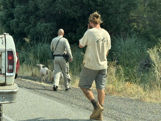
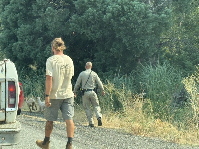
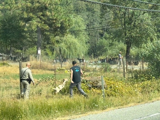
August 4, 2026 at 4:43 PM Accident on Alta Sierra Dr near Pmmy Way. Two cars involved, the roadway is clear.
August 4, 2026 at 4:30 PM A large herd of goats and their herding dog are walking on Dog Bar Road near Wheeler Acres Rd. By the time of posting, they may have covered more ground. Reported as 100-200 goats – if anyone has a photo, send it along.
August 4, 2026 at 1:57 PM Confirmed false alarm on Sutton Way, all units avaiable.
August 4, 2026 at 1:56 PM First unit at scene on Sutton reports nothing showing.
August 4, 2026 at 1:54 PM Commercial fire alarm sounding at the apartment complex on Sutton Way, units dispatched.
August 4, 2026 at 1:04 PM It was truly a joy to watch community members come to the Nevada County Fairgrounds and bring much-needed donations for local non-profits. Read all about it: Nonprofits Draw A Steady Stream of Donations During Community Involvement Day.

Thanks to everyone who came out and helped them help the community. Next, see you at the Fair, starting on August 12, 2026.
August 4, 2026 at 8:32 AM Car vs pole on Hwy 174 at Lower Colfax Rd, units dispatched.
August 4, 2026 at 7:58 AM Smoke from fires in Oregon and Washington creates hazy conditions today.
August 4, 2026 at 6:39 AM NWS Sacramento continued the headline for Elevated Fire Weather Conditions today, as we will continue to see hot and dry conditions with breezy winds at times. This is for the northern Sacramento Valley and adjacent foothills/mountains, Burney Basin, and the Sierra Foothills.
Widespread Moderate HeatRisk is expected through Sunday, with isolated Major HeatRisk on Saturday for parts of the Valley and Foothills. Widespread triple digit heat, with the warmest in the northern Sacramento Valley.

Temperatures will start to cool off by the end of the weekend, with the 90s by early next week.
August 3, 2026 at 10:48 PM The outage has been reduced to 192 PG&E utility customers in the Bitney Springs area. Estimated time of restoration is 3:15 am.

August 3, 2026 at 9:55 PM Thanks to NWS Sacramento’s night shift for the simulated near surface smoke forecast for tonight into Wednesday. We can expect smoke to remain in the area at least through midweek, especially during periods of calmer winds.
August 3, 2026 at 9:29 PM 617 customers out of power from Rudd Road to Newtown.
August 3, 2026 at 9:16 PM Reader report of a power outage on Jones Bar. PG&E map is mum on the extent of the outage.
August 3, 2026 at 8:21 PM The call reporting people trapped in a mine shaft, with injuries, appears to have been a prank/swatting call from a burner phone per NCCFD Chief Robitaille. All units have cleared the scene.
August 3, 2026 at 7:55 PM The smoke check on the San Juan Ridge has yielded no results. Nothing visible in Sierra City either.
August 3, 2026 at 7:33 PM CHP log shows a smoke check in Sierra City.
August 3, 2026 at 7:29 PM Smoke check on Hwy 49 on the San Juan Ridge, units dispached.
August 3, 2026 at 7:25 PM The Diamond staging area is being released for the Granite incident (the possible mine accident.) Search continues.
August 3, 2026 at 6:01 PM Just after 5:02, Nevada County Consolidated Fire District received a call for people trapped in a mine with injuries. Unknown number or location. NCC are on scene and searching multiple known mine sites. NCSAR have also been requested to aid in the search.
August 3, 2026 at 4:15 PM The unplanned outage affecting PG&E customers in Washington and Alleghany is billed as an emergency repair affecting 213 customers. Estimated time of restoration is still 11:15 pm. Thanks to reader Greg for the heads up.

August 3, 2026 at 10:30 AM There is no fire and no river rescue in the Deer Creek area between Newtown Rd and Nevada City. A helicopter with a longline is flying back and forth between the two points, could be a mapping flight.
August 3, 2026 at 10:05 AM The Vernon incident has been knocked down.
August 3, 2026 at 9:35 AM Reported vegetation fire on Mt Vernon Road in Placer County. First unit at scene reports 1/4 acre in grass, correct address is Memory Ln off Mt. Vernon Rd.
August 3, 2026 at 5:55 AM Here are the NWS Sacramento forecast highlights from the overnight shift:
Biggest change overnight is the issuance of a Heat Advisory for the Valley and Sierra foothills today, in effect from 10 AM through 10 PM tonight.
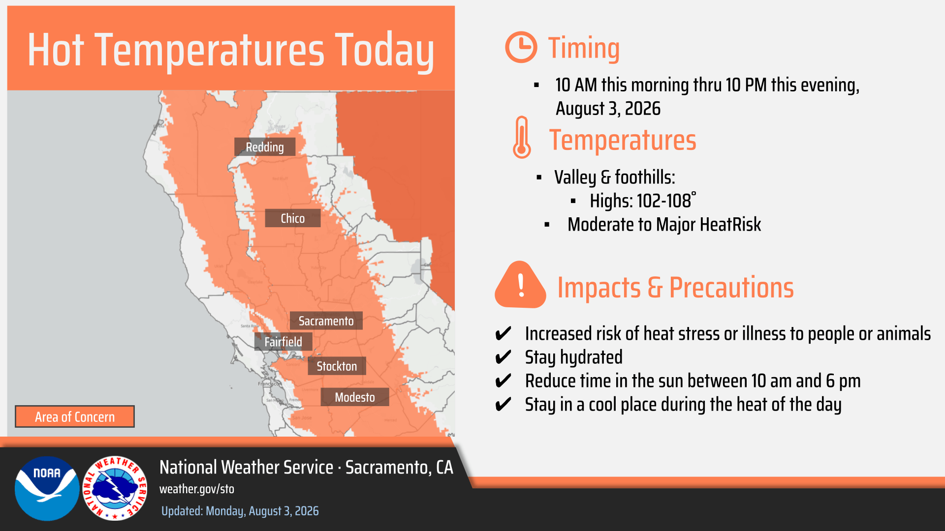
Widespread Moderate HeatRisk, with an increase in areas of Major HeatRisk today across the area led to issuance of advisory. High temperatures of 102 – 108 are in the forecast; hottest in the northern Sacramento Valley.
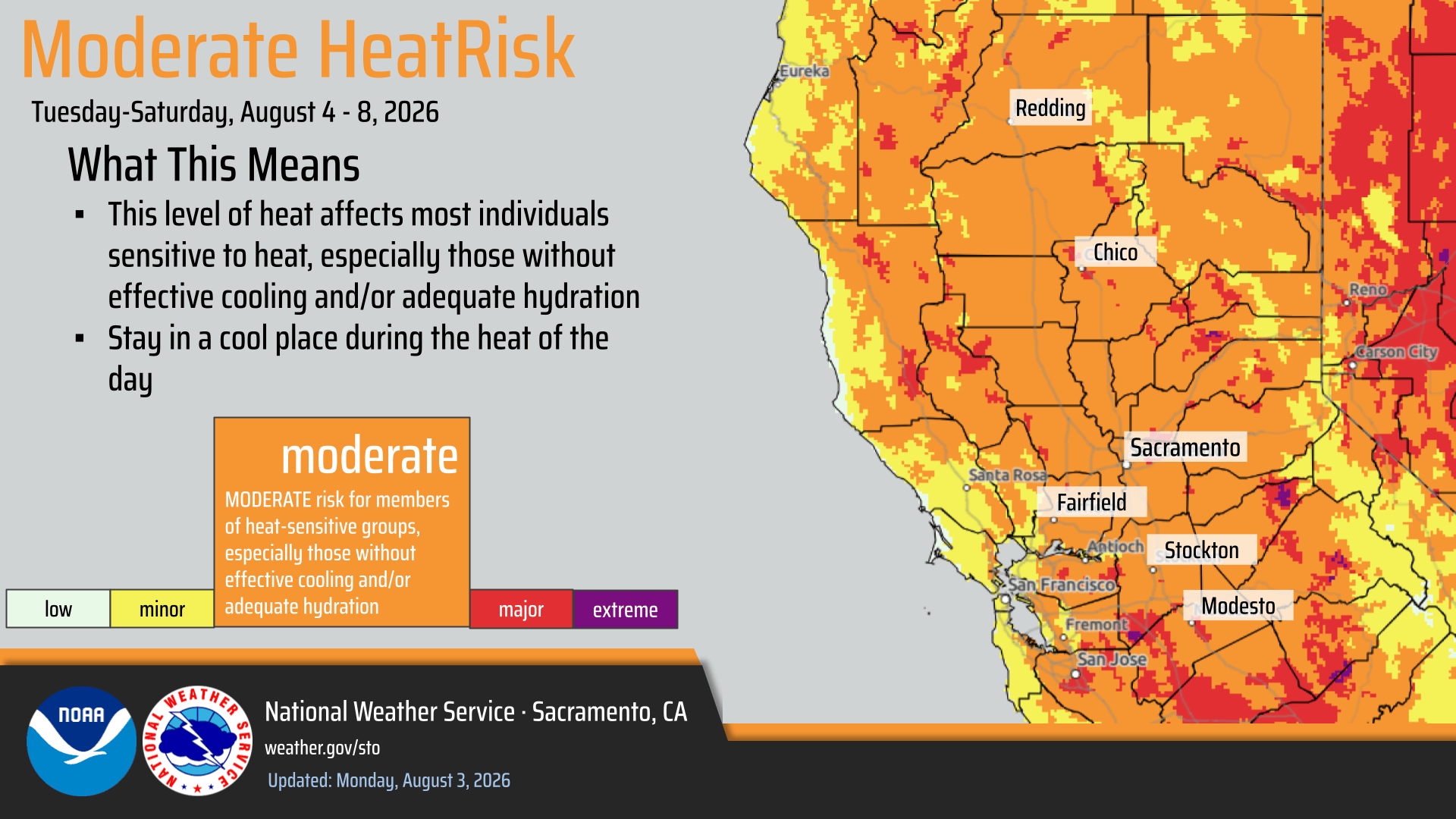
- Elevated Fire Weather Conditions continue today in the northern Sacramento Valley, Burney Basin, and foothills of the Sierra.
- Hot temperatures, low daytime humidity values, and locally breezy north to west winds will lead to easier fire starts/spreads.
- Strongest winds along and west of the I-5 corridor. Strongest winds expected this morning, gradually weakening by the afternoon/evening.
Slightly cooler temperatures tomorrow through Thursday, then warming temperatures Friday and Saturday. Widespread Moderate HeatRisk will continue through Saturday.
August 2, 2026 at 6:02 PM One smoke visible next to a house on the cameras now. First unit at scene reports a woodpile, approximately 20 ft tall on fire. Two engines to continue in, all other resources can cancel.

August 2, 2026 at 5:58 PM Colfax fire reported as a 10 by 10 pile on fire. Nothing showing on the cameras yet.
August 2, 2026 at 5:55 PM Full wildland dispatch for a reported vegetation fire in the area of Hillcrest Blvd in Colfax.
August 2, 2026 at 2:33 PM Tire fire has been extinguished, canceling all incoming resources.
August 2, 2026 at 2:26 PM Semi with trailer on westbound I-80 near the Hwy 174 off ramp, one tire on fire. Units dispatched.
August 2, 2026 at 1:53 PM Just posted the list of items needed by local non-profits so you have time to get ready for Community Involvement Day at the Nevada County Fair this Monday from 1-6 pm.

August 2, 2026 at 1:29 PM All units canceled to the trail incident. No medical need.
August 2, 2026 at 1:22 PM Medical rescue for a possible fracture on the hiking trail near Jones Bar Road, units dispatched.
August 2, 2026 at 12:54 PM First unit at scene on James Ct report one large pile on fire, no extension to the wildland. One engine to continue in, all others can cancel.
August 2, 2026 at 12:39 PM Reported small fire in a woodpile, locals working on it, on James Court near Penny Way in Rancho Loma Rica, Yuba County. Units dispatched.
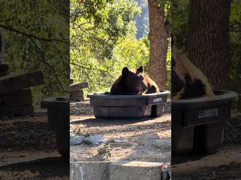
August 2, 2026 at 9:09 AM Got a bigger tub.
August 2, 2026 at 7:39 AM California Incident Management Team 7 is in Washington State, working the Spokane Complex. Peardale-Chicago Park PIO Daniel Ramey is assigned to the team and sent the video below.

August 2, 2026 at 7:22 AM Caprine stroll alert on Dog Bar Road, goats out for a Sunday stroll.
August 2, 2026 at 6:43 AM Here are the forecast updates from the NWS Sacramento overnight shift:
Hot and dry conditions continue through this week, with widespread Moderate HeatRisk across the Valley and Foothills. Hottest days Today through Tuesday; Isolated Areas of Major HeatRisk in the northern Sacramento Valley.
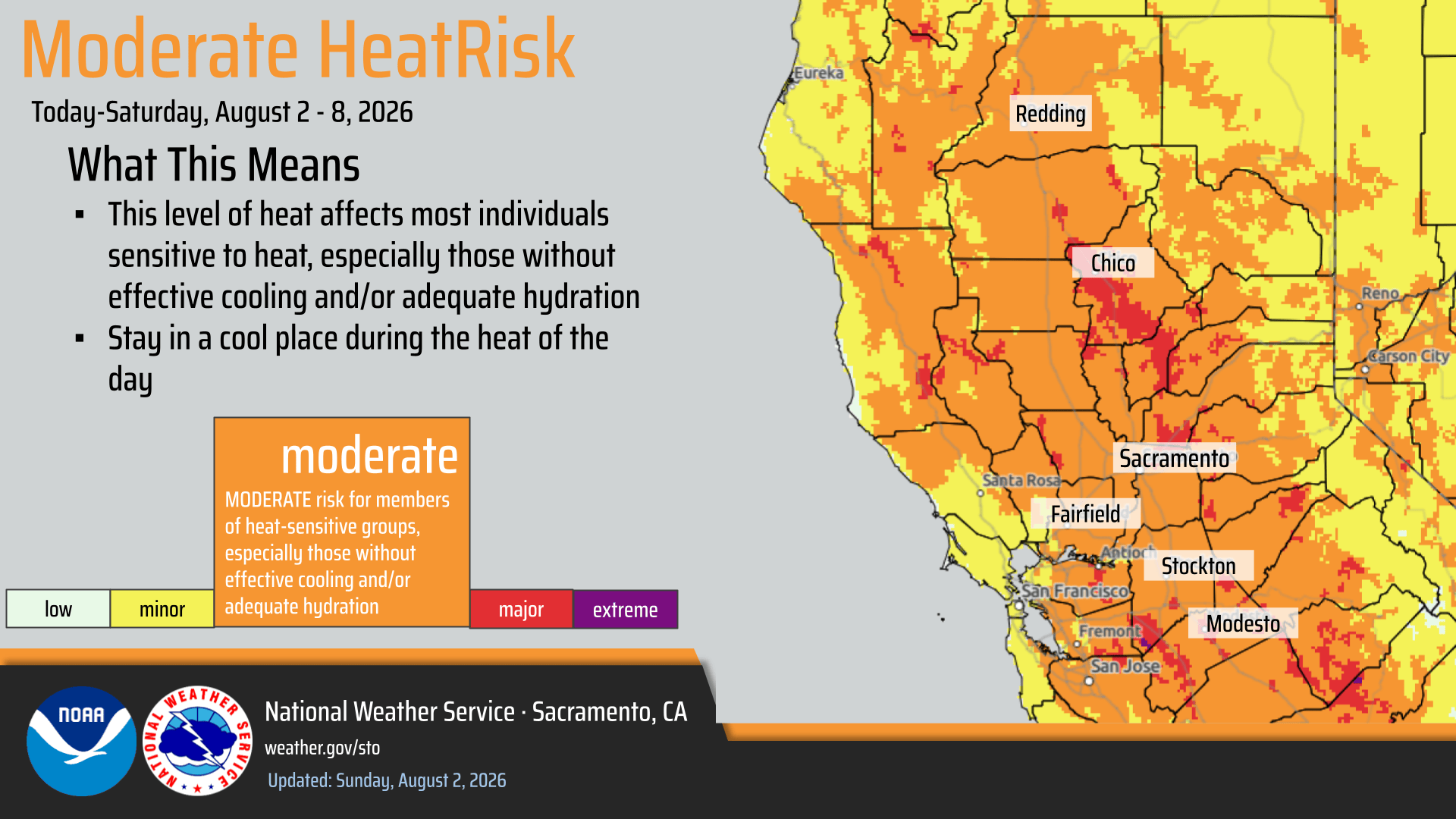
Elevated Fire Weather Conditions through Monday for the northern Sacramento Valley & adjacent foothills, Burney Basin, and into the foothills of the Sierra. Low humidity values, in the single digits to low teens, poor overnight recoveries, and breezy north to west winds, and hot temperatures are the driving factors for the elevated conditions. Strongest winds along and west of the I-5 corridor.

Slight cooldown by late week, but only a few degrees with continued Widespread Moderate HeatRisk in the Valley and Foothills.

August 1, 2026 at 8:30 PM It’ll be hot again tomorrow. The river will be super crowded again. How about a trip to a lake?
August 1, 2026 at 2:57 PM All units released from the Intanko incident.
August 1, 2026 at 2:31 PM Aircraft have lifted from Grass Valley to the Intanko incident, they are over the incident now.
August 1, 2026 at 2:23 PM First unit arriving at scene on Intanko Lane reports they can handle without aircraft.
August 1, 2026 at 2:20 PM Reported residential structure fire, trailer on fire, on Intanko Lane off Spenceville Road near Beale AFB in Yuba County. Possible threat to the vegetation. Units dispatched.
August 1, 2026 at 1:35 PM As expected, parking at the 49 bridge is an exercise in futility. Except for the few, the not-so-smart, the about to be towed who threw caution to the wind and parked anywhere but in the legal spots.
August 1, 2026 at 9:06 AM Motorcycle accident on Ophir Silver Rd, units dispatched for a minor injury.
August 1, 2026 at 6:34 AM Here are the NWS Sacramento highlights:
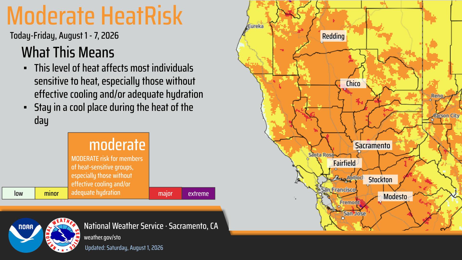
Expecting widespread triple digit heat to arrive today across the Valley along with widespread Moderate HeatRisk. Hottest days today – Monday.
Forecast high temperatures remain below heat product thresholds.

- Weather system well to our north will introduce periods of breezier north to west winds Today – Monday.
- Strongest winds in the northern Sacramento Valley along and west of the I-5 corridor and north of I-80.
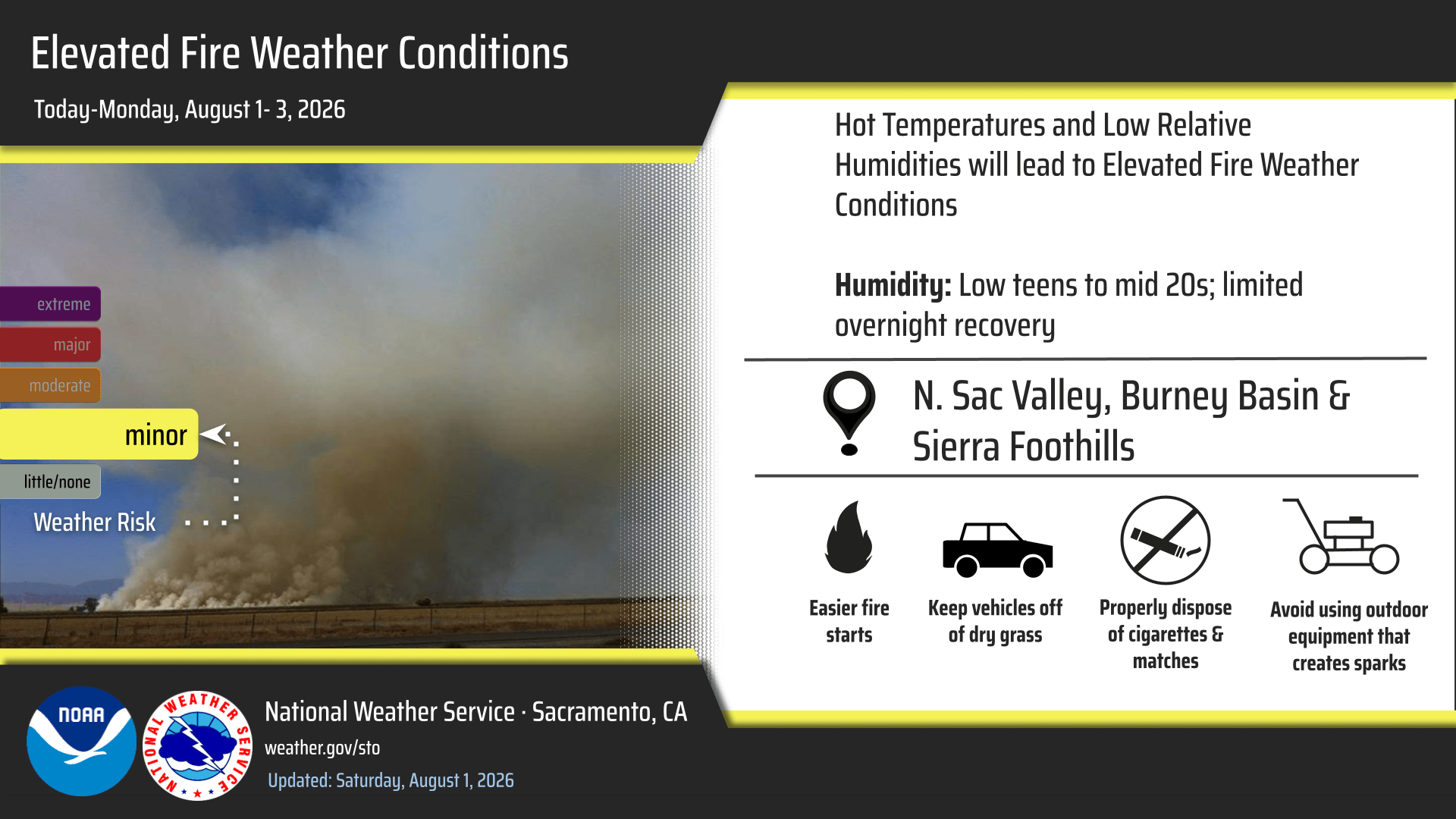
- Elevated Fire Weather conditions today through Monday from the combination of low daytime humidity values, poor overnight recoveries, hot temperatures, and breezy winds.
- Areas of concern are northern Sacramento Valley and adjacent terrain, Burney Basin, and the Sierra foothills.
- Humidity values in the low teens, with localized single digit values possible in the mentioned areas.
August 1, 2026 at 12:09 AM Last month’s log can be found here.